
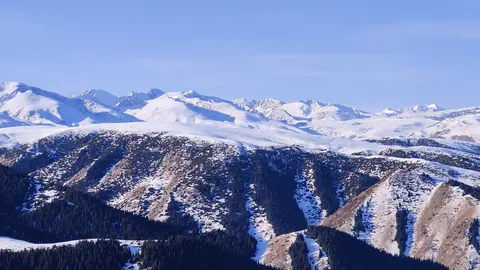
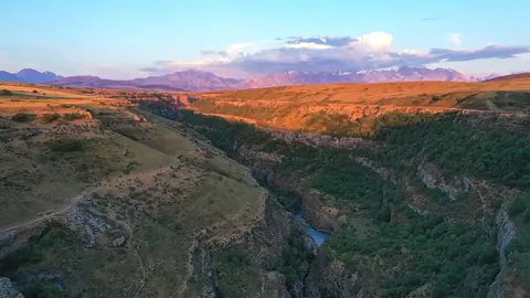


The Tian Shan (also spelled Tien Shan) is a mountain system about 2,900 km long that runs east from the Tashkent area across Central Asia into China. In Kazakhstan it forms the south-eastern and southern rim of the country, and Almaty sits right against it. The name is usually rendered as “Mountains of Heaven”. If you have one day, go up the Ile Alatau from Almaty. Everything else in the Kazakh Tian Shan takes two days or more.
Six sections of the Kazakh Tian Shan, by height and base
The table runs from the highest point down. Heights come from Wikipedia and its references, so treat them as reference figures and not as survey data. Where sources disagree, you see the range. The Dzungarian Alatau is listed in English Wikipedia’s article on the Tian Shan, although it sits further north, on the Chinese border.
| Section | Highest point | Base | Time you need | Our guide |
|---|---|---|---|---|
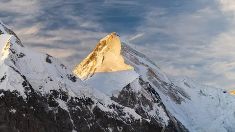
| Central Tian Shan, triple border | Khan Tengri, 6,995–7,010 m | Raiymbek district, about 292 km in a straight line from Almaty | An expedition | Khan Tengri |
| Ile Alatau | Talgar, 4,973–4,979 m | Almaty | One day | Ile-Alatau park |
| Kungey Alatau | 4,771 m | Saty village, 280–320 km from Almaty | Two days | Kolsai, Kaindy |
| Dzungarian Alatau | 4,622 m | Sarkand district | Several days | Zhongar-Alatau |
| Talas Alatau, Western Tien-Shan | Sayram, 4,220–4,238 m | Turkistan Region | Several days | Sayram-Ugam, Aksu-Zhabagly |
| Karatau, north-western spur | Bessaz, 2,176 m | Turkistan Region | Several days | Karatau Reserve |
What this means for planning: height tells you little about effort here. A 4,979 m peak rises in view of Almaty, and you can ride to 3,200 m below it on a lift. The low Karatau takes far longer to reach.
Ile Alatau: the part most visitors mean
For most travellers “the Tian Shan” means the mountains above Almaty. The gondola from Medeu to Shymbulak shows you the range from a cabin. Above it the Kombi lifts climb to Talgar Pass, about 3,200 m. Rules, fees and routes for the protected part are on our page about Ile-Alatau National Park, which is where to go if you are checking entry fees or the 38 open routes.
Two things catch people out. The Medeu rink is closed for reconstruction until the end of 2028, so the stop at Medeu is the dam and the gondola. And Big Almaty Lake has no private cars or electric scooters, so count on a full day’s walk.
Further east, the range gets quieter and the drive gets longer
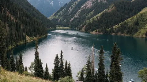
Kungey Alatau is the next range south, and the two lake trips that made it famous start from Saty. Kolsai needs a night there if you want the middle lake, 7–8 km up from the lower one. Kaindy is on the same park ticket. Its rebuilt 10 km access road had its technical opening on 4 November 2026, according to the park; visitor access rules were not stated.
Do not plan on walking from Kolsai over to Lake Issyk-Kul. We could not confirm from a primary source that the pass is open to visitors, and the only legal way into Kyrgyzstan is through a border checkpoint. Our route through both countries uses the Kegen and Korday crossings.
The Western Tien-Shan is a separate trip from the south
This end of the range is a different journey: you base yourself around Shymkent, not Almaty. Western Tien-Shan joined the UNESCO World Heritage List in 2016 as a site shared by Kazakhstan, Kyrgyzstan and Uzbekistan, and our UNESCO page lists Aksu-Zhabagly and Sayram-Ugam on the Kazakh side. Aksu-Zhabagly is a strict reserve, so a visit has to be arranged. Greig’s tulips flower there in early to mid spring, which is the usual reason to pick this section.
The Tian Shan in Kyrgyzstan covers most of the country
The range occupies over 80% of Kyrgyzstan, according to English Wikipedia, while in Kazakhstan it holds only one edge of a huge country. The system’s highest peak, Jengish Chokusu at 7,439 m, stands on the Kyrgyz-Chinese border. If your whole trip is about mountains, read Kazakhstan or Kyrgyzstan before you fix the route.
Border zones: what the decree settles
Most of this range lies close to a border, so check the status of each place first. Government Decree No. 356 names Big Almaty Lake, Ozerny Pass, Kaindy, the lower and middle Kolsai lakes and Zhongar-Alatau National Park as places where foreigners need no border-zone pass. It names no such exemption for Khan Tengri, and Raiymbek district counts as a border district. Tuzkol Lake, where Khan Tengri is visible on a clear day, is not on the exemption list either. Details are on the border zone page.
Frequently asked questions
Where are the Tian Shan mountains located?
Is the Ile Alatau part of the Tian Shan?
What is the highest Tian Shan peak in Kazakhstan?
Can I see the Tian Shan on a day trip from Almaty?
Is the Tian Shan the same as the Altai?
Sources
- Kolsai Lakes National Park: news, 04.11.2026
- Tian Shan — Wikipedia
- Kyrgyzstan — Wikipedia
- Khan Tengri — Wikipedia
- Talgar peak — Wikipedia (Russian)
- Kungey Alatau — Wikipedia (Russian)
- Dzungarian Alatau — Wikipedia (Russian)
- List of mountains in Kazakhstan — Wikipedia
- Karatau Mountains — Wikipedia
- Government Decree No. 356 — border zone limits and exemptions