
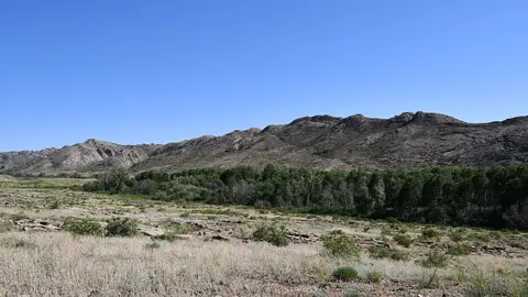
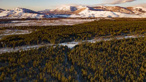
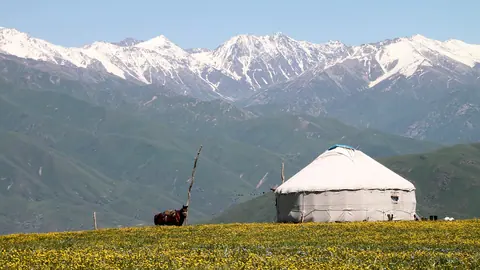
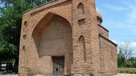


The most photogenic places in Kazakhstan are spread across a huge country, so the real choice is a region and a month, not a single viewpoint. The mountains above Almaty work for day trips, while Mangystau’s chalk cliffs, the Aral Sea and the Altai taiga each need a long trip of their own. Below is a comparison, a month-by-month table and the rules that can cost you a shot.
Pick a region first, because the distances are large
Kazakhstan’s photogenic places fall into clusters several hundred kilometres apart, and few travellers can cover more than two on one trip. Almaty is the easiest base: Shymbulak and Big Almaty Lake are day trips. The west (Aktau, Atyrau) has the chalk plateau of Mangystau and the Ural delta. The south around Shymkent has Silk Road mausoleums, and the far east around Oskemen has taiga and lakes.
| Place | What you photograph | Peak months | Base and distance | Trip |
|---|---|---|---|---|
| Shymbulak | Ski slopes up to Talgar Pass, 3,200 m | Jan–Mar, Jul–Aug | About 25 km south of central Almaty | Day |
| Big Almaty Lake | Turquoise lake at 2,511 m | Jul–Aug | 15 km south of Almaty, on foot | Day |
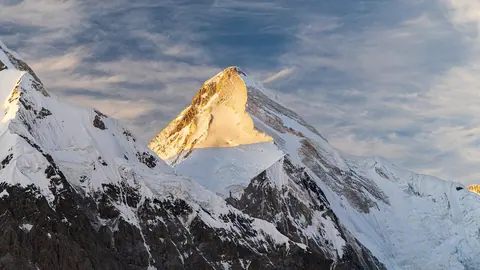
| Khan Tengri | Marble pyramid, 6,995–7,010 m | August | About 292 km from Almaty in a straight line | Expedition |
| Tekeli and Burkhan-Bulak | Gorges, a large waterfall | Jun–Sep | About 235 km from Almaty in a straight line | Day from Taldykorgan |
| Bozzhyra (Mangystau) | Chalk “fangs” on the Ustyurt edge | May, Sep | 298–300 km from Aktau | Long |
| Beket-Ata | Chalk-cliff setting of an underground mosque | Apr–May, Sep | 280–285 km from Aktau | Long |
| Akzhaiyk | Flamingos, pelicans, swans | May, Sep | About 19 km from Atyrau in a straight line | Weekend |
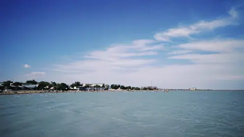
| Lake Balkhash | A lake with two colours of water | Jun–Aug | About 400 km from Almaty in a straight line | Weekend |
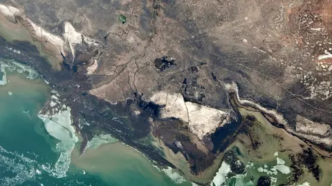
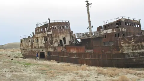
| Aral Sea | Dried seabed, Kokaral dam | May, Sep | About 463 km from Kyzylorda in a straight line | Long |
| Ulytau | Granite range, Jochi Khan mausoleum | May, Sep | About 106 km from Zhezkazgan in a straight line | Long |
| Ridder and West Altai | Fir and cedar taiga, cirque lakes, tors | Jun–Aug | About 116 km from Oskemen in a straight line | Day or longer |
| Sairam | Mausoleums of the 9th–18th centuries | May, Sep | About 15 km from Shymkent in a straight line | Day |
If you have a week and no car, the Almaty rows are the realistic ones. The Mangystau, Aral and Ulytau rows mean off-road driving and planning far ahead.
Almaty’s mountains give the most shots for the least travel
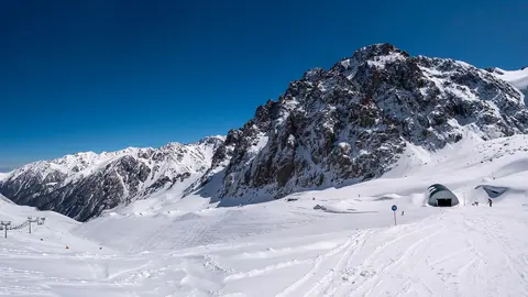
Shymbulak is the most searched photo spot among the English keywords we checked: a 4.5 km gondola climbs from the Medeu valley to a base at 2,260 m, and the top reaches Talgar Pass at 3,200 m. Winter means ski slopes; in summer the resort fills with walkers. The road is shut until 30 November, so late autumn is a weak month.
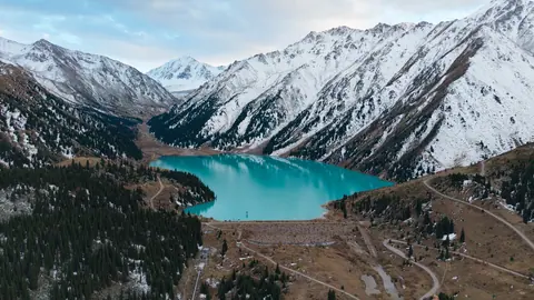
Big Almaty Lake is the opposite kind of trip. The road has been closed to private cars since 2020 and to motorcycles and electric transport since 30 April 2026, so you walk, 15 km each way and 4–6 hours up, and swimming is banned because the lake supplies Almaty’s drinking water. July and August are its peak months.
Khan Tengri is for serious mountain trips only. It is an expedition peak with no trail, on the border with Kyrgyzstan and China, known for its marble pyramid turning red at sunset. Its window is short: August is the single top month. To photograph the pyramid without an expedition, go to the shore of the salt lake Tuzkol: on a clear day it stands on the southern horizon behind the water, about 89 km away in a straight line.
Mangystau: chalk cliffs, salt flats and a mosque you cannot photograph inside
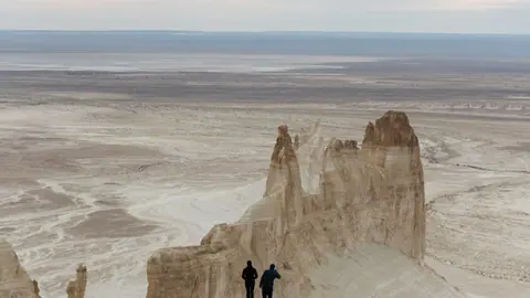
Mangystau is the strongest landscape cluster in the west, and also the hardest to reach. Bozzhyra’s white chalk fangs sit on the edge of the Ustyurt Plateau 298–300 km from Aktau, with Sherkala, the stone balls of Torysh, the Tuzbair salt flat and the Karagiye depression, 132 m below sea level, nearby. Only off-road vehicles get there, there is no mobile signal, and summer runs above +40 °C.
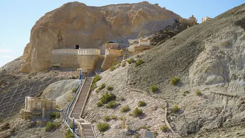
Beket-Ata, an underground mosque cut into a chalk cliff at Oglandy, is 280–285 km from Aktau, a drive of 4–5 hours, with Shopan-Ata on the way. It has been part of a UNESCO World Heritage site since July 2026. Photography inside is not allowed, so plan only for the landscape around it, and treat it as a place of pilgrimage first.
May and September are the months to aim for. April also scores well at Beket-Ata, while July and August are hot and only marginal.
Water and birds: Akzhaiyk, Balkhash and the Aral Sea
For wildlife photography, Akzhaiyk is the clear pick: the Ural delta near Atyrau sits on a migration route between Siberia and East Africa, and thousands of flamingos, pelicans and swans stop there. September and May are its peak months. Access rules need checking before you go.
Lake Balkhash is a 600 km crescent whose western half is nearly fresh and cloudy and whose eastern half is salty and bluish. That contrast is the picture. It is frozen from November to early April, so June to August is the window.
The Aral Sea is a documentary subject more than a pretty one: once the world’s fourth-largest lake, it is now mostly the Aralkum desert, with part of the northern sea brought back by the Kokaral dam. Trips go by jeep, with no road signs.
Steppe and taiga away from the usual routes
Central and eastern Kazakhstan reward photographers who want empty land. Ulytau is a 200 km granite range with Akmeshit peak at 1,131 m, Jochi Khan’s mausoleum and hundreds of recorded monuments. May and September are peak months, and transport has to be arranged in advance.
Ridder is the base for the West Altai Reserve: 86,122 ha of fir and cedar taiga, cirque lakes and granite tors, with the peak at 2,598 m and UNESCO biosphere status since 2020. Summers are short and wet, so June to August is the only real window.
Nearer Almaty’s region, Tekeli sits where three mountain rivers meet in the Dzungarian Alatau. Burkhan-Bulak, described as Kazakhstan’s largest waterfall, is up the Kora gorge. Ereymentau, about 127 km from Astana in a straight line, is the low rocky option for anyone based in the capital.
Which month suits which shot
No single month works everywhere: winter belongs to the Almaty ski slopes, spring and autumn to the deserts and Silk Road sites, and high summer to the lakes and northern mountains.
| Month | Strongest choices | Why |
|---|---|---|
| Jan–Mar | Shymbulak, Oi-Qaragai, Ak-Bulak | Ski season |
| April | Beket-Ata, Arystan Bab, Saryagash | Spring window for desert and southern sites |
| May | Mangystau, Akzhaiyk, Aral Sea, Ulytau, Sairam | Spring migration at Akzhaiyk; good season for desert sites |
| Jun–Aug | Balkhash, Ridder, Zaysan, Tekeli, Big Almaty Lake | Best season for lakes and mountains |
| August | Khan Tengri | The peak’s short climbing window |
| September | Mangystau, Akzhaiyk, Aral Sea, Ulytau, Sairam | Autumn migration at Akzhaiyk; good season for desert sites |
| October | Arystan Bab, Issyk kurgan, Saryagash | Southern history sites still at their peak |
| November | Few strong options | Lakes freeze; the Shymbulak road is shut until 30 Nov |
| December | Oi-Qaragai, Shymbulak | Ski season |
If you can travel only once, May or September covers the widest range of places: desert, birds and history.
Limits that can cost you the picture
Several places on this list restrict what or how you can shoot. Beket-Ata bans photography inside. Big Almaty Lake is closed to private vehicles and bans swimming. Mangystau has no mobile signal and needs an off-road vehicle. Shardara, a large Syr Darya reservoir on the Uzbek border, also needs access checked in advance.
Wildlife expectations need care too. Snow leopards were recorded 65 times by camera traps in the Ile-Alatau above Almaty by November 2021, but seeing one yourself is almost impossible. Plan for landscapes, not for that photograph.
- We could not confirm photo access or rules for Charyn Canyon, Kok Tobe, Panfilov Park, the Almaty Botanical Garden, Baikonur or Aksu-Zhabagly, so they are not compared here.
- We could not confirm Kazakhstan visa photo size or requirements; check with the embassy that issues your visa.
- We could not confirm drone rules for any place on this list.
- Visitor access rules for the Akzhaiyk reserve and the Shardara border area need checking before you travel.
- We could not confirm public transport to Mangystau, Ulytau or the Aral Sea; plan for a hired vehicle.