
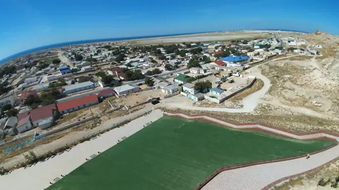
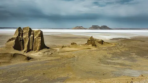


Aktau, Kazakhstan, is a Soviet-built port city on the eastern shore of the Caspian Sea and the base for exploring Mangystau. The sea starts at the city edge. The desert sights lie 56 to about 300 km away, and most of them are spring and autumn trips because summer inland goes above +40 °C.
Where Aktau is and how far the trips go
Aktau lies in Kazakhstan’s far southwest, on the Caspian, with its airport 24–25 km north of the city. Atyrau, the nearest large city covered on this site, is 388 km away in a straight line. We could not confirm distances or connections to Almaty or Astana.
The trips around Aktau fall into three rings. The seafront is in the city itself. Karagiye, Torysh, Sherkala and Fort-Shevchenko are day trips. Shopan-Ata, Karynzharyk, the Ustyurt Reserve and Bozzhyra need a weekend or longer, an off-road vehicle and real preparation.
Straight-line distances understate the drive. Sherkala is about 95 km from Aktau in a straight line but 175–180 km by the figure given for the trip. Bozzhyra is quoted at 298–300 km.
Comparison: nine trips from Aktau
The table puts the options side by side. Read it from the top for easy trips and from the bottom for remote ones.
| Place | Distance from Aktau | Trip length | Known for | Peak months |
|---|---|---|---|---|
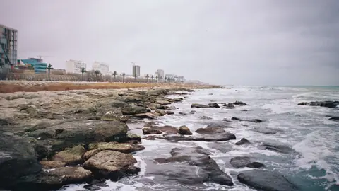
| Caspian seafront | in the city | half day | 5 km seafront walk, cliffs, beaches | Jul–Aug |
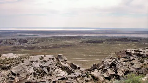
| Karagiye | ~56 km straight line | half day | 132–134 m below sea level | Apr, Oct |
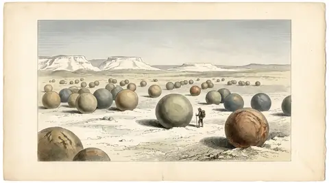
| Torysh | 90–150 km | day | stone spheres up to 4 m | May, Sep |
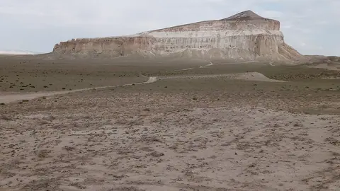
| Sherkala | 175–180 km | day | lone 332 m limestone mountain | May, Sep |
| Fort-Shevchenko | ~121 km straight line | day | Shevchenko exile, lighthouses | May–Jun, Sep |
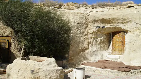
| Shopan-Ata | ~179 km straight line | weekend | rock-cut mosque, old graves | Apr, Oct |
| Karynzharyk | ~275 km straight line | weekend | 2,000 km² of sand and salt flats | Apr, Oct |
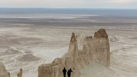
| Ustyurt Reserve | ~284 km straight line | weekend | cliffs over 200 m | Apr, Oct |
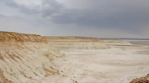
| Bozzhyra | 298–300 km | long | white chalk fangs | May, Sep |
With one free day, Karagiye plus the seafront is the low-effort choice. With two or three days and a 4x4, the Torysh–Sherkala–Bozzhyra line is the natural choice.
Aktau mountains: the hills and cliffs you can reach
There are no high mountains around Aktau; the relief is plateau edges, lone hills and depressions. Sherkala rises to 332 m above sea level, 18 km from the village of Shetpe, and looks like a yurt from one side and a lying lion from the other. Torysh lies at the northern end of the Western Karatau hills.
The most dramatic relief is on the edge of the Ustyurt Plateau. At Bozzhyra white chalk spurs stand along the cliff, and in the Ustyurt Reserve the cliffs exceed 200 m. The lowest ground runs the other way: Karagiye drops to 132–134 m below sea level, the lowest point of land in Kazakhstan, and Karynzharyk also falls below sea level.
If you searched for a mountain range literally called Aktau, check where it is before booking flights: this page covers trips from the Caspian city.
Aktau weather and when to go
Spring and autumn suit the desert, while July and August suit the sea, so no single month covers everything. Summer inland goes above +40 °C at Sherkala and Bozzhyra, and at Ustyurt summer days reach almost 38 °C. The swimming season runs from late May to about August, with the sea around 18 °C.
| Month | What works |
|---|---|
| Jan–Mar | Karagiye and Fort-Shevchenko possible; Bozzhyra, Torysh, Sherkala off or marginal |
| April | Peak for Karagiye, Shopan-Ata, Karynzharyk, Ustyurt |
| May | Peak for Bozzhyra, Torysh, Sherkala, Fort-Shevchenko; sea opens late in the month |
| June | Fort-Shevchenko peak; desert becomes hot |
| Jul–Aug | Sea at its peak; inland trips only possible, Karynzharyk and Ustyurt worst in July |
| September | Peak for Bozzhyra, Torysh, Sherkala, Fort-Shevchenko |
| October | Peak for Karagiye, Shopan-Ata, Karynzharyk, Ustyurt |
| Nov–Dec | Mostly off; a few day trips possible |
The safe planning windows are late April to May and September to early October. A trip in May or September lets you combine the desert with a cool swim or a seafront walk.
What stands in the way without a car
The remote sites are built for self-drive with an off-road vehicle, not for public transport. Bozzhyra is described as off-road only, with no mobile signal, and cars pay an entry fee. We could not confirm buses or shared taxis to any site beyond the city.
Rules differ by place. Torysh has no protected status and no guards, so the spheres depend on visitors leaving them alone. The Ustyurt Reserve is a strict nature reserve, and its visiting regime needs checking in advance. Shopan-Ata is a sacred place with an underground mosque and graves from the 10th to 19th centuries; dress and behave as at any mosque.
Karagiye is the exception: the Aktau–Zhanaozen highway crosses its floor, so it is the easiest desert stop for a visitor without an off-road car.
Combining sights into one route
Several places sit close enough to string together. Torysh and Sherkala are 50–60 km apart, Torysh is 17.5 km from Taushyk and Sherkala 18 km from Shetpe, which makes a natural one-day loop north-east of Aktau.
The Bozzhyra and Mangystau trip passes the Tuzbair salt flat and can be combined with Karagiye and the Torysh–Sherkala area. Fort-Shevchenko is a separate coastal day on the Tupkaragan cape, with fortifications dating from 1717, the fort town from 1846 and the Bautino port nearby. For a sea day without driving, see the Caspian at Aktau.
- Public transport or shared taxis from Aktau to any site outside the city
- Visiting rules and permits for the Ustyurt Reserve
- Current road conditions on the off-road tracks to Bozzhyra and Karynzharyk
- Current entry fee at Bozzhyra and where it is paid
- Fuel, water and food stops along the routes inland