
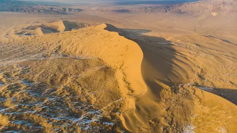
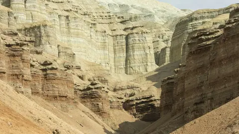
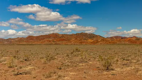
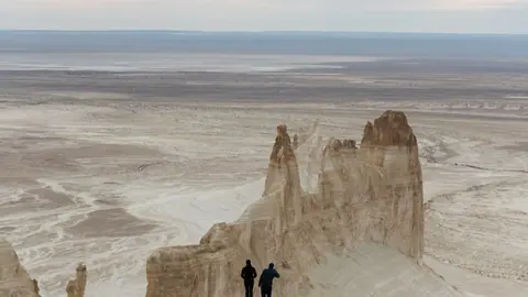
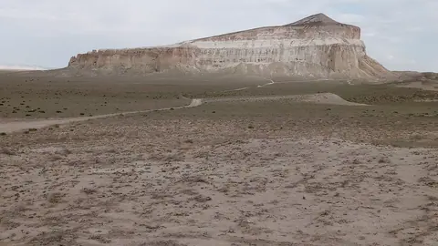
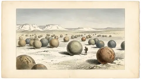
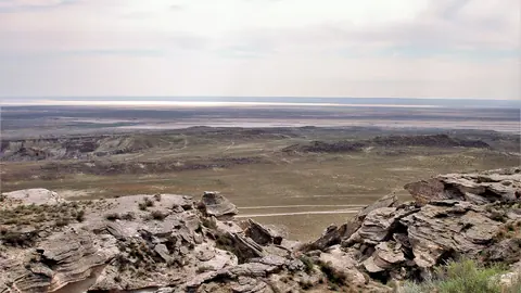
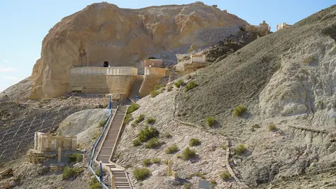
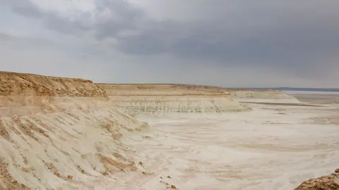
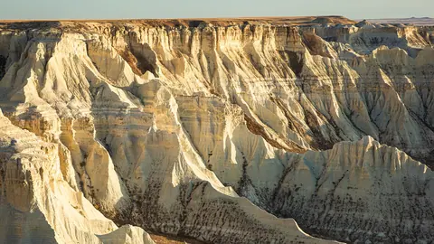


Choosing a desert in Kazakhstan comes down to where you start. From Almaty, the realistic choice is Altyn-Emel National Park, with the Singing Dune and the striped Aktau hills. From Aktau on the Caspian coast, the Mangystau desert opens up: chalk cliffs, stone spheres and the country’s lowest ground.
Two regions cover most desert trips: Altyn-Emel and Mangystau
Most of the places below sit in one of two areas, and that should shape your plan. Altyn-Emel lies east of Almaty and holds the Singing Dune, the Aktau clay hills and the volcanic Katutau range; Katutau is about 210 km in a straight line from Almaty. Mangystau is in the far south-west, where seven of the fifteen places in this guide are reached from the city of Aktau.
One naming trap: the Aktau mountains are in Altyn-Emel, nowhere near the city of Aktau on the Caspian. Book flights and transfers with that in mind.
The remaining deserts are scattered: Moiynkum in the south near Taraz, Kiin-Kerish in the far east near Lake Zaysan, Aktolagai in the west near Atyrau, and the Aral Sea and Barsakelmes in Kyzylorda Region. Each is a separate expedition.
How the desert places compare
This table is for a first cut: start city, trip length and best months. A “day” trip still means a long drive; “long” means several days.
| Place | Start from | Trip | Best months | Known for |
|---|---|---|---|---|
| Singing Dune | Almaty | Weekend | Apr–May, Sep–Oct | Sand mountain 120–150 m high |
| Aktau mountains | Almaty | Weekend | Apr–Jun, Aug–Oct | Banded clay, 60–70 million years old |
| Katutau | Almaty / Taldykorgan | Day | May, Sep | Permian lava, Tiger Mountains |
| Bozzhyra (Mangystau) | Aktau | Long | May, Sep | Chalk “fangs” on the Ustyurt edge |
| Sherkala | Aktau | Day | May, Sep | Lone 332 m lion-shaped hill |
| Torysh | Aktau | Day | May, Sep | Stone spheres up to 4 m |
| Karagiye | Aktau | Day | Apr, Oct | 132–134 m below sea level |
| Beket-Ata | Aktau | Long | Apr–May, Sep | Underground mosque in chalk |
| Ustyurt Reserve | Aktau | Weekend | Apr, Oct | Cliffs over 200 m high |
| Karynzharyk | Aktau | Weekend | Apr, Oct | Salt flats and low dunes |
| Aral Sea | Kyzylorda area | Long | May, Sep | Dried seabed, Kokaral dam |
| Barsakelmes | Kyzylorda area | Long | Apr–May, Sep | Former island, nature reserve |
| Moiynkum | Taraz / Shymkent | Weekend | Apr–May, Sep | 500 km belt of sand ridges |
| Kiin-Kerish | Oskemen | Weekend | May, Sep | Red and white clay towers |
| Aktolagai | Atyrau | Long | May, Sep | 90 km chalk ridge, shark teeth |
If you have one weekend and land in Almaty, the top three rows are your options. If you fly into Aktau, allow extra days to combine several Mangystau sites.
Mangystau desert: chalk country reached from Aktau
The Mangystau desert rewards the most time and asks the most effort. Karagiye is the easy start: a basin about 56 km in a straight line from Aktau, where the Aktau–Zhanaozen highway crosses the floor.
Further out, Torysh lies 90–150 km from Aktau, and Sherkala, 18 km from the village of Shetpe, is 175–180 km away. The two are 50–60 km apart. Torysh has no protected status, so nothing guards the spheres.
The headline sight, the Bozzhyra chalk cliffs, is about 300 km from Aktau and reachable by off-road vehicle only, with no mobile signal. Beket-Ata, 280–285 km and 4–5 hours’ drive from Aktau, is a working pilgrimage site with a pilgrims’ guesthouse and a ban on photos inside; treat it as a place of prayer, not a viewpoint. The Mangystau page covers how these sites link up.
The Ustyurt Reserve and Karynzharyk are for prepared travellers only. Ustyurt is a strict nature reserve whose access rules need checking, and Karynzharyk has no facilities we could confirm.
Desert from Almaty: dunes and clay hills in Altyn-Emel
Altyn-Emel is the only cluster here that works as a weekend from Almaty. The park village of Basshi is given as 250 km from Almaty; the Singing Dune is 35–40 km from Basshi, and the Aktau hills 70–120 km.
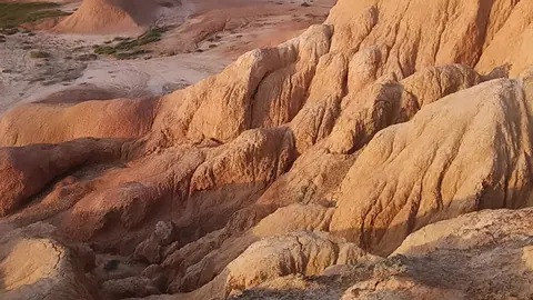
The Singing Dune is 1.5–3 km long and hums only when the sand is dry, so a rainy day can mute it. The Aktau and Katutau mountains sit 40 km apart and show two different deserts: pale banded clay with fossils of ancient rhinos and crocodiles, and dark volcanic rock. Entry to Altyn-Emel is charged per day; check the current fee before you go.
Heat is the main risk. July days in the Aktau hills reach up to +43 °C.
The far-flung deserts: Aral, Moiynkum, Kiin-Kerish and Aktolagai
These places suit travellers who want emptiness more than a checklist. Each needs its own long trip and, in most cases, local help.
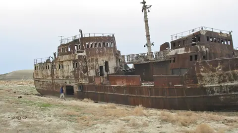
The Aral Sea was once the fourth-largest lake on Earth, about 68,000 km² in the 1950s; most of it is now the Aralkum desert, and the Kokaral dam has brought part of the northern sea back. Trips run by jeep, with no road signs. Nearby Barsakelmes, the sea’s former largest island, now holds a nature reserve whose entry rules we could not confirm.
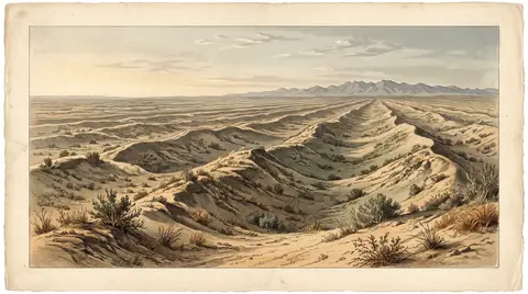
Moiynkum covers 37,500 km² of sand ridges up to 70 m, about 117 km in a straight line from Taraz, but confirmed access routes are missing. Kiin-Kerish, 243 km in a straight line from Oskemen, is a 300 ha canyon of coloured clay whose roads fail after rain. Aktolagai, 252 km in a straight line from Atyrau, is a 90 km chalk ridge where Cretaceous shark teeth turn up; you will have to plan the route yourself.
Spring and September decide the trip
Across all fifteen places, April–May and September are the safe window. Summer days in Mangystau go above +40 °C, and winter rules out most sites.
| Period | What works | What to avoid |
|---|---|---|
| March | Singing Dune, Karagiye, Karynzharyk | Remote Mangystau tracks |
| April–May | Almost everything; Ustyurt and Karagiye peak in April | Rain on Kiin-Kerish clay |
| June–August | Aktau hills and Katutau, early starts only | Mangystau, Ustyurt, Karynzharyk in July |
| September | Best month for nearly every site | Few drawbacks |
| October | Singing Dune, Aktau hills, Ustyurt, Karagiye, Karynzharyk | Kiin-Kerish, Bozzhyra less reliable |
| November–February | Beket-Ata and Karagiye possible; Moiynkum marginal | Most sites are off |
If your dates are fixed in summer, Altyn-Emel is the more forgiving choice. In October, lean towards Ustyurt, Karagiye or Karynzharyk, which peak that month.
What stands in the way without a car
Almost every site here assumes your own vehicle, often an off-road one. Bozzhyra is off-road only, the Aral trips run by jeep, and Moiynkum, Aktolagai, Barsakelmes and Karynzharyk have unconfirmed access details.
We could not confirm any public transport to these places, nor whether English-speaking drivers or guides are available. Expect no mobile signal at the remote Mangystau sites, and plan water and fuel as if nothing is on the way.
- Public transport to any of these desert sites
- Entry rules for the Ustyurt and Barsakelmes reserves
- Current entry fees for Altyn-Emel National Park
- Road conditions to Aktolagai, Moiynkum and Karynzharyk
- Availability of English-speaking drivers or guides in Aktau and Almaty