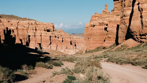
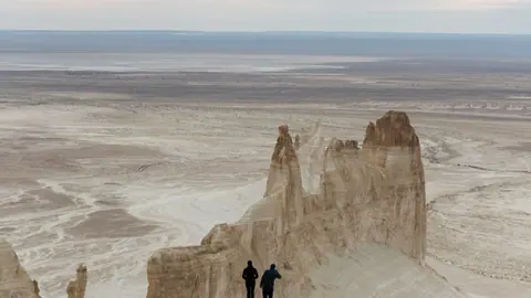
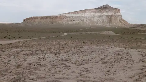
01 Valley of Castles The main section of Charyn, about 3 km long and 200–700 m wide, reached on foot or by park vehicle from the gate.
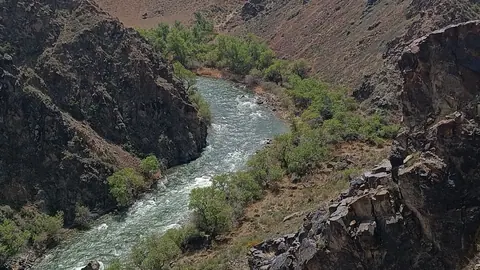
02 The Black Canyon on the Charyn River (Aktogay) A viewpoint right by the paved road to Kolsai, about 20 km in a straight line from the Valley of Castles, so no 4x4 is needed to see it.
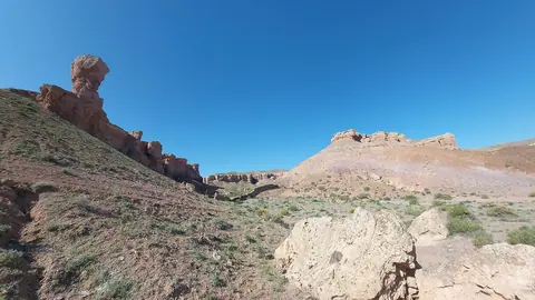
03 Bestamak, Temirlik and Kurtu Temirlik runs 11 km and reaches 160 m deep with very few visitors, and the park lists a Temirlik route.
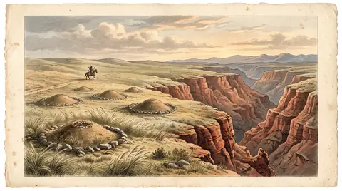
04 Burial mounds and kurgans An archaeological route of the park, where the Sarytogay burial ground is dated from the 1st–2nd century BC to the 2nd century AD.
05 Bozzhyra and the wild landscapes of Mangystau Bozzhyra's white chalk cliffs stand about 300 km from Aktau and need a 4x4 and full self-sufficiency in fuel and water.
06 Sherkala Mountain A lone limestone mountain of 332 m, 18 km from Shetpe, shaped like a yurt from one side and a lion from the other.
Charyn Canyon is the canyon most travellers in Kazakhstan mean. It follows the Charyn River for 154 km, roughly 195–205 km by road east of Almaty, and its walls reach 150–300 m. The other canyons on this page are either side trips from Charyn or a separate expedition in the far west of the country.
Charyn Canyon is a system, not one gorge
Charyn Canyon lies in Almaty Region close to the Chinese border, inside Charyn National Park. English Wikipedia names five parts: the Valley of Castles, Temirlik, the Yellow Canyon, the Red Canyon and Bestamak, plus smaller tracts such as Kurtogay. The rock is sedimentary red sandstone shaped by water and wind.
Figures differ between sources. The canyon is given as 154 km long, while the formation along the river banks is also stated as about 80 or 90 km. Russian Wikipedia dates the rock at about 12 million years; naturalist P. I. Marikovsky placed the start of its formation about 25 million years ago. Even the park’s founding date differs: 23 February 2004 in the Russian and English articles, 23 April 2004 in the Kazakh one.
For a first visit, almost everyone goes to the Valley of Castles, the only part reachable directly from the park gate according to Wikivoyage.
Comparing the canyons at a glance
The table shows the trade-off: the Valley of Castles is easy to reach and busy, the others are quieter but cost you extra hours or a 4x4.
| Place | Region | Size | Access | Who it suits |
|---|---|---|---|---|
| Valley of Castles (Charyn) | Almaty Region | about 3 km long | park gate, then walk or park vehicle | first-timers, day trip |
| Black Canyon (Aktogay) | Almaty Region, Kegen District | depth 98 m or 200–300 m, sources differ | viewpoint by the road to Kolsai | quick photo stop |
| Temirlik | Almaty Region | 11 km long, up to 160 m deep | about 65 km detour via Aksay | people avoiding crowds |
| Bozzhyra (Mangystau) | far west, from Aktau | about 300 km from Aktau | 4x4 only | a separate multi-day trip |
| Sherkala (Mangystau) | far west | 332 m above sea level | 18 km from Shetpe | combined with Bozzhyra |
If you have one day from Almaty, the realistic choice is the Valley of Castles, possibly with Black Canyon on the way to the lakes. Temirlik and the other Charyn canyons need a car and extra planning.
Almaty to Charyn Canyon: what the trip demands
The trip from Almaty to Charyn Canyon is a full day by car. English Wikipedia describes the main road through the villages of Shelek, Baiseit and Kokpek, about 190 km, then a signposted 9 km road through the national park to the parking area.
Without your own car it gets harder. Wikivoyage, updated in 2018, says a car seems to be the only way in and suggests hiring a whole taxi early in the morning at Sayakhat bus station in Almaty. It also reports a rumoured minibus towards Kegen that the bus station staff knew nothing about. Hitchhikers tend to get stranded at the junction, and the 10 km branch road to the gate is too long to walk.
At the gate you pay a fee and show your passport, with extra charges for driving in or camping. Organised tours exist, but we do not list operators; compare what is included before booking.
Trails inside Charyn National Park
The classic Charyn Canyon hike runs through the Valley of Castles, about 5 km round trip with little change in elevation, according to Wikivoyage (2024). The walk on the flat floor is easy; the climb back up is the harder part.
| Trail | Round trip | Effort |
|---|---|---|
| Valley of Castles | about 5 km | easy, little elevation change |
| Witches Gorge | 5.4 km | slightly harder |
| Miocene Gorge | 13 km | long |
The visitor centre offers guided tours on all three. A park-operated vehicle can drive you through the canyon one way or both ways, but waits can be long on busy days. The cliffs are very steep, and Wikivoyage warns plainly that people can fall to their death taking photos.
When to go to Charyn and the other canyons
Spring and autumn are the comfortable windows. Our page on the Valley of Castles recommends April–May and September–October, because the canyon floor has no shade in summer. Summer heat figures differ: up to +35 °C on that page, over 40 °C according to Wikivoyage.
The park sits around 1,300 m above sea level, so nights can be cold even in summer, and strong wind can make a summer day feel wintry. Carry a warm layer whatever the month.
| Place | Suggested months | Main risk |
|---|---|---|
| Valley of Castles | Apr–May, Sep–Oct | no shade, summer heat |
| Black Canyon | Apr–Jun, Aug–Oct (Russian Wikipedia) | open cliff edge |
| Mangystau | mid-Apr to end of May, second half of Sep | summer above +40 °C, nights 20–30 degrees colder |
We could not confirm conditions in winter: road state, trail access and whether the park vehicles run in December or January.
Charyn Canyon and Kolsai Lake in one trip
Charyn and the Kolsai Lakes lie in the same direction from Almaty, so many travellers combine them. Wikivoyage gives about 92 km from the canyon to the lakes and suggests Charyn as a stopover on the way to Saty or on the way back.
Black Canyon sits between Charyn and Saty, about 20 km in a straight line south-west of the Valley of Castles, with a viewpoint right by the road. Kaindy Lake, with its sunken spruce forest, is about 69 km in a straight line from Charyn.
From Charyn, Wikivoyage also gives 65 km to Kegen and 92 km to the Kyrgyz border in the Karkara valley, useful if you continue towards Karakol.
Mangystau: canyon country in the far west
For a completely different landscape, Mangystau in western Kazakhstan has white chalk cliffs rather than red sandstone. Bozzhyra stands on the edge of the Ustyurt plateau about 300 km from Aktau, reachable only by 4x4 on stony ground, and after rain a car may not get through.
There is no mobile signal on site and fuel only in Aktau, Zhanaozen and Shetpe. A loop including Sherkala, Torysh and Bozzhyra is planned at five days and 950–1,100 km. Treat it as a trip of its own, not an add-on to Almaty.
What you can really do in a day from the city is worked out in canyons near Almaty.
- Current entrance fee and extra charges for cars and camping at Charyn National Park
- Whether any public bus or minibus now runs from Almaty towards Charyn
- Winter road and trail conditions at Charyn and whether park vehicles run in December–February
- State of the access road to Temirlik via Aksay
- Location and access details for the place searched as Moon Canyon
Frequently asked questions
Is there a Charyn Canyon entrance fee?
How far is Charyn Canyon from Almaty?
What is the altitude of Charyn Canyon?
How does Charyn Canyon compare with the Grand Canyon?
Can you camp at Charyn Canyon?
What is Black Canyon in Kazakhstan?
Sources
In this section: Where to go in Kazakhstan
- Almaty cable cars: which lines run, where they go and what to check first
- Glamping in Kazakhstan and near Almaty: Night Temperatures, Park Rules, What to Ask
- Horse riding in Kazakhstan: where to ride and what to expect
- Ice skating in Almaty: free city rinks and what is known about the 2026/27 season
- Stargazing in Kazakhstan: meteor shower calendar 2026–2027 and dark skies near Almaty
- Aktobe Kazakhstan: four remote steppe places and the weather that decides when to go
- Alakol, Balkhash or Kapshagay: where to spend a holiday by the water
- Ancient cities of Kazakhstan: nine sites and what is left to see
- Beach lakes in Kazakhstan: which lake suits a summer swim
- Burabay or Bayanaul: which to choose for a northern summer
- Canyons near Almaty: what actually fits into one day
- Caves and underground mosques of Kazakhstan: which one fits your trip
- Charyn or Kolsai with Kaindy: where to go if you have one day
- Choosing a desert in Kazakhstan: dunes, chalk cliffs and a vanished sea
- Day trips from Almaty, Kazakhstan: lakes, peaks, kurgans and ski slopes within a day
- Eagle hunting in Kazakhstan: where to see Kazakh eagle hunters
- From the Kaindy Lake underwater forest to Altai taiga: choosing a forest trip in Kazakhstan
- Hiking in Kazakhstan: where to walk, from Almaty's day trails to the Altai
- Hot springs in Kazakhstan: how to choose between six thermal spas
- Kazakhstan in April: where the season peaks and what can wait until May
- Kazakhstan in August: where the weather and the season line up
- Kazakhstan in July: which mountains, lakes and cities suit the month
- Kazakhstan in June: weather, lakes and where to go this month
- Kazakhstan in March: where to go while the mountains hold snow and the south warms up
- Kazakhstan in May: the places our guide rates at their best this month
- Kazakhstan mountains: ranges, peaks and where to go
- Kazakhstan nature in 20 places: lakes, peaks, canyons and hot springs
- Kazakhstan or Kyrgyzstan: which to choose for a mountain trip
- Kazakhstan tourist attractions: 50 places to visit
- Kazakhstan travel in February: ski slopes, hot springs and warm indoor sights
- Kazakhstan travel in January: ski slopes, hot springs and warm indoor sights
- Kazakhstan without a car: places you can reach by city bus, cable car and on foot
- Lakes near Almaty: how Big Almaty Lake, Kaindy, Issyk and the reservoirs compare
- Lakes of Kazakhstan: 15 places to visit
- Mangystau region: choosing between chalk cliffs, rock mosques and the Caspian coast
- Mosques in Kazakhstan: which to visit and how to behave inside
- Mountains in Almaty and around it: how to pick the right one for your trip
- Museums in Kazakhstan: which to pick by theme, and what to check first
- Places in Kazakhstan without the crowds, and how to choose between them
- Reservoirs in Kazakhstan: the largest, and the few worth a trip
- Sacred places of Kazakhstan and how to choose which to visit
- Seven Wonders of Kazakhstan: two lists and no confirmed result
- Shymbulak or Oi-Qaragai: which resort near Almaty to choose
- Skiing in Kazakhstan: how Shymbulak compares with the other ski resorts near Almaty and in the Altai
- Tamgaly petroglyphs and the other rock art sites of Kazakhstan
- The Kazakh steppe: where to see it, and where you are allowed in
- The Mausoleum of Khoja Ahmed Yasawi and the other shrines and Silk Road cities of Kazakhstan
- The most photogenic places in Kazakhstan, and the month each one looks its part
- The Silk Road in Kazakhstan: three corridors and where to see them
- Tian Shan in Kazakhstan: where the range runs and which part to visit
- Top 10 nature destinations in Kazakhstan
- Trips from Aktau, Kazakhstan: the coast, the desert and the Mangystau hills
- Trips from Karaganda, Kazakhstan: Gulag memorials, granite hills and steppe lakes
- Trips from Kyzylorda: the cosmodrome, the Turkistan shrines and the Syr Darya ruins
- Trips from Oskemen: nine places in East Kazakhstan and when each one works
- Trips from Pavlodar: where to go and how far each place is
- Trips from Taldykorgan: where to go in the Dzungarian Alatau, Altyn-Emel and beyond
- Trips from Taraz: what to see in the city, nearby and further across the south
- Trips from Turkistan, Kazakhstan: ruined cities, shrines and the Karatau hills
- Turgen waterfall, Burkhan-Bulak and Butakovka: choosing a waterfall in Kazakhstan
- Waterfalls near Almaty: how to choose between Turgen and Butakovka
- Weekend trips from Astana: 5 places in nature
- What to do in Almaty in winter, from ski slopes to hot springs
- What to see around Karaganda, Kazakhstan: Gulag memory, granite hills and steppe lakes
- What to see in Akmola Region: lakes, steppe hills and a Gulag memorial
- What to see in Almaty Region: lakes, canyons and mountains around Almaty
- What to see in East Kazakhstan Region and when to go
- What to see in Kyzylorda Region: a spaceport, a shrunken sea and a singing monument
- What to see in Turkistan, Kazakhstan: shrines, ruined cities and spas of the Turkistan Region
- What to see in Zhambyl Region: Taraz's old tombs and the Moiynkum sands
- What to see in Zhetysu Region, and which trip suits you
- Where to go from Almaty for a day or a weekend
- Where to go from Kokshetau: four lakes nearby, and the capital further out
- Where to go from Konaev: the Ili River, Saka kurgans and Almaty's mountains
- Where to go from Semey: eight trips, from the Abai Museum to the Bayanaul lakes
- Where to go from Shymkent: shrines, Silk Road ruins, canyons and spas
- Where to go in Kazakhstan for Nauryz: nature on the 21–23 March holiday
- Where to go in Kazakhstan in autumn
- Where to go in Kazakhstan in December: ski slopes, hot springs and warm indoor sights
- Where to go in Kazakhstan in November, when the weather favours hot springs and indoor sights
- Where to go in Kazakhstan in October: mountain trails near Almaty and the southern shrines
- Where to go in Kazakhstan in September, and what the weather allows
- Where to go in Kazakhstan in spring
- Where to go in Kazakhstan in summer
- Where to go in Kazakhstan in winter
- Where to go in Kazakhstan with kids, and which month suits each place
- Where to go on Kazakhstan's Caspian Sea coast, and when
- Where to see Kazakhstan wildlife: eight places compared
- Which peaks in Kazakhstan suit a hiker's first summit
