Elevation of Almaty and 160 places in Kazakhstan
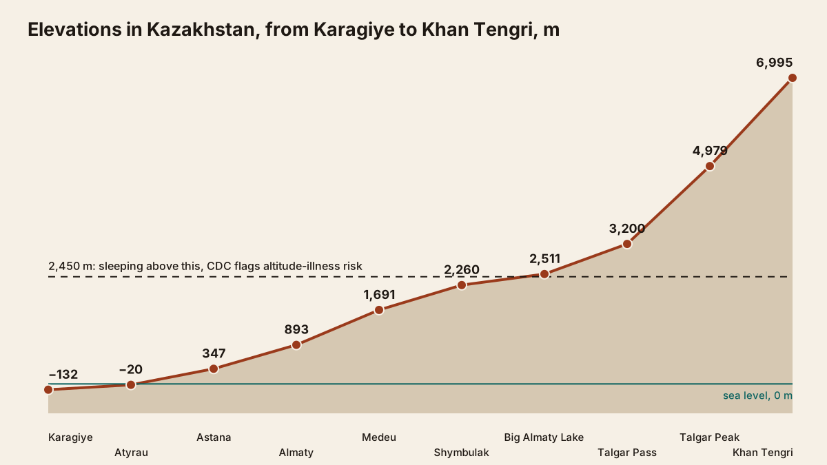
Almaty's centre sits at about 893 m, but the city climbs from roughly 500 m to 1,700 m. Medeu is at 1,691 m, Shymbulak's base at 2,260 m and Big Almaty Lake at 2,511 m. Below: a sortable table of 160 places and cities, and a calculator for how much colder it is up there.
Almaty’s elevation is about 893 m at the centre, but the city spreads up a slope from roughly 500 m to 1,700 m. That is why you see different numbers quoted: English Wikipedia gives 700–900 m for most of the built-up area, and our map point for the city reads 817 m on a digital elevation model. Above town, Medeu sits at 1,691 m, the Shymbulak base at 2,260 m and Big Almaty Lake at 2,511 m. Use the table and calculator below to compare any of 160 places and cities.
Quick answers: the places people ask about
| Place | Elevation, m | Colder than central Almaty, °C |
|---|---|---|
| Kok-Tobe | 1,130 | ≈1.5 |
| Medeu ice rink | 1,691 | ≈5.2 |
| Kolsai lower lake | 1,818 | ≈6.0 |
| Shymbulak base | 2,260 | ≈8.9 |
| Big Almaty Lake | 2,511 | ≈10.5 |
| Talgar Pass, top of Shymbulak | 3,200 | ≈15.0 |
The last column uses the standard lapse rate of 6.5 °C per 1,000 m from central Almaty (893 m). It is an average; on winter nights the real gap is often half that, as explained below.
Elevation table and “how much colder” calculator
Pick a place or type your own elevation, say from your GPS at a trailhead, and choose a city to compare with. The table filters by region and sorts by any column; without JavaScript it shows all rows, highest first. Download every row as kazakhstan-altitude.csv.
The 6.5 °C rule versus real mountain weather
The rule works on summer afternoons and badly overstates the cold on winter nights. We compared 2011–2020 ERA5 reanalysis normals for an Almaty grid point at 814 m with points in the mountains above the city; these normals already appear on each place page.
| Place, grid elevation | By the rule | January night | July day |
|---|---|---|---|
| Kok-Tobe, 1,110 m | 1.9 | 1.8 | 3.6 |
| Medeu, 1,702 m | 5.8 | 2.7 | 7.2 |
| Shymbulak, 2,290 m | 9.6 | 5.4 | 11.3 |
| Big Almaty Lake, 2,508 m | 11.0 | 5.9 | 11.4 |
| Tuyuksu Glacier, 3,660 m | 18.5 | 8.8 | 17.4 |
Figures are degrees colder than the Almaty point; the calculation is ours, from ERA5 series via Open-Meteo.
In July, Shymbulak averages about 17 °C in the afternoon against 29 °C in the city, slightly colder than the rule predicts. On January nights the picture flips, probably because of winter inversions that trap cold air in the basin: Medeu is only 2.7 °C colder than Almaty instead of 5.8 °C. Pack for the forecast at your elevation, not for the rule. Month-by-month figures by altitude are on Almaty mountain weather.
Altitude sickness: where the risk starts
The CDC considers any unacclimatised traveller sleeping at 2,450 m or higher to be at risk, sometimes lower. Headache is the key symptom. Fatigue, nausea, dizziness or loss of appetite often come with it, usually 2–12 hours after arrival.
| Sleeping elevation, first night | CDC risk | Examples here |
|---|---|---|
| below 2,750 m | low | Medeu, Shymbulak base, Big Almaty Lake |
| 2,750–3,400 m | moderate | Talgar Pass, upper Kolsai Lake |
| above 3,400 m | high | Tuyuksu Glacier, summits |
- Above 3,000 m, raise your sleeping elevation by no more than 500 m a day and add a rest night for every 1,000 m gained.
- Above roughly 2,700 m, periodic breathing during sleep is almost universal and not in itself an illness.
- High-altitude cerebral oedema is rare below 4,300 m, but if symptoms get worse at the same elevation, the CDC says to descend.
The CDC table assumes a start below 1,200 m, which central Almaty is. Day trips to Big Almaty Lake, Shymbulak or Medeu with a night back in the city do not fall under the sleeping-altitude rule. Vaccinations, insurance and medicines are covered on the health page.
Where the numbers come from
Each row names its source: the place page, Wikipedia, Wikidata or a digital elevation model (DEM). We use a verified figure from the place page when we have one, otherwise Wikidata’s elevation (property P2044), otherwise the Copernicus GLO-90 DEM at the place’s map point via Open-Meteo.
- A DEM measures one point on the map, not the whole place. For a waterfall or a mausoleum that is close enough; for a canyon the point may fall on the floor or the rim.
- Huge territories are left out. The elevation of the “centre” of a park the size of a province says nothing, so large parks such as Altyn-Emel are not in the table. Their peaks and lakes are on the park pages.
- Mountains show the summit. Peaks such as Khan Tengri are listed at summit height, not base camp.
- References disagree. For Kaindy Lake, sources range from 1,667 to 2,000 m; the table shows 1,862 m from the DEM.
The highest point in Kazakhstan is Khan Tengri at 6,995 m; the lowest is the Karagiye Depression at −132 m. More national figures are in how big is Kazakhstan.
Frequently asked questions
What is the elevation of Almaty?
What is the altitude of Big Almaty Lake?
How high is Shymbulak ski resort?
Can you get altitude sickness in Almaty?
What is the elevation of the Caspian Sea?
How much colder is it at Shymbulak than in Almaty?
Sources
- CDC Yellow Book: High-Altitude Travel and Altitude Illness (23 April 2025)
- Wikipedia: International Standard Atmosphere (6.5 °C per 1,000 m)
- Open-Meteo: Elevation API (Copernicus GLO-90 digital elevation model)
- Copernicus DEM: Global and European Digital Elevation Model
- Wikidata: property P2044, elevation above sea level
- Wikipedia: Almaty (elevation 500–1,700 m)
- Wikipedia (Russian): Almaty (centre 893 m)
- Wikipedia (Russian): Caspian Sea (level −27.16 m in 2009)
- Wikipedia (Russian): Extreme points of Kazakhstan (Khan Tengri, Karagiye)
- Open-Meteo: ERA5 reanalysis archive, 2011–2020 normals
Read also
 Almaty mountain weather: temperatures by altitude and month
 Health and medicine in Kazakhstan: vaccines, insurance, medicines, ticks, altitude
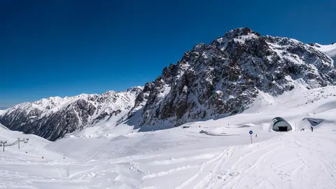 Shymbulak: the ski resort above Medeu and Talgar Pass
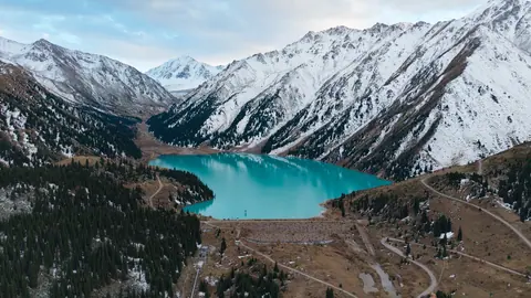 Big Almaty Lake
- Distances from Kazakhstan cities to places
- Kazakhstan climate by month: cities and places