How big is Kazakhstan? Area, borders and extreme points on the map
Kazakhstan covers 2,724,900 km², the ninth-largest country on Earth and the largest with no access to the ocean. It is bigger than France, Spain, Germany, Italy, the UK and Poland combined, borders five countries along 13,398 km of land, and runs on a single time zone, UTC+5.
Kazakhstan is huge: 2,724,900 km², ninth in the world and the largest landlocked country. France, Spain, Germany, Italy, the United Kingdom and Poland together cover 2,365,881 km², still about 359,000 km² less. The country stretches roughly 2,900–2,960 km from west to east and 1,600–1,650 km from north to south, yet it has only about 20.6 million people. For a traveller, that scale decides almost everything: how many days you need, and when it is worth flying instead of driving.
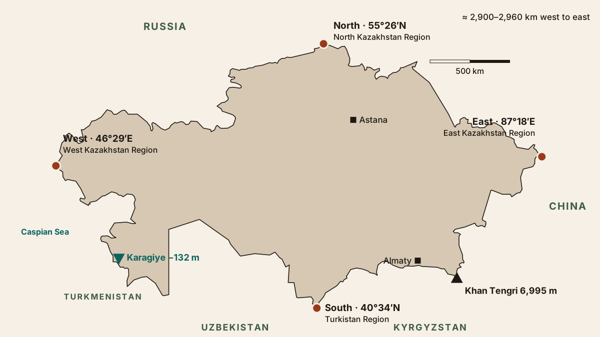
Kazakhstan at a glance
| Fact | Figure |
|---|---|
| Area | 2,724,900 km², 9th in the world |
| Land / water | 2,699,700 / 25,200 km² |
| Land border | 13,398 km with 5 countries |
| Highest / lowest point | Khan Tengri 6,995 m / Karagiye −132 m |
| Population, 1 Oct 2026 | 20,633,529 |
| Density | about 7.6 people per km² |
| Time zone | UTC+5 nationwide since 1 March 2024 |
| Lakes | 48,262, of which 21 exceed 100 km² |
We calculated the density ourselves from the official population and area. Every figure is in one downloadable file: kazakhstan-geography.csv.
How big is Kazakhstan, really?
Kazakhstan is about 4.2 times the size of France, 7.6 times Germany and 11 times the United Kingdom. It is a little over a quarter of the United States and only 55,500 km² smaller than Argentina, the eighth-largest country.
Wikipedia, List of countries and dependencies by area (total area incl. water).
What that means on the ground: Almaty to Astana is about 970 km in a straight line, and Almaty to Uralsk in the far north-west is about 2,100 km. Most visitors base themselves around Almaty and the Tian Shan mountains, then fly if they want Astana, Mangystau or the Altai. Straight-line distances from cities to every place on this site are in the distance tool, and the first-time guide covers how people actually plan the trip.
Which countries border Kazakhstan?
Five countries share 13,398 km of land border with Kazakhstan, and Russia alone accounts for 56% of it.
Committee of Geodesy and Cartography of Kazakhstan, via nur.kz (20 April 2023). Total 13,398 km.
| Neighbour | Border, km | Share |
|---|---|---|
| Russia | 7,548 | 56.3% |
| Uzbekistan | 2,351 | 17.5% |
| China | 1,783 | 13.3% |
| Kyrgyzstan | 1,257 | 9.4% |
| Turkmenistan | 459 | 3.4% |
Sources disagree on the details. English Wikipedia, using CIA World Factbook data, gives 13,364 km and different section lengths, such as 7,644 km with Russia. The head of the Border Service has cited 15,132 km, apparently including sea sections, though the report does not explain the difference. The Chinese section is the best documented: 1,782.75 km under the 2002 demarcation protocol, of which 1,215.86 km runs over land and 566.89 km along rivers and lakes.
On the Caspian Sea Kazakhstan also faces Azerbaijan and Iran. Estimates of its Caspian coastline range from 1,894 to 2,340 km. For crossing points and paperwork, see border crossings and the separate page on the border zone in the mountains.
Is Kazakhstan in Europe or Asia?
Mostly Asia, with a narrow strip of Europe in the far west. The conventional boundary between the continents follows the Ural River, which flows through Atyrau; a marker on the city’s bridge shows where Europe ends. If you draw the line along the Emba River and the Mugodzhar Hills instead, the European part grows. We found no official figure for the share, so we do not quote one.
Kazakhstan belongs to Central Asia together with Uzbekistan, Kyrgyzstan, Tajikistan and Turkmenistan. How the region compares for a trip is covered in Kazakhstan vs Uzbekistan vs Kyrgyzstan.
Extreme points and elevation range
The northernmost point lies at 55°26′N on the Russian border, the southernmost at 40°34′N on the Uzbek border. Three of the four extremes are on the border with Russia.
| Point | Coordinate | Where |
|---|---|---|
| North | 55°26′34″N | Kyzylzhar District, North Kazakhstan, near Isakovka |
| South | 40°34′07″N | Maktaaral District, Turkistan Region, near Zhenis |
| West | 46°29′37″E | Bokeyorda District, West Kazakhstan |
| East | 87°18′55″E | Katon-Karagay District, East Kazakhstan, upper Bukhtarma near the Ukok Pass |
The top of the country, Khan Tengri, reaches 6,995 m. The floor of the Karagiye Depression near Aktau sits 132 m below sea level, a vertical range of 7,127 m. The coordinates come from Russian Wikipedia; because that article lacks references, we checked them against the Natural Earth outline, and they match within 0.2°. Elevations of 160 places and cities are in the altitude tool.
Landscapes, lakes and rivers
Deserts and semi-deserts cover close to 60% of Kazakhstan, and steppe another quarter. Mountains, forest and forest-steppe together take less than a fifth of the land.
| Zone | Share of territory |
|---|---|
| Desert | 44% |
| Steppe | 26% |
| Semi-desert | 14% |
| Mountains | 10% |
| Forest | 5% |
| Forest-steppe | 2% |
Shares follow Russian Wikipedia; other sources split the zones differently. Kazakhstan counts 48,262 lakes, though 45,248 of them are under 1 km². Lake Balkhash, about 16,400 km² in 2000, is the largest lake entirely inside the country; the full ranking is on largest lakes in Kazakhstan. Seven rivers are longer than 1,000 km, led by the Irtysh at 4,248 km.
Population and time
On 1 October 2026 Kazakhstan had 20,633,529 inhabitants, 64% of them in towns and cities, per the Bureau of National Statistics. The population grew by about 138,000 since 1 January 2026, when it stood at 20,495,975.
Since 1 March 2024 the entire country runs on UTC+5, five hours ahead of GMT. Before the change most regions used UTC+6. Differences with neighbouring countries are explained on time in Kazakhstan.
How we built this page
Population comes from the monthly estimate on stat.gov.kz. Border lengths come from the national Committee of Geodesy and Cartography, quoted by nur.kz, because we could not find the table on the committee’s own site. Area, zones and lakes follow Wikipedia articles that cite reference works. The map uses the public-domain Natural Earth outline in a simple projection, not survey-grade geometry. Still missing: the European share, an exact Caspian coastline length and an official maritime border length.
Frequently asked questions
How big is Kazakhstan compared with other countries?
Which countries border Kazakhstan?
Is Kazakhstan in Europe or Asia?
What is the population of Kazakhstan in 2026?
How many time zones does Kazakhstan have?
What is the highest point in Kazakhstan?
Sources
- Bureau of National Statistics of Kazakhstan: population on 1 October 2026 (stat.gov.kz home page)
- Nur.kz: border lengths from the Committee of Geodesy and Cartography, 20 April 2023
- Law of Kazakhstan No. 469 of 4 July 2003 ratifying the Kazakhstan–China border demarcation protocol
- Government Resolution No. 1749 of 23 November 2000 on time calculation, as amended 19 January 2024
- Wikipedia (Russian): Extreme points of Kazakhstan
- Wikipedia (Russian): Geography of Kazakhstan
- Wikipedia: Geography of Kazakhstan
- Wikipedia: Kazakhstan
- Wikipedia: List of countries and dependencies by area
- Natural Earth: Admin 0 Countries 1:50m (map outline)
Read also
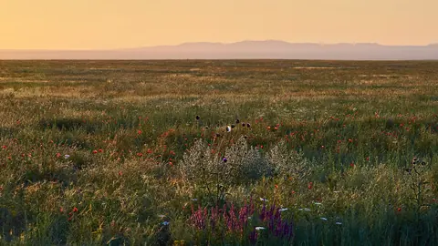 Natural zones of Kazakhstan: from forest-steppe to desert
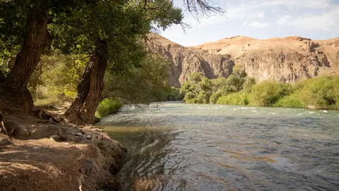 Rivers of Kazakhstan: the longest, their basins and where to see them
- Largest lakes in Kazakhstan by area and depth
- Elevation of Almaty and 160 places in Kazakhstan
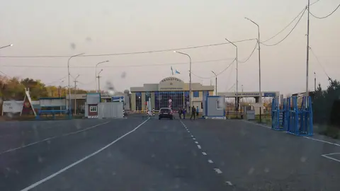 Kazakhstan border crossings: which ones foreigners can use
- Kazakhstan roads in winter: blizzards and closures over 25 years