Earthquakes in Almaty: 50 years of seismic data around the city
Since 1976 the USGS catalogue has logged 78 earthquakes of magnitude 4.5 or more within 200 km of Almaty, about one and a half a year. The strongest was M7.1 in 1978, 142 km away. The closest notable one was M4.8, 19 km from the centre, in 2015.
Verified: 2026-11
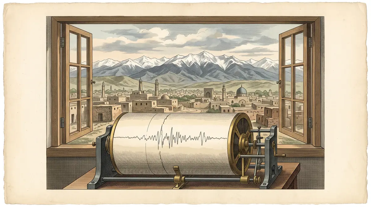
Almaty sits in an active seismic zone at the foot of the Tian Shan, and earthquakes around it are regular while destructive ones are rare. Since 1976 the US Geological Survey catalogue has logged 78 events of magnitude 4.5 or more within 200 km of the city, about one and a half a year. The strongest in those 50 years was M7.1 on 24 March 1978, 142 km east. The closest notable event was M4.8 on 15 March 2015, 19 km south of the centre.
USGS Earthquake Catalog, charyn.kz calculation; 2025–26 is incomplete
The count per five-year period ranges from 2 to 13 with no steady rise or fall. At least one M4.5+ event within 200 km occurred in 35 of 51 years. The longest gap without one was 1,564 days, about 4.3 years; the median gap between events is 138 days.
Almaty earthquake data: what 50 years of USGS records show
Most notable quakes happen south of the city, in and beyond the Northern Tian Shan. Of the 78 events within 200 km, 51 lie to the south, south-east or south-west; only 3 lie to the west or north-west.
USGS Earthquake Catalog, charyn.kz calculation
55 of the 78 events were below M5. Only two reached M6 or more within 200 km in 50 years: the M7.1 of 1978 and an M6.4 on 12 November 1990, 96 km east near Tyup in Kyrgyzstan. Most foci are shallow: median depth 19 km, three-quarters no deeper than 33 km.
People in the city feel tremors more often than this catalogue suggests. Almaty’s emergency department counted 39 felt earthquakes over the past three years, at intensities of 2 to 5 points, none with casualties or damage (Bes.media, 1 October 2026). According to the department, quoted by 24KZ, more than 200 weak earthquakes are recorded in Almaty each year. They fall below the M4.5 threshold used here.
The same department classifies the whole city, 683 km² in eight districts, as a high seismic hazard zone where earthquakes of intensity up to 9–10 points are possible. That is a hazard rating, not a forecast; we found no official forecast with dates or magnitudes and do not offer one.
The strongest earthquakes around Almaty since 1900
The strongest event in the catalogue is the Kemin earthquake of 3 January 1911, M8.0. By USGS coordinates its epicentre lies 37 km from central Almaty.
| Date | Magnitude | Distance from Almaty | Direction | Location |
|---|---|---|---|---|
| 3 Jan 1911 | 8.0 | 37 km | S | Kemin earthquake, Kyrgyzstan |
| 24 Mar 1978 | 7.1 | 142 km | E | 23 km ENE of Tyup, Kyrgyzstan |
| 20 Jun 1938 | 7.0 | 100 km | SW | 22 km ESE of Kemin, Kyrgyzstan |
| 22 Jan 2024 | 7.0 | 261 km | SE | Xinjiang, China |
| 17 Dec 1915 | 6.5 | 248 km | SE | Kyrgyzstan |
| 12 Nov 1990 | 6.4 | 96 km | E | 35 km NW of Tyup, Kyrgyzstan |
| 5 Jun 1970 | 6.3 | 164 km | SE | near Ak-Suu, Kyrgyzstan |
| 19 Apr 1945 | 5.9 | 56 km | SE | 39 km SSE of Esik, Kazakhstan |
| 31 Dec 1982 | 5.8 | 63 km | SE | near Cholpon-Ata, Kyrgyzstan |
| 17 Jun 1988 | 5.7 | 54 km | SE | 42 km SSE of Talgar, Kazakhstan |
The seven strongest events within 300 km, then the three strongest within 100 km after them; dates in UTC. Magnitudes from different decades were calculated by different methods, so do not compare neighbouring rows to the decimal.
How far away: rings of 50 km
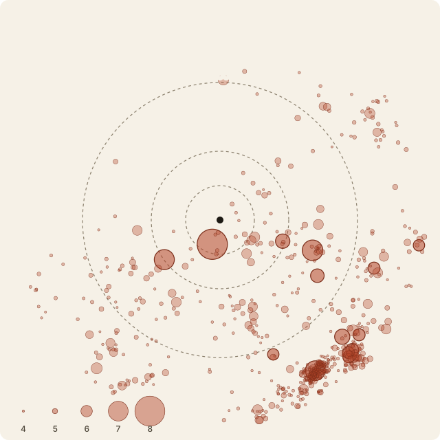
The further from Almaty, the more events fall inside each ring: 7 within 50 km since 1976, 170 in the 250–300 km ring. The outer ring is inflated by the aftershock series after the M7.0 of 22 January 2024.
USGS Earthquake Catalog, charyn.kz calculation
| Date | Magnitude | Distance | Location |
|---|---|---|---|
| 13 Mar 1983 | 4.8 | 29 km | near Otegen Batyr |
| 3 May 1990 | 4.7 | 50 km | near Cholpon-Ata, Kyrgyzstan |
| 25 Jan 1986 | 5.0 | 42 km | 30 km SSE of Talgar |
| 24 Jun 2005 | 4.6 | 34 km | 31 km S of Talgar |
| 29 Dec 2007 | 4.5 | 22 km | 24 km SSW of Almaty |
| 15 Mar 2015 | 4.8 | 19 km | 20 km S of Almaty |
| 4 Mar 2024 | 4.7 | 45 km | near Cholpon-Ata, Kyrgyzstan |
The seven events within 50 km of the centre since 1976. None was stronger than M5.0. Read magnitude together with distance to the city.
January 2024 showed how a distant event becomes local news. The M7.0 struck 261 km away in Xinjiang, and over five weeks USGS logged 58 aftershocks of M4.5 or more nearby. That series is why 2020–2024 shows 84 events within 300 km but only 2 within 200 km.
What to do in an earthquake: official advice
Kazakhstan’s Ministry of Emergency Situations and its regional departments publish rules of conduct on gov.kz, in Russian and Kazakh. Below is what two of those publications agree on: the ministry (26 May 2024) and the Almaty Region department (7 February 2024).
| Where you are | What the ministry advises |
|---|---|
| Indoors | Stay calm. Do not use the lift. Keep away from windows, outer walls and heavy furniture; stand in an inner corner of the room or an inner doorway. |
| Leaving the building | Do not run out during the shaking; leave once it stops. If you can, turn off water, gas and electricity first and take documents, a first-aid kit and a torch. |
| Outdoors | Move to open ground away from buildings, power lines, large trees and billboards. |
| In a car | Stop somewhere safe without blocking emergency vehicles and stay inside. Listen to the radio. |
| Afterwards | Be ready for aftershocks, help older and disabled people, and rely on official information. |
The Almaty Region department adds that strong shaking lasts a little over a minute and that in a low-rise building you can run outside straight away, while the ministry’s publication says to leave after the shaking ends. We show both positions without choosing for you.
For a visitor this boils down to a few habits. In your hotel, find the stairs and exit when you arrive, because lifts are off limits during shaking. On city walks, note the nearest open square. We found no separate official rules for the mountains. Kazakhstan’s emergency number is 112; other numbers and route notification rules are on is Kazakhstan safe.
The emergency department says an early warning system of 28 stations has run in the city since late 2023, with 7 more in testing (Bes.media, 2026). The Almaty Region department says warnings go out by siren, SMS and police loudspeakers. Alerts are sent in Kazakh, Russian and English, according to a December 2025 report we could only find in secondary press, so check this on arrival.
What it means for a trip
The data neither argues for cancelling a trip to Almaty nor offers a forecast. It shows that M4.5+ events around the city happen about one and a half times a year, and that M6+ events within 200 km happened twice in 50 years.
Three useful things: know the rules in the table above, save 112, and in the mountains remember other hazards too, such as mudflows around Almaty. If you plan to head up, see also the mountains near Almaty and Medeu; the city itself is covered on Almaty.
How we calculated
A query to the USGS FDSN Event Web Service: centre 43.238°N 76.946°E, radius 300 km, magnitude 4.0 and above, 1 January 1900 to 8 November 2026. It returned 645 events. Distance from the city centre to each epicentre uses the haversine formula, direction uses the azimuth on eight compass points. Statistics use the period from 1 January 1976 and a threshold of M4.5; we did not check the catalogue’s completeness for weaker events, so M4.0–4.4 events are in the file but not in the conclusions.
Search interest, Ubersuggest, 9 November 2026: almaty earthquake about 1,900 searches a month worldwide, with peaks of 4,400–5,400; the Russian «землетрясение алматы» about 74,000 a month in Kazakhstan, with spikes to 246,000 in November 2024 and 135,000 in May 2025.
The script and raw API response are kept with the project and the query reruns with one command. Every event is in the CSV file. This page is updated after notable events near the city.
What we don’t know
How to cite
Link to this page: “charyn.kz, from the USGS catalogue, data as of 8 November 2026”. Always state the radius and magnitude threshold, for example “78 events of M4.5+ within 200 km since 1976”; without them the number means little. Quote safety rules from the ministry’s own pages on gov.kz. Licence CC BY 4.0.
Frequently asked questions
How often are there earthquakes in Almaty?
Is it safe to visit Almaty because of earthquakes?
What was the biggest earthquake near Almaty?
When was the last earthquake near Almaty?
What should I do if an earthquake hits while I'm in a hotel?
Can earthquakes in China or Kyrgyzstan be felt in Almaty?
Can I download the data?
Sources
- USGS Earthquake Catalog, FDSN Event Web Service: M4.0+ within 300 km of Almaty, 1900 – 8 Nov 2026
- Ministry of Emergency Situations of Kazakhstan: rules of conduct during an earthquake, 26 May 2024 (Russian)
- Almaty Region Emergency Department: basic rules during earthquakes, 7 Feb 2024 (Russian)
- Bes.media, 1 Oct 2026: 39 felt earthquakes in three years, Almaty emergency department data (Russian)
- 24KZ, 21 Sep 2025: emergency department on a tremor near Almaty and weak quakes per year (Russian)
- DigitalBusiness.kz, 4 Dec 2025: emergency department alert in three languages (Russian)
- Ubersuggest: keyword overview, 9 Nov 2026
Read also
 Almaty in winter by numbers: smog, snow and cold days
 Direct flights to Kazakhstan: where they come from and how long they take
 Hotel occupancy in Kazakhstan by region and resort area, 2025–2026
 How foreign visitors spend money in Kazakhstan: survey data by country
 Kazakhstan vs Uzbekistan vs Kyrgyzstan: a data comparison for travellers
 Mangystau month by month: heat, wind and when people go