Zhygylgan, the Fallen Land: when to go, month by month
- January: off season
- February: off season
- March: off season
- April: good
- May: best time
- June: possible
- July: off season
- August: off season
- September: best time
- October: good
- November: off season
- December: off season
Spring and late September are advised for Mangystau: summer heat passes +40 °C.
Zhygylgan, the Fallen Land: why go
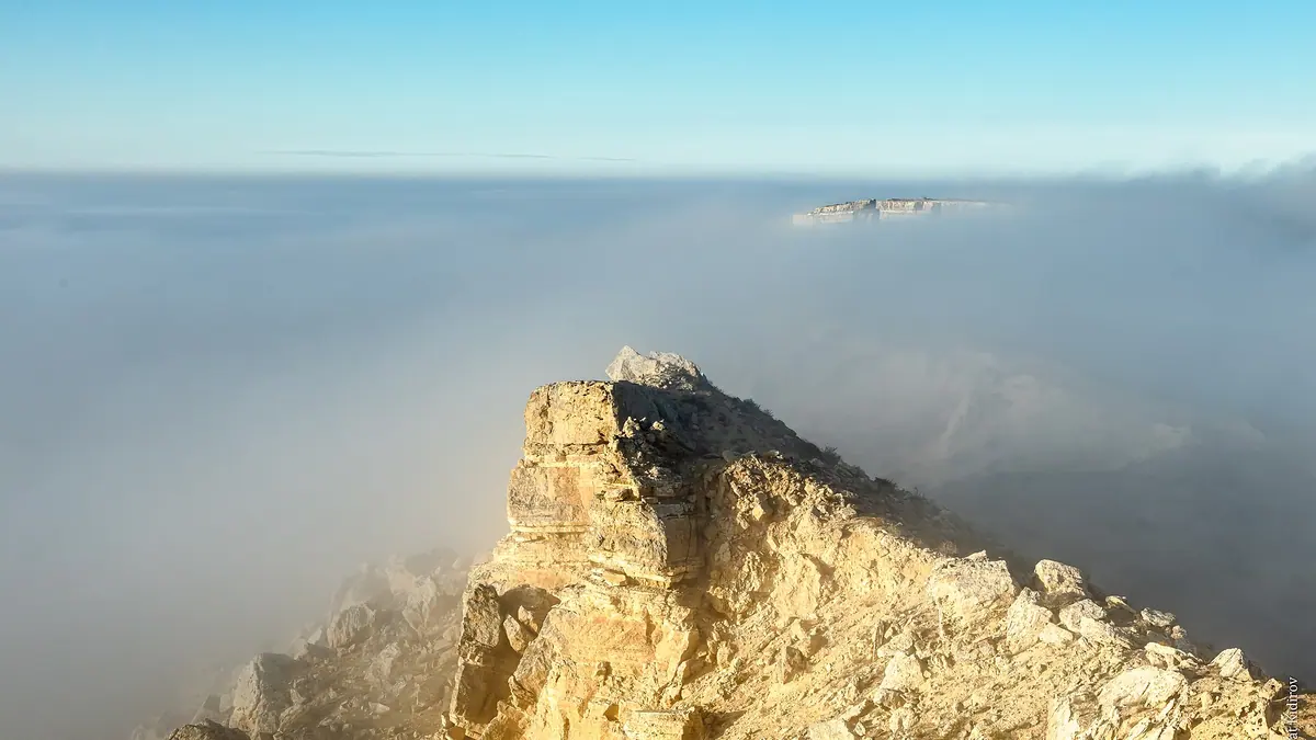
The Zhygylgan cliffs
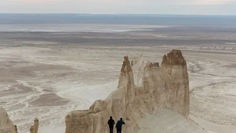
The steppe ends at a rock wall 50–200 m high, in a crescent about 3 km long, according to Tengrinews in 2021.
The 2026 viewpoint
Opened in June 2026, with fencing along the edge and shaded benches. Fees and hours are not given in the report.
Kozdykara salt lake
A small salt lake lies at the bottom. Tengrinews says people swim there and a freshwater spring is close by.
Disputed animal tracks
Tengrinews wrote of hipparion and sabre-tooth tracks in 2021, having noted in 2018 that dinosaur prints had no scientific confirmation.
Zhygylgan, the Fallen Land in photos
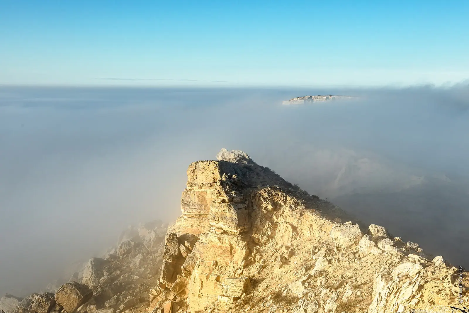
Real photos by travellers (Pexels, Unsplash, Wikimedia Commons); author and licence are given in each caption.
Zhygylgan (“fallen land” in Kazakh) is a vast collapse on the Caspian shore in Tupkaragan District, about 110 km north of Aktau. The steppe ends at a rock wall 50–200 m high, above a chaos of boulders and the salt lake Kozdykara. A fenced viewpoint opened in June 2026. Use it: the unfenced edge is full of cracks.
How big is it?
| What is measured | Size | Source |
|---|---|---|
| The hollow | over 2 km east–west, 4 km north–south | Lada.kz, 2026 |
| The rock wall | about 3 km in a crescent, 50–200 m high | Tengrinews, 2021 |
| The depression | at least 10 km across, about 80 m deep | Tengrinews, 2018 |
| The landslide | over 20 km wide | Tengri Auto, 2026 |
These sources describe different features. Whichever you trust, you will not walk around it in an hour.
What to see
The viewpoint has fencing along the edge and shaded benches; no fee or hours are published. Below, cracked limestone slabs form a maze of caves and canyons. Kozdykara lake is salty, with a freshwater spring nearby according to Tengrinews, and tourists swim there. A lighthouse on the heights helps you spot the place from afar.
The animal tracks are disputed, as the FAQ below explains. Do not chip any stone away.
Getting there
You need a 4x4 or a jeep tour from Aktau; Tengrinews rules out bus, taxi and bicycle.
- About 90 km from Aktau to Taushyk village.
- About 40 km towards Fort Shevchenko.
- Turn for Sultan-Epe mosque.
- About 35 km towards Bautino, with no signs, so use offline maps.
Sultan-Epe is 25–30 km away (40–60 minutes), and Karagiye 180–200 km (3.5–4 hours). Add Fort Shevchenko on the same day or see the Mangystau guide.
Staying safe
Cracks run along the edge and the cliff is still falling (Tengrinews, 2018). Wind is strong, and a fall here means tens of metres. Stay behind the fence and hold on to children. Vipers are common, so wear closed shoes. Bring all food and water from Aktau. For a first visit a local guide is worth it. See our safety page. Spring and late September avoid the +40 °C summer heat.
Zhygylgan, the Fallen Land: tips before you go
- Stay behind the fence: the edge is cracked and still falling.
- Do not camp here: Tengrinews warns of vipers.
- The last stretch has no signs: save a map and bring water from Aktau.
More to see nearby


Frequently asked questions
How do I get to Zhygylgan from Aktau?
Are there really dinosaur footprints?
Can I camp at Zhygylgan?
Sources
Read also
 Almaty Zoo in Kazakhstan: opening hours and how to visit
 Ayusai Gorge, Almaty: visitor centre and waterfall trail
 Gorelnik Gorge above Medeu: waterfalls, trail and season
 Kamenskoe Plateau above Almaty: observatory and trails
 Pervomaiskie Ponds near Almaty: location, swimming, season
 Saty village: base for the Kolsai and Kaindy lakes