Ulytau Mountains: when to go, month by month
- January: off season
- February: off season
- March: off season
- April: possible
- May: best time
- June: good
- July: good
- August: good
- September: best time
- October: possible
- November: off season
- December: off season
May, June and September combine mild days around 18–25°C with dry ground, while November to March stays below freezing.
Ulytau Mountains: why go
Mausoleums of Ulytau
The mausoleums of Jochi Khan, eldest son of Genghis Khan, and of Alasha Khan both stand in the Ulytau range.
Granite hills of the Kazakh Upland
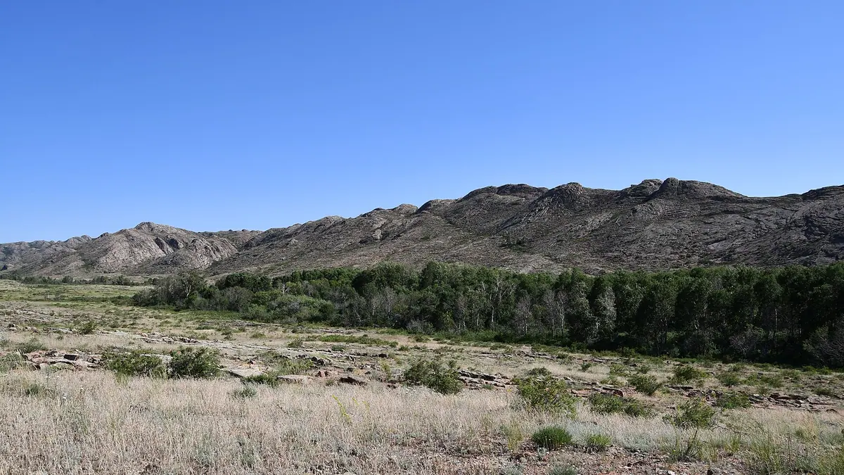
A 200 km granite range cut by ravines, topped by Akmeshit at 1,131 m, with steppe grasses, wormwood and ephedra in the rock crevices.
Reaching Ulytau from Zhezkazgan
Zhezkazgan is about 106 km away in a straight line and Astana 427 km. We could not confirm public transport, so plan a driver or car.
Ulytau in late spring
May and September give highs near 18–20°C and nights around 8°C, while winter nights average −16°C in January.
Timur's stone at Altyn Shoky
In spring 1391 Timur left an inscription on a stone slab on Altyn Shoky mountain in Ulytau, recorded in Russian and Kazakh Wikipedia.
Ulytau Mountains in photos
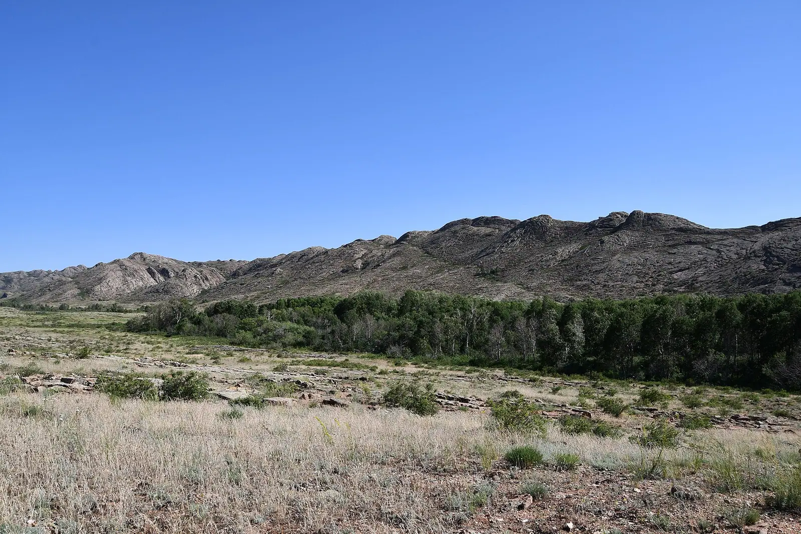
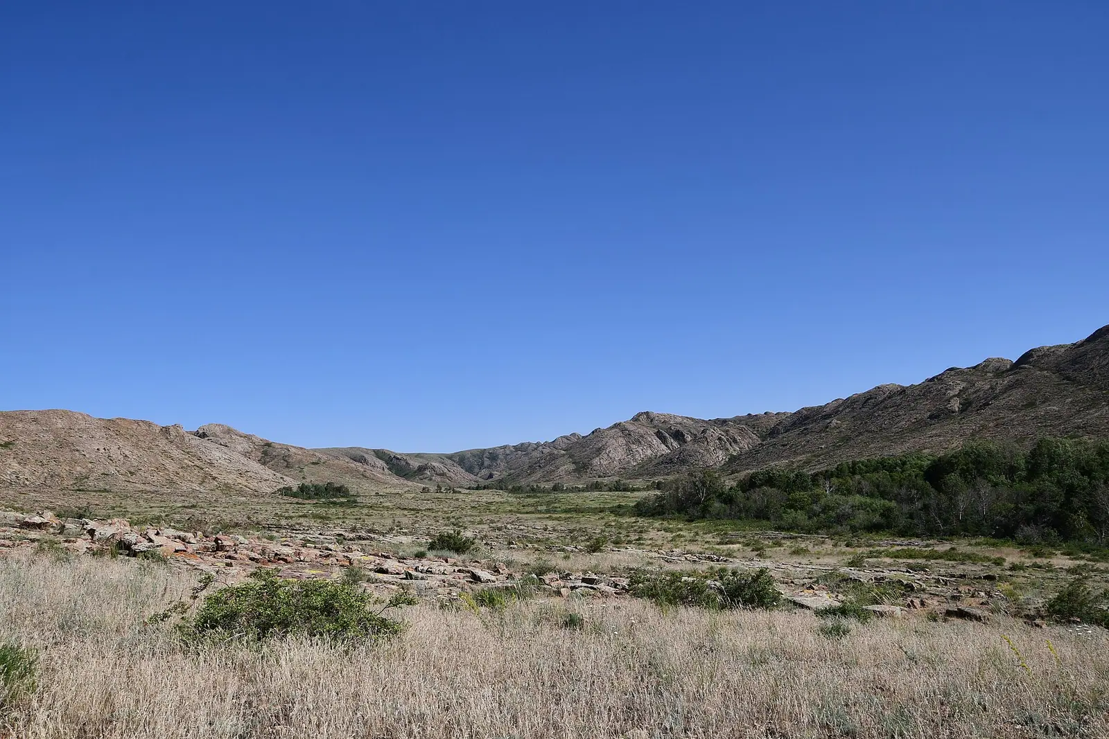
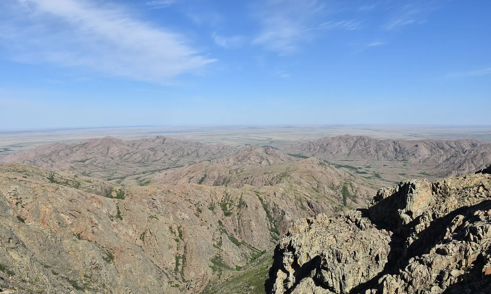
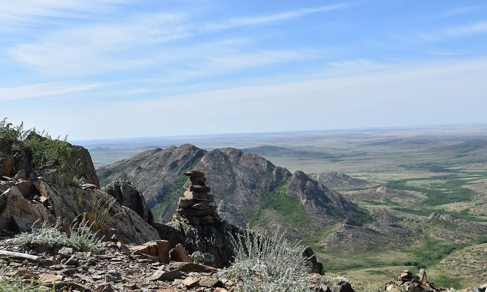
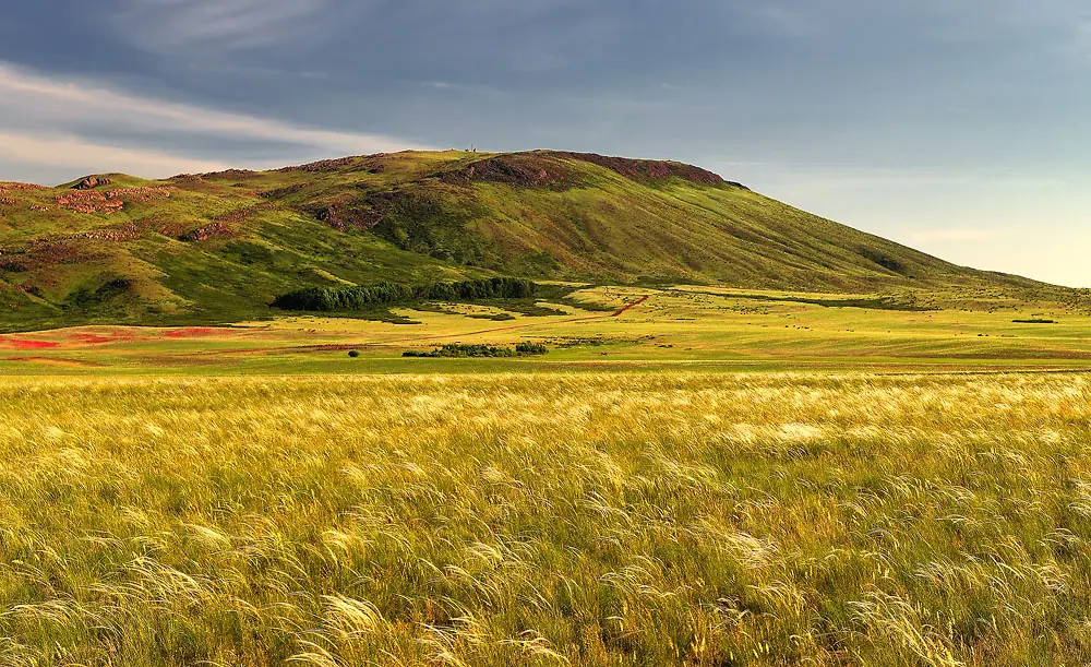
Real photos by travellers (Pexels, Unsplash, Wikimedia Commons); author and licence are given in each caption.
The Ulytau Mountains are a low, rocky granite range in central Kazakhstan, about 106 km in a straight line from the city of Zhezkazgan and 427 km from Astana. The name means “great mountains” in Kazakh. This is a trip for travellers interested in steppe history and open landscape rather than high peaks.
Where Ulytau is and what kind of trip it takes
Ulytau sits in the south-west of the Kazakh Upland, the rolling hill country of central Kazakhstan, and belongs to Ulytau District of Ulytau Region. It is nowhere near the Almaty mountains: the closest pages on this site are about 600 km away or more in a straight line.
The nearest city in the distances we have is Zhezkazgan. Straight-line distances to larger centres:
| From | Straight line |
|---|---|
| Zhezkazgan | about 106 km |
| Astana | about 427 km |
| Kyzylorda | about 434 km |
| Karaganda | about 463 km |
Road distances will be longer. We could not confirm any public transport into the range, road conditions or places to stay, so plan this as a multi-day trip built around Zhezkazgan, and assume you will need your own transport or a local driver.
Low mountains, long distances: the landscape
Expect bare, rocky hills rather than alpine scenery. The range stretches about 200 km from north to south, is built mostly of granite and is cut by ravines carrying seasonal streams. The highest point is Akmeshit: 1,131 m by Russian and English Wikipedia, 1,133 m by Kazakh Wikipedia.
| Feature | Detail |
|---|---|
| Length | about 200 km, north to south |
| Highest point | Akmeshit, 1,131–1,133 m |
| Rock | mainly granite |
| Rivers rising here | Uly-Zhylanshyk, Terisakkan, Zhymyky, Baikonyr, Kalmakkyrgan (Bileuty), Karakengir |
| Plant species recorded | 617, of which 90 medicinal |
Slopes carry steppe grasses, wormwood and ephedra in rock crevices, shrubs on scree, and in places aspen woods and birch groves in damper hollows. Locally Ulytau is called a “land of lakes and springs”, which contrasts with its dry look from a distance.
Why Ulytau matters in Kazakh history
The main reason to come is the density of historic sites. Russian Wikipedia counts about 636 monuments in the district, 282 of them on the historical map of the Ulytau museum, going back to the Palaeolithic and Neolithic. They include kurgans, necropolises, mausoleums of the Begazy-Dandybai culture, rock carvings, ancient mines and furnaces for smelting copper, tin, silver and gold.
The range is linked to some of the best-known names of the steppe:
- Jochi Khan, eldest son of Genghis Khan, had his headquarters here, and his mausoleum stands in Ulytau. Batu Khan is said to have begun his campaign west from here.
- Alasha Khan, described in Kazakh Wikipedia as one of the founders of the Turkic-speaking tribes, also has a mausoleum in the range.
- Tokhtamysh, khan of the Golden Horde, and the emir Edige are, by Wikipedia, buried in these mountains.
- Timur (Tamerlane) left an inscription on a stone slab on Altyn Shoky mountain in spring 1391.
- In 1730 around 40,000 armed men from all three Kazakh zhuzes gathered here.
Kazakh Wikipedia describes Ulytau as a sacred land revered by the Kazakh people. Mausoleums are places of remembrance: dress modestly and behave quietly around graves. Kazakh Wikipedia also mentions the largest Palaeolithic workshop in Kazakhstan on the Karakengir river, and “kurgans with moustaches” whose purpose is still debated, as burial structures or ancient observatories.
When to go to Ulytau
Late spring and early autumn are the comfortable windows; winter is harsh.
Day high, °C / Night low, °C · Rain/snow, mm
A computed reanalysis normal for these coordinates, not weather station records.
Monthly figures
| Month | Day high, °C | Night low, °C | Rain/snow, mm |
|---|---|---|---|
| Jan | -11.3 | -17.9 | 17.2 |
| Feb | -10.4 | -18 | 17.4 |
| Mar | -0.9 | -9.1 | 24.5 |
| Apr | 13.2 | 1.5 | 28.9 |
| May | 20.7 | 7.2 | 25.6 |
| Jun | 25.6 | 12.6 | 22 |
| Jul | 27.6 | 14.5 | 24.7 |
| Aug | 26 | 12.9 | 18.6 |
| Sep | 18.8 | 6.2 | 16.1 |
| Oct | 9.7 | -1 | 20.7 |
| Nov | -1.9 | -9.2 | 24.9 |
| Dec | -8.9 | -15.6 | 29.8 |
These figures are ERA5 reanalysis normals for 2011–2020 at a grid point at 649 m, not a weather station. The higher hills reach about 1,130 m, so expect it cooler and windier up there. May and September bring daytime highs around 18–20°C with nights near 8°C. June to August peak at 25–27°C by day, warm but not extreme, with little shade on bare granite. From November to March daytime highs stay below freezing and January nights average around −18°C. Rainfall is low all year, about 20–34 mm a month, so dry ground is the norm.
Combining Ulytau with other places
Ulytau does not fit easily into a trip built around Almaty. If steppe history is your interest, the sites of Turkestan are the nearest page on this site, still about 600 km away in a straight line. For more rock art, the Tamgaly petroglyphs lie about 846 km away in a straight line. Treat Ulytau as its own leg of the trip from Zhezkazgan or Astana.
- Whether any bus or shared taxi runs from Zhezkazgan into the Ulytau range
- Road conditions to the mausoleums and how far they are from each other
- Accommodation options in or near Ulytau village
- Opening hours and visiting rules at the Ulytau museum and the mausoleums
- Whether a guide is needed to find petroglyphs and ancient mining sites
Ulytau Mountains: tips before you go
- Base yourself in Zhezkazgan, about 106 km away in a straight line, and arrange transport before arriving: we found no bus information.
- Bring sun protection in June–August: highs reach 25–27°C on bare granite slopes with little shade.
- Pack warm layers even in May and September: nights average about 8°C at 649 m and the hills rise to about 1,130 m.
- At the Jochi and Alasha Khan mausoleums dress modestly and keep quiet: Kazakh sources describe Ulytau as sacred land.
More to see nearby


Frequently asked questions
How high are the Ulytau Mountains?
Where is Ulytau located?
What is the weather like in Ulytau?
What is Ulytau known for?
Sources
Read also
 Almaty Zoo in Kazakhstan: opening hours and how to visit
 Ayusai Gorge, Almaty: visitor centre and waterfall trail
 Gorelnik Gorge above Medeu: waterfalls, trail and season
 Kamenskoe Plateau above Almaty: observatory and trails
 Pervomaiskie Ponds near Almaty: location, swimming, season
 Saty village: base for the Kolsai and Kaindy lakes