Tuzkol Lake: when to go, month by month
- January: off season
- February: off season
- March: off season
- April: possible
- May: good
- June: best time
- July: best time
- August: best time
- September: best time
- October: possible
- November: off season
- December: off season
June to September brings highs of about 17–22 °C with cold nights; from November to March daytime highs hover around freezing or below (ERA5 normals for nearby Kegen and Narynkol).
Tuzkol Lake: why go
Khan Tengri and Pobeda above the lake
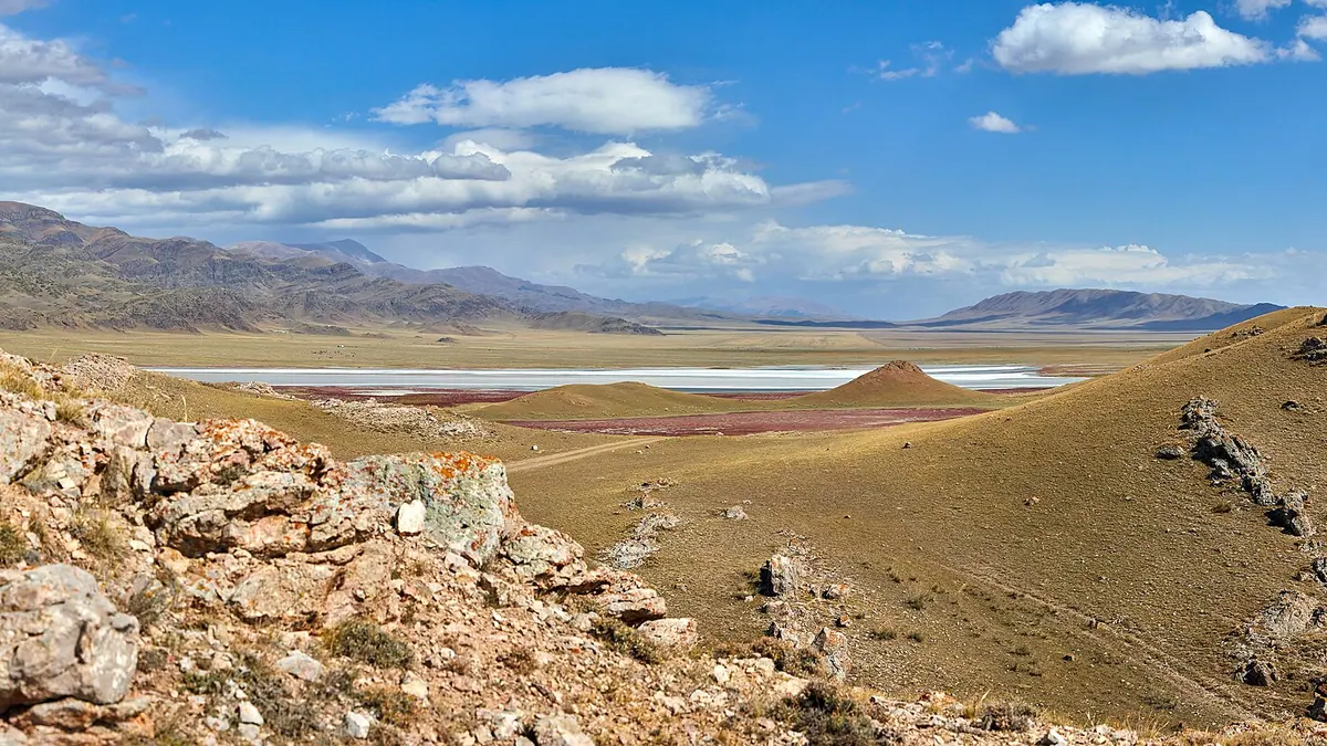
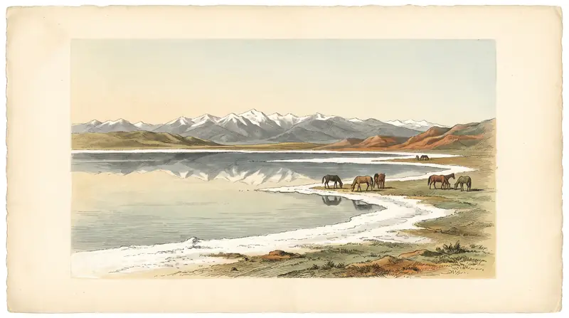
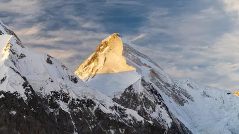
On a clear day the pyramid of Khan Tengri rises due south, with the flat-topped Pobeda Peak to its right. Khan Tengri is about 89 km away, so bring a zoom lens.
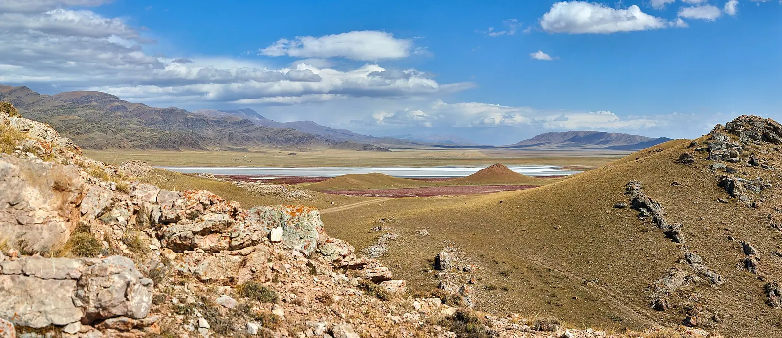
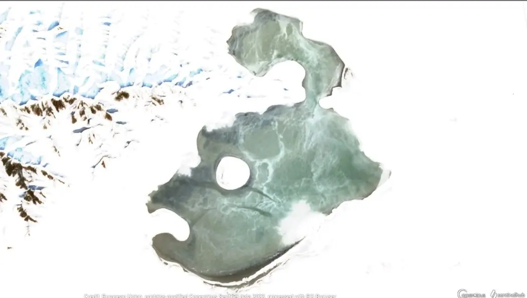
A shallow salt lake
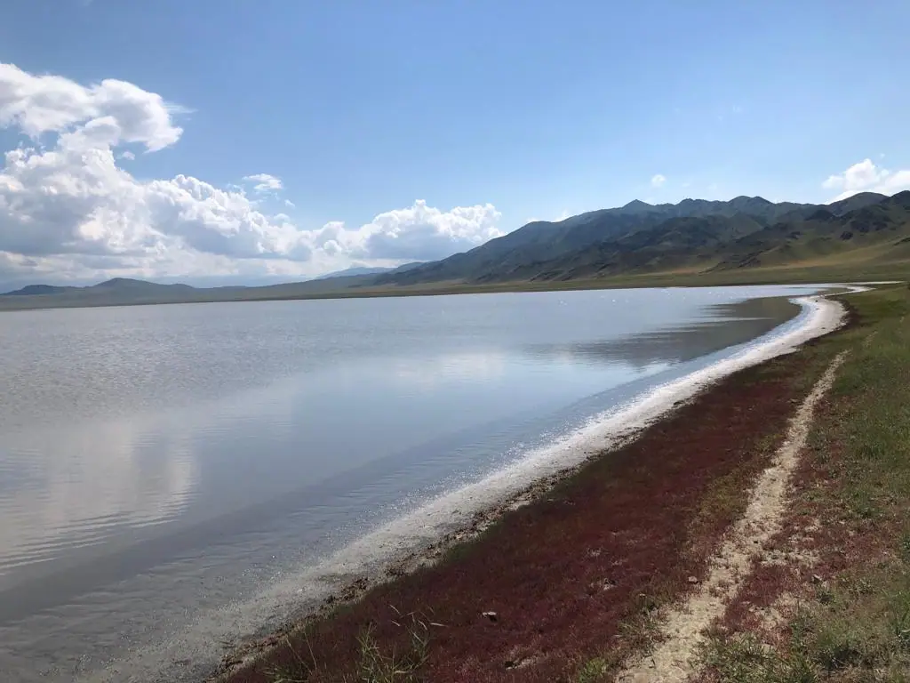
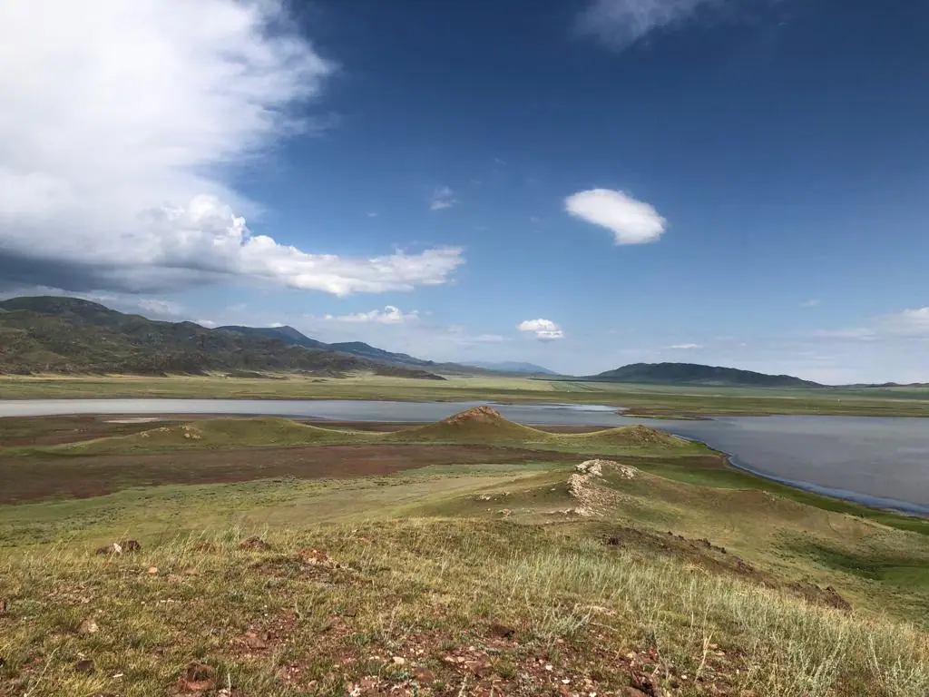
About 0.3 m deep, with salinity of up to 300 g/l that changes with the seasons. The shores are low and marshy and the bottom is muddy.
Migrating waterbirds
A Key Biodiversity Area: 5,000 to over 10,000 waterbirds gather on migration, ruddy shelducks moult here and whooper swans and coots breed.
The road via Karasaz
Turn off the Kegen–Narynkol road at km 40 past Saryzhaz towards Karasaz, then about 12 km east. We could not confirm the condition of the last stretch.
Tuzkol Lake in photos
Summer · 2 photos
More photos · 2 photos
Real photos by travellers (Pexels, Unsplash, Wikimedia Commons); author and licence are given in each caption.
Tuzkol (Kazakh: Тұзкөл, “salt lake”) is a shallow, bitter-salt lake in the Kegen basin of south-east Kazakhstan. People come for one view: on a clear day the pyramid of Khan Tengri (7,010 m) and the long ridge of Pobeda Peak (7,439 m) rise beyond the water to the south. The lake lies about 249 km from Almaty in a straight line, so it fits best into a multi-day loop with Charyn Canyon, Kegen or Narynkol.
Getting there
Tuzkol is about 70 km east of Kegen on the road to Narynkol. Russian Wikipedia describes the turn-off at km 40 past the village of Saryzhaz, heading left to Karasaz; the lake is 12 km east of the village (English Wikipedia says 14 km).
| From | Straight-line distance |
|---|---|
| Almaty | about 249 km |
| Kegen | about 62 km (about 70 km by road) |
| Narynkol | about 34 km |
| Charyn Canyon, Valley of Castles | about 84 km |
| Kaindy Lake | about 124 km |
| Khan Tengri summit | about 89 km |
We calculated straight-line distances from coordinates; roads are always longer. The final stretch from Karasaz is unpaved, and we could not confirm its condition or whether there is phone signal. There is no public transport mentioned in any source we found, so plan on a car or an arranged driver. Our off-road driving page covers what to expect on dirt roads. For the towns on the way, see Kegen and Narynkol.
The Khan Tengri view
The view needs a clear southern sky, and the mountains are far away: about 89 km to Khan Tengri and 108 km to Pobeda. Bring a telephoto or a long zoom if you want the peaks to fill the frame.
We could not find cloud-cover data for the lake itself, so we cannot tell you which months give the clearest skies. The nearest proxy is precipitation at nearby points (table below): winters are dry, and most rain falls from May to August. On a calm day the shallow water can give a reflection, but that depends on the wind on the day. More about the mountain is on our Khan Tengri page, and other viewpoints are in photo spots.
What kind of lake it is
Tuzkol is wide, flat and very shallow. It is fed mainly by groundwater, and its salinity changes with the seasons, reaching up to 300 g/l according to Russian Wikipedia.
| Measure | Value | Source |
|---|---|---|
| Elevation | 1,959 m / 1,951 m | Russian and English Wikipedia / Kazakh Wikipedia |
| Area | 6.6 km², up to 8.5 km² in wet years | Kazakh Wikipedia |
| Size | 5.7 × 2.1 km / 5 km × up to 1 km | Kazakh Wikipedia / KBA |
| Depth | about 0.3 m, up to 0.5–0.6 m in spring and autumn | Kazakh Wikipedia |
| Salinity | up to 300 g/l, varies by season | Russian Wikipedia |
| Shore | low, flat and marshy; muddy bottom | all three Wikipedias |
The sources disagree on the numbers, but the picture is consistent: this is a salt flat with water on it, not a clear alpine lake. Russian Wikipedia notes that its mud is used for mud therapy in clinics in Almaty and the region. The shore is marshy, so leave the car on firm ground and walk to the water.
Birds
Tuzkol is listed as a Key Biodiversity Area covering 3,134 ha, last assessed in 2007. A survey in August 2006 counted 35 bird species, 21 of them waterbirds and shorebirds, and 4,445 birds in total. On migration, the assessment says, 5,000 to more than 10,000 waterbirds gather regularly.
| Species | What they do here |
|---|---|
| Ruddy shelduck | moults in large numbers |
| Common crane, demoiselle crane | gather in significant numbers |
| Whooper swan, black-necked grebe, coot | breed |
| Gulls, terns, waders | nest in colonies on the islets |
| Golden eagle, steppe eagle, Barbary falcon | in the nearby mountains |
None of the site is formally protected (0%). Overgrazing is named as the main threat, with recreation on the northern shore another. If you come for birds, keep away from the islets during the nesting season.
Weather and when to go
There is no weather station at the lake. The table gives ERA5 reanalysis normals for 2011–2020 at two nearby points: Kegen (1,846 m, about 62 km west) and Narynkol (1,814 m, about 34 km south-east). The lake sits a little higher than both, so expect it to be slightly cooler.
| Month | Kegen high / low | Narynkol high / low | Rain, Kegen / Narynkol |
|---|---|---|---|
| January | −7.6 / −20.3 °C | −7.6 / −19.2 °C | 16 / 8 mm |
| April | 12.1 / −1.8 °C | 12.7 / −1.1 °C | 66 / 60 mm |
| May | 16.6 / 2.7 °C | 16.7 / 2.3 °C | 89 / 73 mm |
| July | 22.1 / 8.8 °C | 22.3 / 8.3 °C | 61 / 103 mm |
| September | 17.7 / 3.1 °C | 18.2 / 2.9 °C | 54 / 65 mm |
| October | 11.0 / −4.4 °C | 11.3 / −4.6 °C | 46 / 33 mm |
June to September is the practical window, with daytime highs of 17–22 °C. Nights are cold even in midsummer, so pack a warm layer. September is drier than July and still mild by day.
Border zone and documents
Raiymbek District borders China. Government Resolution No. 356 lists places where border-zone permits for foreigners do not apply, including Kolsai, Kaindy, Saty and the Bayankol gorge, but Tuzkol is not on that list. How to read the resolution is explained on our border zone permits page.
In practice, carry your passport, and if you plan to drive further south towards the border or into the mountains beyond the lake, ask the border service first. We could not confirm whether a foreigner needs a permit for the lake itself.
- Which months most often give a clear view of Khan Tengri from the lake.
- The condition of the dirt road from Karasaz and whether there is phone signal.
- Whether foreigners need a border-zone permit to visit the lake.
- Whether there is an entry fee, and whether the spa that opened on the northern shore in 2006 (per the KBA record) still operates.
Tuzkol Lake: tips before you go
- Carry your passport: Raiymbek District borders China, and Tuzkol is not on the list of border-zone exceptions.
- Pack warm layers even in summer: July nights average about 8–9 °C in nearby Kegen and Narynkol.
- Leave the car on firm ground: the lakeshore is marshy.
More to see nearby


Frequently asked questions
Where is Tuzkol Lake?
How far is Tuzkol from Almaty?
Can you see Khan Tengri from Tuzkol?
Can you swim in Tuzkol Lake?
Are there flamingos at Tuzkol?
Do I need a border permit for Tuzkol?
When is the best time to visit Tuzkol?
Sources
- Key Biodiversity Areas: Tuzkol Lake (KBA 21969), assessed 2007
- Tuzkol, Raiymbek District — Wikipedia
- Тузколь (озеро, Райымбекский район) — Russian Wikipedia
- Тұзкөл (Алматы облысы) — Kazakh Wikipedia
- Government Resolution No. 356 of 16 Apr 2014 on the border zone (Russian)
- Open-Meteo Historical Weather API: ERA5, 2011–2020
Read also
 Almaty Zoo in Kazakhstan: opening hours and how to visit
 Ayusai Gorge, Almaty: visitor centre and waterfall trail
 Gorelnik Gorge above Medeu: waterfalls, trail and season
 Kamenskoe Plateau above Almaty: observatory and trails
 Pervomaiskie Ponds near Almaty: location, swimming, season
 Saty village: base for the Kolsai and Kaindy lakes