Tamgaly Tas petroglyphs: when to go, month by month
- January: possible
- February: possible
- March: possible
- April: best time
- May: best time
- June: good
- July: possible
- August: possible
- September: best time
- October: good
- November: possible
- December: possible
May and September have daytime highs near 26 °C, while July is close to 34 °C and winter days hover around freezing.
Tamgaly Tas petroglyphs: why go
Five deities of Tamgaly Tas
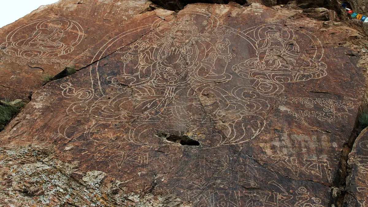
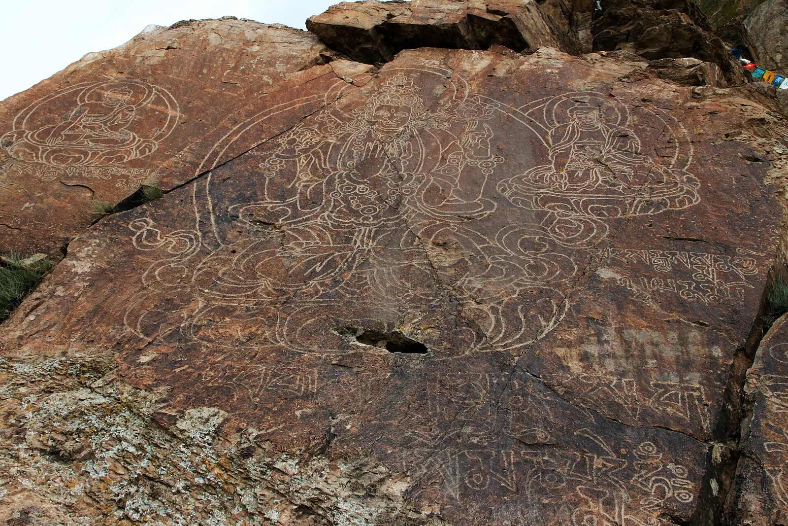
A central panel of Shakyamuni, Avalokiteshvara and the Medicine Buddha, plus separate Nageshvararaja and Akshobhya, carved with Tibetan prayer texts.
A Dzungar khan's open-air temple
Galdan Boshugtu Khan took an active part in the carvings; the first figure, a four-armed Avalokiteshvara on a lotus throne, is dated to 1677.
A short hop from Konaev
The site lies about 22 km in a straight line from Konaev and about 92 km from Almaty, close to the highway along the Ili River.
Spring and autumn on the Ili
May and September bring highs near 26 °C; July averages 33.5 °C, and winter nights fall to about −9 °C on the reanalysis grid.
Film-set fakes at Tamgaly Tas
Images on the southern part of the cliff were cut in the 1950s–70s for cinema shoots and are not historical, so check which panel you photograph.
Tamgaly Tas petroglyphs in photos
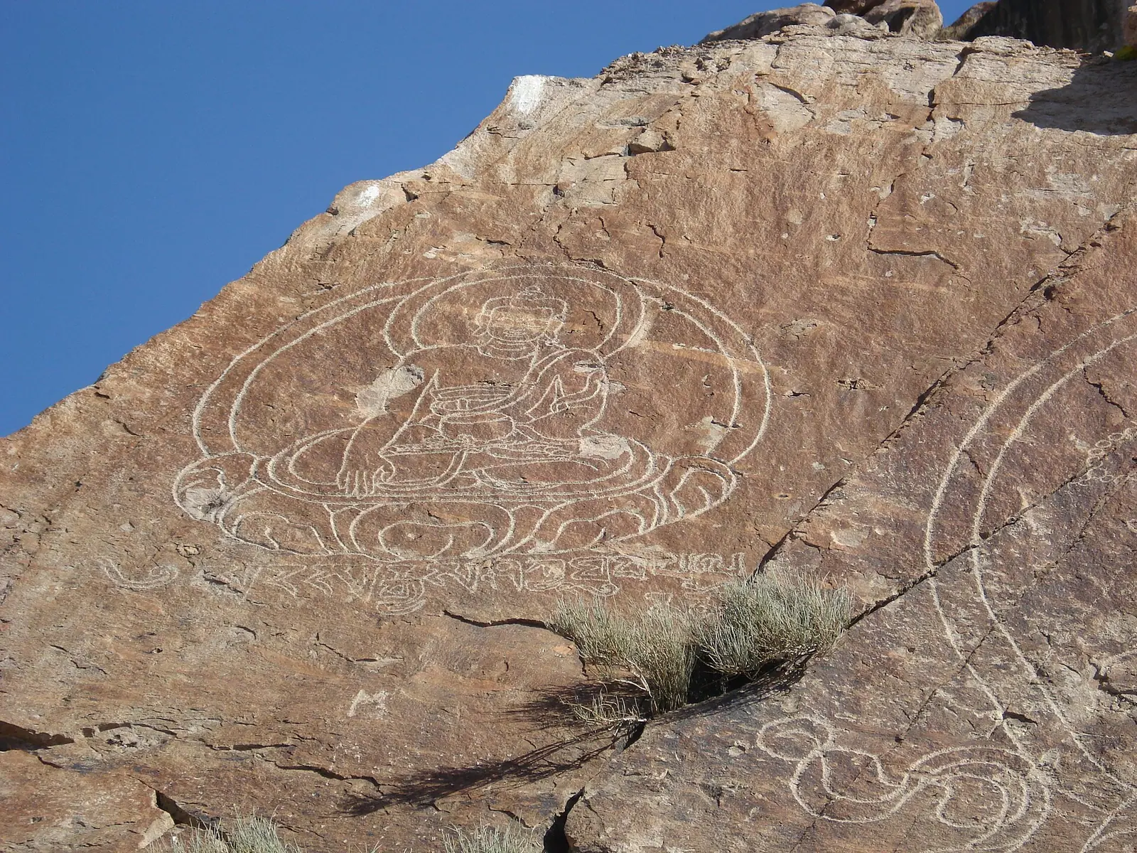
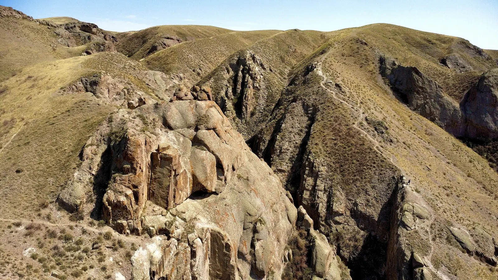
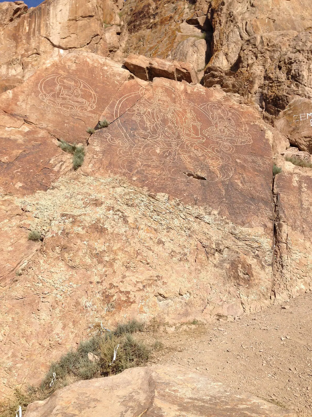
Real photos by travellers (Pexels, Unsplash, Wikimedia Commons); author and licence are given in each caption.
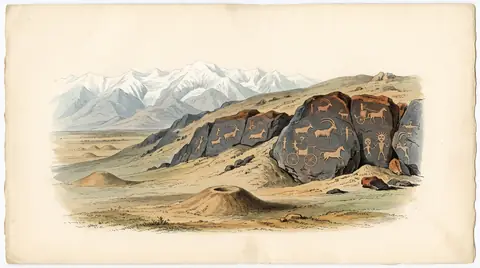
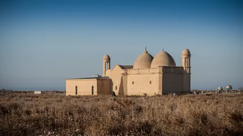
The Tamgaly Tas petroglyphs are Tibetan Buddhist images and prayer inscriptions carved on riverside rocks of the Ili, in Almaty Region, about 92 km in a straight line north of Almaty. They date mostly to the second half of the 17th century, when the Oirats of the Dzungar Khanate turned the site into an open-air temple. It is a short, half-day kind of stop near Konaev, but the site is unguarded and practical details are thin.
What you actually see at Tamgaly Tas
The core of the site is a group of five carved Buddhist deities on the rocks by the river. A central panel shows Buddha Shakyamuni, the Bodhisattva Avalokiteshvara and the Medicine Buddha Bhaisajyaguru with Tibetan inscriptions; separate images show the Buddhas Nageshvararaja and Akshobhya. By the English-language Wikipedia account, the images and inscriptions are spread over 15 scattered blocks at the foot of the cliff.
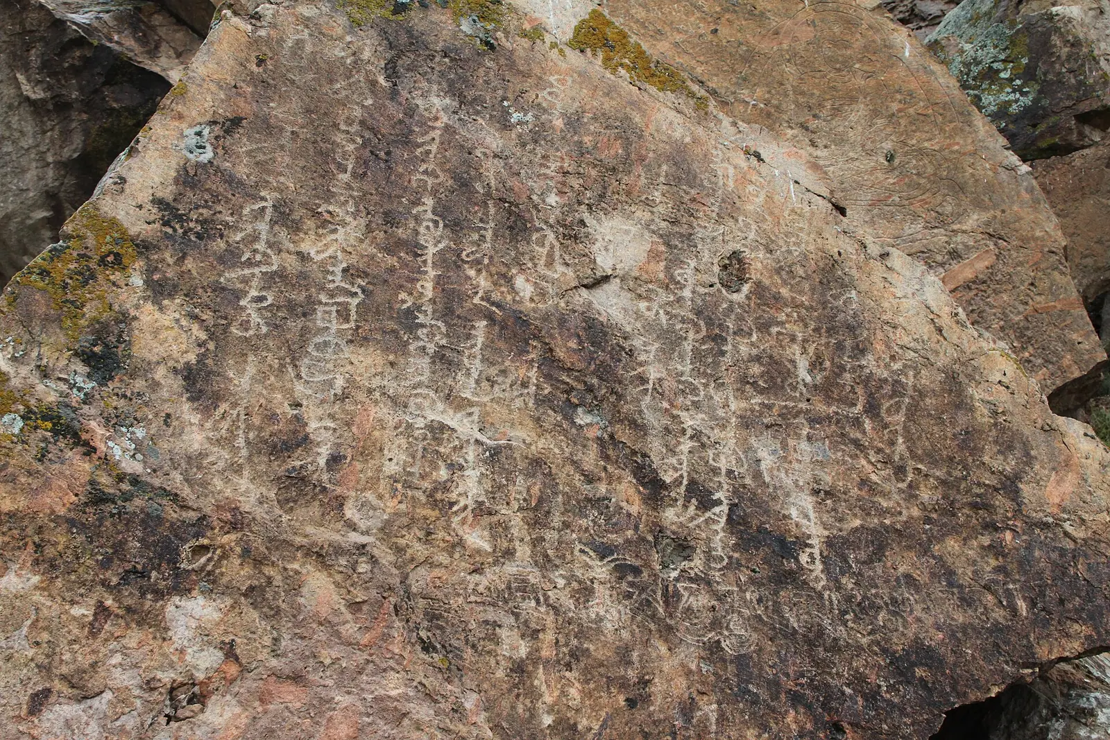
Around the figures are prayer texts: mantras of Manjushri (who is not himself depicted), an appeal to the Fourth Panchen Lama Lobsang Chökyi Gyaltsen (1570–1662), and several carvings of the six-syllable mantra om mani padme hum, some in Tibetan and ten later ones in the Oirat “clear script”. The longest and latest text is a tall vertical Oirat inscription.
One caution for photographers: in the 1950s–70s new images were added on the southern part of the cliff for film shoots. They carry no historical value, so check which panel you are looking at.
| Item | What it is |
|---|---|
| Main images | 5 Buddhist deities, Tibetan iconography |
| Scripts | Tibetan, Oirat “clear script”, one Old Turkic runic stone |
| First dated figure | 1677, Avalokiteshvara figure (English Wikipedia) |
| Latest inscription | 1771, Volga Kalmyk thanksgiving text |
| Modern additions | Film-set images, 1950s–70s, southern cliff |
Who carved it and why the name changed
The temple was created by Oirat and Tibetan masters with the active involvement of the Dzungar ruler Galdan Boshugtu Khan. In 1677, by the English Wikipedia, Galdan made the first “iconostasis”, a four-armed Avalokiteshvara seated on a lotus throne, and over the next five years images and mantras were added. The Oirats lived in the Ili valley from the second quarter of the 17th to the mid-18th century, during the Dzungar Khanate (1635–1758).
The site also holds a stone with Old Turkic runic writing of the 8th–9th centuries, attributed, with some doubt, to the Kipchaks. The last inscription came in 1771 from Volga Kalmyks who fled to the Ili valley; the scholar N. S. Yakhontova reads it as thanks to the Buddhas for deliverance from danger, disease and lack of fodder.
After the Dzungars left, Kazakhs named the place Tamga or Tamgaly-Tas, roughly “stones with signs”. Ablai Khan and Sultan Abulfeiz are said to have marked a stone here with a tamga, a tribal brand, claiming the land for the Uysun and Naiman. Chokan Valikhanov sketched the site in 1856, and Alexei Pozdneev described the inscriptions in detail at the end of the 19th century (sources give 1896–1898 and 1899).
Where it is and how far from Almaty
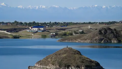
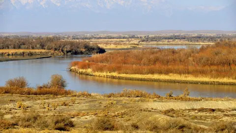
The carvings sit in the Khabtsagai tract on the Ili River, between the mouth of the left tributary Kurta and the steppe river Shengeldy, in the former Kapchagai district. The straight-line distance is about 22 km from Konaev (formerly Kapchagai) and about 92 km from Almaty. One Wikipedia text gives 120 km north of Almaty without saying how it was measured, and also contradicts itself on which bank of the Ili the site lies; the Russian article says the left bank.
| From | Straight-line distance |
|---|---|
| Konaev | about 22 km |
| Almaty | about 92 km |
| Taldykorgan | about 152 km |
The site is described as close to the highway and to Konaev, which makes a day trip from Almaty realistic. We could not confirm any bus, taxi route or the condition of the last stretch of road, so travellers without a car and without Russian should arrange transport in advance. Konaev and the reservoir are covered on our Kapshagay page.
When to go: hot summers, cold winters
Spring and early autumn are the comfortable windows for walking among the rocks.
Day high, °C / Night low, °C · Rain/snow, mm
A computed reanalysis normal for these coordinates, not weather station records.
Monthly figures
| Month | Day high, °C | Night low, °C | Rain/snow, mm |
|---|---|---|---|
| Jan | -0.1 | -9.3 | 21.3 |
| Feb | 2.5 | -7.9 | 19.8 |
| Mar | 12.7 | 0.8 | 33.9 |
| Apr | 20.9 | 8.3 | 59.8 |
| May | 26.4 | 13 | 55.5 |
| Jun | 31.5 | 18.7 | 46.7 |
| Jul | 34.1 | 20.5 | 22.6 |
| Aug | 32.4 | 18.2 | 20.1 |
| Sep | 26.5 | 12.4 | 21.8 |
| Oct | 18.4 | 6 | 32.5 |
| Nov | 7.7 | -1.7 | 38.5 |
| Dec | 1.5 | -7.1 | 23.2 |
These figures are ERA5 reanalysis normals for 2011–2020 at a grid point at 473 m, not a weather station. July averages a daytime high of about 34.1 °C and the rocks offer little shade, so midday visits in July and August are tiring. May (about 26 °C highs) and September (about 26 °C) are the most pleasant; April and October are cooler at 17–20 °C. From December to February daytime highs hover around 1 °C and nights drop to about −9 °C. April and May are the wettest months at roughly 56–60 mm, still modest; late summer is dry.
Protection, respect and what has gone wrong
Tamgaly Tas has been under state protection since 1981 and is a listed monument of local significance of Almaty Region (2010, No. 1519). The list classes it as an early Iron Age monument, a dating the English Wikipedia calls incorrect. There is no physical guard on site and access is not restricted.
That openness has a cost: being near the highway and Konaev, the rocks keep collecting new graffiti and autographs. A sign at the entrance describes it as a Buddhist open-air temple, so treat it as a sacred place. Do not touch, chalk or wet the carvings for photos, and do not climb on the inscribed blocks.
- Road condition and the exact access route to the rocks from the highway
- Any public transport or shared taxi from Almaty or Konaev
- Whether an entry fee, opening hours or a ranger post exist now
- Current condition of the carvings given ongoing graffiti
Tamgaly Tas petroglyphs: tips before you go
- Avoid midday in July: average highs reach about 33.5 °C and the rocky bank has little shade; carry water for that reason.
- Look for the tall vertical Oirat text: it is the latest inscription, left by Volga Kalmyks in 1771.
- Skip the southern cliff panels if short on time: they were added for 1950s–70s film shoots.
- Combine with Konaev, about 22 km in a straight line, but arrange a car in advance as we found no public transport details.
More to see nearby