Talgar Settlement, a medieval Silk Road town on the edge of modern Talgar: when to go, month by month
- January: possible
- February: possible
- March: possible
- April: good
- May: good
- June: best time
- July: good
- August: good
- September: best time
- October: good
- November: possible
- December: possible
June and September combine mild highs of about 20–23°C with less rain than April and May, while winter highs hover around freezing.
Talgar Settlement, a medieval Silk Road town on the edge of modern Talgar: why go
The Talgar Settlement rampart
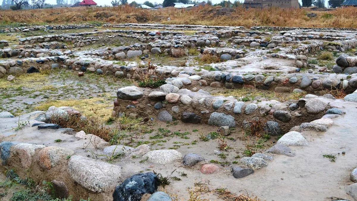
The rampart and moat of the 9 ha fortified core survive, tracing a near-square with walls of 280 to 302 m and corners facing the cardinal points.
Talkhiz, a town of steel and trade
At its 11th–13th century peak, Talkhiz made damask steel and embossed metalwork, and imported Chinese porcelain, Persian bronze and Indian chess pieces.
A short hop from Almaty
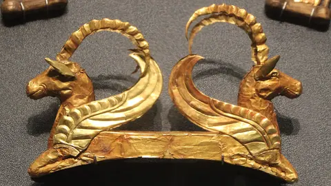
The ruins sit at the southern edge of Talgar, about 27 km in a straight line from Almaty, and about 20 km from the Issyk kurgan of the Golden Man.
June and September at Talgar
ERA5 normals show highs near 23°C in June and 20°C in September, while April and May are the wettest months with about 120–140 mm of rain.
Yurts inside Talgar courtyards
Archaeologists found yurt bases in house courtyards, showing that settled townspeople still kept nomadic habits alongside stone homes with spruce walls.
Talgar Settlement, a medieval Silk Road town on the edge of modern Talgar in photos
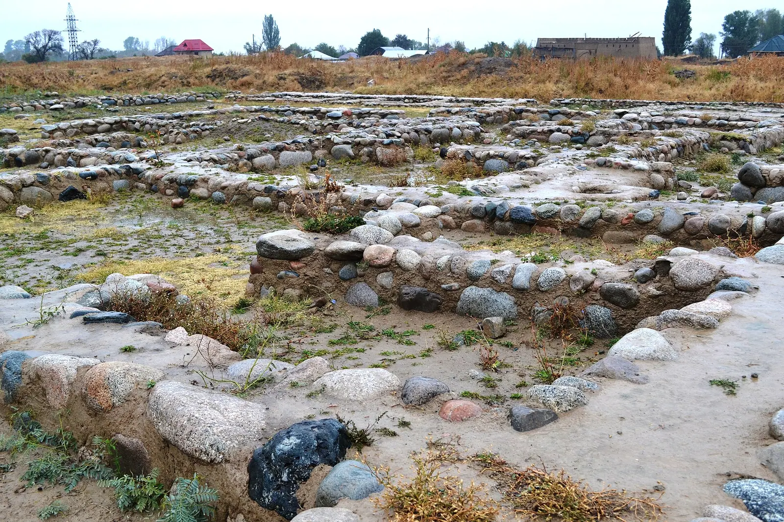
Real photos by travellers (Pexels, Unsplash, Wikimedia Commons); author and licence are given in each caption.
Talgar Settlement, also known as Talkhiz or Talkhir, is the site of a medieval Silk Road town at the southern edge of present-day Talgar, about 27 km in a straight line from Almaty. What survives is an earthwork: a rampart, a ditch and low stone wall fragments, not standing buildings. It suits a half-day trip for travellers who care about Silk Road history more than about dramatic ruins.
What Talgar Settlement is and what is left to see
Talgar Settlement is the outline of a fortified medieval town, and the visible remains are modest. The site sits in the foothills of the Ile-Alatau, on the right bank of the Talgar River, next to the southern outskirts of the town of Talgar in Almaty Region. The fortified core stands on raised ground, and its rampart and moat still trace the old walls. In the suburb outside the wall, only fragments of stone walls rise above the ground.
| Key data | |
|---|---|
| Other names | Talkhiz, Talkhir, Talhiz |
| Location | Southern edge of Talgar, right bank of the Talgar River |
| Distance from Almaty | about 27 km in a straight line |
| Total area | about 30 ha, fortified core 9 ha |
| Founded | 8th century AD |
| Abandoned | second half of the 13th century |
| Status | UNESCO World Heritage (2014), national monument of republican significance |
The table sets expectations: this is a large archaeological field with a mountain backdrop. If you expect walls and towers like those of the cities on the southern Silk Road, you will be disappointed.
Why a small town here mattered on the Silk Road
Talkhiz was a craft and trade centre that linked the Ili valley with China, Iran, India and Japan. It grew up at the end of the 8th century on the site of an earlier Wusun settlement, at the junction of the Ili and Chu valleys. The Persian geography Hudud al-Alam of 982 lists it as a large town.
| Period | What happened |
|---|---|
| 8th–3rd centuries BC | Saka farming settlements nearby |
| 3rd century BC – 5th century AD | Wusun state in Zhetysu (Semirechye) |
| Late 8th century | Town founded on a Wusun settlement |
| 10th century | Residents adopt Islam; town named in Hudud al-Alam (982) |
| 11th – early 13th century | Peak, 5,000–6,000 inhabitants |
| Second half of 13th century | Decline after the Mongol conquest, town deserted |
Sources differ slightly on the golden age: Russian Wikipedia gives the 11th to early 13th century, Kazakh Wikipedia the 10th to 13th. Most people were Turkic, mainly Karluks, with Sogdian settlers, and Buddhists and Nestorian Christians lived here too. Many residents could write in both Arabic and Old Turkic script. The town was known for ironwork, including damask steel, and for basma, a technique of embossing metal with dies.
How the town was laid out
The fortified core is a near-square with its corners pointing roughly to the cardinal directions. Its walls measure 300 m on the north-east, 280 m on the north-west and 302 m on each of the other two sides, about 1.2 km in total. Towers guarded the corners and walls, gates faced each other in the middle of each side, and two streets crossing between them split the town into four quarters.
Homes were multi-room courtyard houses with stone footings and upper walls of Tien Shan spruce, heated by tandyr ovens, with a pen for livestock in the yard. Archaeologists found yurt bases inside some courtyards, a trace of nomadic habits. The town had at least 60 closed residential quarters, or mahallas, of 6 to 15 houses each, plus cobbled streets, water pipes, sewers and public baths.
Where the finds from Talgar are kept
The best-known find from Talgar Settlement is in Almaty, not on site. The best-known find, a 12th–13th century copper dish with winged sphinxes and running animals, is shown at the Central State Museum of Kazakhstan. Digs also turned up glazed pottery, clay toys, weapons, glass vessels and jewellery, and a collection of imported bronze mirrors is also known. Coin blanks suggest the town had its own mint. Imports included Chinese porcelain bowls, Japanese and Sogdian ceramics, Persian bronze jugs and Indian bone chess pieces.
Pairing the site with a museum visit in Almaty gives the earthworks their context. We could not confirm which of these pieces are on display now.
Who dug here, and where the sources disagree
Excavation dates depend on which source you read. Russian Wikipedia says the first digs were led by V. D. Gorodetsky in 1921 and 1924, followed by A. N. Bernshtam in the late 1930s, with the most productive work starting in 1977 under T. V. Savelyeva. Kazakh Wikipedia says systematic excavation only began in 1955 under I. I. Kopylov. It adds that from 1994 archaeologists from the USA, Germany, Japan and Israel joined Kazakh teams. In the 19th century, travellers and scholars such as Semenov-Tyan-Shansky, Chokan Valikhanov, Przhevalsky and Barthold visited the ruins.
Protection problems you may notice
Talgar Settlement has had a troubled recent history, and the setting may not feel pristine. After the Soviet Union broke up, a cottage settlement went up right next to the ruins, and by Wikipedia the site was long unfenced, used for grazing and dumping rubbish. In 2012, days after a newspaper article on its condition, vandals damaged some restored interiors. The site was fenced only after the UNESCO listing in 2014, and in 2018 activists still called its protection inadequate. A plan to run a road to the Ak Bulak ski resort across the site was dropped in autumn 2016.
We could not confirm the current state of fencing, signage or any visitor facilities.
Getting there from Almaty and combining it with other sites
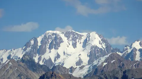
The settlement is a short trip from Almaty: about 27 km in a straight line, at the southern edge of Talgar. We could not confirm road routes, public transport or whether there is a car park, so a traveller without a car or Russian should plan a taxi and check the exact entrance point first. It can be paired with another early history stop nearby. The Issyk kurgan of the Golden Man lies about 20 km in a straight line away. For mountain scenery the same day, see nature near Almaty. Talgar Peak, the highest point of the Ile-Alatau, is a separate trip altogether.
When to visit Talgar Settlement
Late spring to early autumn works best, with June and September the most comfortable. The figures below are computed ERA5 reanalysis normals for 2011–2020 at a grid point at 1,099 m, not a weather station.
Day high, °C / Night low, °C · Rain/snow, mm
A computed reanalysis normal for these coordinates, not weather station records.
Monthly figures
| Month | Day high, °C | Night low, °C | Rain/snow, mm |
|---|---|---|---|
| Jan | -1.4 | -7.8 | 31.6 |
| Feb | 1.1 | -5.8 | 41.1 |
| Mar | 8.5 | 0.5 | 83.3 |
| Apr | 14.9 | 6.1 | 151.6 |
| May | 18.8 | 9.4 | 132.8 |
| Jun | 23.2 | 13.3 | 116.6 |
| Jul | 26.3 | 16.1 | 110.3 |
| Aug | 25.2 | 14.7 | 117.7 |
| Sep | 20.8 | 10 | 106.7 |
| Oct | 13.5 | 3.5 | 88.1 |
| Nov | 4.9 | -2.6 | 68.2 |
| Dec | 0.2 | -6 | 39.1 |
July is the warmest month, with average highs near 26°C and lows around 16°C. April and May are the wettest months at roughly 120–140 mm each, so expect muddy ground on an open earthwork. From December to February, average highs hover around or below freezing and nights drop to about -8 to -10°C. In winter the mounds may be under snow and hard to read. September brings highs near 21°C and less rain than spring.
Which sites are on the UNESCO list and which are not yet is explained in the Silk Road in Kazakhstan.
- Opening hours, entry rules and whether there is a ticket
- Public transport or taxi access from Almaty and the exact entrance point
- Whether there are signs, a visitor centre or guided tours on site
- The current state of fencing and protection after reports up to 2018
- Which Talgar finds are currently on display at the Central State Museum
Talgar Settlement, a medieval Silk Road town on the edge of modern Talgar: tips before you go
- See the sphinx dish at the Central State Museum in Almaty first: the site itself has mounds, not artefacts.
- Avoid April and May if you want dry ground: they are the wettest months, with about 120–140 mm of rain each.
- The fortified core is large: its four walls add up to roughly 1.2 km.
- Pair it with the Issyk kurgan, about 20 km away in a straight line, for a half-day Saka-to-Silk-Road history trip.
More to see nearby


Frequently asked questions
Is Talgar Settlement a UNESCO World Heritage site?
What does the name Talkhiz mean?
How far is Talgar Settlement from Almaty?
Why was Talgar abandoned?
Can I see objects found at Talgar?
Sources
Read also
 Almaty Zoo in Kazakhstan: opening hours and how to visit
 Ayusai Gorge, Almaty: visitor centre and waterfall trail
 Gorelnik Gorge above Medeu: waterfalls, trail and season
 Kamenskoe Plateau above Almaty: observatory and trails
 Pervomaiskie Ponds near Almaty: location, swimming, season
 Saty village: base for the Kolsai and Kaindy lakes