Verified: 2026-10
Sherkala Mountain: when to go, month by month
- January: off season
- February: off season
- March: possible
- April: good
- May: best time
- June: possible
- July: possible
- August: possible
- September: best time
- October: possible
- November: off season
- December: off season
Mid-April to late May and the second half of September; summer tops +40 °C, and there is no reliable word on winter trips.
Sherkala Mountain: why go
Sherkala: a yurt and a lion
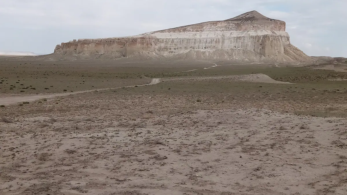
A lone 332 m limestone mountain that looks like a white yurt from one side and a lion resting its head on its paws from the other.
Legends of the lion's fortress
The name goes back to Persian «shir-kala». Stories tell of a summit fortress and tunnels inside the rock, though archaeology has not confirmed them.
Akmysh oasis below Sherkala
A grove with a spring and a stream at the foot of the mountain, about 150 km from Aktau, with a statue of a girl placed in the mid-1980s.
The Kyzylkala ruins
A medieval town of the 10th–13th centuries with a twelve-tower fortress; a trading square with gold dinars was found near Sherkala in 2016.
Stone spheres on the slopes
Concretions like those at Torysh lie around the base and on the slopes; broken ones show traces of shells and fish.
Sherkala Mountain in photos
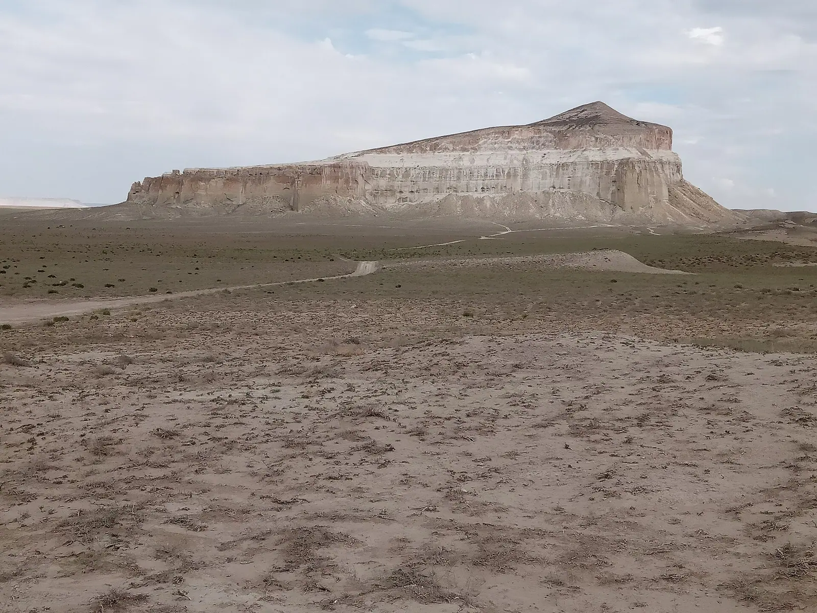
Real photos by travellers (Pexels, Unsplash, Wikimedia Commons); author and licence are given in each caption.
Sherkala is a solitary limestone mountain in the steppe of Mangystau District, 18 km north of the village of Shetpe, rising to 332 m above sea level. Aktau is about 94 km away as the crow flies, but Tengri Auto clocks the driving route at 175–180 km. Go in spring (mid-April to late May) or in the second half of September, because summer here means +40 °C. Most people combine Sherkala with the Torysh valley of stone balls and the rest of a Mangystau loop.
What Sherkala is
The mountain stands entirely on its own in flat steppe, not far from the Karatau ridge. Its limestone sides are steep and soften towards the top, so the whole thing reads as a giant tent. Kazakhstan’s register of sacred sites describes it as dense limestone resting on yellowish sandstone with Cretaceous layers. The eastern face is cut by gullies and niches, and Wikipedia mentions numerous caves inside the mountain.
Round stone concretions lie scattered on the slopes and around the base, the same kind of spheres you will see at nearby Torysh. Wikipedia notes that some broken ones show traces of shells and fish.
| Fact | Value | Source |
|---|---|---|
| Height above sea level | 332 m | Wikipedia |
| Height in the sacred-sites register | 308 m | archaeology.kz, 2017 register |
| From Shetpe | 18 km north | Wikipedia, archaeology.kz |
| From Aktau | 94 km straight line; 175–180 km by road | Wikipedia; Tengri Auto (2026) |
| To Torysh | 50–60 km depending on route | Tengri Auto (2026) |
| Coordinates | 44°15′18″ N, 52°00′23″ E | Wikipedia |
Why “lion’s fortress”
The name is usually traced to Persian shir-kala, “lion’s fortress”, and once you are there it makes sense. Approach from one side and you see a white yurt; from the other, a sleeping lion with its head on its paws.
Several legends cling to the mountain. One says a fortress on the summit fell after attackers cut the defenders off from their well; another says the defenders vanished into tunnels inside the rock and never came out. We found no archaeological evidence for a summit fortress, so treat these as stories. The mountain is revered locally, and folk belief holds that a wish made before walking around it will come true. The 2017 register lists it as both a natural monument and a sacred site.
Akmysh oasis and the Kyzylkala ruins
At the foot of Sherkala lies Akmysh, a small grove with a spring and a stream — rare shade in this landscape. Lada.kz (2015) put it about 150 km from Aktau, with a statue of a girl at the entrance placed by a local resident in the mid-1980s. The grove belongs to the Mangystau State Historical and Cultural Reserve. Archaeologist Andrey Astafyev warned back then that the stream was getting shallower, because wells along the Western Karatau pump water to Shetpe.
Next to it is the medieval site of Kyzylkala. According to Lada.kz (2015), settlers from Khorezm founded it in the 10th century; its fortress had twelve towers, and the town was abandoned in the 13th century after Genghis Khan crushed Khorezm. In 2022 Astafyev called it the region’s only large medieval town, inhabited for about 300 years. A trading square was found near Sherkala in 2016, with gold dinars among the finds.
Getting to Sherkala from Aktau
Head northeast from Aktau to the district centre of Shetpe; the mountain is 18 km beyond it. Tengri Auto makes Sherkala the first stop on a five-day loop: Aktau — Sherkala — Torysh — Shakpak-Ata — Bozzhyra — Karagiye — Zhygylgan — Sultan-Epe — Aktau, 950–1,100 km in total, of which only about 35% is paved.
Before you set off:
- Fuel. There are filling stations in Aktau, Zhanaozen and Shetpe and none out in the steppe (Tengri Auto). Fill up in Shetpe.
- Vehicle. For the full loop Tengri Auto recommends a prepared 4x4 or crossover with good clearance and more than one spare, as the local flint slices tyres.
- Sleeping. There are no hotels on the route — you camp or sleep in the car.
When to visit Sherkala
Tengrinews (2021) recommends mid-April to late May and the second half of September for Mangystau. Summer heat easily goes past +40 °C, and the desert cools by 20–30 degrees at night (Tengri Auto, 2026). In spring keep an eye on the forecast: Kyzylsay park has reported buses and machinery getting stuck after downpours in the region. We found no reliable information on winter trips.
Is there a fee?
New Kyzylsay park fees took effect on 1 September 2026, but reports list the park’s sites as Bozzhyra, Tuzbair, Kyzylkup and Mount Bokty — Sherkala is not mentioned (Lada.kz, August 2026). We found no separate fee for Sherkala or Akmysh. If someone asks for a fee at the oasis, ask for a receipt. How Kazakhstan’s MCI-based fees work is explained in the fee calculator.
How to behave at Sherkala
- Do not climb to the summit: the slopes are steep and locals advise against it.
- Leave the concretions where they are; at Torysh, stone theft has already become a problem.
- Sherkala and Akmysh are revered places — behave as you would at a shrine.
- Expect no signal in the steppe; download offline maps first. Our general checklist is before you go.
Nearby
- Torysh valley of stone balls — 50–60 km away, the next stop on the loop.
- Shakpak-Ata underground mosque — 50–70 km beyond Torysh on the Tengri Auto loop. Mangystau’s rock mosques joined the UNESCO World Heritage List in 2026.
- Bozzhyra and Mangystau — the wider route, fees and desert safety.
Sherkala Mountain: tips before you go
- Fill up in Shetpe: beyond it there are no filling stations, only back in Aktau and Zhanaozen.
- Do not climb to the top: the slopes are steep and locals advise against it.
- Leave the concretions alone: at nearby Torysh, stone theft is already a problem.
- There are no hotels on the route: bring a tent and plenty of water and food.
More to see nearby

Frequently asked questions
How far is Sherkala from Aktau?
How high is Sherkala Mountain?
Can you climb Sherkala?
What does the name Sherkala mean?
When should I visit Sherkala?
Is there an entrance fee for Sherkala?
What else is near Sherkala?
Sources
- Шеркала — Russian Wikipedia
- Sherkala, a nature monument — archaeology.kz (register of sacred sites of Kazakhstan, 2017)
- Sherkala, Sultan-Epe: a route through the most mysterious region — Tengri Auto, 13 Jun 2026 (in Russian)
- From Almaty to Bozzhyra: a road trip across Kazakhstan — Tengrinews, 24 May 2021 (in Russian)
- Akmysh tract in Mangystau — Lada.kz, 10 Jun 2015 (in Russian)
- Archaeologist Andrey Astafyev on the Kyzylkala site — Lada.kz, 24 Mar 2022 (in Russian)
- What visitors will pay at Bozzhyra and other Mangystau sites — Lada.kz, 13 Aug 2026 (in Russian)