Sauran, the abandoned walled city on the Syr Darya steppe: when to go, month by month
- January: possible
- February: possible
- March: good
- April: best time
- May: good
- June: possible
- July: possible
- August: possible
- September: best time
- October: best time
- November: possible
- December: possible
April and October bring highs around 19–22°C, while June to August average 34–36°C and December to February stay near freezing.
Sauran, the abandoned walled city on the Syr Darya steppe: why go
Sauran's oval city wall
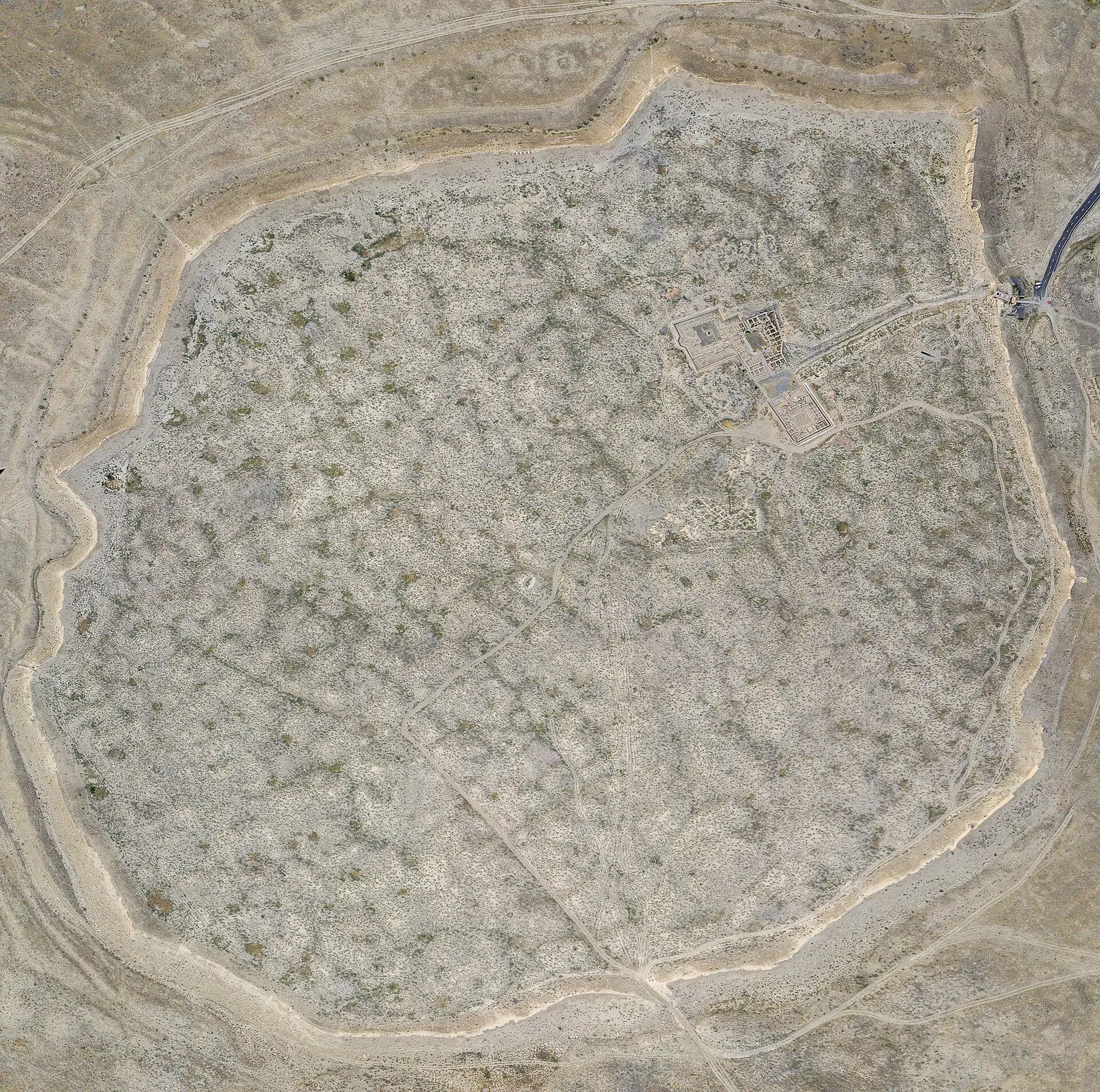
Mud-brick and rammed-earth walls still stand 3–6 m high around an 800 by 550 m platform, with four two-storey tower stumps and a 15–20 m wide moat.
The karez wells of Sauran
The first karez found in Kazakhstan: chains of 5 m ventilation shafts spaced 12–15 m apart, once linking wells to underground channels that watered the fields.
A side trip from Turkistan
The ruins lie 43 km north-west of Turkistan, 2 km off the Samara–Tashkent highway. We could not confirm public transport, so plan on a hired driver.
Spring and autumn at Sauran
April and October average highs of about 22°C and 19°C. July reaches 36°C with almost no rain, so summer visits work best at first light.
Bricks for the Yasawi mausoleum
Sauran supplied brick and tile for the Khoja Ahmed Yasawi mausoleum in Turkistan, commissioned by Timur in 1389, so the two sites share building material.
Sauran, the abandoned walled city on the Syr Darya steppe in photos
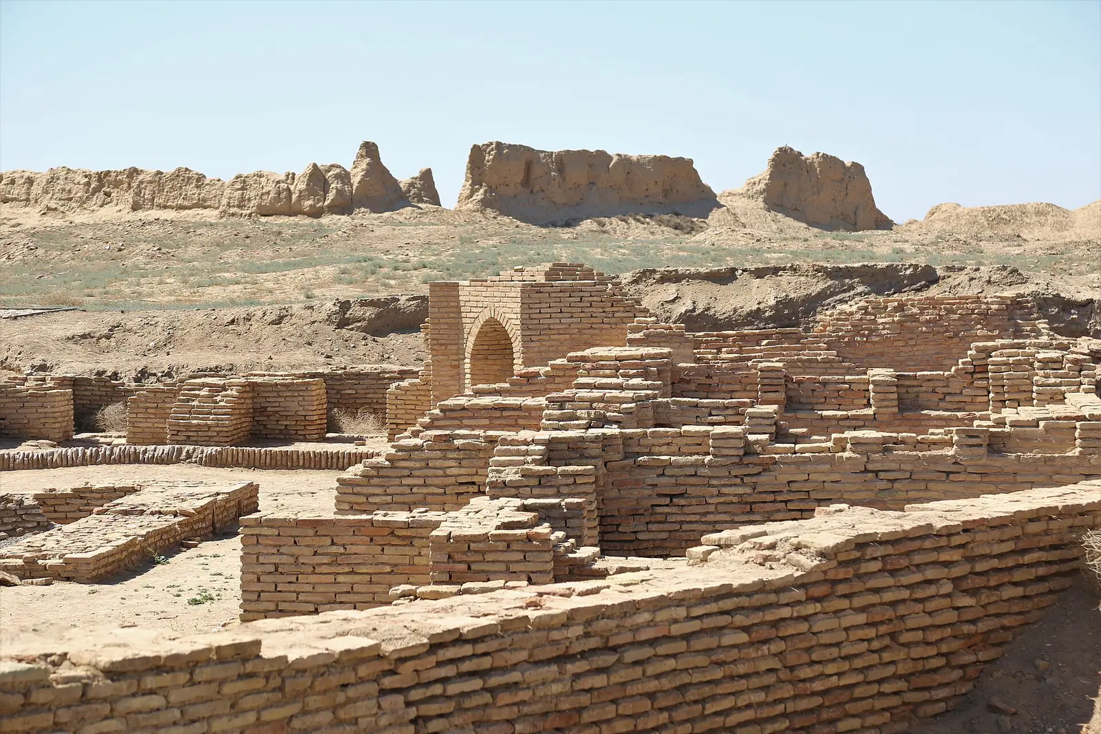
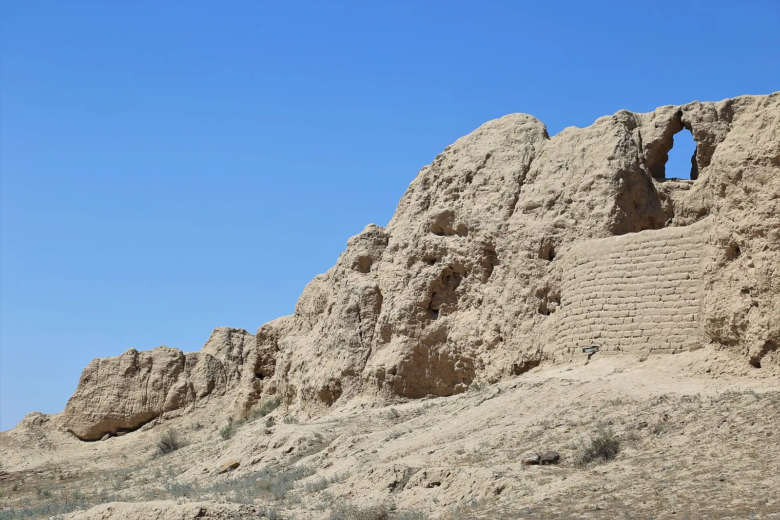
Real photos by travellers (Pexels, Unsplash, Wikimedia Commons); author and licence are given in each caption.
Sauran is a medieval walled city in southern Kazakhstan, 43 km north-west of Turkistan and close to the Syr Darya river. What survives is an oval platform ringed by eroded walls up to 6 m high, with the ruins of a mosque and madrasa inside and lines of old underground-canal wells outside. It is a half-day side trip from Turkistan rather than a destination on its own.
Where Sauran is and how it fits a Kazakhstan trip
Sauran lies in Turkistan Region, in the far south of Kazakhstan, about 46 km in a straight line from Turkistan and 198 km from Shymkent. Almaty is far away: its sights are roughly 740–760 km in a straight line, so this is a southern-Kazakhstan trip, not a day out from Almaty.
The site sits 2 km south of the Samara–Tashkent highway and about 500 m from the railway line. The modern village of Sauran is a separate place, 14 km south-east of the ruins, so do not confuse the two when asking directions. Most visitors will pair it with the mausoleum city of Turkistan, which is the natural base.
We could not confirm any public transport to the ruins. Without a car and without Russian or Kazakh, plan on arranging a driver in Turkistan.
| Key fact | Figure |
|---|---|
| Distance from Turkistan | 43 km north-west per Russian and English Wikipedia; 44 km per Kazakh Wikipedia |
| Site size | 800 m north-east to south-west, 550 m north-west to south-east |
| Surviving walls | 3–6 m high, on a 2–3 m base |
| Moat | 1–3 m deep, 15–20 m wide |
| Peak population | up to 15,000 |
| Abandoned | first half of the 19th century |
| Status | monument of republican significance, part of the Azret-Sultan museum-reserve |
Expect low earthen remains rather than standing buildings.
What you actually see inside the walls
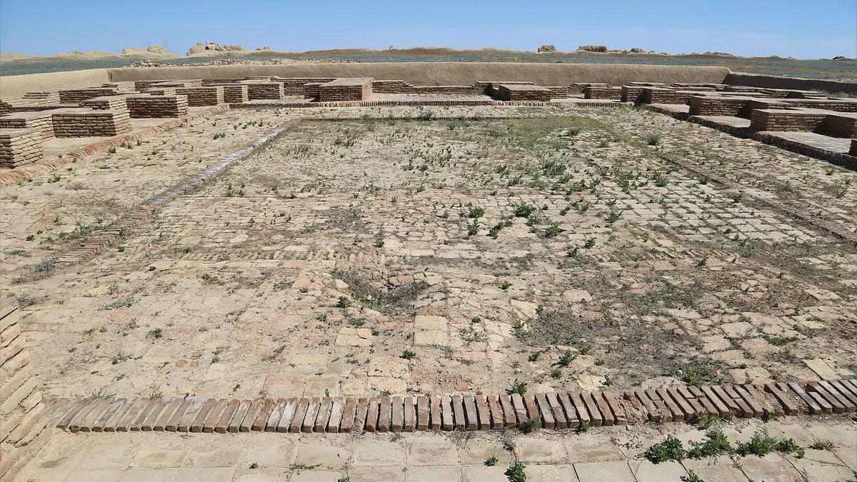
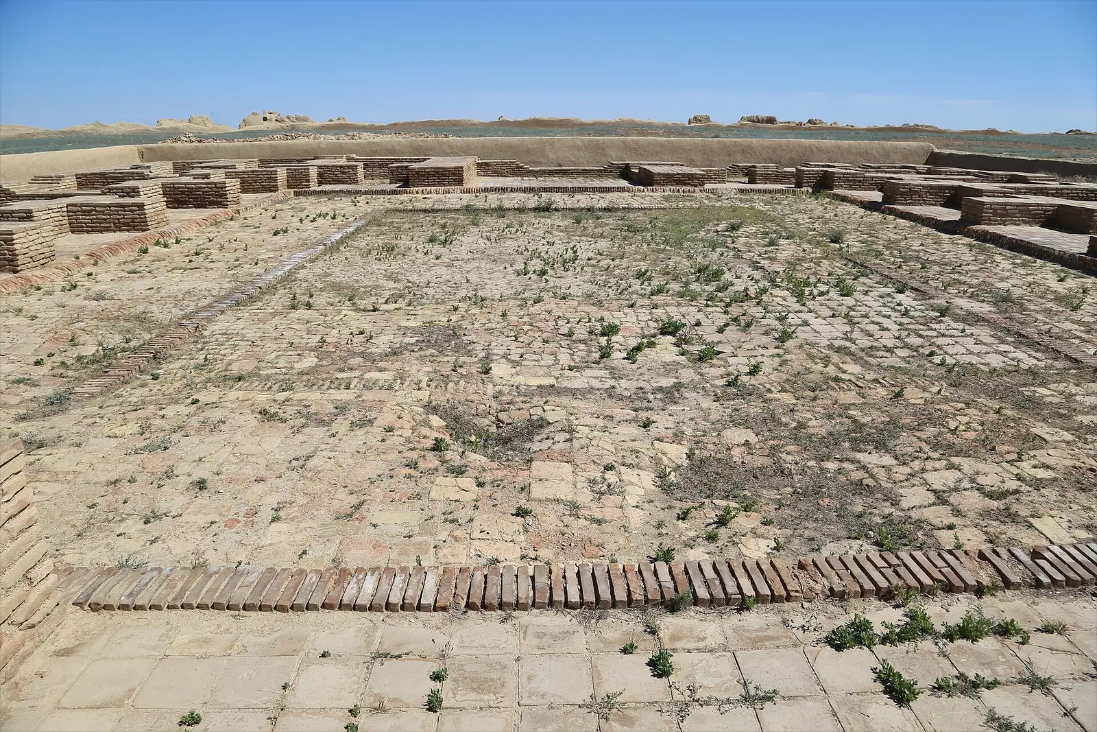
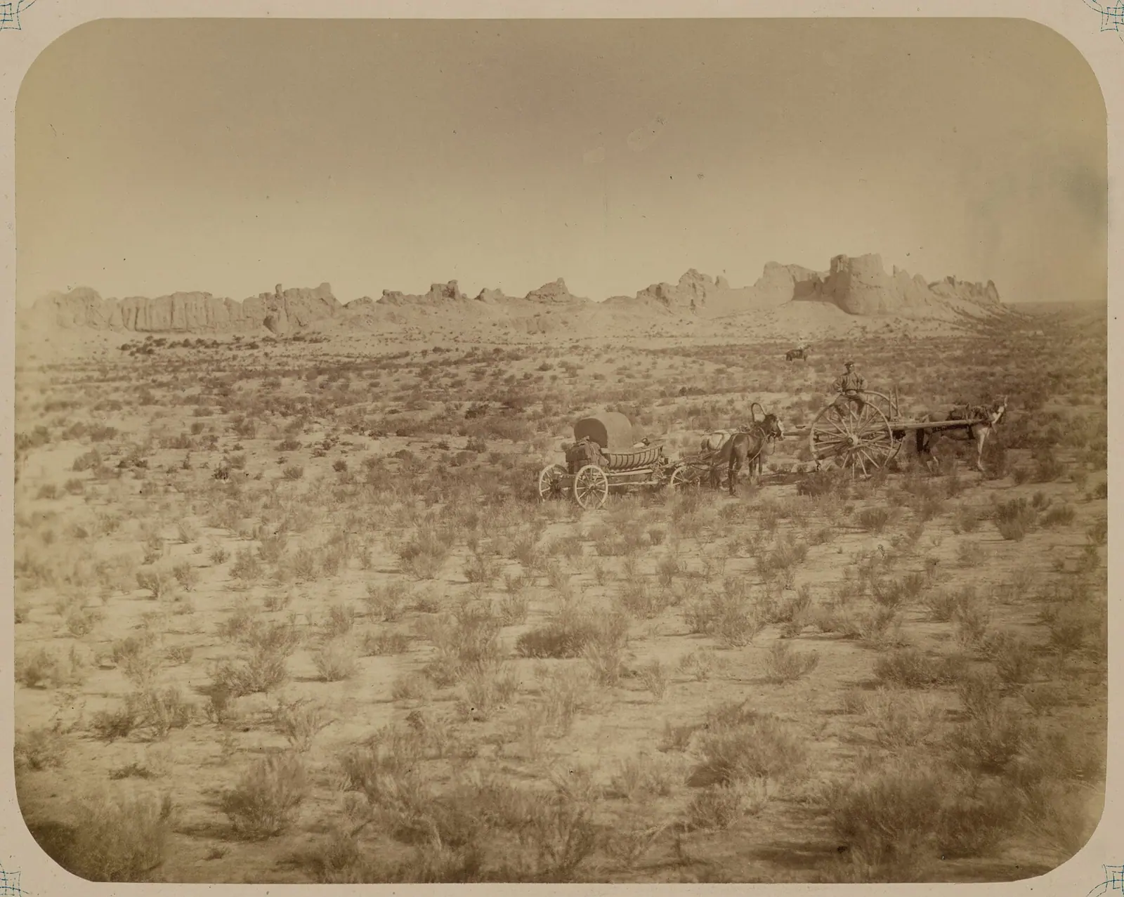
The visible city is an oval platform 2–2.5 m high, enclosed by a wall of mud brick and rammed earth. Stretches of that wall survive at 3–6 m, along with the remains of four two-storey towers that once carried domes.
The main gate was in the north-east, flanked by two towers that formed a corridor about 20 m long. From it the main street ran south-west and split the town nearly in half. About 210 m in from that gate, on the left, was the central square with the cathedral mosque and the madrasa.
- Cathedral mosque: 34 by 31 m, many-domed, with a courtyard of 17.8 by 15.3 m and outer walls up to 1.4 m thick. Much of its brick was later taken away.
- Madrasa: built in 1515 on the order of the Bukhara ruler Ubaidullah Khan, 31.5 by 28 m. The students’ cells survive best. Its two minarets, described by a 16th-century visitor as swaying, collapsed in the second half of the 19th century.
- Unidentified domed building north of the mosque, over 2,000 square metres, possibly a madrasa, Sufi lodge or caravanserai, with traces of copper or bronze working.
- Khanaka, a hexagonal Sufi lodge near the north-east gate.
Many ruins are poorly preserved because locals used them as a brick quarry after the city emptied. Expect footprints and wall stumps, not intact domes.
The karez wells and the suburbs outside
Sauran is the first place in Kazakhstan where a karez system was found: wells linked by underground channels that brought water to the fields. The historian Vasifi, who lived here in 1514–1515, wrote that it was built by two hundred Indian slaves.
What remains are chains of ventilation shafts about 5 m across, spaced 12–15 m apart. Beyond the wall a ring of suburbs ran out to about 1,600 m, covering some 4 square km with roughly 350 farmsteads of about 1 hectare each, with traces of melon fields, orchards, vineyards and grain plots. A festival mosque stood in the eastern suburb.
Sauran’s history in brief
The city you visit is the second Sauran. Before the 13th century the town stood 3 km to the south-east, at the site now called Karatobe, and the Mongols destroyed it in the first half of the 13th century. The city was rebuilt on the present spot on the caravan route between the Karatau range and the Syr Darya.
| Period | What happened |
|---|---|
| 10th century | Al-Muqaddasi describes a large city with seven walls, a border fortress against Oghuz and Kipchaks |
| 1320 | White Horde ruler Sasy-Buqa buried here; the city becomes a White Horde centre |
| Late 14th century | Timur rebuilds it as a fortress; it supplies brick and tile for the Khoja Ahmed Yasawi mausoleum, commissioned in 1389 |
| 15th–17th centuries | Part of the Kazakh Khanate, repeatedly retaken from the Shaybanids |
| 1598 | Heavy damage in a Shaybanid siege with catapults and tunnels under the walls |
| 1680s | Irreversible decline begins |
| 1723–1727 | Destroyed by the Dzungars |
| Early 19th century | Finally abandoned |
The link to Turkistan is worth knowing before you go: bricks from Sauran went into the Yasawi mausoleum you will likely see the same day. Kazakh Wikipedia gives different dates: it says the trading centre was founded in the 12th century and that research dates the city to the 7th–18th centuries.
Finds and research
The first archaeological survey was by P. I. Lerch in 1867, followed by Soviet expeditions in 1947, 1967 and 1986, and work under Kazakhstan’s Cultural Heritage programme from 2004. Most finds are workshop traces and pottery from the city’s decline, but Chinese celadon and porcelain of the 16th–17th centuries also turned up. In 2015 a hoard of 25 kg of copper coins was found, including local issues and coins struck in Muscovite Russia under Tsar Alexei Mikhailovich.
In 2016 the Ministry of Culture and Sport announced plans to nominate Sauran for the UNESCO World Heritage list. We could not confirm whether that nomination has moved forward.
When to visit Sauran
Spring and autumn are the comfortable windows; midsummer is hot and winter is cold.
Day high, °C / Night low, °C · Rain/snow, mm
A computed reanalysis normal for these coordinates, not weather station records.
Monthly figures
| Month | Day high, °C | Night low, °C | Rain/snow, mm |
|---|---|---|---|
| Jan | 2.9 | -4.8 | 30.6 |
| Feb | 4.9 | -4.7 | 26 |
| Mar | 14 | 3 | 36.9 |
| Apr | 21.9 | 9.5 | 22.5 |
| May | 29.5 | 15.6 | 20.7 |
| Jun | 34.5 | 20.1 | 4.3 |
| Jul | 36.6 | 22.2 | 1.8 |
| Aug | 34.8 | 20.6 | 2.6 |
| Sep | 28.4 | 14.1 | 1.8 |
| Oct | 19.3 | 6.4 | 13.9 |
| Nov | 8.7 | -1.1 | 32.6 |
| Dec | 2.9 | -5.1 | 35.3 |
These are computed ERA5 normals for 2011–2020 at a grid point at 211 m, not station readings. April averages highs of about 22°C and October about 19°C, which suits walking an open site. May and September already reach 28–30°C by day. July averages a high of 37°C and June to September are almost rain-free, so a summer visit means going early in the morning. December and January have highs near 3°C and nights around −5°C; the wettest months are November to March, though totals stay modest at about 21–37 mm a month.
Ruzbikhan in the 15th century described Sauran as built in open, level steppe. We could not confirm whether there is any shade or shelter at the site today, so plan as if there is none.
Combining Sauran with Turkistan and the south
The practical plan is Turkistan plus Sauran in one or two days. Shymkent, about 198 km in a straight line, is the bigger city in the region, and the mineral-water resort of Saryagash lies further south, about 255 km in a straight line. Kyzylorda is about 235 km away in the other direction along the Syr Darya. For the main city sights and the Yasawi mausoleum, see the Turkistan guide.
Nine sites are compared by what you can see today in the ancient cities of Kazakhstan.
- Whether there is an entry fee and what the opening hours are
- How to reach the site without a car from Turkistan
- Whether there is shade, water, toilets or a visitor centre at the site
- Whether walking on the walls and inside the ruins is permitted
- Current status of the 2016 UNESCO nomination plan
Sauran, the abandoned walled city on the Syr Darya steppe: tips before you go
- Base yourself in Turkistan, 43 km away, and arrange a driver there; we could not confirm buses or trains stopping at the ruins.
- Go in April or October, when average highs are about 19–22°C; July averages 36°C with under 2 mm of rain.
- Ask for the ancient city, not Sauran village: the modern village is 14 km south-east of the ruins.
- Look for the north-east gate first: the main street and the mosque square, 210 m inside, are laid out from it.
More to see nearby


Frequently asked questions
How far is Sauran from Turkistan?
Is the Sauran ancient city the same as Sauran village?
How big is Sauran?
Is Sauran a UNESCO World Heritage Site?
Why was Sauran abandoned?
Sources
Read also
 Almaty Zoo in Kazakhstan: opening hours and how to visit
 Ayusai Gorge, Almaty: visitor centre and waterfall trail
 Gorelnik Gorge above Medeu: waterfalls, trail and season
 Kamenskoe Plateau above Almaty: observatory and trails
 Pervomaiskie Ponds near Almaty: location, swimming, season
 Saty village: base for the Kolsai and Kaindy lakes