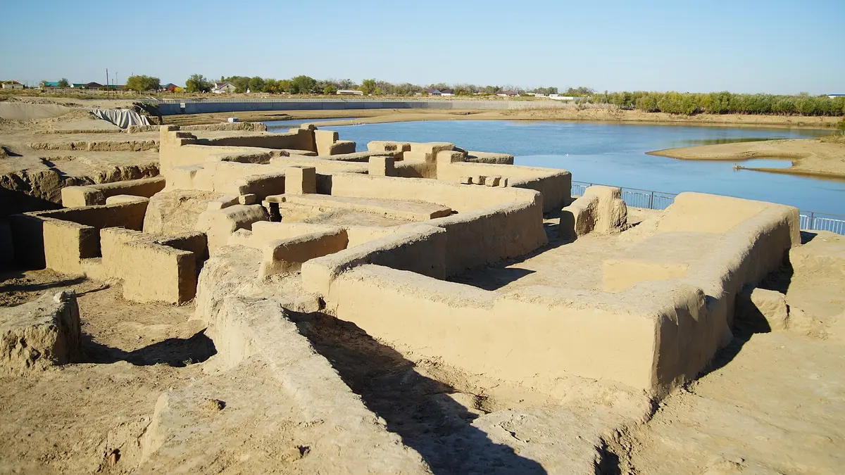
Saraishyk, the Golden Horde city on the Ural River near Atyrau: when to go, month by month
- January: possible
- February: possible
- March: possible
- April: good
- May: best time
- June: good
- July: possible
- August: possible
- September: best time
- October: good
- November: possible
- December: possible
May and September are mild enough to walk the open excavations, July and August are hot, and winter leaves mainly the indoor museums.
Saraishyk, the Golden Horde city on the Ural River near Atyrau: why go
Saraishyk open-air settlement
Enter by the old west gate to see an excavated Golden Horde street, a bathhouse, family crypts and a caravanserai-type palace building.
Pantheon of Khans
A 14-metre memorial by Sayin Nazarbekov naming rulers buried here, from Golden Horde khans Mengu-Timur and Janibek to Kasym Khan.
Getting to Saraishyk from Atyrau
The site lies about 47 km in a straight line from Atyrau on the Ural River; we could not confirm public transport, so plan a car in advance.
Spring and autumn at Saraishyk
May and September bring average highs of about 27°C and 24°C; July averages around 34°C on an open site with little shade.
A sand show in the visitor centre
The multimedia hall of the 2023 visitor centre tells Saraishyk legends and history through a sand-animation show, next to a children's museum.
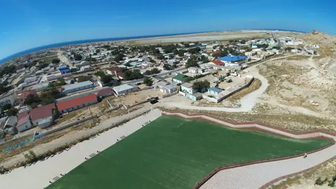
Saraishyk, the Golden Horde city on the Ural River near Atyrau in photos
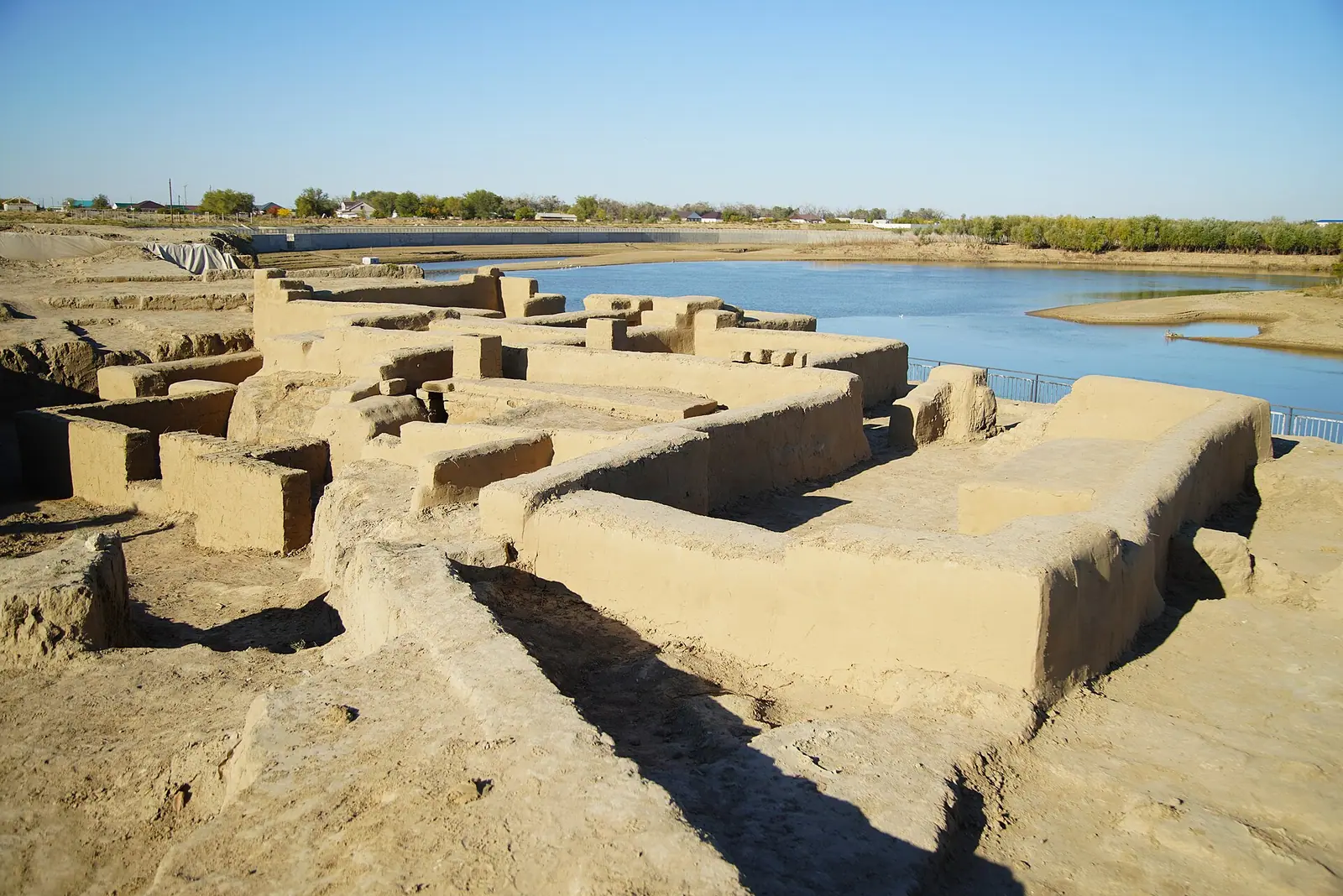
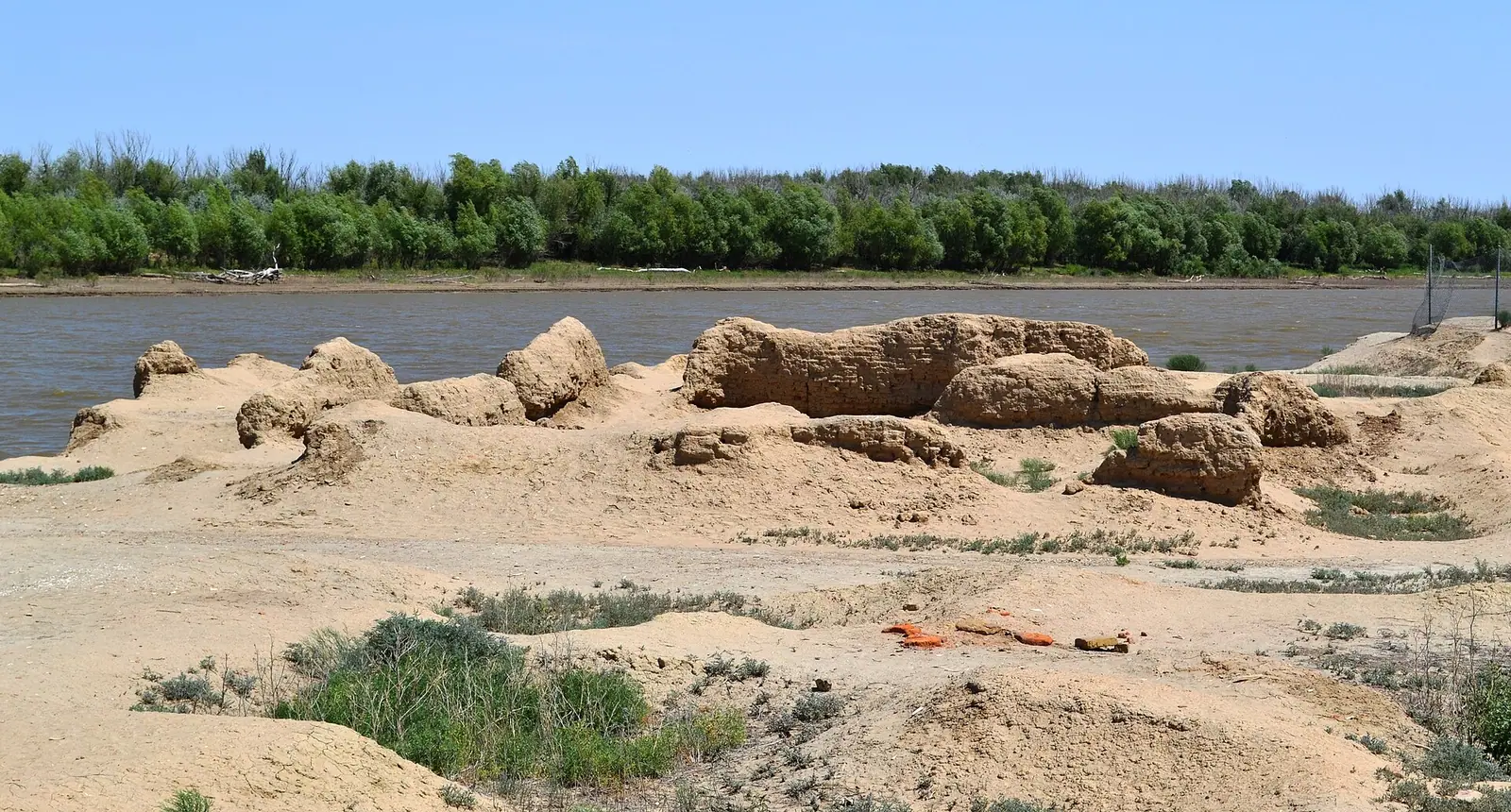
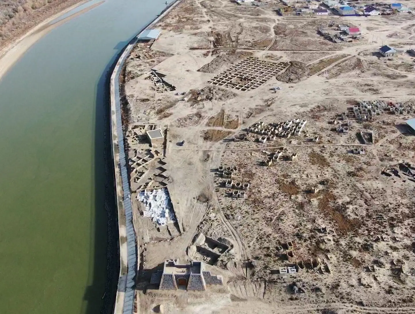
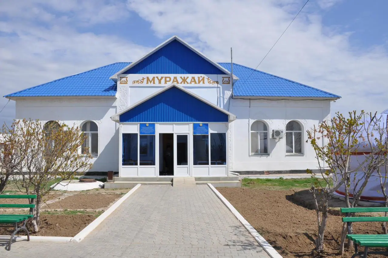
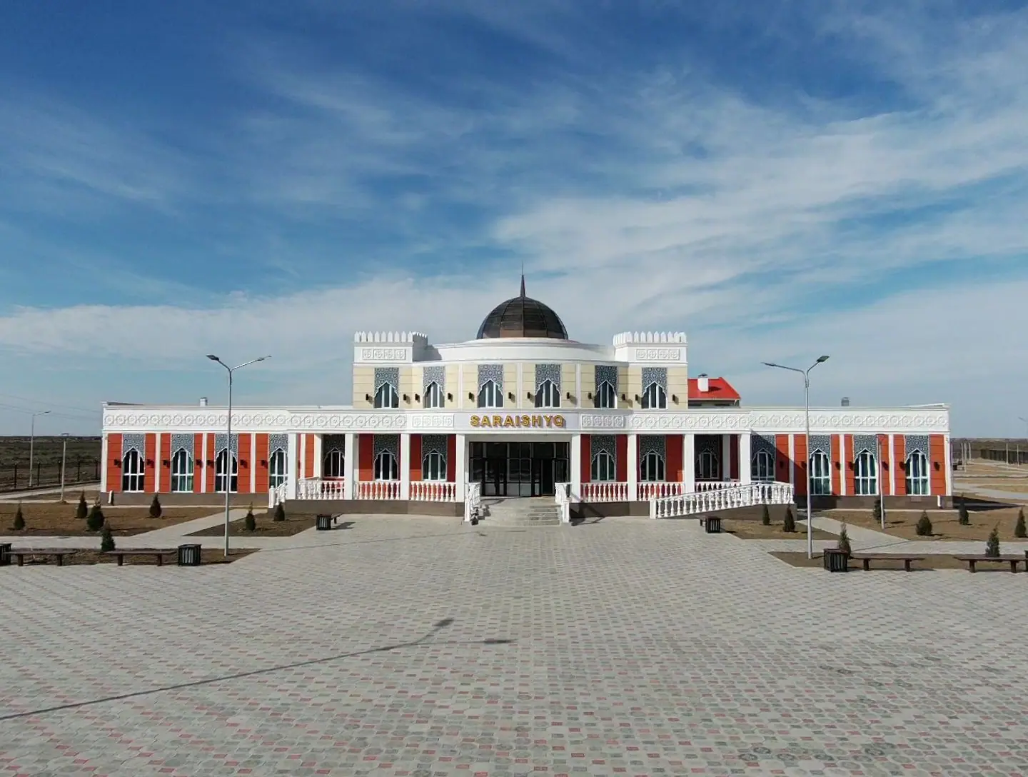
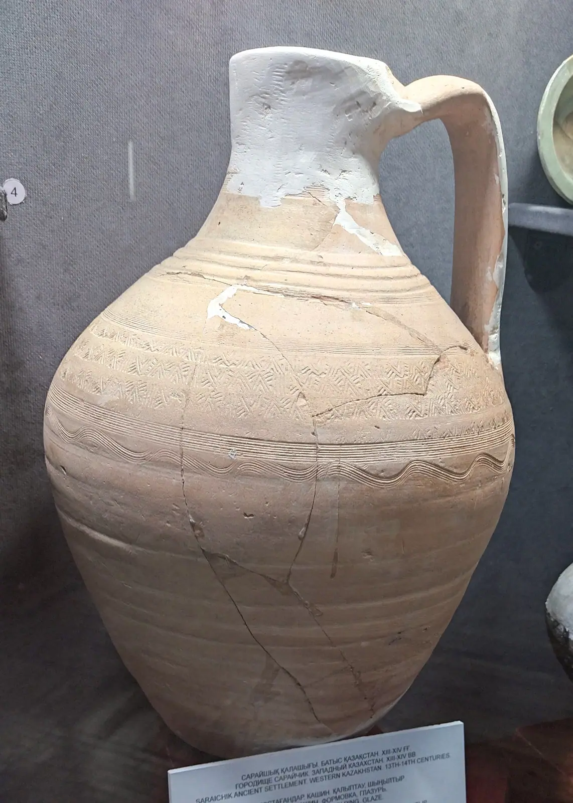
Real photos by travellers (Pexels, Unsplash, Wikimedia Commons); author and licence are given in each caption.
Saraishyk is a medieval city site on the right bank of the Zhaiyk (Ural) River in western Kazakhstan, about 47 km in a straight line from Atyrau. In the 14th–16th centuries it was known as “Little Sarai”, one of the three largest cities of the Golden Horde. The ruins now form an open-air museum, with a visitor centre, an ethnographic museum and a 14-metre memorial to the rulers buried here.
What Saraishyk is and why it matters
Saraishyk is the site of a city that flourished between the 13th and 16th centuries on a caravan route linking Crimea, the Caucasus, Karakorum and China. During the Golden Horde era it was a religious, political, trading and economic centre. Along with Sarai-Batu and Sarai-Berke it counted among the three largest cities of the Horde.
Several sources, including the Genealogy of the Turks by Abulghazi Bahadur Khan, say the city was founded by Batu Khan. Later it belonged to the Nogai Horde and the Kazakh Khanate, and rulers of all three states were buried here.
| Key fact | Detail |
|---|---|
| Location | Saraishyk village, Makhambet District, Atyrau Region |
| Setting | Right bank of the Zhaiyk (Ural) River |
| Main period | 13th–16th centuries |
| Distance | About 47 km in a straight line from Atyrau |
| Status | State historical and cultural museum reserve |
| Collection | About 6,343 stored items, mostly Golden Horde, Nogai and early Kazakh finds |
If you have a broader interest in medieval steppe cities, Saraishyk pairs thematically with Sauran near Turkistan and Ulytau, where Jochi had his headquarters, although both are far away across the country.
What you can see at the site
The complex has four parts, and the ruins are only one of them. Plan time for the museums too, not only the open ground.
| Part | Opened | What is there |
|---|---|---|
| Medieval settlement | Excavations ongoing since 2019 | West gate, fishing site, dwelling, Golden Horde street, family crypts, crypts at “Khan molasy”, bathhouse, a caravanserai-type palace building |
| Visitor centre | July 2023 | Main history exhibition, hyperrealistic figures of khans, city model, archaeology hall, multimedia sand show, children’s museum |
| Ethnographic museum | September 1999 | History of the reserve, a furnished yurt, Kazakh household items of the 19th–20th centuries, a Second World War exhibition about local soldiers |
| Pantheon of Khans | September 1999 | 14-metre memorial by sculptor Sayin Nazarbekov with inscribed names of rulers buried in Saraishyk |
Visitors enter the settlement through its west gate, once part of the city’s defences. The visitor centre covers the story from before the Golden Horde through the Nogai Horde and the Kazakh Khanate to the city’s decline. Guided tours and QR-code information are mentioned for the site, but we could not confirm whether any of it is available in English.
The Pantheon of Khans: a memorial, treat it with respect
The Pantheon of Khans is a memorial to the rulers buried in old Saraishyk, not an archaeological ruin. Its tombstones carry the names and reign years of Golden Horde rulers Mengu-Timur, Tokhta and Janibek, the Nogai emir Okas, Shikh-Mamai and Yusuf-biy, and Kasym Khan of the Kazakh Khanate.
In the centre stands an apple tree brought from an apple orchard as an old symbol of Saraishyk, together with memorial stones. The 1999 complex also included a mosque.
How to plan a visit from Atyrau
Atyrau is the nearest city, about 47 km away in a straight line; road distance will be longer. Saraishyk is in the far west of Kazakhstan, a long way from Almaty and Astana.
We could not confirm any bus or shared-taxi service to the village, or the state of the road. Without a car and without Russian or Kazakh, the practical approach is to arrange transport from Atyrau in advance. The visitor centre building includes guest accommodation, useful for a longer look at the site. We could not confirm how it is booked.
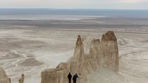
The Mangystau sights such as Bozzhyra and the Mangystau plateau are roughly 350–400 km away in a straight line, so they are a separate trip, not a side visit.
When to go to Saraishyk
Late spring and early autumn are the comfortable windows. The figures below are ERA5 reanalysis normals for 2011–2020 at a grid point at about 20 m below sea level, not readings from a weather station.
Day high, °C / Night low, °C · Rain/snow, mm
A computed reanalysis normal for these coordinates, not weather station records.
Monthly figures
| Month | Day high, °C | Night low, °C | Rain/snow, mm |
|---|---|---|---|
| Jan | -3.5 | -9.7 | 17.1 |
| Feb | -2.1 | -10 | 11.6 |
| Mar | 7.1 | -2.3 | 18.3 |
| Apr | 17.9 | 6.2 | 20.5 |
| May | 27.1 | 14.6 | 20 |
| Jun | 31.7 | 18.6 | 13.4 |
| Jul | 34.2 | 21.4 | 10.3 |
| Aug | 32.5 | 19.5 | 9.3 |
| Sep | 24.5 | 12.2 | 8.8 |
| Oct | 15 | 4.1 | 15.1 |
| Nov | 4.6 | -3.3 | 11.7 |
| Dec | -1.7 | -7.5 | 18 |
May averages highs around 27°C and September around 25°C, with nights in the mid-teens: good for walking the open excavation area. July is hot, with average highs about 34°C and nights above 22°C, and there is little shade on an open archaeological site. Summer is also the driest stretch, around 10 mm of precipitation a month. From December to February daytime highs stay below zero and nights drop to about −10°C, so a winter visit means mostly the indoor museums.
| Season | What to expect |
|---|---|
| April–May | Mild to warm, highs rising from about 17°C to 27°C |
| June–August | Hot and dry, highs 31–34°C |
| September–October | Warm then cool, highs about 24°C falling to 15°C |
| November–March | Cold, frost at night, highs near or below zero in midwinter |
- Opening days and hours of the visitor centre and the open-air site
- Entrance fees and whether guided tours are available in English
- Public transport from Atyrau to Saraishyk village and the road condition
- How to book the guest accommodation in the visitor centre building
Saraishyk, the Golden Horde city on the Ural River near Atyrau: tips before you go
- Start at the 2023 visitor centre: its city model and history exhibition give context for the settlement outside.
- Avoid midday in July: average highs reach about 34°C and nights stay above 22°C, and the open-air site has little shade.
- Arrange transport from Atyrau beforehand; the site is about 47 km away in a straight line and we found no confirmed bus service.
- Treat the Pantheon of Khans as a memorial to rulers buried in Saraishyk; the 1999 complex also included a mosque.
More to see nearby


Frequently asked questions
Where is Saraishyk?
Who founded Saraishyk?
Is there a museum at Saraishyk?
Are excavations still going on?
Sources
Read also
 Almaty Zoo in Kazakhstan: opening hours and how to visit
 Ayusai Gorge, Almaty: visitor centre and waterfall trail
 Gorelnik Gorge above Medeu: waterfalls, trail and season
 Kamenskoe Plateau above Almaty: observatory and trails
 Pervomaiskie Ponds near Almaty: location, swimming, season
 Saty village: base for the Kolsai and Kaindy lakes