Otrar, the Silk Road city in southern Kazakhstan that fell to Genghis Khan: when to go, month by month
- January: possible
- February: possible
- March: good
- April: best time
- May: good
- June: possible
- July: possible
- August: possible
- September: good
- October: best time
- November: possible
- December: possible
April and October bring daytime highs around 20–22°C, while June to August average 34–36°C on an exposed plain and winter nights drop below freezing.
Otrar, the Silk Road city in southern Kazakhstan that fell to Genghis Khan: why go
The Otrar mound and citadel
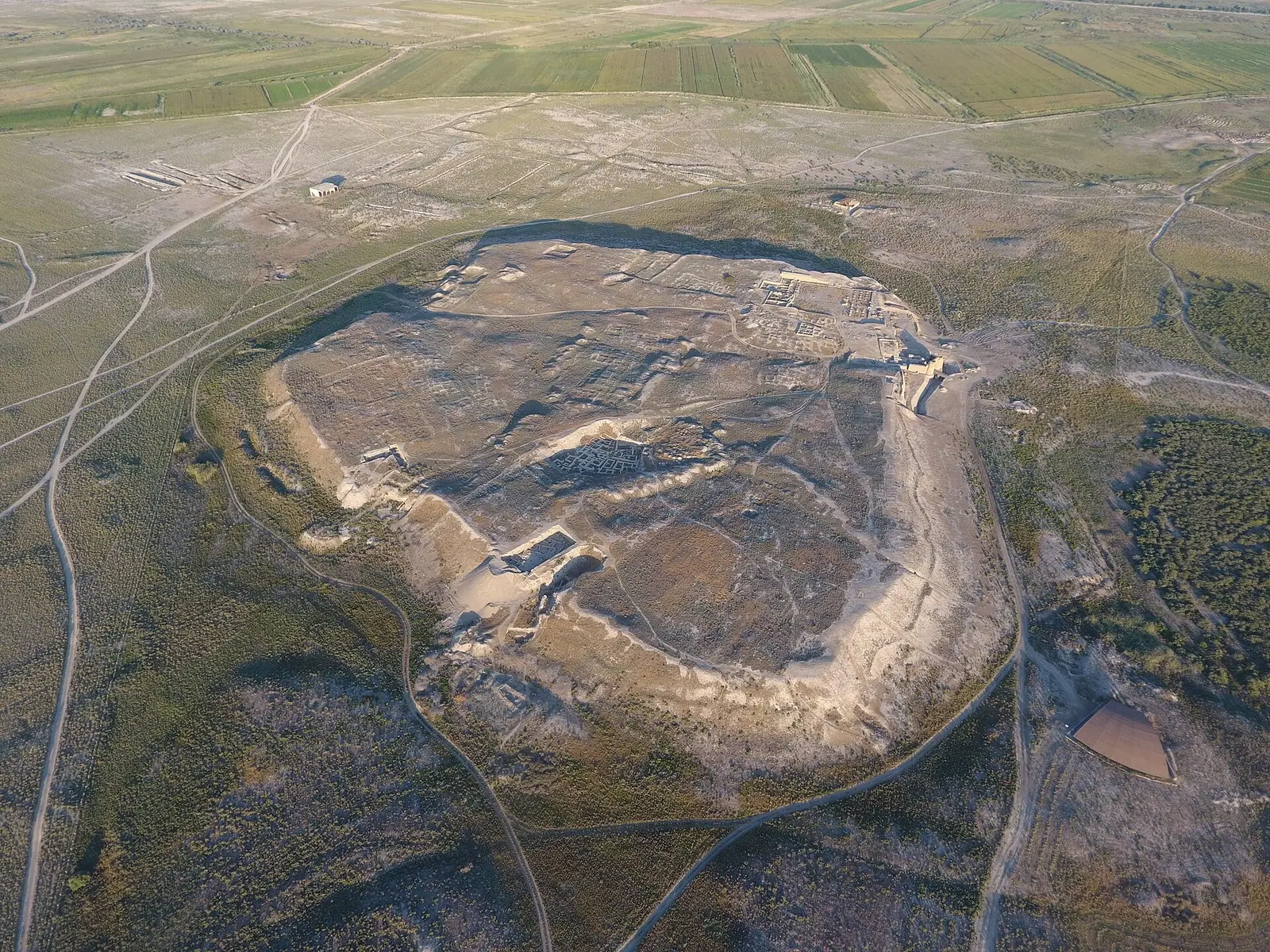
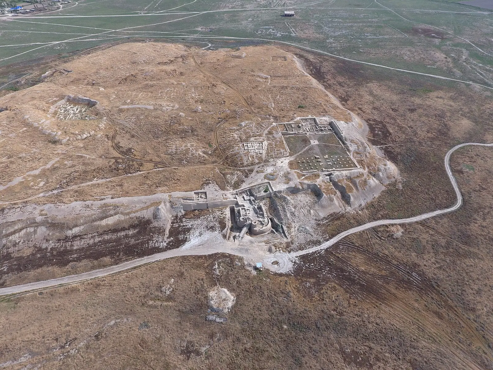
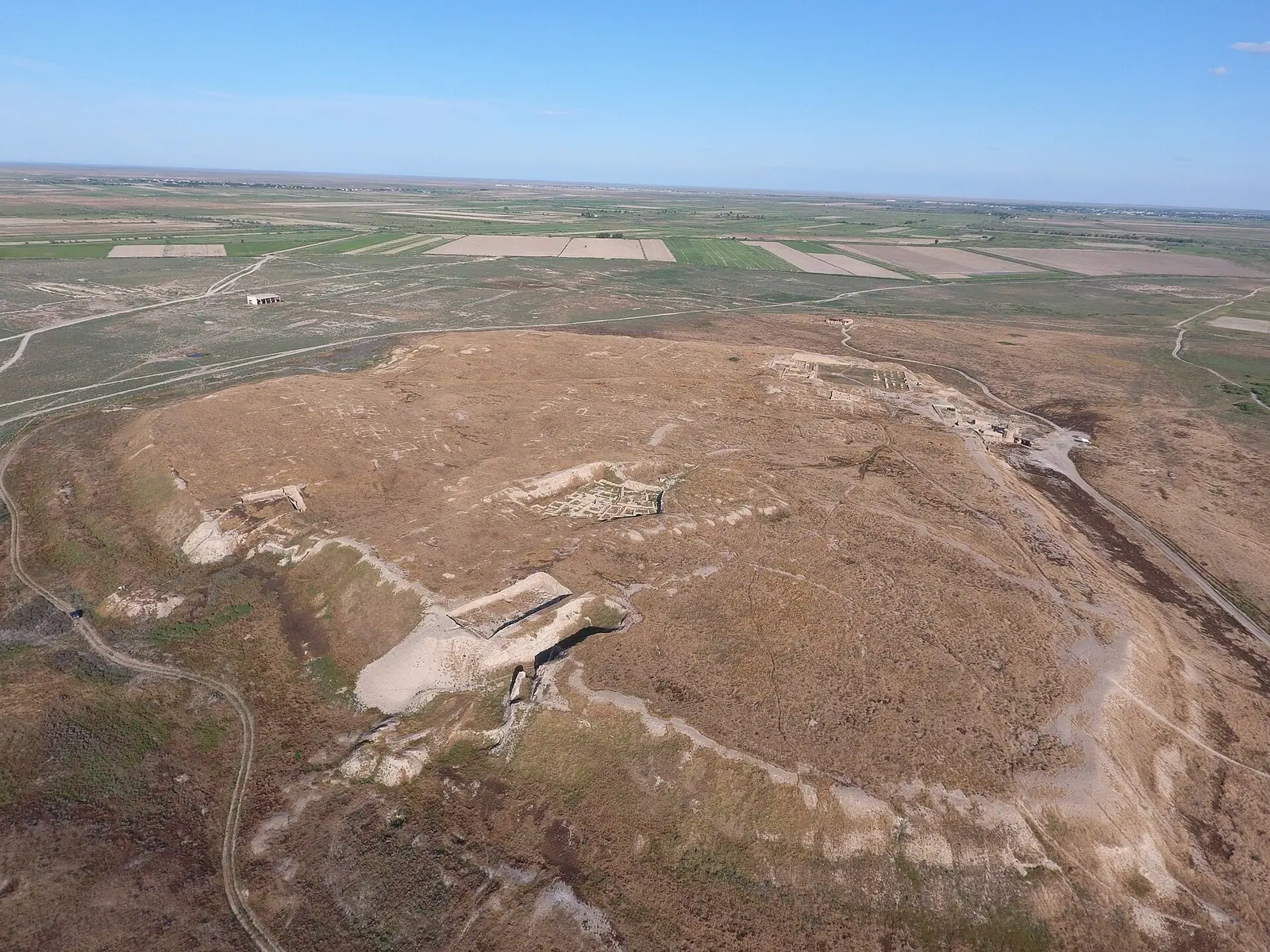
A five-sided hill up to 18 m high, formed by the citadel and walled town, with three former gates and traces of the moat still visible.
The fall of Otrar, 1219
After a 450-man Mongol caravan was executed here in 1218, Genghis Khan's sons besieged the city for five or six months, then burned it.
Otrar as a trip from Turkistan
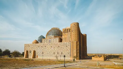
The site lies about 50 km in a straight line from Turkistan, so it pairs with Yasawi's mausoleum and the Arystan Bab mausoleum close to the ruins.
Otrar's fierce summer heat
July highs average 36.5°C with barely 5 mm of rain, so April and October, with highs around 20–22°C, suit walking the open ruins far better.
Otrar's camel-shaped water vessel
Kilns found here show Otrar made pottery for the region; one notable find is a vessel shaped as a camel with a woman's head and a cradle on its back.
Otrar, the Silk Road city in southern Kazakhstan that fell to Genghis Khan in photos
Real photos by travellers (Pexels, Unsplash, Wikimedia Commons); author and licence are given in each caption.
Otrar, also written Otyrar and once called Farab, is the site of an ancient Silk Road city in southern Kazakhstan, about 50 km in a straight line from Turkistan and 120 km northwest of Shymkent. The killing of a Mongol caravan here in 1218, known in Kazakh as the Otrar catastrophe, gave Genghis Khan the pretext for his invasion of Central Asia, and the city was besieged in 1219. What you visit now is an archaeological site: a five-sided mound, excavated quarters, bath houses and the traces of a moat, best combined with a stay in Turkistan.
Where Otrar is and what kind of trip it demands
Otrar lies in the Otyrar district of Turkistan Region, on the lower Arys river near its confluence with the Syr Darya, next to the modern village of Talapty. Russian Wikipedia places it 10 km west of Timur railway station and 57 km south of Turkistan; Kazakh Wikipedia puts it 7 km northwest of Temir station. From Almaty it is far: roughly 700 km in a straight line to the west, so it is not a day trip from there.
The practical base is Turkistan, about 50 km in a straight line, where most visitors already come for the mausoleum of Khoja Ahmed Yasawi. Our Turkistan guide covers that city and Sauran alongside Otrar. Shymkent, 120 km away, is the other option. Expect a half-day or full-day excursion by road, and plan it as an archaeology stop rather than a museum with reconstructed buildings.
| Key fact | Figure |
|---|---|
| Other names | Otyrar, Farab, Tarband, Turarband, Karachuk |
| Straight line to Turkistan | about 50 km |
| Distance to Shymkent | 120 km northwest |
| Height of main mound | up to 18 m from its base |
| Shape | five-sided hill, sides 145 to 400 m |
| Area | 20 ha for the hill (English Wikipedia) or 200 ha for the whole site (Kazakh Wikipedia, and about 2 km² in English Wikipedia) |
| Occupied | about 2,000 years, from the 1st century AD to the early 19th century |
| Excavations | since 1969 |
The area figures differ because the sources measure different things: the hill alone, or the settlement with its suburbs.
The fall of Otrar in 1219
The fall of Otrar began with a caravan. In 1218 a Mongol trade caravan of around 450 men, including an envoy of Genghis Khan, reached the city. The governor, an uncle of the Khwarazmshah Muhammad II, accused them of spying and had them executed. English Wikipedia names him Inalchuq; Russian and Kazakh sources call him Kair-khan (Qayyr-khan).
When Genghis Khan’s ambassadors demanded punishment, the Shah had the Muslim envoy beheaded and the beards of the two Mongol companions shaved. In autumn 1219 Mongol armies led by Genghis Khan’s sons besieged Otrar. The sources disagree on the length: five months in English Wikipedia, six in Russian Wikipedia. Russian Wikipedia says famine set in, a resident named Karadja opened a gate at night and was later executed by Jochi, and the governor, who fought to the end, was killed by having molten silver poured into his eyes and mouth. The city was burned, much of the population killed and the rest enslaved.
The story is the reason most people know the name. If you come for it, note that the city was rebuilt after 1219 and again in the 15th century.
Otrar after the Mongols: rebuilt, then abandoned
Otrar did not end in 1219. It recovered within decades and by the middle of the 13th century was again a large trade centre; an Armenian traveller listed it among the major Syr Darya cities in 1255, and a Florentine merchant’s notes on the route to the Far East mention it in 1320.
| Period | What happened |
|---|---|
| 1st century AD | earliest settlement layers |
| 6th to 8th centuries | capital of a local Kangar dynasty, known as Turarband |
| 9th to 10th centuries | counted among the Isfijab towns; mint of its own coins |
| early 13th century | part of Khwarazm; coins struck here 1210–1218 |
| 1219 | Mongol siege and destruction |
| 14th century | White Horde khans build madrasas and mosques |
| 1405 | Timur dies here at the start of his campaign against China |
| 1465–1718 | a town of the Kazakh Khanate (Russian Wikipedia) |
| 1723–1727 | ruined by the Dzungars |
| end of 18th century | about 40 families left, against perhaps 5,000–7,000 in the 14th–17th centuries |
| early 19th century | finally abandoned after drought and failed irrigation |
The month of Timur’s death differs by source: January 1405 in Russian Wikipedia, February 1405 in English Wikipedia. Otrar is also named as the birthplace of the philosopher and mathematician al-Farabi, and the Sufi preacher Arystan Bab lived here; his mausoleum stands near the site.
What survives at the Otrar ruins
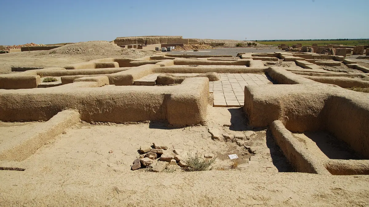
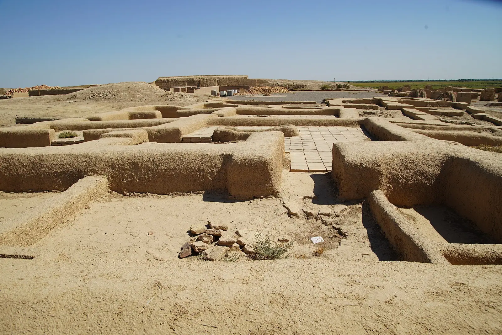
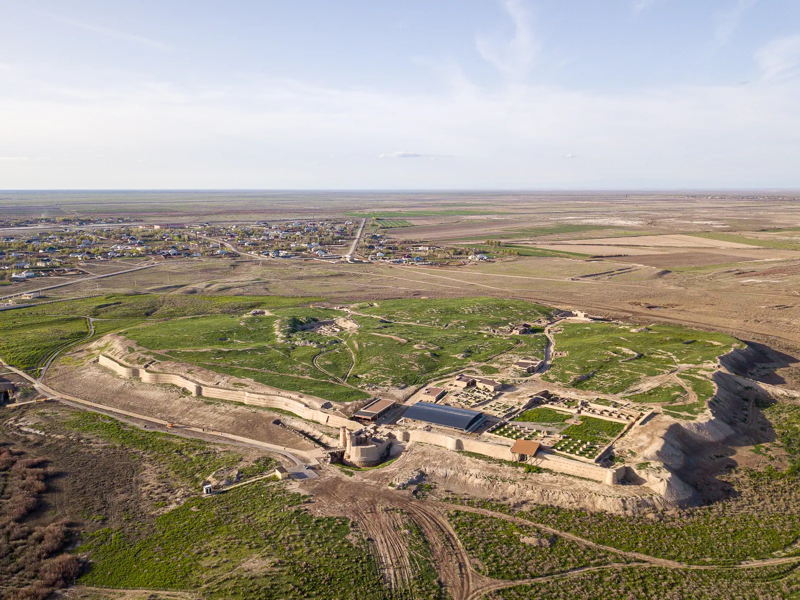
The visible site is a five-sided hill formed by the Ark (citadel) and the Shahristan (walled town), rising up to 18 m. Kazakh Wikipedia notes the city had three gates, the central one on the south side, and that the northeast and east walls are the better preserved. Remains of the moat around the main mound can still be traced.
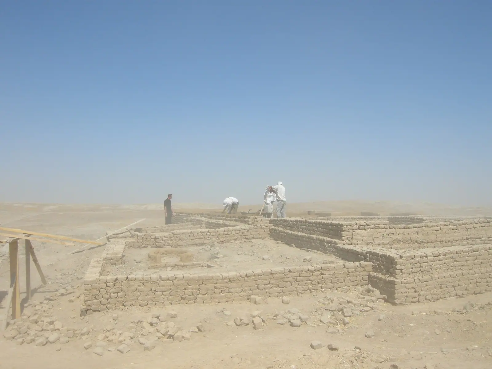
Archaeologists have exposed several residential quarters, mosques and two bath houses of the 9th to 12th centuries in the suburbs outside the wall, with hot-water systems, bathing halls and a prayer room. Kilns and pottery show Otrar was a ceramics centre; one well-known find is a water vessel in the shape of a camel with a woman’s head.
The wider oasis holds more ruin mounds, including Kuyruktobe, Kokmardan, Altyntobe and Mardan-Kuik. From 2001 to 2004 a UNESCO, Kazakhstan and Japan project worked on conservation, and a state programme for reviving ancient Otrar has run since 2004. An open-air archaeological museum was planned; we could not confirm whether it is open or what it includes.
When to go: spring and autumn, not high summer
The climate figures below are computed ERA5 reanalysis normals for a grid point at 206 m near the site, not readings from a weather station.
Day high, °C / Night low, °C · Rain/snow, mm
A computed reanalysis normal for these coordinates, not weather station records.
Monthly figures
| Month | Day high, °C | Night low, °C | Rain/snow, mm |
|---|---|---|---|
| Jan | 3.9 | -3.6 | 29.9 |
| Feb | 5.8 | -3.6 | 28.1 |
| Mar | 15.1 | 4.2 | 39.3 |
| Apr | 22.9 | 10.9 | 26.1 |
| May | 30.6 | 17.1 | 15 |
| Jun | 35.5 | 21.2 | 6.3 |
| Jul | 37.7 | 23.6 | 1.7 |
| Aug | 35.8 | 22 | 1.6 |
| Sep | 29.5 | 15.6 | 1.6 |
| Oct | 20.2 | 7.8 | 15.9 |
| Nov | 9.5 | 0 | 27.5 |
| Dec | 3.9 | -3.7 | 25.7 |
Summer is the obstacle. Average highs reach 35.5°C in June, 37.7°C in July and 35.8°C in August, with almost no rain from June to September, and the site is an open plain of ruins. April (highs around 23°C) and October (around 20°C) are the comfortable months; May and September are warm at about 29°C, manageable if you go early in the day. Winter highs sit near 2–6°C with nights below freezing in December to February, possible but bleak. Most of the year’s rain falls from November to April, around 28–34 mm a month.
Getting there without a car: what we could not confirm
We found no confirmed public transport to Otrar, no entry rules and no opening hours. The nearest named railway point is Timur (Temir) station, 7–10 km away, but we could not confirm which trains stop there or how you would continue to the site.
For a visitor with no car and no Russian, the realistic plan is to arrange a driver from Turkistan and combine Otrar with the nearby Arystan Bab mausoleum. Signage languages at the site are also something we could not verify. If you are travelling further south, Saryagash is about 170 km in a straight line from Otrar.
Nine sites are compared by what you can see today in the ancient cities of Kazakhstan.
- Whether an entry ticket, opening hours or a visitor centre exist at the site.
- Any public transport from Turkistan or Shymkent to Otrar, and which trains stop at Timur (Temir) station.
- Whether the planned open-air archaeological museum has opened and what it shows.
- Current road condition to Talapty and the site.
- Whether information boards or guides are available in English.
Otrar, the Silk Road city in southern Kazakhstan that fell to Genghis Khan: tips before you go
- In May or September highs near 29°C; start early, as the open site and June–August highs of 34–36°C make midday walking hard.
- Allow time for the Arystan Bab mausoleum near the ruins; Arystan Bab is the Sufi preacher said to have lived and taught in Otrar.
- Spell the name both ways when asking for a driver: Otrar in Russian, Otyrar in Kazakh. The district carries the same name.
- Most rain falls November to April at about 28–34 mm a month.
More to see nearby


Frequently asked questions
Where is Otrar, Kazakhstan?
What is The Fall of Otrar film from 1991?
Is Otrar still a city today?
What happened to the Otrar library?
Who was born in Otrar?
Sources
Read also
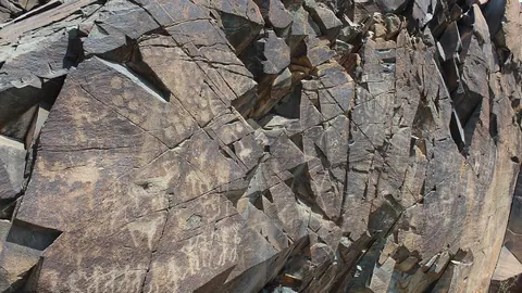 Tamgaly (Tanbaly) petroglyphs
- Tamgaly petroglyphs and the other rock art sites of Kazakhstan
 UNESCO heritage in Kazakhstan: seven sites
 Tamgaly Tas petroglyphs: a Buddhist open-air temple on the Ili River
 Eshkiolmes Petroglyphs: over 4,000 rock carvings on a Zhetysu ridge
 Turkestan: the Yasawi Mausoleum, Sauran and Otrar