- Getting there
- 22–25 km from Almaty
- Fee
- ≈ $1.40 (649 ₸) Park fee: 0.15 MCI · MCI 4,325 ₸ in 2026 · at 450 ₸ to $1 · MCI calculator
- When
- Jun–Sepbest timeNow: possible
- Altitude
- Kotyrbulak peak 3,029 m
- On foot
- Loop ~17 km, +1,808 m
- Transport
- Bus 209
Kotyrbulak gorge near Almaty: when to go, month by month
November · now- January: good
- February: good
- March: possible
- April: possible
- May: good
- June: best time
- July: best time
- August: best time
- September: best time
- October: good
- November: possible
- December: good
Ridge trails run June to September; snow still lies on the crest in late May, avalanches are possible on Lesnoy pass in winter, and ski bases operate lower in the gorge.
Kotyrbulak gorge near Almaty: why go
Kotyrbulak and Bukreev peaks
The ridge between Kotyrbulak and Butakovka: Kotyrbulak peak at 3,029 m (OSM) and Bukreev peak at 3,010 m with a memorial stele to the climber Anatoli Boukreev.
A loop over Butakovsky pass
About 17 km and 1,808 m of ascent in an X-Travels report (2020); water at the last house and at Kotyrbulak spring 8–9 km in.
Traverse to Lesnaya Skazka
Over the Aktas plateau to Oi-Karagai: about 12 km, +840 m and −1,006 m, high point 2,373 m, about 7.5 hours with breaks (X-Travels, 2021).
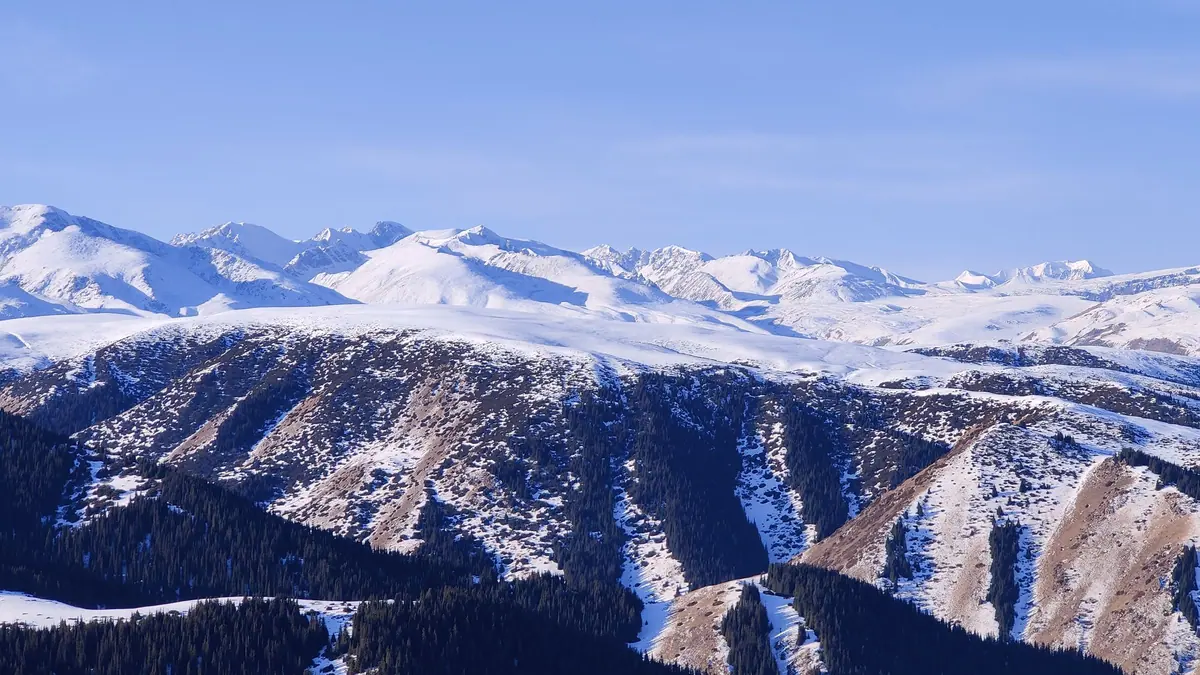
Kotyrbulak (Kazakh Qotyrbulaq) is a gorge on the north side of the Trans-Ili Alatau, the next valley east of Butakovka. The village of Beskainar sits at its mouth, and the road up the gorge ends at a pair of ski bases. There is no visitor centre and no waterfall. People come for the ridge above, with Kotyrbulak peak (3,029 m) and Bukreev peak (3,010 m), and for a long traverse into the neighbouring Oi-Karagai valley.
Where Kotyrbulak is
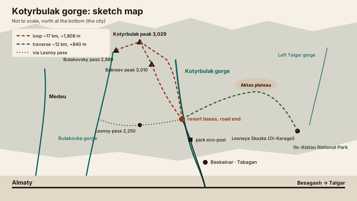
The Kotyrbulak stream runs north off the main ridge and reaches the plain near the village of Tuzdybastau in Talgar district (OSM). On the map:
- to the west is Butakovka gorge, linked to Kotyrbulak by Lesnoy pass;
- at the mouth, by Beskainar, is the small Tabagan ski area;
- to the east lie the Aktas plateau, the Belbulak and Left Talgar gorges and Oi-Karagai with the Lesnaya Skazka valley.
The gorge is inside Ile-Alatau National Park. Sources put the bases at the road end 22 or 25 km from Almaty.
Getting there: bus 209 or a car
| Option | What we know |
|---|---|
| Bus | No. 209 runs to the Pioneer resort in Kotyrbulak; two new buses were put on the route in February 2024 |
| From | the Palace of Sports, 8:00 departure in a 2021 report |
| Car or taxi | through Beskainar and up the gorge to the bases |
| Fee | park eco-post past Beskainar: ≈ $1.44 (648.75 ₸) per walker, ≈ $2.88 (1,297.5 ₸) per car in 2026 |
There are few departures, so check the return bus in 2GIS before you set off. If you finish the traverse in Oi-Karagai, bus 210 runs back to town from there (X-Travels, 2021). The fee is set in MCI and changes every January; the calculator does the sum.
Trails from Kotyrbulak
The park publishes no official trail descriptions for Kotyrbulak. These three come from hikers’ reports.
| Route | Length | Ascent | Altitude |
|---|---|---|---|
| Loop: bases — Butakovsky pass — Kotyrbulak and Bukreev peaks — bases | about 17 km | 1,808 m | ridge at 2,600–2,700 m and above |
| Traverse: bases — Aktas plateau — Belbulak — Lesnaya Skazka | about 12 km | +840 m, −1,006 m | 1,612–2,373 m |
| From Butakovka: Lesnoy pass — Bukreev — Kotyrbulak — Butakovsky pass | 15.4 km | 1,292 m | 2,250–3,040 m |
The loop (X-Travels, August 2020) starts with a kilometre of dirt road to the last house, which is where you fill up with water. Then comes a small pass at about 2.5 km, the ridge at 5 km and three saddles to Butakovsky pass, one with an obelisk. The next water is Kotyrbulak spring, 8–9 km in. The ridge looks across to the Left Talgar gorge and Komsomol peak.
The traverse (X-Travels, June 2021) is the gentlest option: about 7.5 hours including lunch and stops, nothing technical. Fill up at the spring below the ridge; the next water is in Lesnaya Skazka. A 2024 comment says a road has since been cut across Aktas.
From Butakovka, the way in is Lesnoy pass (2,250 m): about 1.3 km of dirt road from the parking area at the former Trudovye Rezervy camp, left into the first side valley, then about 2 km of trail to the saddle. Sxodim says the pass is walkable all year but avalanche-prone in winter.
Kotyrbulak and Bukreev peaks
The two summits sit on one ridge about half a kilometre apart. Kotyrbulak is 3,029 m on OpenStreetMap and 3,030–3,040 m in the X-Travels report; Bukreev peak, also called Pionersky, is 3,010 m. A stele on Bukreev remembers Anatoli Boukreev, the Almaty-based climber who died in an avalanche on Annapurna on 25 December 1997. On the way up, the Talgar massif (4,973 m) is in view to the left.
No climbing is involved, but this is above 3,000 m: weather turns within an hour and there is no shelter from a storm on the crest.
When to go
| Period | What works |
|---|---|
| June — September | ridge, loop and traverse: the best window |
| Late May | the Aktas traverse, with barberry in flower; patches of snow on the crest |
| October | shorter outings, early snow higher up |
| Winter | ski slopes at the bases; Lesnoy pass avalanche-prone |
Kotyrbulak, Butakovka or Tabagan
| Place | Go for | Effort |
|---|---|---|
| Kotyrbulak | the ridge, peaks around 3,000 m, the traverse to Oi-Karagai | a full day, 1,300–1,800 m of ascent |
| Butakovka | a 15–30 m waterfall, visitor centre since April 2026 | 2.3 km walk, or 2.5–3 hours over the pass |
| Tabagan | a day of skiing on 6 runs | no hiking |
For a short walk with children, choose Butakovka; for a summit day, Kotyrbulak. Other trails near the city, each with its trailhead and transport, are in our guide to hiking in Almaty.
Kotyrbulak gorge near Almaty: tips before you go
- We found no waterfall or visitor centre in Kotyrbulak; for a waterfall go to neighbouring Butakovka.
- There is no water above the last house until Kotyrbulak spring: fill up below.
More to see nearby


Frequently asked questions
Where is Kotyrbulak gorge?
How do I get to Kotyrbulak without a car?
Is there an entry fee?
Is there a waterfall in Kotyrbulak?
How long is the hike to Kotyrbulak peak?
Sources
- OpenStreetMap: Kotyrbulak valley (way 1274670977)
- OpenStreetMap: Kotyrbulak peak, ele 3029 (node 1738683212)
- X-Travels: around Kotyrbulak and Bukreev peaks, 27.08.2020 (in Russian)
- X-Travels: Bukreev and Kotyrbulak peaks from Butakovka, 03.06.2015 (in Russian)
- X-Travels: Almatau — Aktas plateau — Lesnaya Skazka, 02.06.2021 (in Russian)
- Bizmedia: new buses on routes 209 and 210, 09.02.2024 (in Russian)
- Sxodim: Lesnoy pass, 22.06.2021 (in Russian)
- Order No. 232 of 02.10.2024, annex 11 (Ile-Alatau park fees) — Adilet
- Wikipedia: Anatoli Boukreev
Read also
-
Butakovka waterfall and gorge
-
Oi-Qaragai: the all-season mountain resort near Almaty
-
Tabagan ski resort: a small hill near Almaty for a short ski day
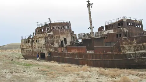 Aralsk (Aral), Kazakhstan: the former port, ship graveyard and how to get there
- Astana Grand Mosque: visiting the largest mosque in Central Asia
- Baikonur launch: how tourists watch a rocket lift off