Komsomol Peak (Nursultan Peak), Almaty: height, routes, history
Komsomol Peak is the snowy four-thousander of the Ile Alatau you can see from Almaty. Officially it has been Nursultan Peak since 1998. It is a mountaineering summit: the easiest routes are graded 2A–2B and cross a crevassed glacier.
- Getting there
- ~14 km from top of Shymbulak
- When
- Jul–Augbest timeNow: off season
- Altitude
- 4,376 m on the state list
- History
- Nursultan Peak since 1998
- Time
- 1–2 days with a guide
- Note
- Mountaineering: 2A–3B, glacier
Komsomol Peak (Nursultan Peak), Almaty: when to go, month by month
November · now- January: off season
- February: off season
- March: off season
- April: off season
- May: possible
- June: good
- July: best time
- August: best time
- September: good
- October: possible
- November: off season
- December: off season
Sources give no set season: both well-known mass ascents were in July, and the first ski descent in May 2015. In winter the approaches carry avalanche risk and deep snow.
Komsomol Peak (Nursultan Peak), Almaty: why go
Three names
Alma-Ata Peak until 1935, Komsomol Peak from 11 July 1935 after the first Komsomol camp, Nursultan Peak from 1998. The 2026 state route list still says Komsomol Peak.
The Bogdanovich Glacier
Every described route reaches the crevassed Bogdanovich Glacier. On the south-west ridge (2B) a 30–40 m snow and ice crest guards the summit, and crampons are needed.
878 climbers in one day
On 8 July 2001, 878 people set out on a mass ascent; about 170 reached the summit because of bad weather (Caravan).
First ski descent
On 8 May 2015 Vitaly Komarov and Igor Podgursky made the first ski descent from the summit, down the south couloir.
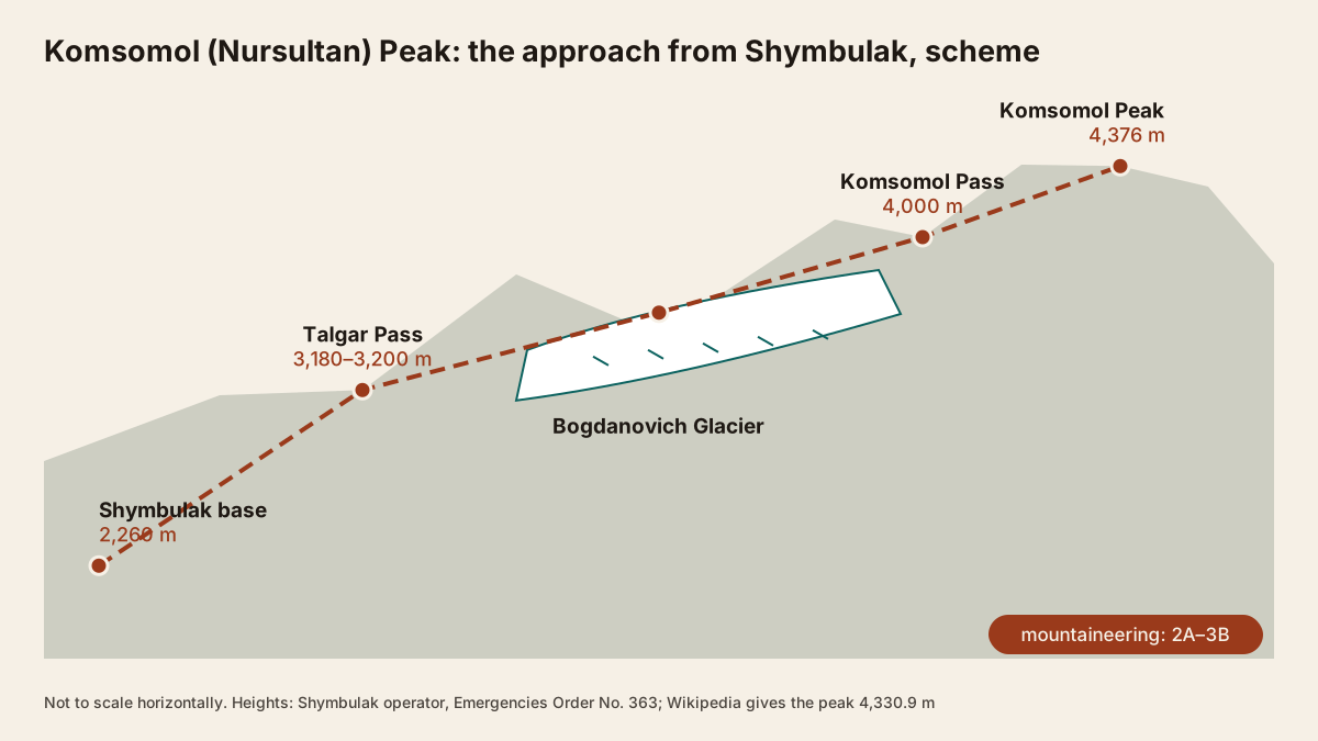
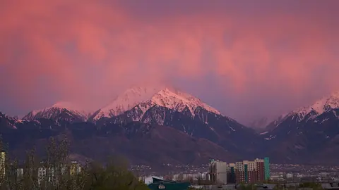
Komsomol Peak is the snow-capped summit of the Ile (Trans-Ili) Alatau that rises south-east of Almaty and is visible from the city. Since 1998 its official name has been Nursultan Peak. Kazakhstan’s state list of tourist routes gives it 4,376 m; Russian Wikipedia says 4,330.9 m. This is a mountaineering objective, not a hike: the easiest routes are graded 2A–2B, the approach crosses the crevassed Bogdanovich Glacier, and a guided ascent takes 1–2 days.
Komsomol Peak at a glance
| Height | 4,376 m (state list) or 4,330.9 m (Wikipedia) |
| Other names | Nursultan Peak (since 1998), Maloalmatinsky Peak |
| Easiest routes | 2A–2B, via the Bogdanovich Glacier |
| Guided ascent | 1–2 days, about 14 km, 1,176 m from the top lifts |
| Gear | crampons, ice axe, rope, tent |
| Paperwork | route notification under Order No. 363 |
Which height is right?
Two numbers circulate. The Emergencies Ministry’s route list (item 81), Trekking Club and Zabugorshiki all use 4,376 m. Russian Wikipedia gives 4,330.9 m and 298 m of prominence, and a 2001 Caravan news story said 4,333 m. None of these sources explains the 45 m gap or publishes a survey method. For planning it makes no difference: the routes and gear are the same.
Where it is
The peak sits on the northern slope of the Ile Alatau, on the ridge between the head of the Small Almaty (Malaya Almatinka) valley and the Talgar basin. The state list puts the summit at 43.086360, 77.120239 and Komsomol Pass (4,000 m) just south of it. Neighbours on the same list include Fizkulturnik Peak (4,068 m), Heroes-Panfilovtsy Peak (4,120 m) and Karlytau Peak (4,100 m). Big Almaty Peak is about 20 km to the west.
Three names for one mountain
Until 1935 the summit was known as Alma-Ata or Maloalmatinsky Peak. On 11 July 1935, after the first Komsomol mountaineering camp, it became Komsomol Peak, and in 1998 it was renamed after Kazakhstan’s first president, Nursultan Nazarbayev (Russian Wikipedia). Climbing sites such as Trekking Club still use the old name, and so does the 2026 edition of the state route list. Write both names in your route notification.
The peak has a history of mass ascents. On 8 July 2001, for the 10th anniversary of independence, the city government organised one: 878 people took part, but only about 170 reached the top because of bad weather (Caravan). On 8 May 2015 Vitaly Komarov and Igor Podgursky made the first ski descent, down the south couloir.
Routes and grades
Grades follow the Soviet/Kazakh scale, where 1A is the easiest and 6B the hardest.
| Route | Grade | Notes |
|---|---|---|
| Descent route to Komsomol Pass | 2A | used for coming down |
| South-west ridge | 2B | from the Bogdanovich Glacier |
| North-west ridge | 3B | steep loose rock, up to 80° in places |
On the south-west ridge (Trekking Club), you leave the glacier along the lateral moraine, climb a broad scree slope to rock gendarmes, follow about 250 m of broken blunt ridge with 5–8 m steps and 150 m of easier ridge, then cross a 30–40 m snow-and-ice crest just below the summit. Crampons are recommended. The north-west ridge has three approaches from the Malaya Almatinka valley, all ending on the Bogdanovich Glacier, and finishes on a 40° snow-and-ice slope; in winter the approaches are avalanche-prone. SummitX describes a further line from a bivouac on the glacier moraine to the saddle between Fizkulturnik and Komsomol: a 6 am start and 9–10 hours to the top, first climbed in July 1936.
What a guided ascent looks like
Zabugorshiki’s outline: start at the Medeu ice rink, ride the lifts to the top of Shymbulak, cross towards the Bogdanovich Glacier with its crevasses and seracs, pass a nunatak (a rock island in the ice), go over Komsomol Pass and make the hardest push to the summit, then return the same way. They also run trips to Komsomol Pass only, but that is still glacier travel that needs a rope and crampons.
Seeing it without climbing
- Talgar Pass, 3,180–3,200 m: the top of the Shymbulak ski area, about 35 minutes by lifts from Medeu.
- Mynzhylky plateau, about 3,000 m: roughly three hours’ walk up a wide track from the resort (Tengrinews, 2020).
- Kumbel Peak, 3,280 m: a hard day hike with views of the snowy range, including Nursultan Peak (Tengrinews guide).
See also our overview of the Small Almaty Gorge, which lines these points up by altitude.
How it compares with other peaks above Almaty
Figures come from our pages on each peak.
| Peak | Height | Type of trip |
|---|---|---|
| Furmanov Peak | 3,053 m | hike, 7–8 h, no gear |
| Kumbel Peak | 3,280 m | hard hike, 7.5–10 h |
| Big Almaty Peak | 3,680–3,681 m | long hike, 12–15 h, no gear in summer |
| Komsomol Peak | 4,376 m | mountaineering, 2A–3B, glacier |
| Talgar Peak | 4,973–5,017 m | mountaineering, from 3A, expedition |
None of the hiking peaks above the city touches a glacier. Komsomol is the first summit in this list that needs mountaineering, and its approaches start from the top of the Shymbulak lifts rather than days away, as with Talgar. Being close to the city does not make its routes any easier.
Season, weather and safety
We found no published climbing season for this peak. The two well-known mass ascents were in July (1935 and 2001) and the first ski descent in early May 2015. Weather decides the outcome: in 2001 fewer than one in five participants made the top. Check mountain weather around Almaty and the Shymbulak avalanche bulletin before you go.
Komsomol Peak and Komsomol Pass (items 81 and 80) are on the Order No. 363 list, so file a route notification via the eQonaq service, by e-mail to the regional authority or by calling 112. From Shymbulak base (2,260 m) the summit is over 2,000 m higher; if you have never been above 3,000 m, start with lower peaks. Emergency numbers: 112, and 109 for Almaty’s rescue service. More in our safety guide.
Komsomol Peak (Nursultan Peak), Almaty: tips before you go
- Write both names in your route notification: Order No. 363 lists the summit as Komsomol Peak.
- To see the massif without climbing, ride the lifts to Talgar Pass (3,180–3,200 m).
- Cross the Bogdanovich Glacier only roped up and in crampons: it has crevasses and seracs.
More to see nearby
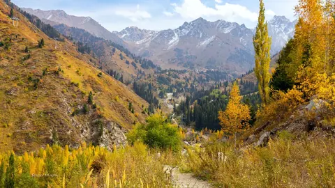
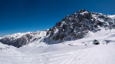
- Kumbel Peak above Almaty Kumbel is a bare, rocky summit right above Almaty, 3,280 m on Kazakhstan's official list of …


Frequently asked questions
How high is Komsomol Peak?
Is Komsomol Peak the same as Nursultan Peak?
Can a fit hiker climb Komsomol Peak?
How long does a Komsomol Peak climb take?
Where can I see Komsomol Peak without climbing it?
Sources
- Пик Нурсултан — Russian Wikipedia
- Emergencies Ministry Order No. 363, list of tourist routes, as amended 12.07.2026 (zakon.uchet.kz mirror)
- Peak Komsomol, south-western ridge, 2B — Trekking Club
- Peak Komsomol, north-western ridge, 3B — Trekking Club
- Route description: from the ridge — SummitX
- Komsomol Peak ascent — Zabugorshiki
- Mass ascent of Komsomol Peak on 8 July — Caravan, 09.07.2001
- Kumbel — Tengrinews guide
- Avalanche safety — Shymbulak
Read also
-
Small Almaty Gorge: from Medeu to the Tuyuksu glacier, stop by stop
-
Shymbulak: the ski resort above Medeu and Talgar Pass
 Big Almaty Peak: climbing above Big Almaty Lake in 2026
 Aralsk (Aral), Kazakhstan: the former port, ship graveyard and how to get there
- Astana Grand Mosque: visiting the largest mosque in Central Asia
- Baikonur launch: how tourists watch a rocket lift off