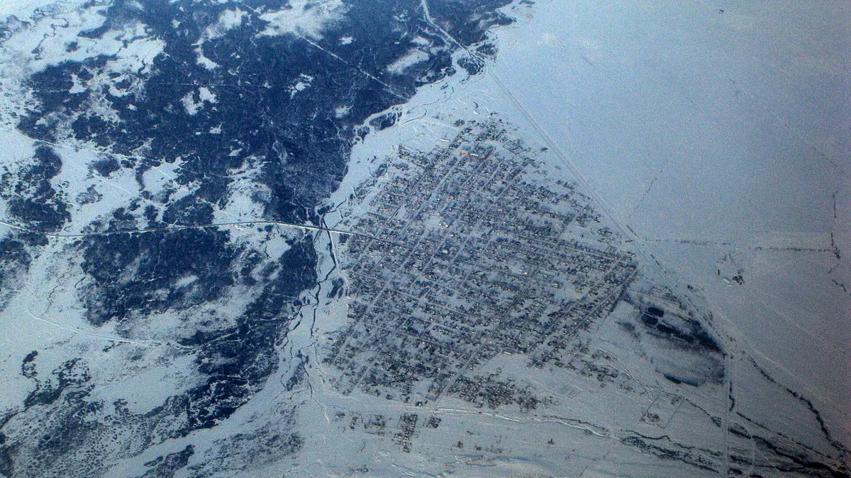
Narynkol, a high mountain village on Kazakhstan's border with China: when to go, month by month
- January: off season
- February: off season
- March: off season
- April: possible
- May: good
- June: good
- July: best time
- August: best time
- September: best time
- October: possible
- November: off season
- December: off season
July to September bring average highs of 17–22 °C and nights above freezing, while November to March stay near or below zero by day and very cold at night.
Narynkol, a high mountain village on Kazakhstan's border with China: why go
Narynkol under the Meridional range
The village stands at 1,801 m on the northern slopes of the Meridional range, where the Narynkol and Bayankol rivers join, about 57 km from Khan Tengri.
From hunters' camp to district centre
Narynkol began in 1872 as a hunters' camp, was a district centre from 1936 to 1997, and by Russian Wikipedia became Raiymbek District's centre again in 2018.
The long road to Narynkol
It is about 273 km from Almaty in a straight line and roughly 82 km east-south-east of Kegen. We could not confirm public transport, so plan on a car or driver.
Short summer in Narynkol
Only June to August have average night temperatures above about 5 °C. July highs reach about 22 °C, but June to August is also the wettest stretch of the year.
A border road that never happened
The Narynkol–Muzart crossing to China opened in 1992 with hopes of a highway over the Muzart Pass. The road was never built and the crossing closed in 2008.
Narynkol, a high mountain village on Kazakhstan's border with China in photos
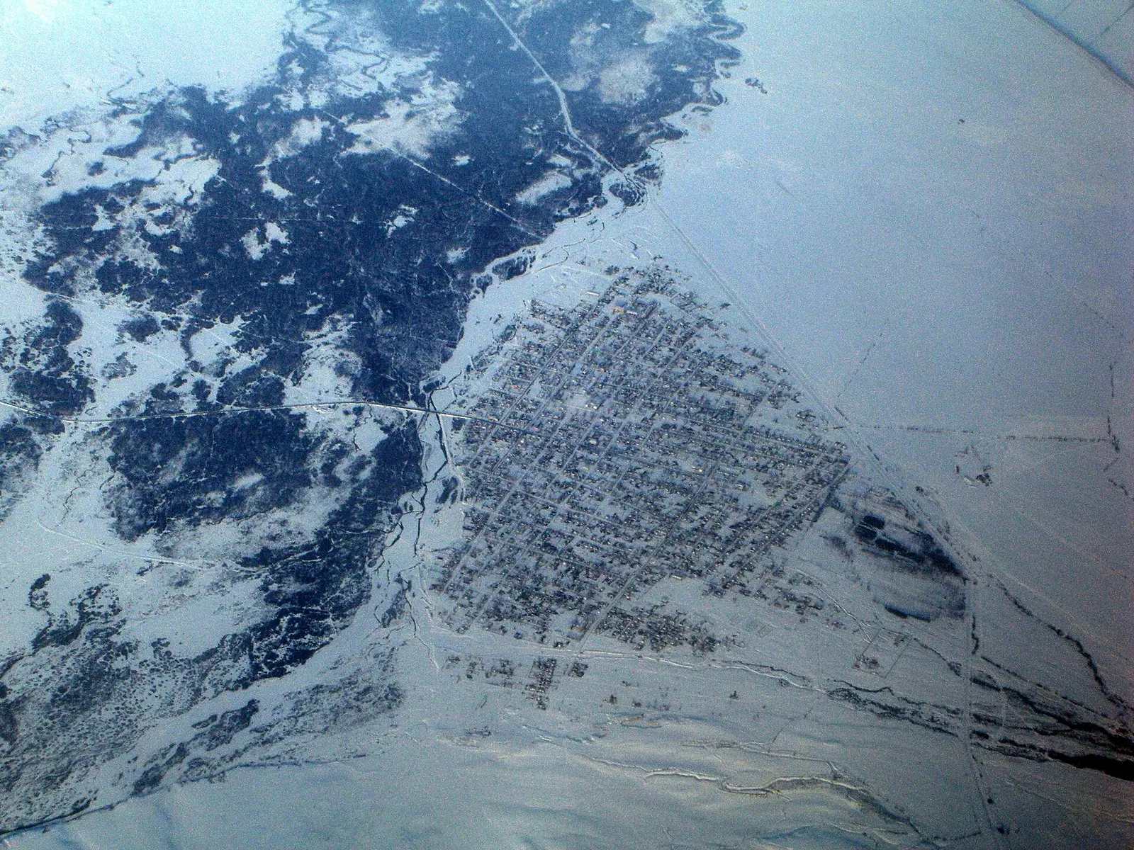
Real photos by travellers (Pexels, Unsplash, Wikimedia Commons); author and licence are given in each caption.
Narynkol is a village at 1,801 m in the south-east corner of Kazakhstan, close to the border with China and about 273 km in a straight line from Almaty. It is a working farm settlement, not a resort, and for most foreign visitors it makes sense as a remote base in the mountains towards Khan Tengri. Plan it as a multi-day trip in summer, with your own transport or a driver.
Where Narynkol is and what kind of trip it demands
Narynkol lies on the northern slopes of the Meridional range, where the Narynkol and Bayankol rivers meet, near the border with China. By Wikipedia it is about 82 km east-south-east of Kegen; the Kazakh Wikipedia puts it at about 370 km south-east of Konaev, the regional capital.
For a traveller without a car this is the main obstacle: we could not confirm any bus or shared-taxi schedule from Almaty, and road conditions are not covered here. Treat Narynkol as an expedition-style detour rather than a day trip.
| Key data | Value |
|---|---|
| Elevation | 1,801 m |
| Coordinates | 42.73° N, 80.17° E |
| Straight line from Almaty | about 273 km |
| Straight line from Khan Tengri | about 57 km |
| Population (1 Jan 2019) | 7,040 |
| Climate type | humid continental (Köppen Dfb) |
Road distances will be longer than these straight-line figures.
Narynkol weather: short warm summers, long hard winters
Summer is the only comfortable season: July days average about 20 °C, while January days stay below freezing at around −7 °C with nights near −17 °C. The figures below are computed ERA5 reanalysis normals for 2011–2020 at a grid point at 1,814 m, almost the same height as the village, so they should be close to conditions in Narynkol itself. They are not weather-station readings.
Day high, °C / Night low, °C · Rain/snow, mm
A computed reanalysis normal, not weather station records. Temperature is from ERA5-Land (about 9 km grid); precipitation is from ERA5, a value for a cell about 25 km wide rather than a mountain station, so it may miss extra mountain precipitation.
Monthly figures
| Month | Day high, °C | Night low, °C | Rain/snow, mm |
|---|---|---|---|
| Jan | -6.8 | -17.2 | 8.3 |
| Feb | -3.6 | -14.3 | 13.8 |
| Mar | 2.8 | -9.1 | 18.5 |
| Apr | 9.7 | -2.7 | 60.4 |
| May | 14.4 | 0.2 | 73.3 |
| Jun | 17.7 | 4.1 | 111.5 |
| Jul | 20.2 | 6.9 | 103.2 |
| Aug | 19.3 | 6.5 | 109.7 |
| Sep | 15.7 | 2.3 | 65 |
| Oct | 8.7 | -5.8 | 33.3 |
| Nov | -0.5 | -13.3 | 20.8 |
| Dec | -5.9 | -16.5 | 8.7 |
Source: Open-Meteo: ERA5-Land (temperature) and ERA5 (precipitation), 2011–2020
What this means in practice: from June to August nights stay above freezing (about 4.1–6.9 °C on average), but they are cool, so pack a warm layer even in July. June is also the wettest month, with about 112 mm of precipitation, and July and August are only slightly drier, so expect showers. September is a good compromise: days around 16 °C, nights about 2.3 °C and roughly 65 mm of precipitation. From November to March average highs are near or below zero and nights drop to −8 to −17 °C.
| Season | Days / nights (avg) | What to expect |
|---|---|---|
| Dec–Feb | −6 to −3 °C / −17 to −14 °C | Very cold, dry, deep winter |
| Mar–Apr | 4 to 11 °C / −8 to −2 °C | Frosty nights, wetter in April |
| May–Jun | 16 to 19 °C / 2 to 6 °C | Green pastures, frequent rain |
| Jul–Aug | about 21–22 °C / about 8 °C | Warmest, still showery |
| Sep | about 17 °C / 3.5 °C | Drier, cool nights |
| Oct–Nov | 10 to 0 °C / −4 to −12 °C | Fast slide into winter |
Distance from Almaty to Narynkol
The straight-line distance from Almaty to Narynkol is about 273 km; we could not confirm the road distance or the driving time. Other straight-line distances: about 282 km to Konaev, 293 km to Taldykorgan and 718 km to Taraz.
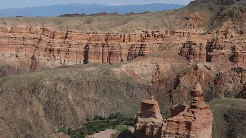
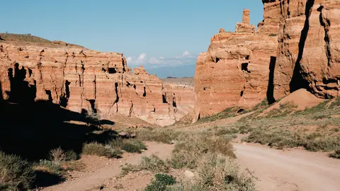
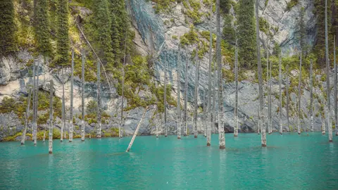
Also in the region are Charyn Canyon, about 112 km in a straight line from Narynkol, and Kaindy Lake, about 142 km. Closer still is the salt lake Tuzkol, about 34 km away, with a view of Khan Tengri on a clear day. Combining one of these with Narynkol is a natural way to justify the long drive, but check road times before building a tight schedule.
A village of herders, potato fields and a closed border crossing
Narynkol began in 1872 as a hunters’ camp. From 1936 to 1997 it was the centre of the former Narynkol District, and according to the Russian Wikipedia it again became the administrative centre of Raiymbek District on 2 April 2018. The English Wikipedia still names Kegen as the district centre, so the sources disagree on this point.
The economy rests on livestock and crops grazed and grown on wide grasslands, with potatoes a large share; the Kazakh Wikipedia also lists coal mining and timber sawing. Population has been falling: 8,816 in 1999, 7,731 in 2009 and 7,040 in 2019.
In 1992 the Narynkol–Muzart border crossing with China opened, with hopes of a highway over the Muzart Pass towards the Tarim Basin. The road was never built, and the crossing closed in 2008 for lack of traffic. Do not plan to enter China here.
Narynkol and the Khan Tengri massif
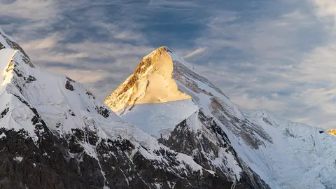
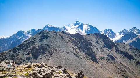
Narynkol is about 57 km in a straight line from Khan Tengri, the highest point of Kazakhstan, which lies about 57 km away in a straight line. We could not confirm how approaches to the massif are organised from Narynkol, or what border-zone permits apply, so ask whoever arranges your mountain trip before you set off.
What we could not confirm about the Tekes Valley
This page carries the name Tekes Valley, but we could not confirm a description of the valley itself: its extent, landscapes, trails or access. What is certain is the setting of Narynkol on the northern slopes of the Meridional range at the confluence of two rivers, among large pastures. Anyone planning to explore the valley beyond the village should get current local information first.
- Road distance, driving time and road condition from Almaty to Narynkol
- Any bus or shared-taxi service to Narynkol and its schedule
- Border-zone permit rules for visiting Narynkol and the mountains towards Khan Tengri
- Accommodation and fuel availability in the village
- Access, trails and landscapes of the wider Tekes Valley
Narynkol, a high mountain village on Kazakhstan's border with China: tips before you go
- Pack a warm layer even in July: average night temperatures in Narynkol are around 8 °C at 1,801 m.
- Carry rain gear from June to August, when monthly precipitation averages roughly 87–94 mm.
- Do not route a trip to China via Narynkol: the Muzart border crossing has been closed since 2008.
- Pair the drive with Charyn Canyon or Kaindy Lake, about 112 and 142 km away in a straight line.
More to see nearby


Frequently asked questions
What is the weather like in Narynkol?
How far is Narynkol from Almaty?
What is the best month to visit Narynkol?
Can you cross into China at Narynkol?
Who is from Narynkol?
Sources
Read also
 Almaty Zoo in Kazakhstan: opening hours and how to visit
 Ayusai Gorge, Almaty: visitor centre and waterfall trail
 Gorelnik Gorge above Medeu: waterfalls, trail and season
 Kamenskoe Plateau above Almaty: observatory and trails
 Pervomaiskie Ponds near Almaty: location, swimming, season
 Saty village: base for the Kolsai and Kaindy lakes