Karagiye Depression, the deep karst basin near Aktau: when to go, month by month
- January: possible
- February: possible
- March: possible
- April: best time
- May: good
- June: possible
- July: possible
- August: possible
- September: good
- October: best time
- November: good
- December: possible
Spring and autumn highs of 17–27°C suit walking, while summer on the floor averages up to 35°C and winter nights drop below freezing.
Karagiye Depression, the deep karst basin near Aktau: why go
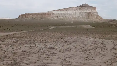
The black escarpment of Karagiye
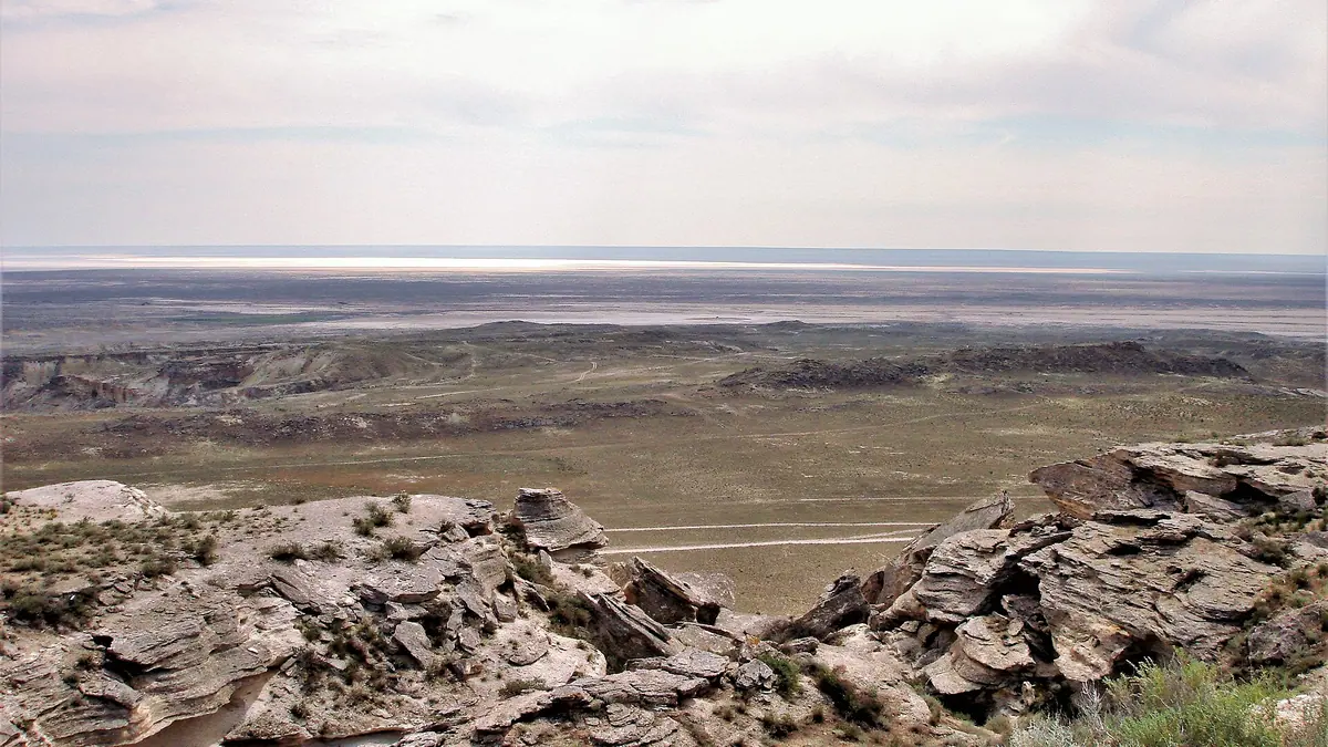
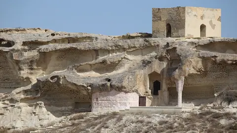
The eastern rim is a steep wall of shell limestone and chalk 10–15 m high or more, darkened by the sun so it reads as black from afar, hence the name.
A basin carved by dissolving rock
Underground water dissolved limestone, dolomite and gypsum, caves collapsed repeatedly, and ravines and ledges show the relief is still shifting today.
Karagiye on the Aktau–Zhanaozen road
A national highway runs through the depression, so it is reachable by ordinary car from Aktau, about 56 km away in a straight line.
Spring and autumn in Karagiye
On the floor, July highs average near 35°C with nights around 25°C. April–May and September–October bring highs of roughly 17–27°C.
Mushrooms in a desert basin
English Wikipedia says Karagiye is the only place on the Mangyshlak Peninsula where mushrooms grow, and local people gather them.
Karagiye Depression, the deep karst basin near Aktau in photos
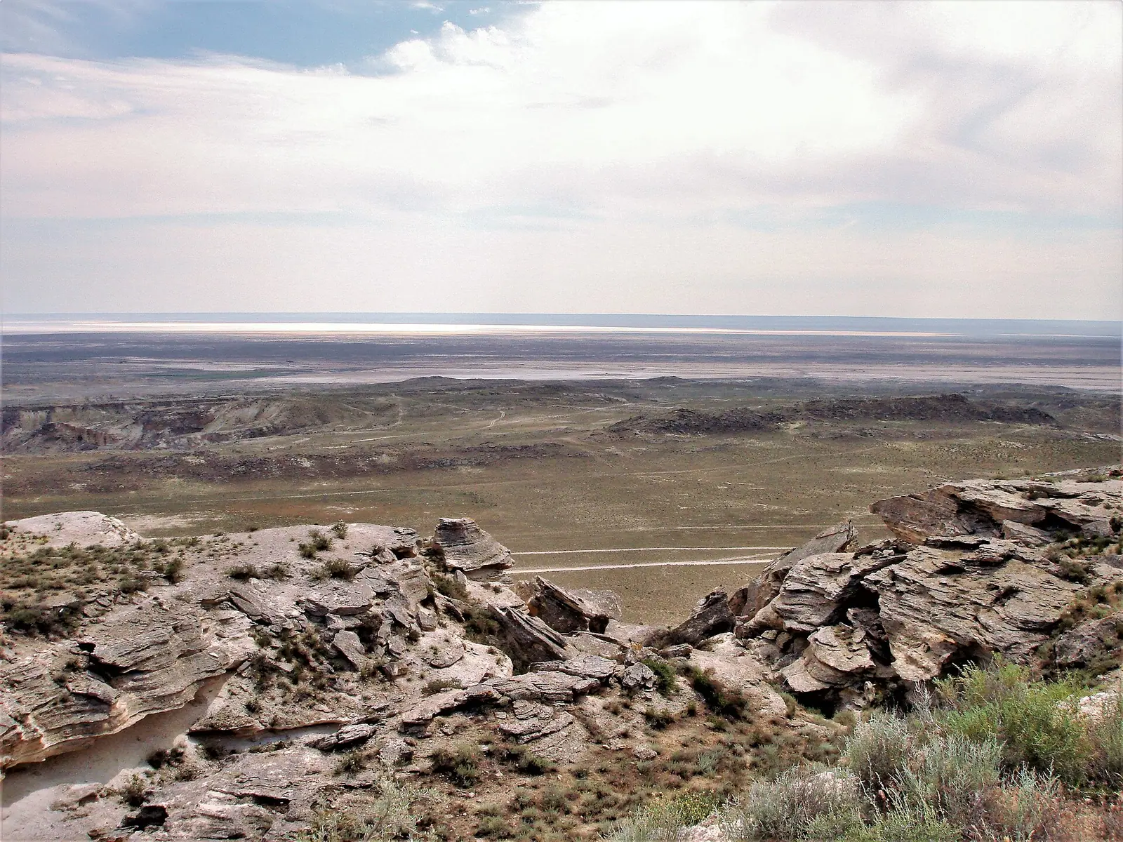
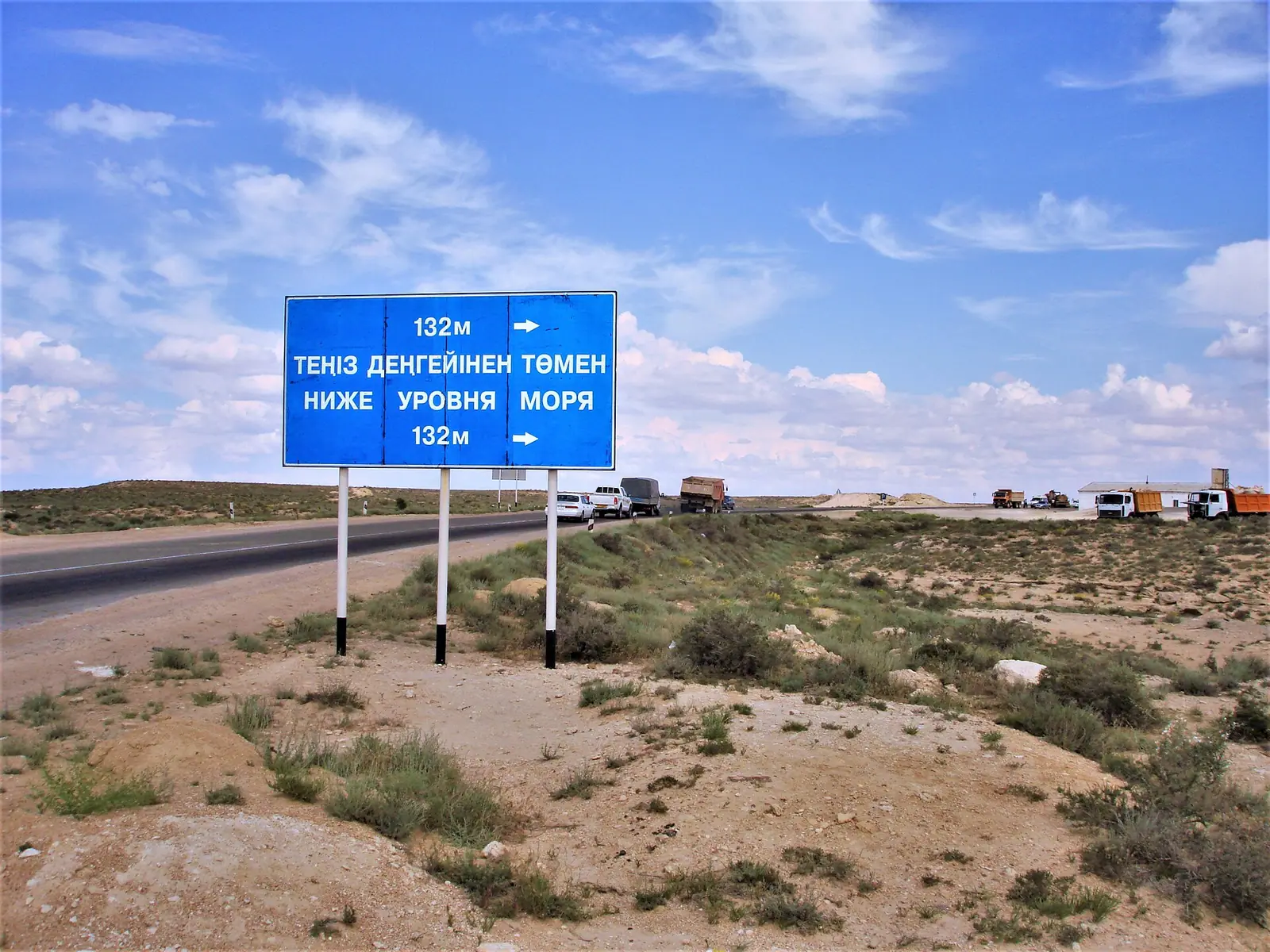
Real photos by travellers (Pexels, Unsplash, Wikimedia Commons); author and licence are given in each caption.
The Karagiye Depression is a dry karst basin on the Mangyshlak Peninsula in western Kazakhstan, about 56 km in a straight line from Aktau on the Caspian coast. Its floor lies roughly 132–134 m below sea level, which makes it the lowest point in Kazakhstan. For a traveller it is a short trip from Aktau rather than an expedition, as a national highway runs through it.
Where Karagiye is and what kind of trip it needs
Karagiye sits in Mangystau Region, in Kazakhstan’s far west, close to the eastern shore of the Caspian Sea. Aktau, the regional centre, is about 56 km away in a straight line; Russian Wikipedia gives roughly 50 km. Almaty and Astana are on the other side of the country, so in practice you fly to Aktau and go from there.
By Kazakh Wikipedia, a national highway linking Aktau with the oil town of Zhanaozen crosses the depression, together with oil, gas and water pipelines. That means the basin is reachable by ordinary road. We could not confirm any public transport that stops at a viewpoint, so without a car you will need a taxi or a hired driver.
Karagiye pairs naturally with other sights of the peninsula: see the Bozzhyra and Mangystau nature guide for the wider region.
How deep and how big: the figures do not agree
English Wikipedia calls Karagiye the lowest point in Kazakhstan, but the sources give different numbers. English Wikipedia also calls it the lowest point in Central Asia and the former Soviet Union, while Russian Wikipedia says it is the deepest dry depression in Kazakhstan and one of the deepest in Asia.
| Measure | Russian Wikipedia | Kazakh Wikipedia | English Wikipedia |
|---|---|---|---|
| Lowest point | 132 m below sea level | 132 m below sea level | about 134 m below sea level (at Vpadina Kaundy) |
| Length | 85 km | 85 km | 40 km |
| Width | up to 25 km | 10–25 km | not given |
The length gap is large. The 40 km figure in English Wikipedia describes a “trench”, which may refer to a narrower feature than the whole 85 km oval basin.
How the basin formed and what you see in it
Karagiye is a karst feature. Underground water dissolved limestone, dolomite and gypsum along cracks, opening funnels and caves whose roofs collapsed again and again until a huge hollow formed. Russian Wikipedia notes the process has not stopped: cliffs and ledges cut by wide gullies and ravines show the relief is still changing.
The eastern rim is a steep escarpment of shell limestone and chalk, 10–15 m high or more, darkened by long exposure to the sun. From a distance it looks like a black wall, which fits the name: kara means “black” and kiya a “steep slope”, though another reading gives “black jaw”. The upper layers are hard Sarmatian limestone; the middle is soft clay that crumbles easily, so edges can be unstable.
On the floor lies Lake Batyr, whose level and area change a lot; when it dries out the bottom turns to salt flats. Kazakh Wikipedia also describes the Ashchyagar stream, which breaks into separate pools in summer, and black wormwood as the main plant cover.
Wildlife, wells and people in the depression
English Wikipedia lists mouflon, corsac fox, snakes, hares and vultures in the basin. It also says Karagiye is the only place on the Mangyshlak Peninsula where mushrooms grow, and locals collect them.
The basin is not empty land. Kazakh Wikipedia names wells such as Zhanaorpa, Sauytty, Kynabai, Shukyr and Kokshe, and winter camps including Orsha and Borzhakty, as well as Karasengir. It also mentions historical monuments and ancient settlement sites at the north-eastern end, and active extraction of oil, shell-rock building stone and uranium. Expect industrial infrastructure alongside the scenery. The basin’s second name, Batyr, comes from a Turkic tribal name meaning “warrior”.
When to go to Karagiye
Spring and autumn are the sensible seasons; midsummer on the floor is hot. The figures below are 2011–2020 normals from the ERA5 reanalysis at a grid point at −131 m, practically the depth of the floor, not a weather station. The rim and the plateau above sit higher and will feel somewhat different.
Day high, °C / Night low, °C · Rain/snow, mm
A computed reanalysis normal for these coordinates, not weather station records.
Monthly figures
| Month | Day high, °C | Night low, °C | Rain/snow, mm |
|---|---|---|---|
| Jan | 4.1 | -2.1 | 14.3 |
| Feb | 5.3 | -2.8 | 8.4 |
| Mar | 12.5 | 2.9 | 18.5 |
| Apr | 19.8 | 8.5 | 16.6 |
| May | 28.9 | 16.5 | 14.4 |
| Jun | 34.4 | 21.6 | 7.9 |
| Jul | 36.8 | 24.4 | 9.3 |
| Aug | 35.3 | 22.5 | 3.5 |
| Sep | 28.5 | 16.2 | 6.3 |
| Oct | 19.6 | 8.9 | 6.1 |
| Nov | 10.2 | 2.2 | 14.3 |
| Dec | 5.1 | -1.1 | 15 |
July averages a high near 37°C and a night low around 24°C, so nights stay warm. April–May (highs about 17–27°C) and September–October (about 19–27°C) are the comfortable windows. Winter days hover around 4–5°C with nights just below freezing in January and February. Rain is scarce all year, around 143 mm in total, with only 5–8 mm a month in summer, so shade and water matter. Kazakh Wikipedia gives harsher figures, −7°C in January and 26°C in July as averages, and 75–100 mm of annual precipitation.
| Period | What to expect | Verdict |
|---|---|---|
| Apr–May | Highs 17–27°C, a little rain | Best |
| Jun–Aug | Highs 32–35°C, nights 22–25°C, very dry | Early morning only |
| Sep–Oct | Highs 19–27°C, dry | Best |
| Nov–Mar | Highs 4–11°C, nights around 0°C, below freezing in Jan–Feb | Possible, cold wind likely |
The plans to flood Karagiye
Karagiye lies below the level of the Caspian. That has drawn engineers for nearly a century. Soviet scientists in the 1930s proposed letting sea water into the basin to power a 35 MW hydro plant, turning it into a second Kara-Bogaz-Gol.
In the 21st century, by Russian Wikipedia, the third stage of the Inzhu-Marzhan recreation and infrastructure project for Mangystau envisaged filling Karagiye, with a 70 m waterfall and a power plant. Ecologists object that Karagiye and Karakol are protected natural areas, that the Caspian’s level could change, and that mirabilite from a salty reservoir could be spread by wind. We could not confirm the current status of these plans.
Combining Karagiye with the rest of Mangystau
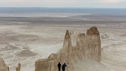
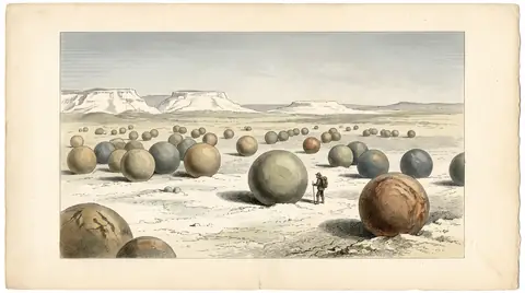
Karagiye can be combined with other Mangystau sights. Mount Sherkala is about 96 km away in a straight line and the stone spheres of Torysh about 108 km. The old Caspian town of Fort-Shevchenko is about 173 km away in a straight line. Road distances will be longer.
- Whether there is a marked viewpoint or parking, or any other visitor infrastructure on the rim.
- Any bus or shuttle from Aktau to the depression, or shared transport.
- Current protected-area status and any entry or permit rules.
- Road condition of tracks leading off the main highway to the rim and floor.
- Current status of the plans to flood the basin.
Karagiye Depression, the deep karst basin near Aktau: tips before you go
- Plan a road trip from Aktau: we found no public transport to the depression, only the Aktau–Zhanaozen highway across it.
- In June–August go at dawn: floor highs reach about 32–35°C and nights stay near 22–25°C, so the heat is hard to escape.
- Keep back from cliff edges: the middle layers are soft clay that crumbles quickly under the hard limestone rim.
- Carry enough water: rainfall averages only 5–8 mm a month in summer and there are no confirmed facilities in the basin.
More to see nearby


Frequently asked questions
Where is the Karagiye Depression on the map?
Is Karagiye the lowest point in Kazakhstan?
Can I visit Karagiye without a car?
Is there water in the Karagiye Depression?
Sources
Read also
 Ustyurt Plateau: visiting the Ustyurt Reserve in western Kazakhstan
 Shakpak-Ata underground mosque: getting there and what to know
-
A Mangystau itinerary for 3 or 5 days, planned out from Aktau
- Trips from Aktau, Kazakhstan: the coast, the desert and the Mangystau hills
- Mangystau region: choosing between chalk cliffs, rock mosques and the Caspian coast
- Where to go on Kazakhstan's Caspian Sea coast, and when