Irgiz-Turgai Reserve, the saiga refuge of the Aktobe steppe
A vast protected area in Kazakhstan's northern desert zone, created in 2007 to bring back the saiga antelope. Before planning a trip, note that its boundary signs say entry is forbidden.
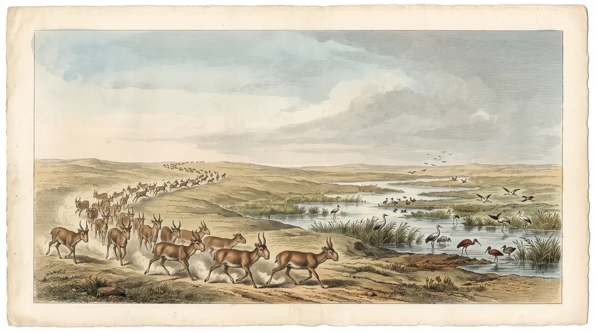
Irgiz-Turgai Reserve, the saiga refuge of the Aktobe steppe: when to go, month by month
- January: off season
- February: off season
- March: possible
- April: good
- May: best time
- June: good
- July: possible
- August: possible
- September: best time
- October: good
- November: possible
- December: off season
Spring and early autumn avoid both the dry 30°C summer heat and winter highs below freezing, though access depends on permission.
Irgiz-Turgai Reserve, the saiga refuge of the Aktobe steppe: why go
Saiga herds of Irgiz-Turgai
Set up to restore the Betpak-Dala saiga population; Kazakh Wikipedia reports growth from about 7,000 in 2007 to 138,763 head.
Turgai river valley
Protected habitats include the Turgai valley with marshy meadows and willow thickets, plus wetlands amid grass and wormwood plains.
Remote central steppe
The closest city in the data, Zhezkazgan, is about 338 km away in a straight line; Aktobe is about 498 km. No confirmed transport.
Hot summers, frozen winters
July averages a 30.6°C high with about 6 mm of rain; January highs sit near -7°C. May and September are the mild windows.
Signs every 7 km
The reserve boundary carries a marker every 7 km stating it is a specially protected area where entry is prohibited.
The Irgiz-Turgai Reserve is a state nature reserve in the Irgiz district of Aktobe region, western-central Kazakhstan, set up to protect the Betpak-Dala population of saiga antelope. It covers the Turgai river valley, wetlands and wide desert-steppe plains. It is remote and not set up for casual visits: signs along its boundary read that entry is forbidden.
What the Irgiz-Turgai Reserve protects
The reserve exists mainly for the saiga. It was created by Government Decree No. 109 of 14 February 2007 to protect and restore the Betpak-Dala saiga population, along with wetlands, steppe and desert landscapes.
The ground lies in the zone of northern deserts. Protected habitats include the Turgai river valley with marshy meadows and willow thickets, wetlands, and broad plains of grass, wormwood and perennial saltwort. By Russian Wikipedia, it is the largest protected natural area in Kazakhstan among those that operate as separate legal entities.
| Key data | Detail |
|---|---|
| Region | Irgiz district, Aktobe region |
| Created | 14 February 2007 |
| Main purpose | Saiga recovery, wetlands, steppe |
| Area | 52,000 ha from the former Turgai reserve plus 711,549 ha of reserve lands |
| Sections | Atan basy and Alakol systems |
| Neighbouring regions | Kyzylorda (south), Karaganda (east), Kostanay (north) |
The area wording in Russian Wikipedia is ambiguous, so treat the two land figures as components rather than a confirmed total.
Saiga numbers rose sharply after 2007
Kazakh Wikipedia says about 7,000 saiga lived in the area when the reserve opened in 2007 and gives a current figure of 138,763 head. That figure carries no year, so it may be out of date. Even so, it describes roughly a twentyfold rise, which is the main reason the reserve matters to conservation in Kazakhstan.
For a traveller this means the reserve is a working wildlife refuge, not a park with trails and viewpoints. We could not confirm any organised saiga-watching programme.
Entry is marked as forbidden
The boundary is marked with a sign every 7 km. By Kazakh Wikipedia, the signs state that this is a specially protected area and that entry is prohibited.
We could not confirm whether any permit system, visitor zone or ranger-led access exists. Entry is marked as prohibited, and the distances involved make a wasted trip expensive in time. Contact the reserve administration before you build any plan around it.
Where it is and how far from the cities
The reserve sits deep in the steppe. We could not confirm road distances or any public transport; the figures below are straight-line distances from the reserve’s reference point.
| From | Straight line |
|---|---|
| Zhezkazgan | about 338 km |
| Kyzylorda | about 405 km |
| Aktobe | about 498 km |
| Kostanay | about 566 km |
Road routes across the steppe are usually longer than these lines. Without a car, a local driver and some Russian or Kazakh, reaching the area would be hard; we have no confirmed route to share.
When to go: spring and early autumn
The climate is sharply continental, with hot, very dry summers and freezing winters. The figures below are ERA5 reanalysis normals for 2011–2020 at a grid point 52 m above sea level, not a weather station.
Day high, °C / Night low, °C · Rain/snow, mm
A computed reanalysis normal for these coordinates, not weather station records.
Monthly figures
| Month | Day high, °C | Night low, °C | Rain/snow, mm |
|---|---|---|---|
| Jan | -7 | -12.1 | 17.4 |
| Feb | -7 | -12.9 | 11.3 |
| Mar | 2.6 | -4.6 | 25.1 |
| Apr | 12.6 | 3.8 | 17.7 |
| May | 20.6 | 11.5 | 15.2 |
| Jun | 26.8 | 18.6 | 4.9 |
| Jul | 29.7 | 21.7 | 7.1 |
| Aug | 28.3 | 20.3 | 9.3 |
| Sep | 21.5 | 14.1 | 9.9 |
| Oct | 12.5 | 5.9 | 21.8 |
| Nov | 2.3 | -2.2 | 24.4 |
| Dec | -4.4 | -8.7 | 25.9 |
May and September are the most comfortable months, with average highs of about 21°C and 22°C. July averages a high of 29.7°C and only about 7 mm of rain, so midsummer is hot and dry with little shade on open steppe. From December to February average highs stay below freezing, down to about -7°C in January, with nights near -13°C. April and October are cool but workable.
Combining it with other places
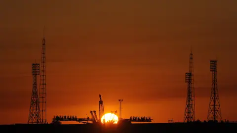
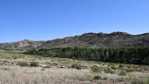
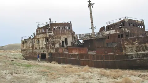
The nearest pages on this site are a long way off. Baikonur is about 241 km in a straight line, the granite hills of Ulytau about 287 km, and the Aral Sea about 459 km. None of these is a day trip from the reserve; each needs its own planning.
National figures for all three populations are on the saiga in Kazakhstan page. For the strict category, see nature reserves.
- Whether visitors can obtain a permit or enter any part of the reserve
- Road distances and condition of roads to the reserve
- Any public transport to Irgiz village or the reserve
- Date of the 138,763 saiga count
- The reserve’s exact total area
Irgiz-Turgai Reserve, the saiga refuge of the Aktobe steppe: tips before you go
- Contact the reserve administration before travelling: boundary signs state that entry is prohibited.
- Plan around May or September, when average highs are about 22°C and 21°C rather than July's 30.6°C.
- In summer carry plenty of water: June to August average under 9 mm of rain a month on open steppe.
- Treat the 338 km from Zhezkazgan as a straight line; the real road trip will be longer.
More to see nearby


Frequently asked questions
Where is the Irgiz-Turgai Reserve?
Can tourists visit the Irgiz-Turgai Reserve?
How many saiga live in the reserve?
What is the weather like in Irgiz?
How far is the reserve from Aktobe?
Sources
Read also
 Almaty Zoo in Kazakhstan: opening hours and how to visit
 Ayusai Gorge, Almaty: visitor centre and waterfall trail
 Gorelnik Gorge above Medeu: waterfalls, trail and season
 Kamenskoe Plateau above Almaty: observatory and trails
 Pervomaiskie Ponds near Almaty: location, swimming, season
 Saty village: base for the Kolsai and Kaindy lakes