Lake Inder and the Inder Hills: when to go, month by month
- January: off season
- February: off season
- March: possible
- April: good
- May: best time
- June: good
- July: possible
- August: possible
- September: best time
- October: good
- November: possible
- December: off season
May and September fall between average July highs of about 33 °C and winter highs below freezing, on very dry open steppe.
Lake Inder and the Inder Hills: why go
Lake Inder's salt-dome shores
Salt domes are widespread along the shores of Lake Inder, a salt lake east of the Ural River in the northern Caspian Depression.
Karst sinkholes of the Inder Hills
The low Inder Hills, just 52 m above sea level, hold hundreds of sinkholes, deep shafts, caves and ravines in the area.
North from Atyrau to Inder
The Atyrau–Uralsk highway crosses Inder District. The lake lies about 140 km in a straight line from Atyrau, so plan a long day or an overnight.
Two short seasons at Inder
May and September bring highs of about 24–26 °C. July averages around 33 °C on the lake grid point, and January lows are near −10 °C.
Springs and mud on the north-east
Many mineral springs and deposits of therapeutic mud occur on Lake Inder's north-eastern shore. The mineral inderborite takes its name from this area.
Lake Inder and the Inder Hills in photos
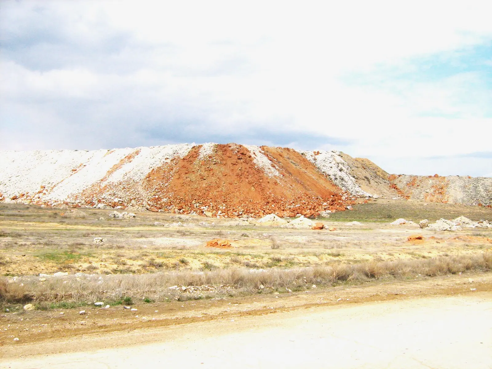
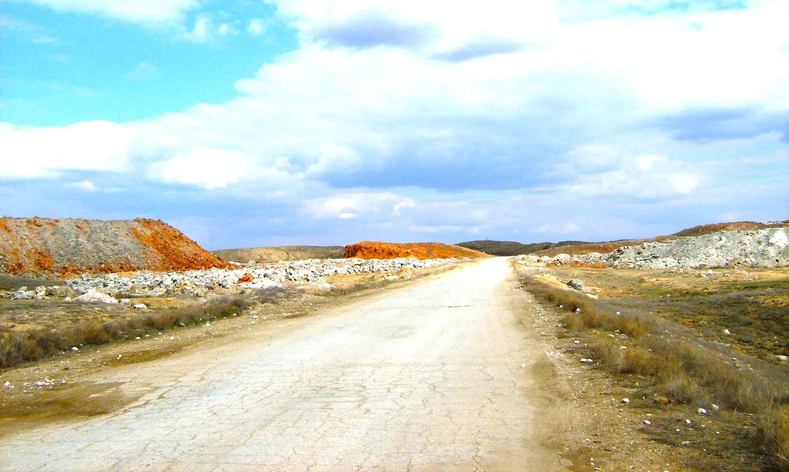
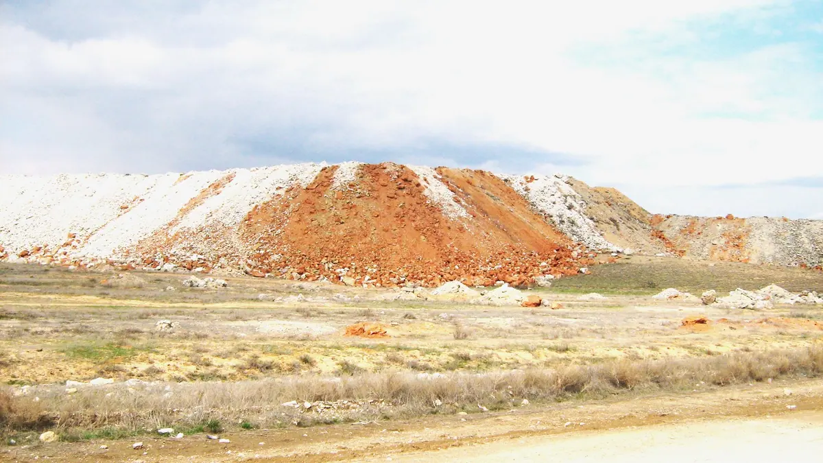
Real photos by travellers (Pexels, Unsplash, Wikimedia Commons); author and licence are given in each caption.
Lake Inder is a salt lake in the north of Atyrau Region, in western Kazakhstan, about 140 km in a straight line north of the city of Atyrau. Its shores carry salt domes, and the Inder Hills beside it, only 52 m above sea level, are full of karst sinkholes. This is a niche trip for travellers interested in geology and steppe landscapes. It is not a resort, and practical information is thin.
Where Lake Inder is and what kind of trip it demands
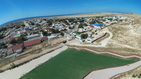
Lake Inder lies in Inder District, on the east side of the Ural River (Zhayyk in Kazakh), in the northern part of the Caspian Depression. The district centre is the settlement of Inderbor. Almaty and Astana are on the far side of the country, so for a foreign visitor this is a side trip from Atyrau, the regional city.
The Ural divides the district in two. West of the river is sandy desert plain, the eastern edge of the Naryn sands. East of it a low plateau rises, carrying the Inder Hills (52 m) and Zhamantau (26 m), then fades into steppe with salty soils. The lake sits east of the Ural.
| Key fact | Figure |
|---|---|
| Region | Atyrau Region, Inder District |
| Nearest city | Atyrau, about 140 km in a straight line |
| Inderbor to Atyrau | 200 km, as given by Kazakh Wikipedia |
| Oral (Uralsk) | about 325 km in a straight line |
| Inder Hills height | 52 m above sea level |
| Zhamantau height | 26 m above sea level |
| District area | 10,900 sq km |
| District population | 31,644 (2013 estimate); 33,500 (2018, Kazakh Wikipedia) |
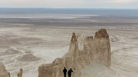
The low heights show what kind of landscape to expect. The interest here lies in salt, gypsum and collapsed ground, not in mountain views. Anyone expecting hills in the usual sense will find a gently raised plateau.
Salt domes, sinkholes and mineral springs: what the landscape holds
Salt domes are widespread along the shores of Lake Inder, and karst sinkholes are numerous in the Inder Hills. Kazakh Wikipedia describes hundreds of hollows, deep shafts, caves large and small, and ravines in this area. The district’s gypsum reserves are given as 10–15 billion tonnes.
The ground also contains borates, including the mineral inderborite, which is named after this place. Potassium and magnesium salts occur here as well. On the north-eastern shore of the lake there are many mineral water springs and deposits of therapeutic mud. We could not confirm whether any of them have facilities or whether bathing is allowed.
Along the Ural floodplain grow dense tugai thickets, the riverside woodland of Central Asian deserts. The steppe has black wormwood, orache and kochia. Wolf, fox, badger, saiga and wild boar are listed for the district, along with waterbirds. Seeing a saiga is never guaranteed.
An industrial district: what the quarries mean for visitors
Inder is a working mining area, and that shapes any visit. The district’s industry is built on borate quarries and a processing plant run by the company Inderbor, with salt also produced by Indertuz. The quarries are part of the landscape near the lake and the hills.
We could not confirm which parts of the shore or the hills are open to the public. Some ground near active workings or above karst may be fenced or unsafe. Sinkhole country can have unstable edges, so stay well back from the rims of shafts and collapses.
Getting to Inder from Atyrau
The Atyrau–Uralsk highway passes through Inder District, so the road link runs north from Atyrau. Kazakh Wikipedia gives 200 km from Inderbor to Atyrau. It is not clear whether that is a road distance, and the straight-line distance from the lake to Atyrau is about 140 km.
Buses between Atyrau and Inderbor are clearly in demand, but we could not confirm the operators, schedule, departure point or fares. We also have no information on transport from Inderbor to the lake shore or the hills. Without a car and without Russian or Kazakh this will be hard to arrange. Plan on hiring a driver in Atyrau and checking the route with them.
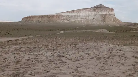
If you are building a longer trip in western Kazakhstan, the desert landscapes of Mangystau and Bozzhyra lie about 496 km in a straight line to the south. They are a separate journey, not a day trip from Inder.
When to go: short springs and autumns between hard extremes
The best windows are May and September. Midsummer is hot and winter is cold and windswept on open steppe.
Day high, °C / Night low, °C · Rain/snow, mm
A computed reanalysis normal for these coordinates, not weather station records.
Monthly figures
| Month | Day high, °C | Night low, °C | Rain/snow, mm |
|---|---|---|---|
| Jan | -4.3 | -10.9 | 17.8 |
| Feb | -2.8 | -11 | 15 |
| Mar | 6.4 | -3.3 | 21.1 |
| Apr | 17.6 | 5.3 | 21.5 |
| May | 26.8 | 13.7 | 17.9 |
| Jun | 31.1 | 17.7 | 17.5 |
| Jul | 33.7 | 20.5 | 9.4 |
| Aug | 32.2 | 18.8 | 7.6 |
| Sep | 24.2 | 11.5 | 11.7 |
| Oct | 14.8 | 3.6 | 17.8 |
| Nov | 4.1 | -3.8 | 12.2 |
| Dec | -2.4 | -8.5 | 19.8 |
These figures are computed normals for 2011–2020 from the ERA5 reanalysis at a grid point at −8 m, not readings from a weather station. In July, average highs reach about 34 °C. In January, average lows are around −11 °C and highs stay below freezing.
Russian Wikipedia gives district averages of −12.3 °C in January and 25.3 °C in July, with about 200 mm of precipitation a year. The two sources measure different things, but both point the same way: very little rain, with a near-dry July and August at about 8.5 mm a month. Kazakh Wikipedia notes that salt lakes in the district often dry out in summer, though it does not name Lake Inder. The lake may look very different in August than in May.
| Period | What to expect |
|---|---|
| Dec–Feb | Highs below 0 °C, lows near −10 °C; not sensible |
| Mar | Thaw, highs around 7 °C; possible |
| Apr–May | Highs 17–26 °C; best for walking |
| Jun–Aug | Highs 31–33 °C, very dry; early mornings only |
| Sep | Highs around 24 °C; best in autumn |
| Oct–Nov | Cooling fast, highs 14 °C then 4 °C |
For travellers this means planning around two short seasons. Outside them, a long drive on open steppe brings real heat or real cold.
- Bus operators, timetable, departure point and fares between Atyrau and Inderbor
- Whether the lake shore and the Inder Hills are open to visitors near the active borate quarries
- Whether the mineral springs and mud on the north-eastern shore have facilities or allow bathing
- Road condition and track access from Inderbor to the lake and the sinkhole areas
- Exact size and depth of Lake Inder
Lake Inder and the Inder Hills: tips before you go
- July and August get about 8.5 mm of rain each and highs near 33 °C. Carry plenty of water and walk early in the morning.
- Stay well back from sinkhole rims in the Inder Hills: the area is riddled with shafts and collapses.
- Arrange a driver in Atyrau: we could not confirm any transport from Inderbor to the lake shore.
- Salt lakes here often dry out in summer, so visit in May if you want to see water rather than a salt crust.
More to see nearby


Frequently asked questions
How far is Lake Inder from Atyrau?
How far is Inder from Uralsk?
Is there a bus from Atyrau to Inder?
What is the weather like in Inder?
What is the Inder quarry?
Sources
Read also
 Almaty Zoo in Kazakhstan: opening hours and how to visit
 Ayusai Gorge, Almaty: visitor centre and waterfall trail
 Gorelnik Gorge above Medeu: waterfalls, trail and season
 Kamenskoe Plateau above Almaty: observatory and trails
 Pervomaiskie Ponds near Almaty: location, swimming, season
 Saty village: base for the Kolsai and Kaindy lakes