The Ereymentau Mountains: a low rocky range in the steppe east of Astana
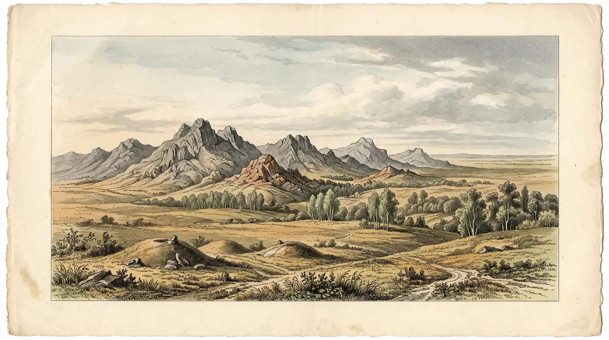
A 70–75 km chain of rocky hills rising out of the northern Kazakh steppe, topping out at 901 m, with a branch of Buiratau National Park, burial mounds and more than 400 plant species.
The Ereymentau Mountains: when to go, month by month
- January: off season
- February: off season
- March: off season
- April: possible
- May: good
- June: best time
- July: good
- August: best time
- September: good
- October: possible
- November: off season
- December: off season
Only June to August are reliably mild, with highs near 21 °C, while November to March stays below freezing by day.
The Ereymentau Mountains: why go
Akdym, top of Ereymentau
At 901 m Akdym is the highest point of the range, in the southern sector where ridges turn from south-west to north-east and rock outcrops appear.
A refuge for steppe plants
Over 400 vascular plant species grow here, including relict Krylovia, irises, pasque flowers and Red Book black alder among birch and aspen.
A day trip range from Astana
The hills sit about 127 km in a straight line from Astana, with Ereymentau town at the northern end and Beloyarka village at the southern end.
Short summer in Ereymentau
June to August highs reach about 21 °C with nights of 10–12 °C; July brings around 89 mm of rain, the wettest month of the year.
Stone statues in the steppe
Among the hills lie Stone and Bronze Age burial grounds, Scythian monuments and Turkic stone statues.
The Ereymentau Mountains in photos
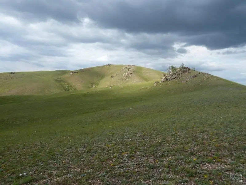
Real photos by travellers (Pexels, Unsplash, Wikimedia Commons); author and licence are given in each caption.
The Ereymentau Mountains (also spelled Yereymentau) are a range of low rocky hills about 127 km in a straight line east of Astana, in the Akmola and Karaganda regions of Kazakhstan. They peak at 901 m and carry a branch of Buiratau National Park, valued for steppe plants, wildlife and Stone and Bronze Age burials. This is a quiet nature trip for summer, not a dramatic mountain landscape.
What the Ereymentau Mountains are and where they sit
Ereymentau is a compact island of rocky hills and ridges inside the Kazakh Upland, the vast area of low worn-down hills that covers much of central and northern Kazakhstan. The name is usually translated from Kazakh as “small barrier of mountains” or “small mountains”, which sets expectations well. The town of Ereymentau lies at the northern end of the range and the village of Beloyarka at the southern end.
By Kazakh Wikipedia, the massif runs 70–75 km from north to south-west and is about 15 km wide. English Wikipedia describes the slopes as mostly smooth, with rocky outcrops and cliffs in places; Kazakh Wikipedia calls them steep and cut by gullies. A narrow band of unploughed foothill steppe surrounds the hills.
| Key fact | Figure |
|---|---|
| Highest point | Akdym, 901 m, in the south |
| Length / width | 70–75 km / about 15 km |
| Nearest big city | Astana, about 127 km in a straight line |
| Other cities | Karaganda about 157 km, Pavlodar about 280 km (straight line) |
| Protection | Ereymentau branch of Buiratau National Park since 11 March 2011 |
| Bird area | Part of a 364,580 ha Important Bird Area |
For a traveller, the distances mean this is a day or overnight trip from Astana, not from Almaty, which is far to the south.
The ridges: modest heights, wide views
No ridge here needs climbing gear: the range is made of several moderate ridges aligned north–south in the north and south-west to north-east in the south. The figures below come from Wikipedia and show how gentle the relief is against the surrounding plain.
| Ridge | Position | Highest point |
|---|---|---|
| Akdym | south | 901 m |
| Altyntau | north | 750 m |
| Karatau | east | 661 m |
| Bozashykyrtau | — | 658 m |
| Zhartas | west | 524 m |
The Olenti river flows along the eastern foot of the range. Tributaries of the Sileti start on the western slopes, and the Moiyldy, which feeds the Ishim, rises at the southern end. If you want relief and rock rather than rolling hills, aim for the southern sector around Akdym.
Why scientists value it: a refuge for steppe plants and animals
The main reason Ereymentau is protected is biological, not scenic. Russian Wikipedia describes the massif as a refuge where plants from very different floras met along old watershed lines, and counts over 400 species of vascular plants on a small area. A 1981–1982 field survey recorded over 350 species, so the figure depends on the count you read.
Rare species include Krylovia, a relict of dry steppe once widespread in Asia and now known in small populations near Lake Baikal and in Kazakhstan; it was found on the northern spurs of the Sunkariya ridge. In the protected areas you can still occasionally see Siberian and other irises, pasque flowers, wood anemone, small fritillary and a broad-leaved orchid, plus black currant, raspberry and hawthorn. Black alder, listed in the national Red Book, grows mixed with birch and aspen.
The animal list mixes mountain, forest and steppe species: argali, Siberian roe deer, wolf, corsac fox, bobak marmot, stoat, black grouse, grey partridge, ruddy shelduck, greylag and white-fronted geese.
Burial mounds and stone statues
The hills hold numerous burial grounds from the Stone and Bronze Ages, Scythian-era monuments and Turkic stone statues. We could not confirm which of them are signposted, how to reach specific sites, or whether any are open to visitors in an organised way. Treat burials and statues as you would any grave: look, photograph, do not climb on them or move stones.
When to go: June to August, with July the wettest month
Summer is the only comfortable window, and it is short. The figures below are computed normals for 2011–2020 from the ERA5 reanalysis at a grid point at 885 m, close to the height of the highest ridges; the lower valleys and steppe are likely to be a little warmer.
Day high, °C / Night low, °C · Rain/snow, mm
A computed reanalysis normal for these coordinates, not weather station records.
Monthly figures
| Month | Day high, °C | Night low, °C | Rain/snow, mm |
|---|---|---|---|
| Jan | -14.1 | -21.7 | 8.1 |
| Feb | -12.3 | -20.6 | 12.2 |
| Mar | -4.2 | -12.3 | 22.7 |
| Apr | 9.7 | -1.6 | 30.6 |
| May | 16.1 | 3.1 | 34.2 |
| Jun | 20.8 | 9.2 | 67.2 |
| Jul | 21.7 | 10.6 | 86.2 |
| Aug | 20.9 | 8.8 | 39.4 |
| Sep | 14.4 | 2.7 | 32.5 |
| Oct | 5.4 | -3.5 | 36.2 |
| Nov | -6.4 | -13.1 | 27 |
| Dec | -11.5 | -18.5 | 18.7 |
June to August brings daytime highs around 21 °C and nights of 10–12 °C, so pack a warm layer even in July. July is also the wettest month, with about 86 mm of precipitation, more than double most other months, so expect showers. May and September are possible, with highs near 14–16 °C but nights only around 4 °C. From November to March daytime highs stay below zero, and January averages about −14 °C by day and −22 °C at night: this is serious steppe winter with no shelter from the wind on the ridges.
| Period | What to expect |
|---|---|
| May | Cool nights near 4 °C |
| June–August | Warmest, highs about 21 °C, frequent July rain |
| September | Highs about 14 °C, drier than July |
| October–April | Freezing or near-freezing, not a hiking season |
Getting there and what stands in the way
The practical challenge is logistics, not terrain. Ereymentau town is the gateway at the northern end, and Astana is the nearest major city at about 127 km in a straight line; road distance will be longer. We could not confirm bus or train schedules from Astana, road conditions into the hills, or where visitors may enter the national park branch.
Plan on arranging transport in advance and carrying offline maps. If you want lakes and pine-covered hills in the same part of the country, compare with Zerenda near Kokshetau; for another granite range in the central steppe, see Ulytau.
- Public transport from Astana to Ereymentau town and onward into the hills
- Road conditions and access points into the national park branch
- Entry rules, permits or fees for the Buiratau park branch
- Whether marked trails or signposted archaeological sites exist
- Accommodation options in or near the range
The Ereymentau Mountains: tips before you go
- Bring a warm layer even in July: average night lows at ridge height are only 10–12 °C.
- Pack rain gear for July, which averages about 89 mm of precipitation, the wettest month by far.
- Head for the southern sector near Akdym (901 m) if you want the most relief and rock.
- Treat burial mounds and Turkic stone statues as graves: do not climb on them or move stones.
More to see nearby


Frequently asked questions
How far is Ereymentau from Astana?
What is the weather like in the Ereymentau Mountains?
How high are the Ereymentau Mountains?
Is Ereymentau a national park?
How far is Ereymentau from Pavlodar?
Sources
Read also
 Almaty Zoo in Kazakhstan: opening hours and how to visit
 Ayusai Gorge, Almaty: visitor centre and waterfall trail
 Gorelnik Gorge above Medeu: waterfalls, trail and season
 Kamenskoe Plateau above Almaty: observatory and trails
 Pervomaiskie Ponds near Almaty: location, swimming, season
 Saty village: base for the Kolsai and Kaindy lakes