Lake Bolshoye Chebachye: when to go, month by month
- January: possible
- February: possible
- March: off season
- April: off season
- May: possible
- June: best time
- July: best time
- August: best time
- September: good
- October: possible
- November: off season
- December: possible
The lake is ice-free roughly from late May to November, and only June to August bring mild days; winter is severe and spring break-up is unsuitable for a lake trip.
Lake Bolshoye Chebachye: why go
Bolshoye Chebachye's open water
The largest lake of the Burabay group, 23-25.5 km² by different sources, almost free of water plants and cut into many bays by peninsulas.
Granite and pine on the shore
A tectonic basin with granite cliffs up to 18-20 m on the south side, pine and birch on the slopes, and pebble and sand beaches between them.
Getting to the lake from Astana
The lake is about 233 km from Astana and 61 km from Kokshetau in a straight line, 16.5 km north of Shchuchinsk, by Burabay village.
A short summer at Chebachye
July averages near 23 °C by day and 14 °C at night, but it is also the wettest month, with about 96 mm of rain in the 2011-2020 normals.
The lake called Little Baikal
Its depth and size earned Bolshoye Chebachye the nickname Little Baikal, and one of its peninsulas, once an island, is known as the Singing peninsula.
Lake Bolshoye Chebachye in photos
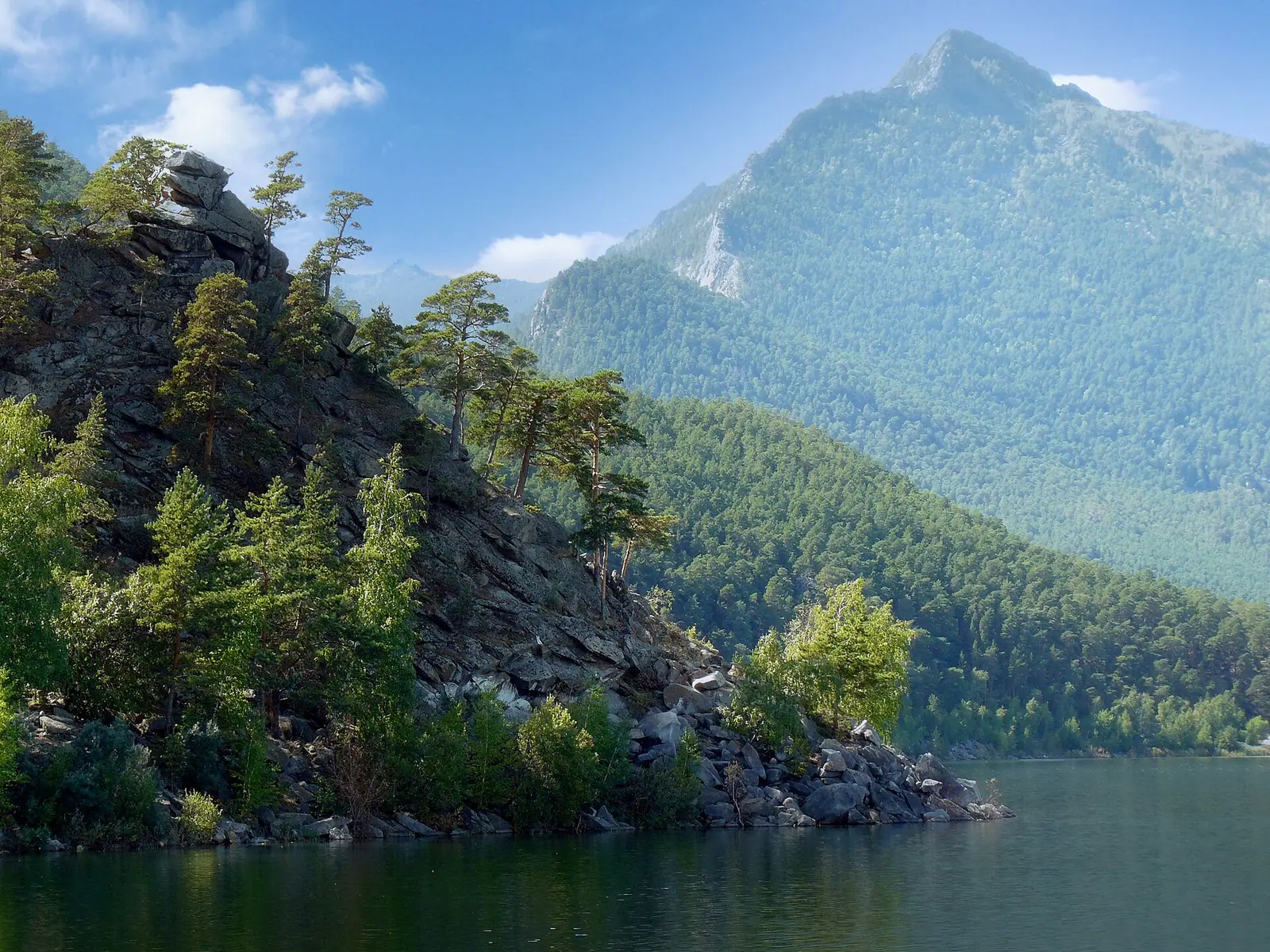
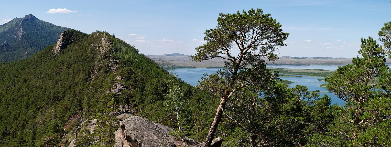
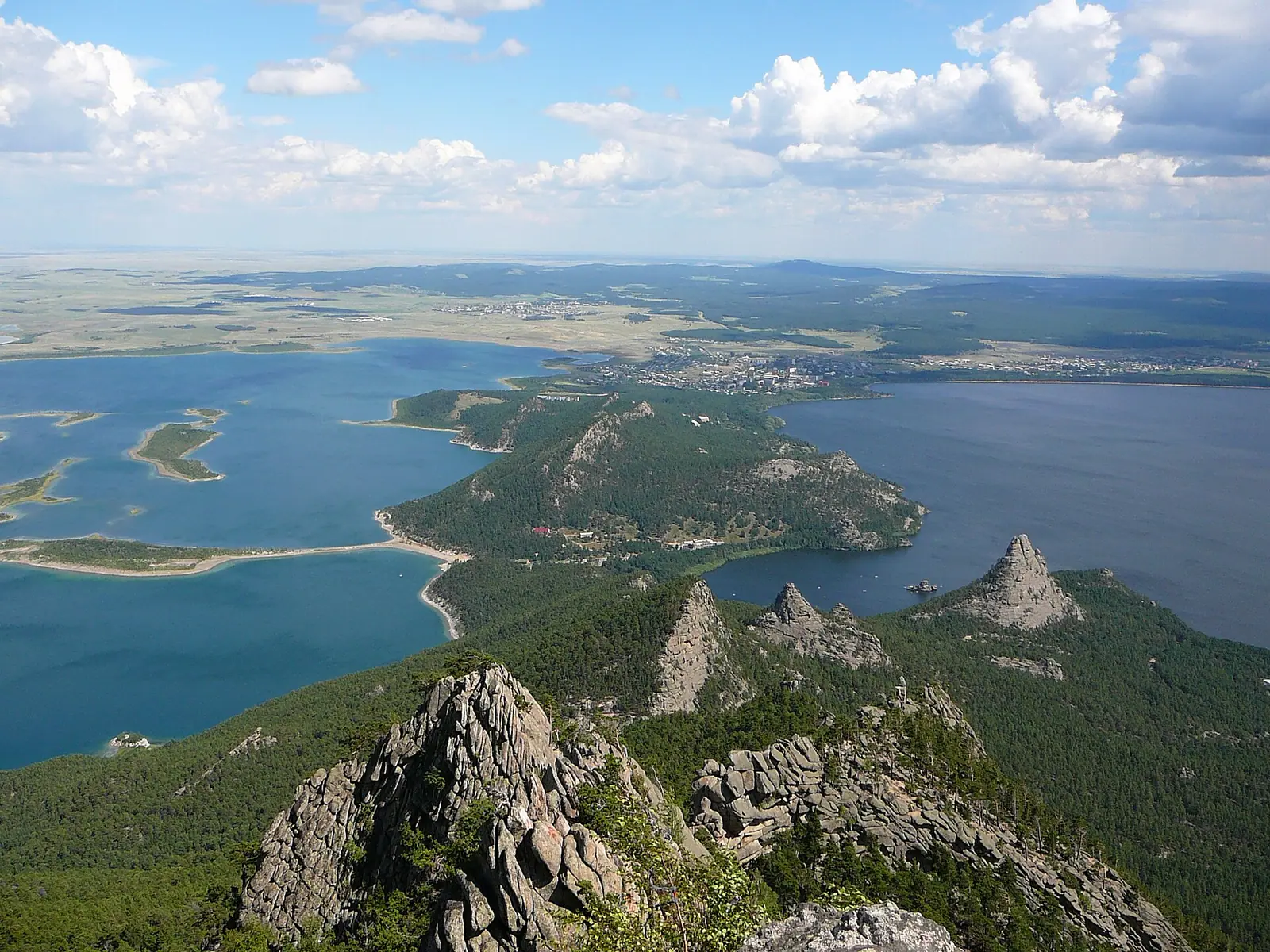
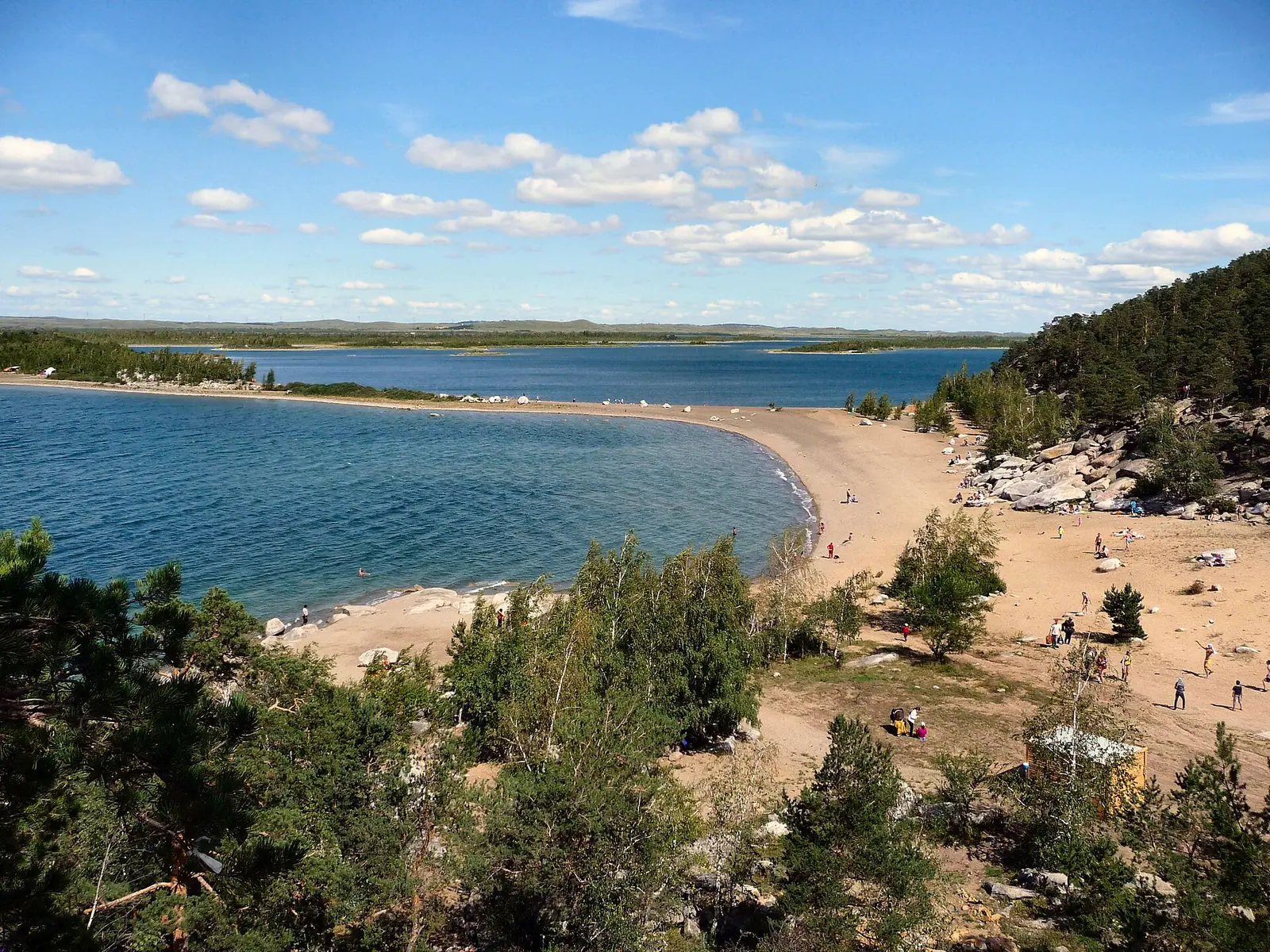
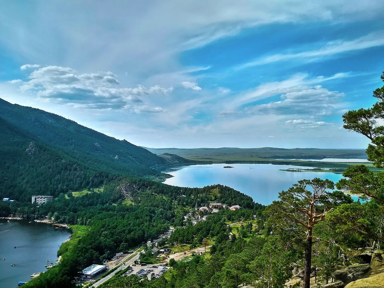
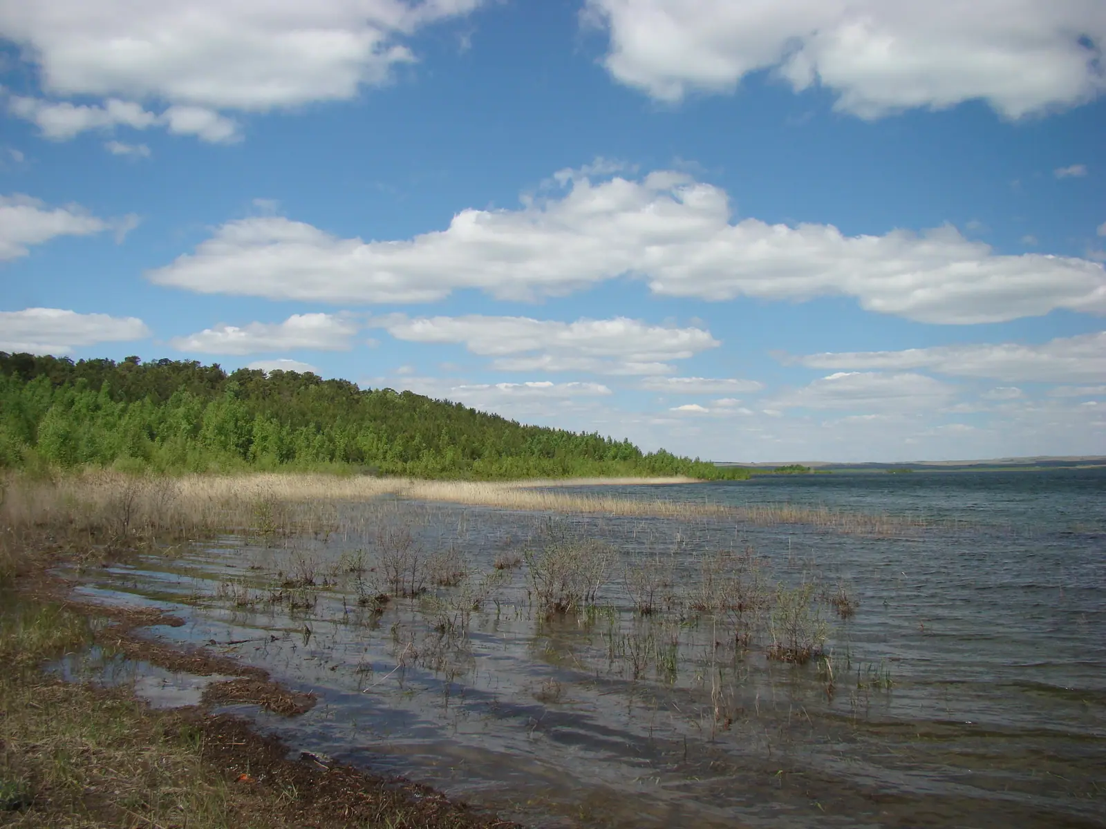
Real photos by travellers (Pexels, Unsplash, Wikimedia Commons); author and licence are given in each caption.
Lake Bolshoye Chebachye, known in Kazakh as Ulken Shabakty, is the largest lake of the Burabay group in Akmola Region, northern Kazakhstan. It sits in Burabay National Park, about 61 km in a straight line from Kokshetau and about 233 km from Astana. Expect clear open water, granite shores under pine and birch, and a short summer season.
Where the lake is and what kind of trip it takes
The lake lies 16.5 km north of the town of Shchuchinsk, at the foot of Mount Kokshetau (947 m), in the Shchuchinsk-Borovoye resort zone. The village of Burabay stands on its south-eastern shore and draws drinking and household water from the lake. Lake Burabay lies to the south, and the Kurkireuik (Gromotukha) stream runs from it into Bolshoye Chebachye.
For a foreign visitor this is a trip from Astana, not from Almaty: Almaty is at the other end of the country. The nearest city in the distance list is Kokshetau, about 61 km in a straight line; Astana is about 233 km and Petropavl about 208 km, also straight-line figures. We could not confirm buses, trains or road conditions, so plan the last stretch before you leave, especially if you have no car and no Russian.
A clear, deep lake with granite shores
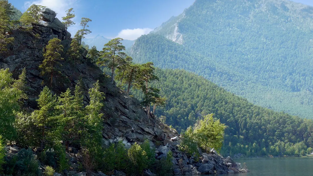
Bolshoye Chebachye is an open lake almost without water plants; reeds and rushes grow only in a shallow north-eastern bay, by the Kazakh Wikipedia. The basin is tectonic. The southern shore is high and cliffy, up to 18-20 m, while the northern and eastern shores are low. Granite outcrops alternate with fine pebbles and sandy beaches, and the slopes are covered in pine and birch.
The shoreline is cut by peninsulas into many bays, and there are several islets. One of them, the so-called Singing (also Smorodinovy or Omsky) peninsula, used to be an island. Because of its depth and size the lake is also nicknamed Little Baikal.
Sources do not agree on the lake’s size. The table gives the ranges so you are not misled by a single figure.
| Measure | Figures in different sources |
|---|---|
| Water area | about 23 km² (Russian Wikipedia) or 25.5 km² (English and Kazakh Wikipedia) |
| Length | 7.7 km or 8.3 km |
| Width | 4.7 km or 5.1 km |
| Average depth | 10-14.4 m, most often given as about 11 m |
| Maximum depth | 33 m in most sources; 24 m and 38 m also appear |
| Elevation | 301.6 m above sea level |
| Catchment | 150 km² |
For a visitor the practical point is simple: this is a large, deep lake, not a shallow pond, so treat swimming far from shore with care.
When to go: open water lasts only from late spring to autumn
The lake is frozen for roughly half the year, so the window for a lake trip is June to September. Russian Wikipedia says it freezes in late November and opens in late April; the Kazakh article gives mid-November and 15-25 May. Plan around the later date if you want open water in May.
Day high, °C / Night low, °C · Rain/snow, mm
A computed reanalysis normal for these coordinates, not weather station records.
Monthly figures
| Month | Day high, °C | Night low, °C | Rain/snow, mm |
|---|---|---|---|
| Jan | -12.7 | -19.8 | 11.7 |
| Feb | -10.7 | -17.9 | 10.1 |
| Mar | -2.6 | -10.1 | 18.9 |
| Apr | 10.2 | 0.4 | 34.3 |
| May | 18 | 5.5 | 39.4 |
| Jun | 22.3 | 11.1 | 56 |
| Jul | 23.2 | 13 | 92.7 |
| Aug | 22.4 | 11.2 | 57.4 |
| Sep | 15.9 | 5.6 | 38.3 |
| Oct | 6.8 | -1.1 | 37.5 |
| Nov | -4.1 | -10.1 | 21.4 |
| Dec | -9.9 | -16.6 | 17.3 |
These are ERA5 reanalysis normals for 2011-2020 at a grid point at 389 m, not a weather station; the lake itself is lower, at about 302 m. July is the warmest month, with average highs near 23 °C and nights near 13 °C. June and August are close behind. July is also the wettest month, with about 93 mm of precipitation, so expect showers. The figures are for a grid point and may differ from conditions at the shore.
Winter is severe: January averages around -13 °C by day and -20 °C at night. A winter visit is possible for the frozen landscape, but we could not confirm any rules on going out onto the ice.
| Period | What to expect |
|---|---|
| Dec-Mar | Lake frozen, days well below zero |
| Apr-May | Ice breaking up, cold nights, April nights around freezing |
| Jun-Aug | Open water, mild days, July wettest |
| Sep | Cooling, highs around 15 °C |
| Oct-Nov | Near-freezing nights, ice from mid to late November |
Fish, water quality and what that means for swimmers
Fishing on the lake is common. Perch, bream and chebak (roach) are native; carp, tench, ripus and peled were introduced and have settled well, and there are crayfish. English Wikipedia translates the name Ulken Shabakty as “Big Fish”.
Russian Wikipedia also states that the water exceeds the permitted concentration of sulphates, copper, iron and fluorides. It gives no year for this measurement. We could not confirm current water-quality data or whether swimming is restricted at particular beaches, so check locally before swimming or drinking untreated water.
Protected status and the small sister lake
The lake belongs to Burabay National Park, created by a government decree of 12 August 2000 and classed as a protected area of national importance. We could not confirm entry fees, permits, fishing rules or camping rules inside the park.
Lake Kishi Shabakty, also called Maloye (Small) Chebachye, lies about 3 km to the west, and Lake Shchuchye about 16 km to the south-south-west. If you are combining this area with another lake in pine hills, Zerenda is about 81 km away in a straight line, near Kokshetau. For more granite country in the steppe, Ulytau is a separate long trip, about 551 km away.
- Public transport from Astana or Kokshetau to Burabay village and the lake shore
- Burabay National Park entry fees, permits and rules for camping and fishing
- Current water-quality data and any swimming restrictions at beaches
- Whether going out onto the winter ice is allowed or safe
- Road conditions on the final approach to the shore
Lake Bolshoye Chebachye: tips before you go
- Aim for June to August: ice can linger until 15-25 May by one source, and frost returns by November.
- Pack rain gear in July, the wettest month, with about 96 mm of precipitation in the climate normals.
- Check water quality locally: Russian Wikipedia reports sulphates, copper, iron and fluorides above permitted limits.
- Sort transport before leaving Astana or Kokshetau; the lake is 233 km and 61 km away in a straight line, and we have no bus details.
More to see nearby

Frequently asked questions
What is Maloye Chebachye?
How deep is Lake Bolshoye Chebachye?
When does the lake freeze?
Can you fish in the lake?
Is Bolshoye Chebachye the same as Ulken Shabakty?
Sources
Read also
 Almaty Zoo in Kazakhstan: opening hours and how to visit
 Ayusai Gorge, Almaty: visitor centre and waterfall trail
 Gorelnik Gorge above Medeu: waterfalls, trail and season
 Kamenskoe Plateau above Almaty: observatory and trails
 Pervomaiskie Ponds near Almaty: location, swimming, season
 Saty village: base for the Kolsai and Kaindy lakes