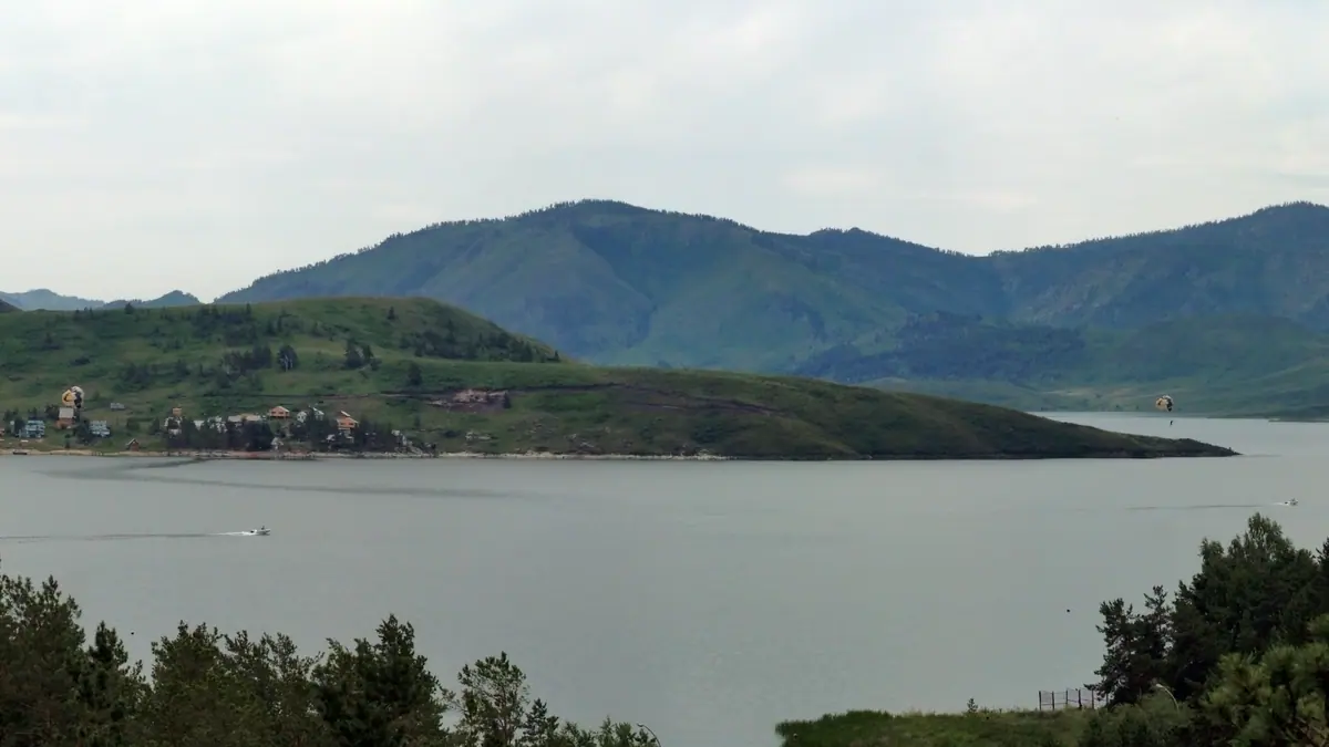
Bukhtarma Reservoir: when to go, month by month
- January: off season
- February: off season
- March: off season
- April: off season
- May: possible
- June: best time
- July: best time
- August: best time
- September: good
- October: possible
- November: off season
- December: off season
June to August bring warm days of 26–27 °C, and the water level peaks in August; winter highs stay below freezing.
Bukhtarma Reservoir: why go
Bukhtarma's open water
Bays in the Bukhtarma and Narym valleys run 30–50 km long and up to 10 km wide, and the main body stretches 425–600 km depending on the source.
A lake that swallowed Zaysan
Filling began in April 1960, and by 1962 the Irtysh had joined Lake Zaysan into one water body; Palaeolithic finds on the east shore date to about 1.8 million years.
The Bukhtarma Bridge
Opened on 21 October 2024 north of Kuygan, the 1,316 m bridge replaced the Kurchum ferry; the Vasilyevka ferry had already closed in 2020.
Short summer at Bukhtarma
June to August brings highs of about 26–27 °C and the year's highest water, which peaks in August; winter days stay below freezing from November to March.
Water that rises and falls
Seasonal swings of 1.3–3.8 m and up to 5 m between years mean a spring shoreline can sit far from the August waterline.
Bukhtarma Reservoir in photos
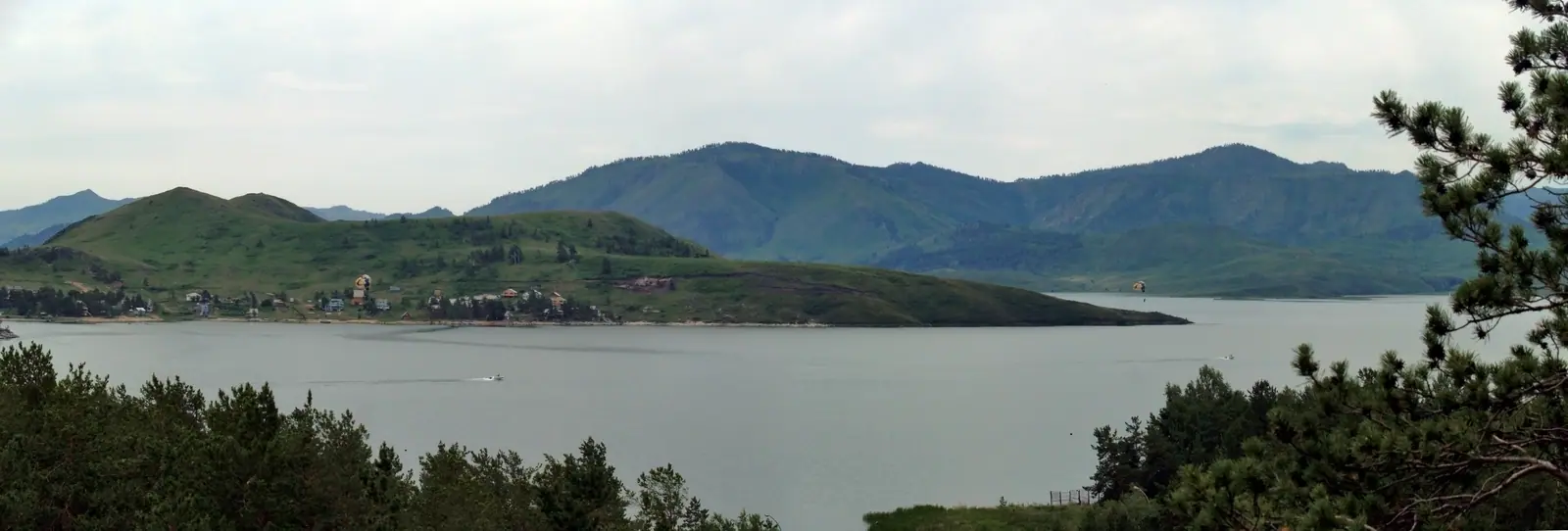
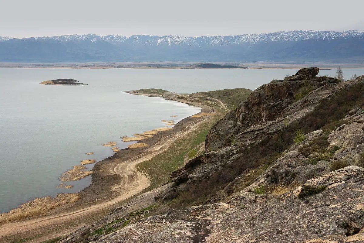
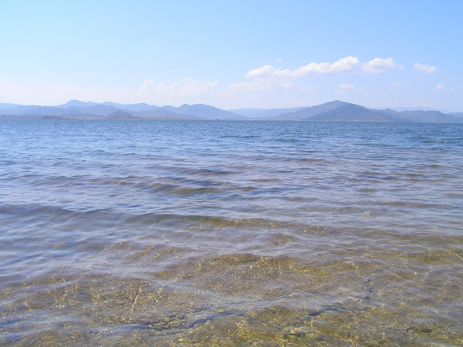
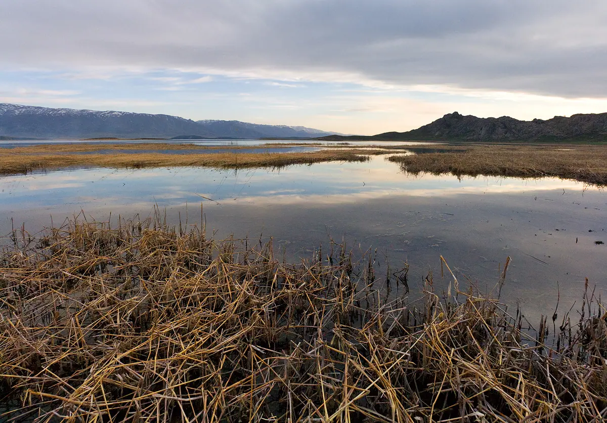
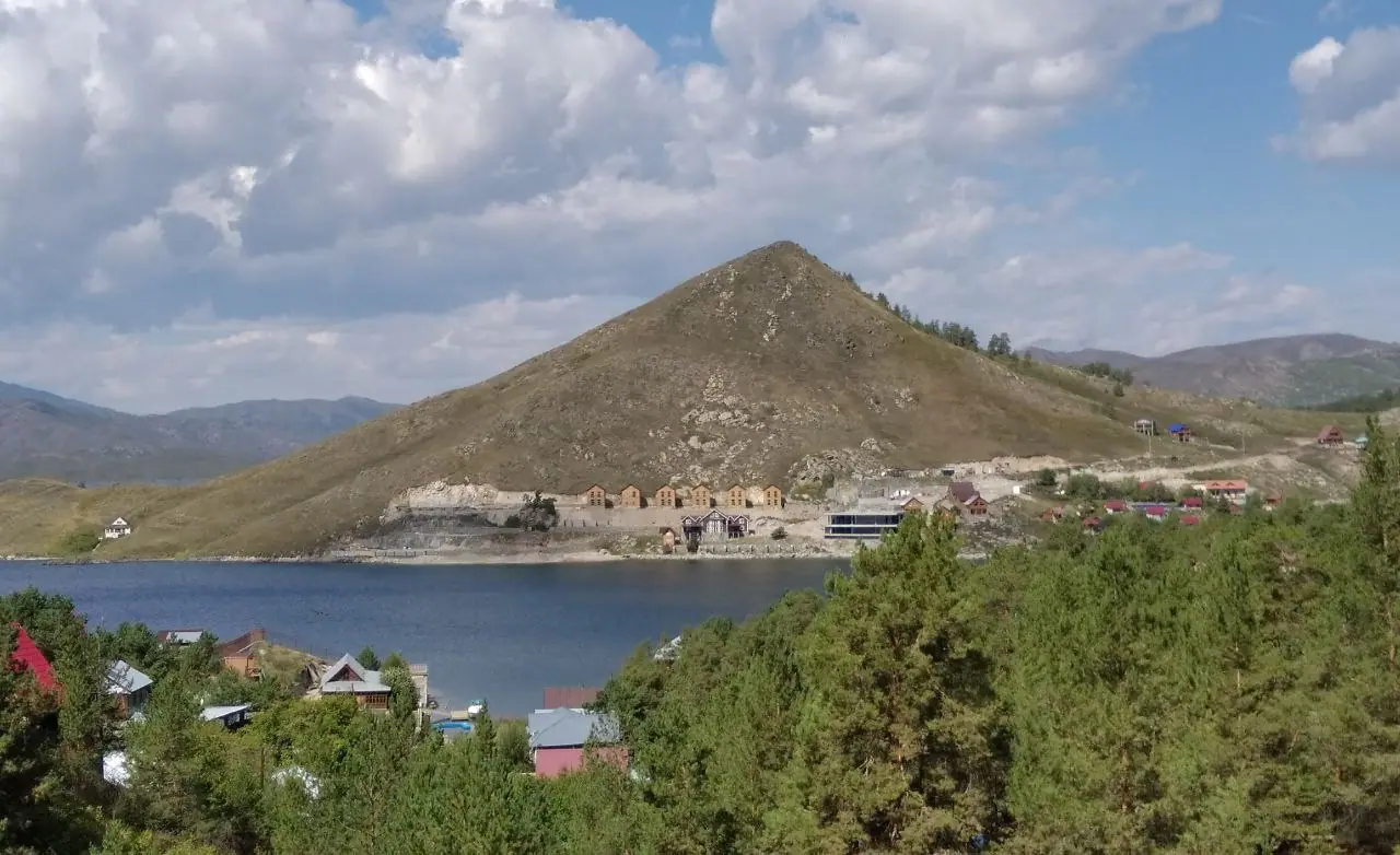
Real photos by travellers (Pexels, Unsplash, Wikimedia Commons); author and licence are given in each caption.
Bukhtarma Reservoir (Kazakh: Buqtyrma) is the largest reservoir in Kazakhstan and Central Asia, formed by a dam on the Irtysh River in East Kazakhstan. It sits about 146 km in a straight line from Oskemen (Ust-Kamenogorsk), far in the country’s northeast, and its season is a short, warm summer from June to August.
Where Bukhtarma is and what kind of trip it demands
Bukhtarma lies in East Kazakhstan Region, between the Kalba, Narym and Kurchum ridges, a long way from Almaty and from the Charyn and Kolsai circuit most visitors start with. The nearest large city is Oskemen, about 146 km in a straight line from the reservoir’s mid-point; Semey is about 320 km. Road distances will be longer, and we could not confirm any bus or train route to the shore.
Transport is the hard part to plan. The reservoir is a place for a stay of several days on the water, not a single viewpoint you tick off. Plan it as part of a trip to East Kazakhstan together with Altai destinations such as Rakhmanov Springs, and expect to arrange local transport from Oskemen.
How big the reservoir is, and why the figures differ
The two Wikipedia editions give different sizes; the Kazakh article includes the Black Irtysh delta, Zaysan and the lower Bukhtarma and Narym rivers. The Russian article treats the reservoir as the Irtysh valley stretch plus the broad reach that formed over Lake Zaysan; the Kazakh article explicitly includes the Black Irtysh delta, Zaysan and the lower Bukhtarma and Narym rivers.
| Measure | Russian Wikipedia | Kazakh Wikipedia |
|---|---|---|
| Water surface | 5,490 km² | 5,940 km² |
| Length | 425 km | 600 km |
| Greatest width | 35 km | 40 km |
| Volume | 49.6 km³ | 49.6 km³ |
| Depth | average 9.6 m | maximum 80 m |
For a visitor, the point is scale: bays in the Bukhtarma and Narym valleys and the Monchekur basin alone run 30–50 km long and up to 10 km wide. The Russian article ranks it fifth in the world among valley reservoirs by surface area. The Kazakh article splits it into an upper lake-like part, a middle mountain-valley part and a lower mountain part.
A dam from 1960 that joined the Irtysh with Lake Zaysan
Filling began in April 1960 behind the Bukhtarma hydroelectric dam, and by 1962 the Irtysh waters had merged with Lake Zaysan into one body of water. Since 1966 it has regulated the river’s flow over multiple years. If you plan to see Zaysan itself, our page on Lake Zaysan covers the upper end.
The power plant stands on the Irtysh 5 km upstream of Serebryansk. By English Wikipedia it has 9 turbines, 675 MW of capacity and about 2.77 billion kWh of output a year, and is run by Kazzinc under a long-term concession. The reservoir also deepens the Irtysh for shipping and feeds irrigation in East Kazakhstan and Pavlodar regions in spring.
The shores are old ground in a deeper sense too. On the eastern shore, in the western foothills of the Narym Range, two Palaeolithic sites, Kurchum-1 and Kurchum-2, were found in deposits whose upper boundary is dated to about 1.8 million years ago.
Crossing the water: ferries closed, a bridge opened in 2024
Since 21 October 2024, traffic crosses on the Bukhtarma Bridge north of the village of Kuygan, which at 1,316 m is described as the longest bridge in Kazakhstan. It replaced the ferry between Kurchum and Samarskoye districts, which closed that month. A second crossing, the Vasilyevka ferry between Katon-Karagay and Kokpekty districts, shut in 2020 as unprofitable.
This matters if you are routing towards Katon-Karagay or the Kurchum side: older maps and trip reports may still show ferries that no longer run. We could not confirm current road conditions to the bridge.
When to go: a short warm summer, a long hard winter
The lake season is June to August, when days are warm and the water level rises towards its August peak. The figures below are computed ERA5 reanalysis normals for 2011–2020 at a grid point at 390 m, not a weather station.
Day high, °C / Night low, °C · Rain/snow, mm
A computed reanalysis normal for these coordinates, not weather station records.
Monthly figures
| Month | Day high, °C | Night low, °C | Rain/snow, mm |
|---|---|---|---|
| Jan | -10.3 | -19.1 | 24.8 |
| Feb | -6.4 | -16.9 | 20.8 |
| Mar | 3 | -8 | 33.5 |
| Apr | 15.8 | 2.3 | 42.4 |
| May | 20.8 | 7.2 | 45 |
| Jun | 26.7 | 14.9 | 51.4 |
| Jul | 27.7 | 16.4 | 83.9 |
| Aug | 27.1 | 14.1 | 57.8 |
| Sep | 21 | 7.7 | 50.8 |
| Oct | 11.8 | 1.9 | 62.9 |
| Nov | 0.2 | -7.6 | 52 |
| Dec | -7.3 | -15.5 | 29.4 |
Average daytime highs sit around 27–28 °C from June to August, with nights of 16–18 °C. The grid point is a model cell, so temperatures on the shore may differ. July is also the wettest month at about 84 mm, so expect some summer rain. From November to March daytime highs stay below zero, dropping to about −10 °C in January with nights near −19 °C.
| Period | What to expect |
|---|---|
| April–May | Highs 14–19 °C; water level starts rising in early May |
| June–August | Highs 26–27 °C; level peaks in August |
| September | Highs about 20 °C, nights about 10 °C |
| October | Highs about 10 °C, one of the wetter months |
| November–March | Below freezing by day |
The water level swings by season: the Kazakh article gives 1.3–3.8 m between September and April, and up to 5 m between years. Beaches and jetties can look very different in spring than in late summer.
Water quality: a documented problem
Pollution has been recorded on Bukhtarma, so check current conditions before swimming. In June 2013 a white-grey slick 7 km long appeared; tests found ammonium salts 37 times and nitrates 136 times over the limit, traced to dam building on the Bukhtarma River near Turgusun using spoil from an old mine.
Sewage is the longer-running issue. Russian Wikipedia reports that treatment works at one holiday base have not operated since 1998 and that waste is released through a pipe at 15 m depth. A July 2019 study found 24,000 E. coli bacteria per litre, and a criminal case was opened against that base’s management. We could not confirm the situation today.
The water is otherwise fresh and soft, with mineralisation of 0.05–0.14 g/l. The Kazakh article lists carp, pike-perch, grass carp and other fish, with an average catch of 8,000–9,000 tonnes a year.
For a closer option from Oskemen, compare the Sibiny Lakes, 85 km from the city.
A table by area and volume is on the page about reservoirs in Kazakhstan.
- Public transport from Oskemen to the reservoir shore and journey times
- Current water quality and whether swimming is advised at specific shores
- Road conditions to the Kuygan bridge and the Kurchum side
- Ice safety and access in winter
- Any entry, fishing or boating rules on the reservoir
Bukhtarma Reservoir: tips before you go
- Aim for July or August: the water level rises from early May and peaks in August, so shores look fullest then.
- Pack a rain layer for July, the wettest month at about 78 mm in the computed normals.
- Ignore old maps showing the Kurchum or Vasilyevka ferries: both closed, and the Kuygan bridge carries traffic since October 2024.
- Ask about water quality before swimming: sewage with high E. coli counts was recorded near one holiday base in 2019.
More to see nearby


Frequently asked questions
How far is Bukhtarma from Oskemen (Ust-Kamenogorsk)?
What is the weather like at Bukhtarma in summer?
Is the Bukhtarma Reservoir frozen in winter?
Is Bukhtarma a river or a reservoir?
Can you swim in the Bukhtarma Reservoir?
Sources
Read also
 Almaty Zoo in Kazakhstan: opening hours and how to visit
 Ayusai Gorge, Almaty: visitor centre and waterfall trail
 Gorelnik Gorge above Medeu: waterfalls, trail and season
 Kamenskoe Plateau above Almaty: observatory and trails
 Pervomaiskie Ponds near Almaty: location, swimming, season
 Saty village: base for the Kolsai and Kaindy lakes