Besshatyr kurgans: when to go, month by month
- January: off season
- February: possible
- March: possible
- April: good
- May: best time
- June: good
- July: possible
- August: possible
- September: best time
- October: good
- November: possible
- December: off season
May and September bring highs of about 24–25°C, while July averages 32°C and winter highs stay near freezing.
Besshatyr kurgans: why go
The Great Besshatyr mound
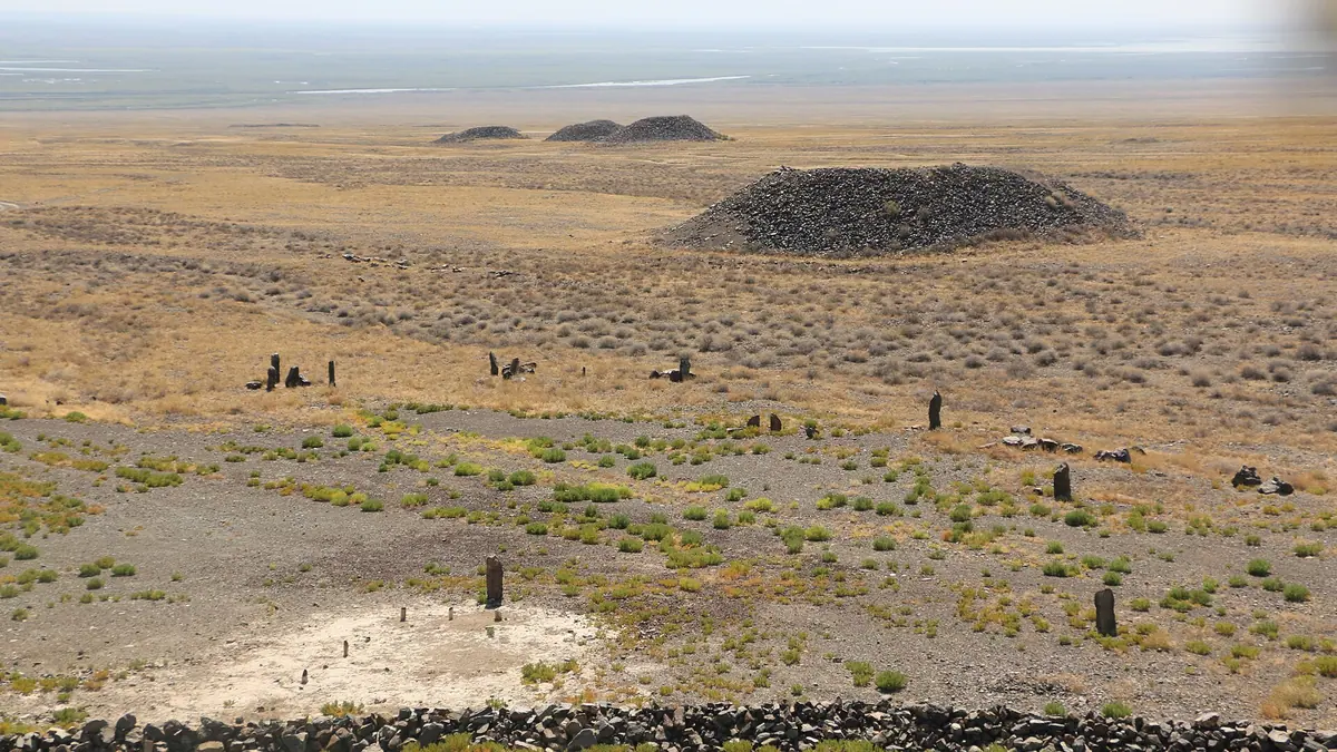
A truncated cone 17 m high and about 105 m across, ringed by a spiral of 94 stone fences, some upright stones carved with Kazakh clan tamgas.
Carved slabs of Besshatyr
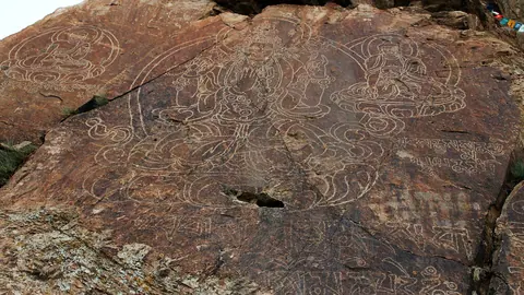
Stone fences around six mounds carry images of mountain goats, wild boar and wolves, with sun symbols and circles like the Kazakh "eye" tamga.
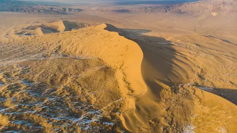
Besshatyr and the Singing Dune
The kurgans lie about 29 km in a straight line from the Singing Dune, both inside Altyn-Emel, so one park trip can cover the two.
Spring and autumn at Besshatyr
Computed normals give highs near 25°C in May and 24°C in September, against about 32°C in July and around 0°C in January.
Spruce logs from 200 km away
The large mounds were lined with Tien Shan spruce cut in the Ile-Alatau 200–250 km away and floated down the river, by Russian Wikipedia.
Besshatyr kurgans in photos
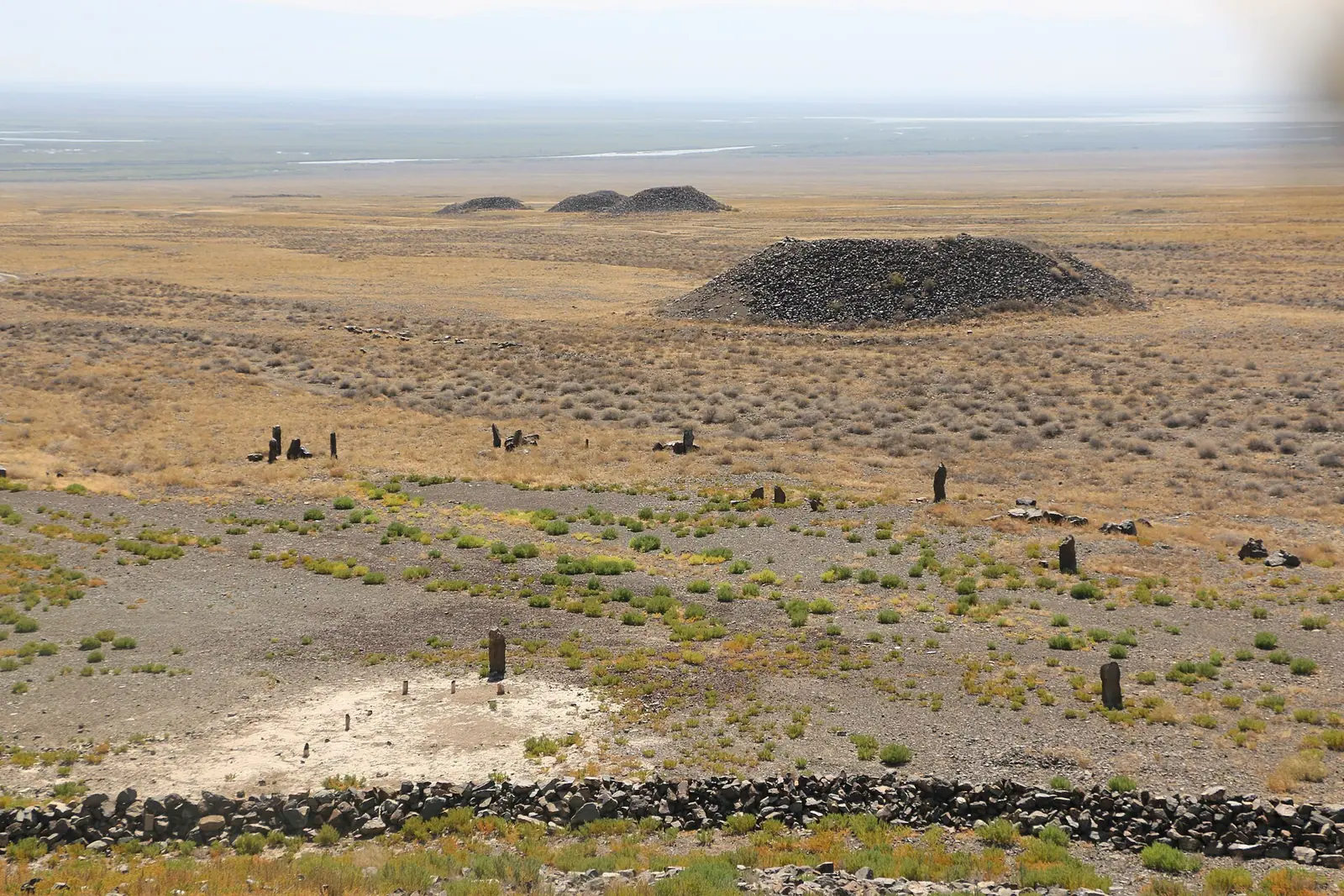
Real photos by travellers (Pexels, Unsplash, Wikimedia Commons); author and licence are given in each caption.
The Besshatyr kurgans are a Saka-era burial ground of 31 mounds on the right bank of the Ili River, inside Altyn-Emel National Park, about 131 km from Almaty in a straight line. The name means “five tents” in Kazakh, and the biggest mound rises 17 m. It is a site for travellers who already plan to visit Altyn-Emel, and it pairs naturally with the park’s other stops.
What Besshatyr is: a Saka necropolis of the 6th–4th centuries BC
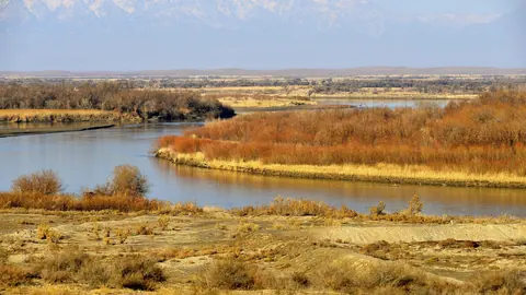
Besshatyr is a complex of tombs built by the Saka tribes of Semirechye between the 6th and 4th centuries BC. English Wikipedia says the name “Five Tents” most likely comes from the number of the largest mounds. The site lies in the Shylbyr tract at the foot of the Zhelshagyr hills, about 3 km from the right bank of the Ili, in Kerbulak district of Zhetysu region. Older texts place it in Almaty region, which reflects the administrative map before Zhetysu region was created.
The Kazakh Wikipedia notes that Besshatyr is on the state list of monuments of history and culture of republican significance. Researchers describe it as a sacred place where the Saka held ceremonies and made offerings, not only a cemetery. Treat it as a burial ground: walk around the mounds rather than over them.
| Key data | Figure |
|---|---|
| Age | 6th–4th centuries BC |
| Number of mounds | 31 (21 stone-covered, 10 rubble and clay) |
| Largest mound | 17 m high, 105 m across (104 m in Kazakh Wikipedia) |
| Area | about 2 km²; roughly 1 km west–east by 2 km north–south |
| Underground passages | 55 m in total, in 6 large mounds |
| Mounds excavated | 18 |
The passages and finds described below are known from excavations.
How the mounds are arranged and what to look for
The mounds fall into three size classes, and the size reflected rank. Large ones were built for chiefs and military leaders, middle ones for lower commanders and known warriors, small ones for ordinary soldiers and common people. The biggest, the 2nd and 3rd mounds, belong to the northern group.
| Class | Diameter | Height | Who was buried |
|---|---|---|---|
| Large | 45–105 m | 6–17 m | Chiefs and military leaders |
| Medium | 25–38 m | 5–6 m | Lower commanders, known warriors |
| Small | 6–18 m | 0.8–2 m | Ordinary soldiers and people |
For a visitor this means the northern group is where the scale is. The Great Besshatyr mound has the shape of a truncated cone on a multi-layered stone base. Around it runs a spiral of 94 ring fences of upright stones and large boulders, and some menhirs carry carved tamgas, the clan marks of Kazakh families.
Six of the stone-covered mounds are fenced by long chains of stone slabs. Many slabs bear images of mountain goats, wild boar and wolves, plus sun symbols and circles resembling the Kazakh “eye” tamga. Excavation of the fences turned up traces of fire, burnt animal bones and fragments of rough clay pots.
What archaeologists found inside
The large mounds were lined inside with wood: massive trunks of Tien Shan spruce, cut in the Ile-Alatau range 200–250 km away and floated down the river, according to Russian Wikipedia. Building one large mound took up to 50,000 m³ of stone and clay. In six large mounds archaeologists found underground passages 1.68 m high and 0.8 m wide.
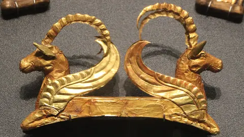
Finds included a short akinak sword, iron knives and daggers with butterfly-shaped hilts, spearheads, part of a wooden shield, quiver remains with bronze arrowheads, an iron girth buckle, bronze pins, bracelets, four agate and two gold beads. We could not confirm where these objects are kept today or whether any are shown on site.
Sources differ on the research dates. Russian Wikipedia gives 1957 and 1959–1962 for the Semirechye expedition led by K. A. Akishev; English Wikipedia gives 1959–1961 and says the first mention came from Vladimir Gorodetsky in 1924. If you have already seen the Issyk kurgan and the Golden Man, Besshatyr is another Saka-era site.
Other burial grounds around Besshatyr
Besshatyr is not alone. Next to it lie the Saka burial grounds of Kzylauyz, Altyn-Emel and Karashoky. About 3 km to the southeast are later Usun burials: Besshatyr II with 33 mounds, and a little further Kalkan I with 118 burial structures. Near the Altyn-Emel pass there are cemeteries of the same name with 36 mounds.
Kazakh Wikipedia also mentions a chain of 45 stone fences stretching 450 m, about 10 km west of Besshatyr. English Wikipedia reads the spread of seasonal sites as a sign that the Saka of Semirechye moved with the seasons, wintering elsewhere. We could not confirm which of these neighbouring sites are open to visitors or marked on the ground.
Getting there: a trip built around Altyn-Emel
Kazakh Wikipedia puts Besshatyr inside the park, 65 km north of Basshi village. In straight lines it is about 92 km from Konaev, 122 km from Taldykorgan and 131 km from Almaty; road distances will be longer. The Singing Dune is about 29 km away in a straight line, so most visitors will combine the two.
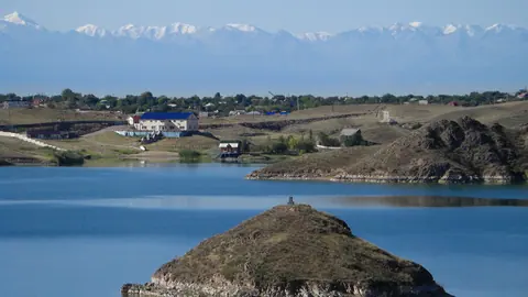
We could not confirm public transport, road surface, park entry rules or whether a park escort is needed. For a traveller without a car or Russian, that makes Besshatyr hard to reach independently; plan it as part of a multi-day Altyn-Emel trip rather than a day out. Konaev is about 92 km away in a straight line, and the Kapchagay reservoir page is about 59 km away.
If you only have one day near Almaty, the options in nature near Almaty or Charyn Canyon are easier to fit.
When to go: spring and early autumn
May and September are the comfortable months; July is hot and winter is cold. The climate figures below are computed normals from the ERA5 reanalysis for 2011–2020 at a grid point at 676 m, not a weather station.
Day high, °C / Night low, °C · Rain/snow, mm
A computed reanalysis normal for these coordinates, not weather station records.
Monthly figures
| Month | Day high, °C | Night low, °C | Rain/snow, mm |
|---|---|---|---|
| Jan | 1.2 | -7.5 | 11.4 |
| Feb | 3.7 | -6.1 | 11.6 |
| Mar | 13.1 | 2.1 | 18 |
| Apr | 20.9 | 8.7 | 38.7 |
| May | 25.9 | 12.5 | 43.3 |
| Jun | 30.1 | 17.4 | 47.4 |
| Jul | 32.9 | 19.3 | 24.3 |
| Aug | 31.3 | 17.4 | 21.5 |
| Sep | 25.8 | 12.1 | 15.5 |
| Oct | 17.5 | 5.8 | 20 |
| Nov | 7.8 | -0.8 | 28 |
| Dec | 2.6 | -5.3 | 15.9 |
In May average highs reach about 25°C and in September about 24°C, with nights of 13–12°C. July averages 33°C in the afternoon, and August 31°C: walking between mounds in the open steppe is best done early or late. From December to February daytime highs stay around 0–2°C with nights down to about −8°C. The wettest stretch is April to June at roughly 39–41 mm a month, still a dry climate; the rest of the year is drier.
- Park entry rules, permits and whether an escort is required to visit Besshatyr
- Road condition and driving route from Basshi or the park office to the kurgans
- Any public transport to Altyn-Emel or the site
- Whether the underground passages or any finds can be seen by visitors
- Which neighbouring burial grounds are marked or open to visit
Besshatyr kurgans: tips before you go
- Combine Besshatyr with the Singing Dune: they are about 29 km apart in a straight line inside Altyn-Emel.
- Head for the northern group first: it holds the largest mounds, the 2nd and 3rd, up to 17 m high.
- Avoid midday in July: average highs there reach about 32°C on open ground around the mounds.
- Walk around the mounds, not over them: researchers describe Besshatyr as a sacred Saka burial and ritual site.
More to see nearby