Bayterek Tower in Astana: when to go, month by month
- January: possible
- February: possible
- March: possible
- April: possible
- May: good
- June: best time
- July: best time
- August: best time
- September: good
- October: possible
- November: possible
- December: possible
The deck is indoors, though opening hours are unconfirmed; only June to August is warm outside, while November to March stays below freezing by day.
Bayterek Tower in Astana: why go
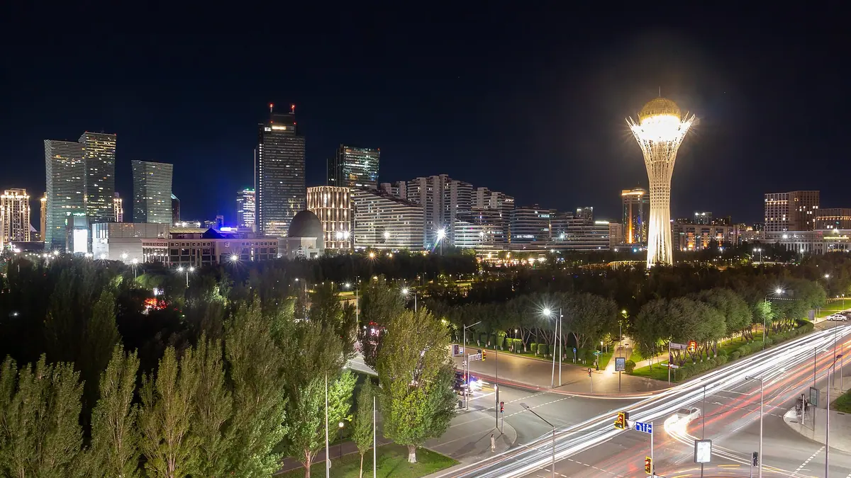
The golden sphere of Bayterek
A 22-metre gold-mirrored glass sphere holds the viewing deck, with 360-degree views over Astana from one level and a second level up a flight of stairs.
Bayterek and the 1997 capital move
The tower marks the transfer of the capital from Almaty to Astana in 1997, and the number 97 is built into its height to mark that year.
A city stop on Nurjol Boulevard
Bayterek stands in central Astana on Nurjol Boulevard, so it fits into a walking day in the capital with no car, tour or long transfer needed.
Summer is the easy season
June to August brings average highs near 25 °C, while January averages about −11 °C by day, which makes the plaza walk the hard part in winter.
Two versions of the religions globe
The wooden globe at the top bears signatures of 17 religions by Russian and Kazakh Wikipedia, while English Wikipedia describes 16 radiating segments.
Bayterek Tower in Astana in photos
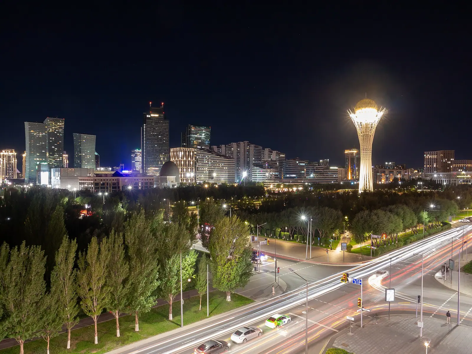
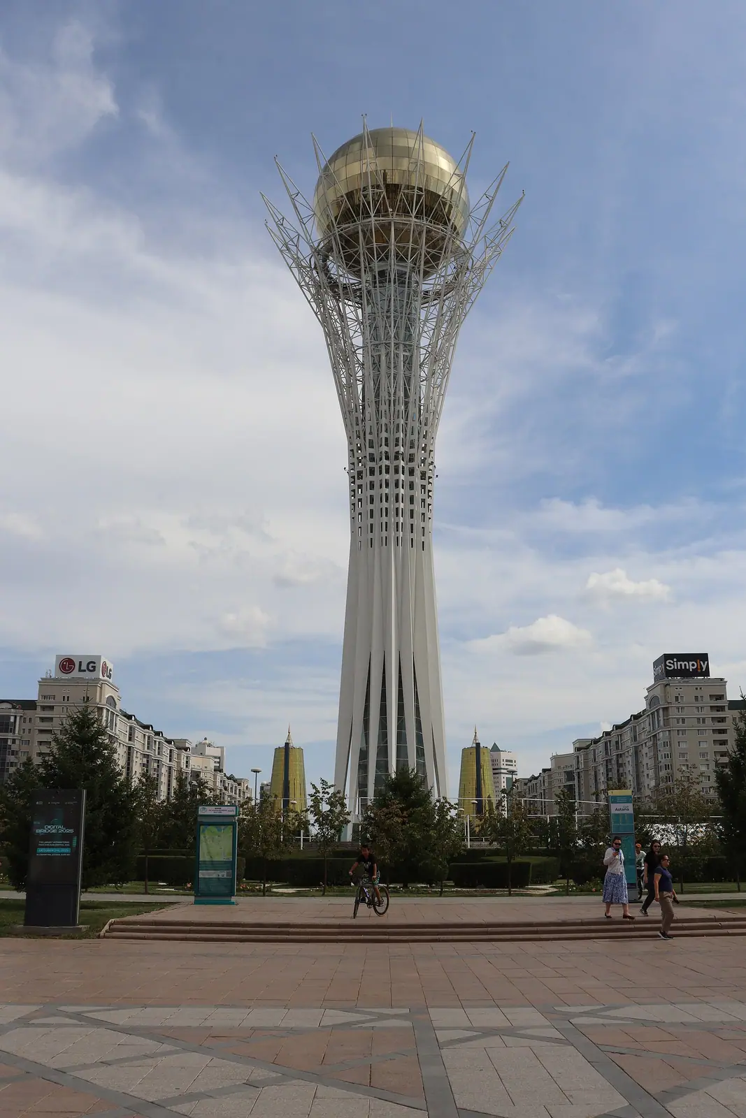
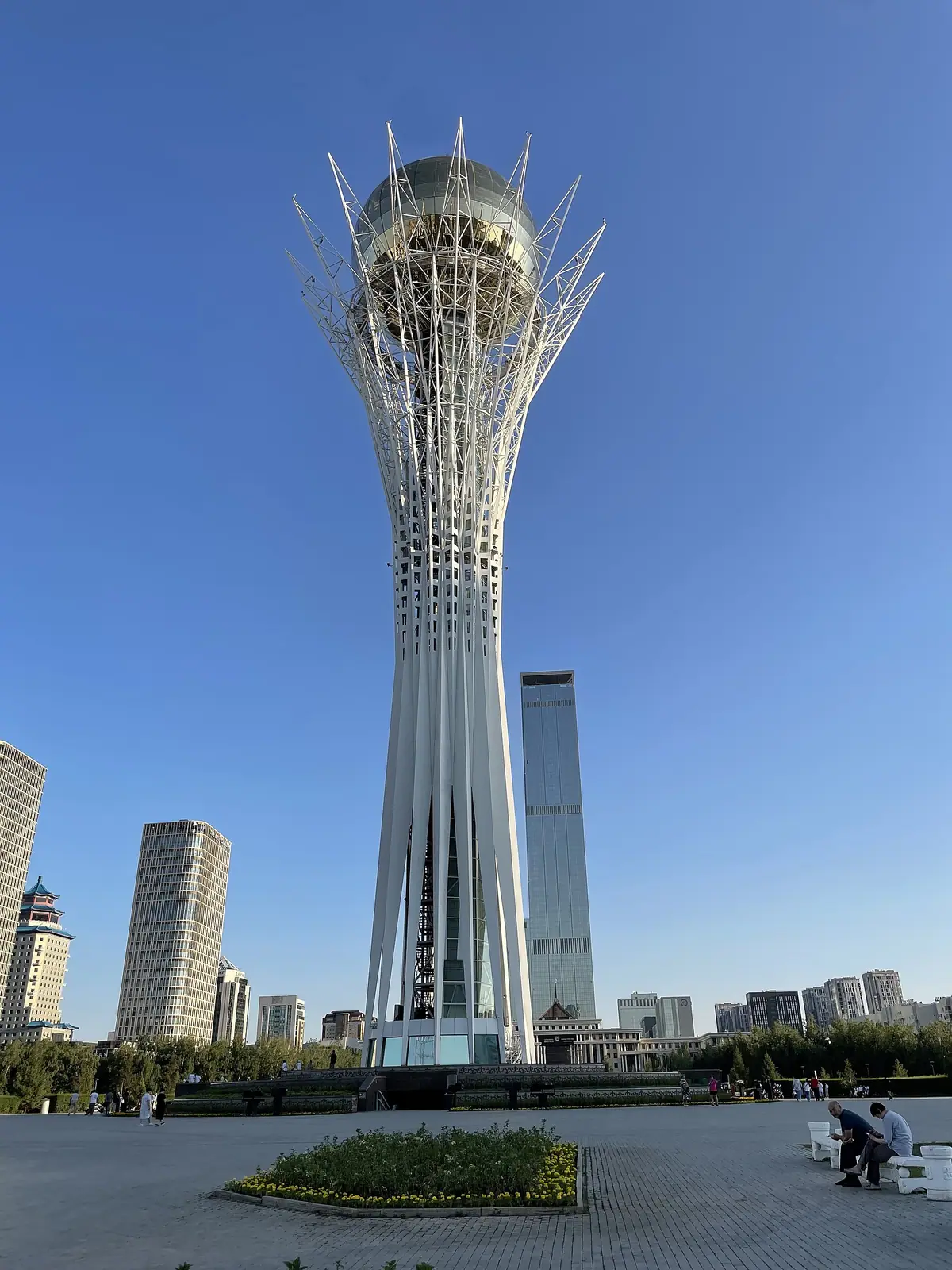
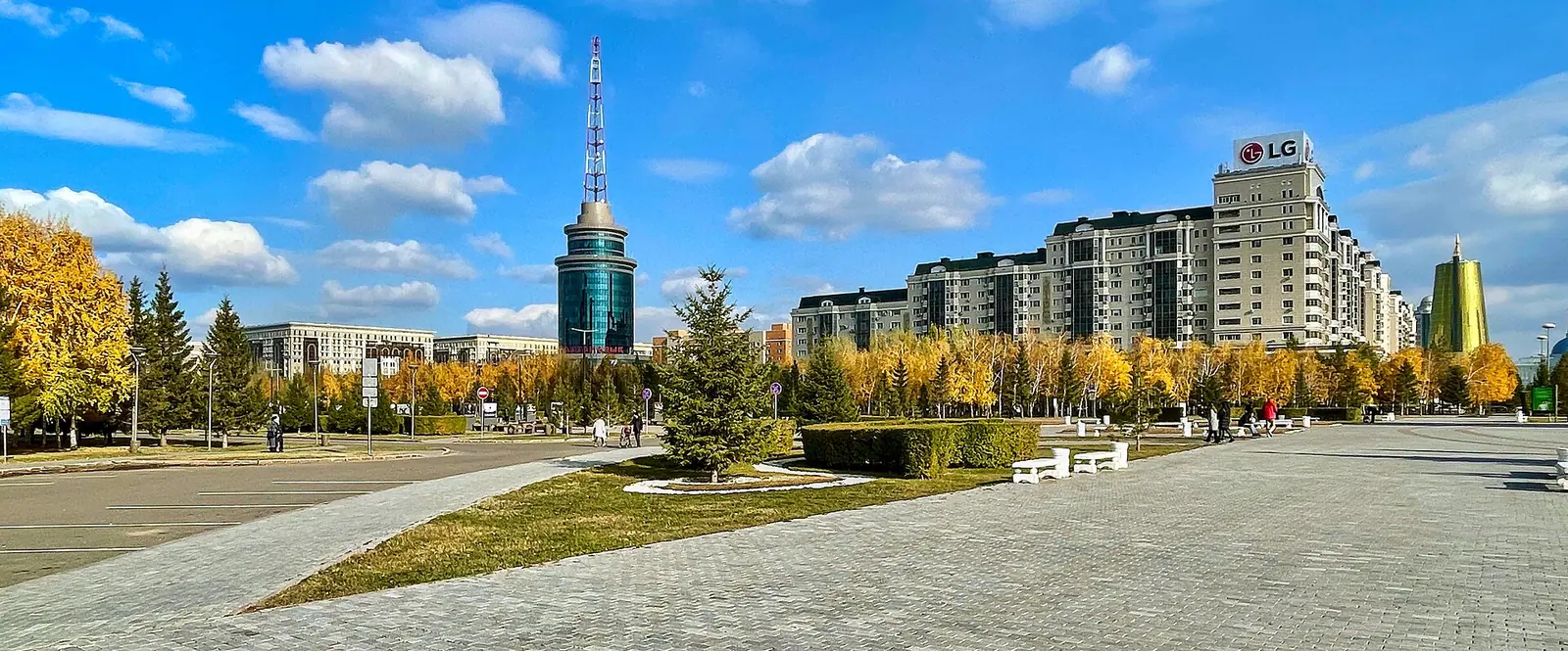
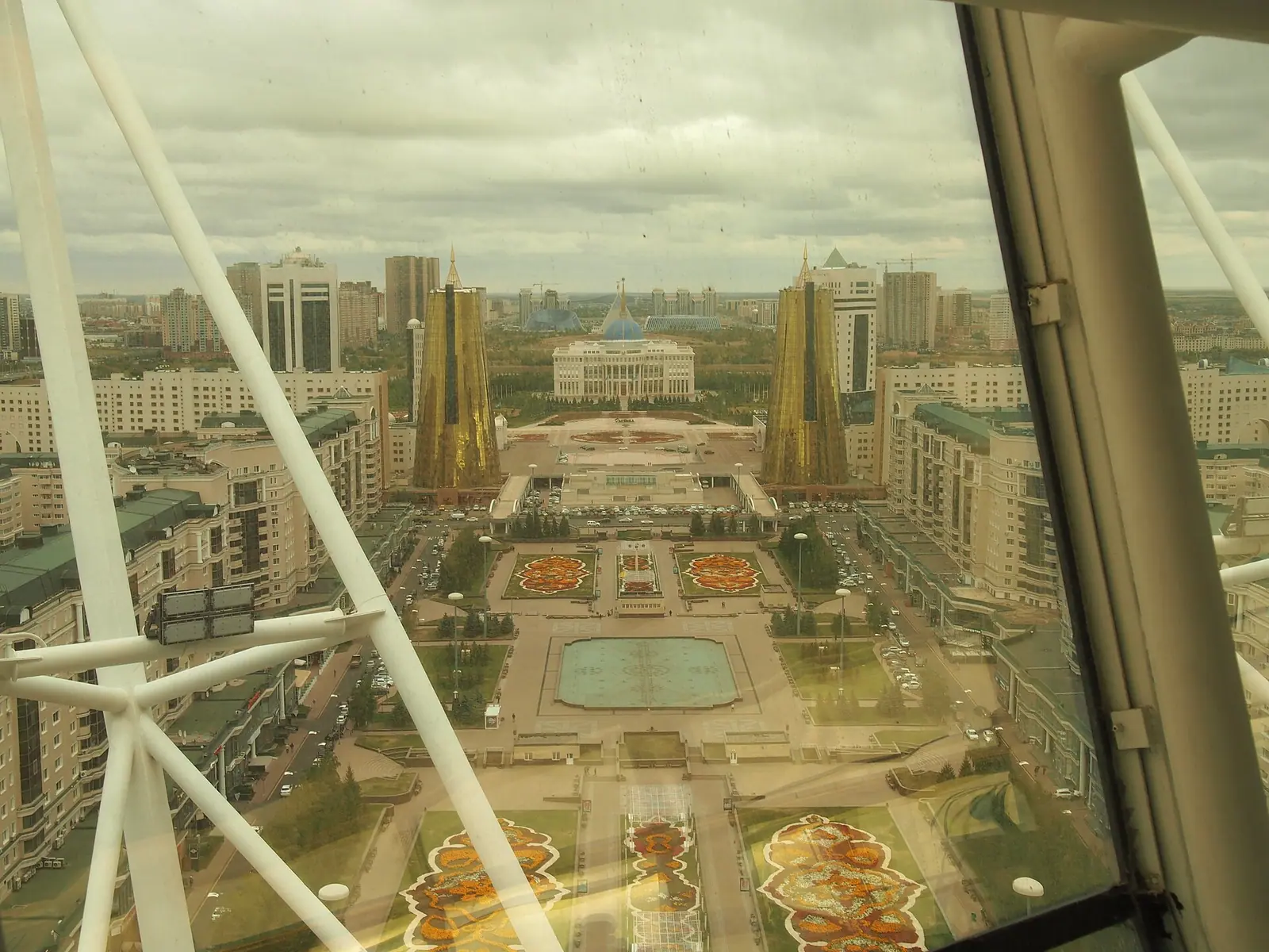
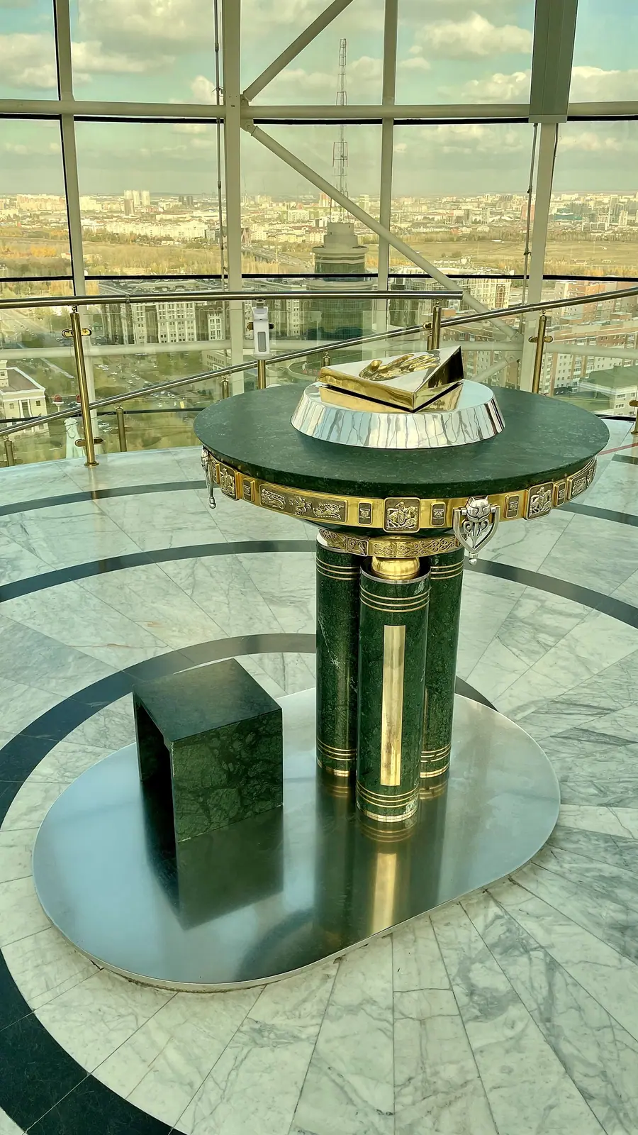
Real photos by travellers (Pexels, Unsplash, Wikimedia Commons); author and licence are given in each caption.
Bayterek Tower is the landmark monument and observation tower of Astana, the capital of Kazakhstan, standing on Nurjol Boulevard in the city centre. Lifts inside the shaft take visitors up into a golden glass sphere for 360-degree views over the city. It is an urban sight, not a nature trip: plan an hour or two of a day in Astana rather than a separate journey.
What Bayterek is and why it stands in Astana
Bayterek was built as a symbol of the move of Kazakhstan’s capital from Almaty to Astana (then Akmola) in 1997. By English Wikipedia it is popular with both foreign visitors and Kazakhs and is considered emblematic of post-independence Kazakhstan. Russian Wikipedia notes it is listed as a historical and cultural monument of local significance in Astana.
The name means “poplar” or “tall poplar tree” in Kazakh. The design draws on a folktale: the hero Er-Tostik finds the tree of life Bayterek, where the magic bird Samruk lays a golden egg once a year. The golden sphere is that egg, resting between the branches. Knowing the story before you go turns a tall steel structure into something you can read from the plaza.
How tall is Bayterek: the key figures, and where sources differ
The structure is 105 metres tall overall, and the number 97 is built into it on purpose to mark 1997. The sources do not agree on exactly what is at 97 metres, and the weight figures also differ, so treat the table as a range rather than a spec sheet.
| Figure | Value | Note |
|---|---|---|
| Total height | 105 m | All three Wikipedia versions agree |
| The “97 m” figure | Height of the structure (Russian and Kazakh Wikipedia) or of the observation deck (English Wikipedia) | Sources describe it differently |
| Sphere diameter | 22 m | Agreed |
| Sphere position | Set at 76.9 m | Russian Wikipedia |
| Sphere surface area | 1,553 m² | Russian and Kazakh Wikipedia; glazing of the dome given as 1,555 m² in the construction figures |
| Weight of the dome | Almost 70 t | Kazakh Wikipedia also gives about 300 t for the sphere |
| Metal structures | About 1,000 t | Construction figures |
| Underground level | 4.5 m below ground | Russian Wikipedia |
For a visitor the practical point is simple: the viewing deck sits high above central Astana, inside glass, so weather affects the view more than your comfort.
Inside the tower: from the lower level to the golden sphere
A visit runs bottom to top. By Russian Wikipedia the lower level sits 4.5 metres below ground and holds a café, aquariums and the Bayterek photo gallery about how the project was built; English Wikipedia describes a ticket booth and exhibition space in the base. From there two lifts rise inside the shaft to the sphere.
The observation area has two levels: one with 360-degree views of Astana and beyond, and a higher one reached by a flight of stairs. On the upper level is the composition “Ayaly alakan” (“caring hands”), a gilded bronze imprint of the right hand of Nursultan Nazarbayev, the first president, on an ornate pedestal. A plaque invites visitors to place a hand in it and make a wish, and many do. Beside it stands a wooden globe linked to the Congress of Leaders of World and Traditional Religions; Russian and Kazakh Wikipedia say it carries signatures of representatives of 17 religions, while English Wikipedia describes 16 radiating segments.
The sources also differ on the entrance. Russian Wikipedia places the main entrance 4.8 metres above ground, reached by an openwork concrete staircase, while English Wikipedia says entrances are sunk below eye level and reached by stairs from the plaza. Either way, expect steps; we could not confirm step-free access.
The design story: an arch, a spire and a sketch
Several designs were considered for the new capital’s landmark, according to Nazarbayev’s memoirs as quoted by Wikipedia. Zurab Tsereteli proposed a 200-metre arch topped by a golden warrior, and Arab architects suggested a 200-metre spire with a large yurt-shaped building at its base. The president chose the Bayterek idea and sketched its outline himself; the Union of Architects of Kazakhstan turned the sketch into a project.
Cost was a deciding reason: the estimate for Bayterek was roughly a twelfth of Tsereteli’s proposal. The design team was led by Akmurza Rustembekov, with architects Suyerkhan Bazarbayev and Zhumabek Aytbalayev, structural engineer Mark Vanshteyn and interior designer Aytuar Ospanov. English Wikipedia dates the commission to 1996; Russian Wikipedia says it was formally handed over in 2003, and that it won the Grand Prix of the International Association of Unions of Architects as the best project and building of 2002 among CIS countries.
When to go: long cold winters, short warm summers
Astana has a sharply continental climate, and the figures below are computed normals for 2011–2020 from the ERA5 reanalysis at a grid point at 348 m, not readings from a weather station.
Day high, °C / Night low, °C · Rain/snow, mm
A computed reanalysis normal for these coordinates, not weather station records.
Monthly figures
| Month | Day high, °C | Night low, °C | Rain/snow, mm |
|---|---|---|---|
| Jan | -11.6 | -19.2 | 14.5 |
| Feb | -9.7 | -18 | 15.5 |
| Mar | -1.2 | -9.7 | 22.8 |
| Apr | 13.1 | 1.4 | 28.2 |
| May | 20.2 | 6.7 | 29.9 |
| Jun | 25.1 | 12.7 | 41.8 |
| Jul | 26 | 14.2 | 61.8 |
| Aug | 25.1 | 12.3 | 28.1 |
| Sep | 18.4 | 6.3 | 23.6 |
| Oct | 8.8 | -0.2 | 31.2 |
| Nov | -3.4 | -10 | 28.6 |
| Dec | -9.1 | -16.1 | 23.2 |
June to August is the comfortable window, with average daytime highs of about 25 °C and nights of 13–15 °C. July is also the wettest month, around 62 mm, so a cloudy or rainy day can dull the panorama. May and September are mild, with highs near 20 °C and 18 °C. From November to March daytime highs stay below freezing, and January averages about −12 °C by day and −19 °C at night.
| Season | What to expect at Bayterek |
|---|---|
| June–August | Warm days, pleasant for walking Nurjol Boulevard and the plaza; summer showers |
| May, September | Mild days, cool nights; a good balance |
| April, October | Days around 8–13 °C, nights near freezing |
| November–March | Hard frost; the deck is indoors, but time outside on the plaza is short |
The viewing deck is enclosed, so a winter visit looks possible, but we could not confirm opening hours.
Fitting Bayterek into a Kazakhstan trip
Bayterek is in the heart of Astana, so it needs no car or tour: it is a stop on a city day. We can only give straight-line distances: Karaganda is about 189 km in a straight line, Kokshetau about 277 km. Almaty, the former capital, is far to the south.
If you are basing yourself in Astana and want nature, the pine hills and lake at Zerenda lie about 255 km in a straight line, and the granite hills of Ulytau about 423 km. Both are full-day or overnight trips, unlike Bayterek. We could not confirm public transport to the tower, ticket arrangements or whether staff speak English, so check these on arrival or with your accommodation.
- Ticket price and how tickets are sold
- Opening hours and days closed
- Public transport routes to Nurjol Boulevard
- Whether the café, aquariums and photo gallery on the lower level still operate
- Step-free access to the entrance and the upper deck level
Bayterek Tower in Astana: tips before you go
- Read the Samruk folktale first: the golden sphere is the bird's egg in the tree of life, and the design makes sense from the plaza.
- July is the wettest month at about 63 mm; if the panorama matters to you, keep a spare day in your Astana plans.
- From November to March daytime highs stay below freezing, so dress for the outdoor plaza even though the deck is indoors.
- Expect stairs at the entrance and between the two deck levels; we could not confirm step-free access, so ask on site if needed.
More to see nearby


Frequently asked questions
How tall is Bayterek Tower?
What does the name Bayterek mean?
What is the handprint at the top of Bayterek?
When was Bayterek built?
Can you visit Bayterek in winter?
Sources
Read also
 Almaty Zoo in Kazakhstan: opening hours and how to visit
 Ayusai Gorge, Almaty: visitor centre and waterfall trail
 Gorelnik Gorge above Medeu: waterfalls, trail and season
 Kamenskoe Plateau above Almaty: observatory and trails
 Pervomaiskie Ponds near Almaty: location, swimming, season
 Saty village: base for the Kolsai and Kaindy lakes