Barsakelmes: when to go, month by month
- January: off season
- February: off season
- March: possible
- April: best time
- May: best time
- June: possible
- July: possible
- August: possible
- September: best time
- October: good
- November: off season
- December: off season
May and September have mild days around 22 °C, while summer is hot and rainless and winter stays below freezing.
Barsakelmes: why go
Barsakelmes plateau
The southern part is a raised plateau reaching 108–113 m, with rocky cliffs on the west side and a flat, gentle eastern shore facing the old sea bed.
Surveyed in 1848
Geographer A. Maksheyev and topographer A. Akishev mapped the island in August 1848, and Taras Shevchenko made the first sketches of its plants and animals.
Far from Aralsk and Kyzylorda
Barsakelmes lies about 180 km southwest of Aralsk and about 445 km from Kyzylorda in a straight line, with no public transport we could confirm.
Short spring and autumn window
May and September bring highs of about 22–23 °C. July averages 31.5 °C with almost no rain, and winter days stay below freezing.
A hoax of time and UFOs
Stories of broken time and a flying lizard on Barsakelmes were a chain of Soviet hoaxes, later admitted by writer Sergey Lukyanenko and fan club organiser Grigory Neverov.
Barsakelmes in photos
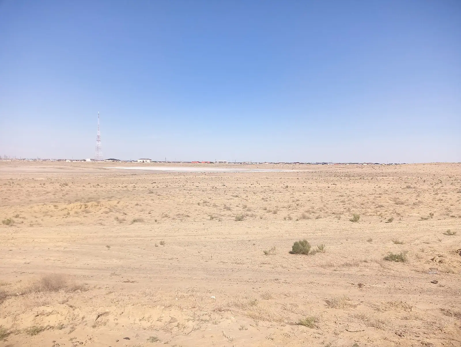
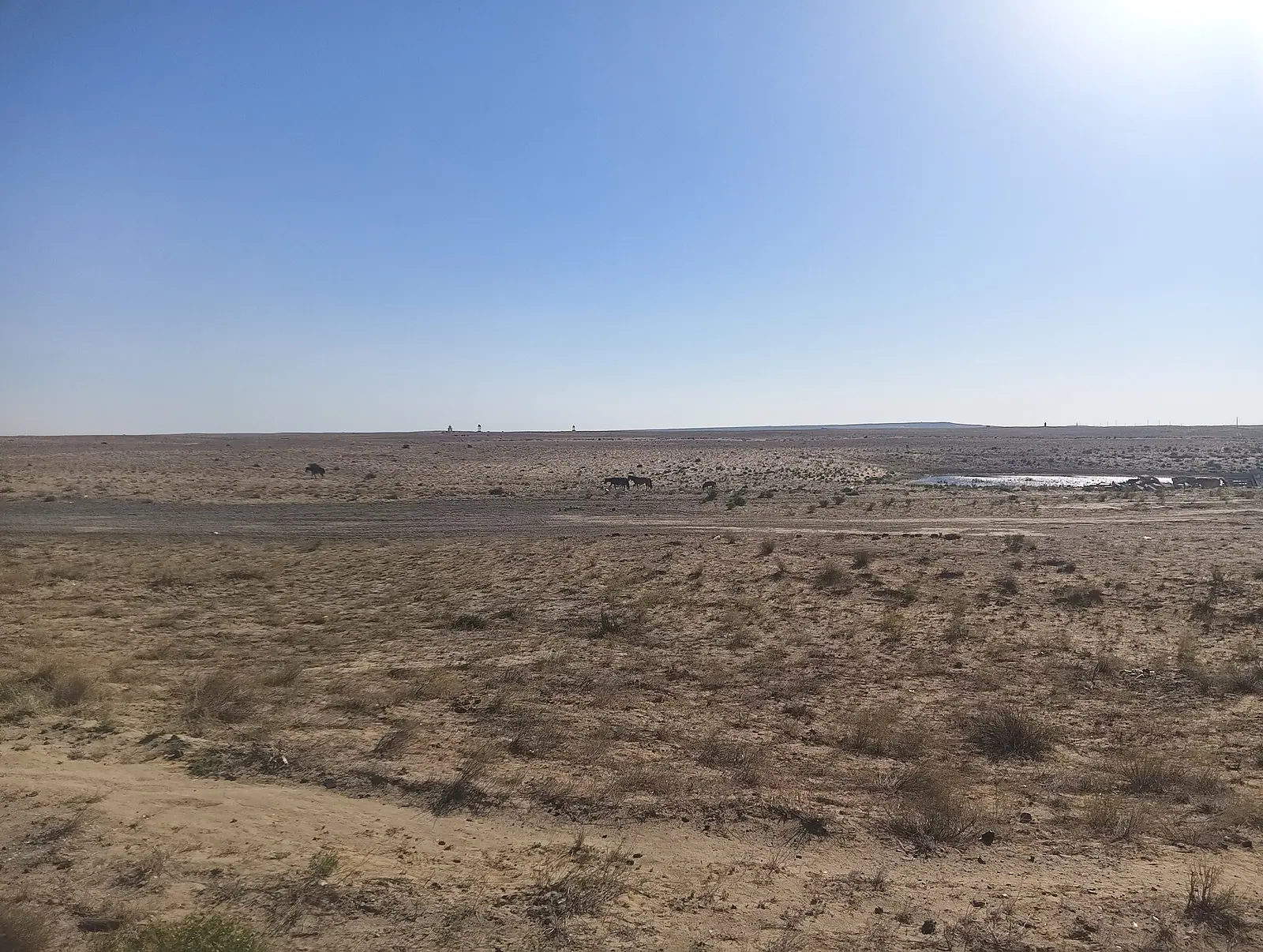
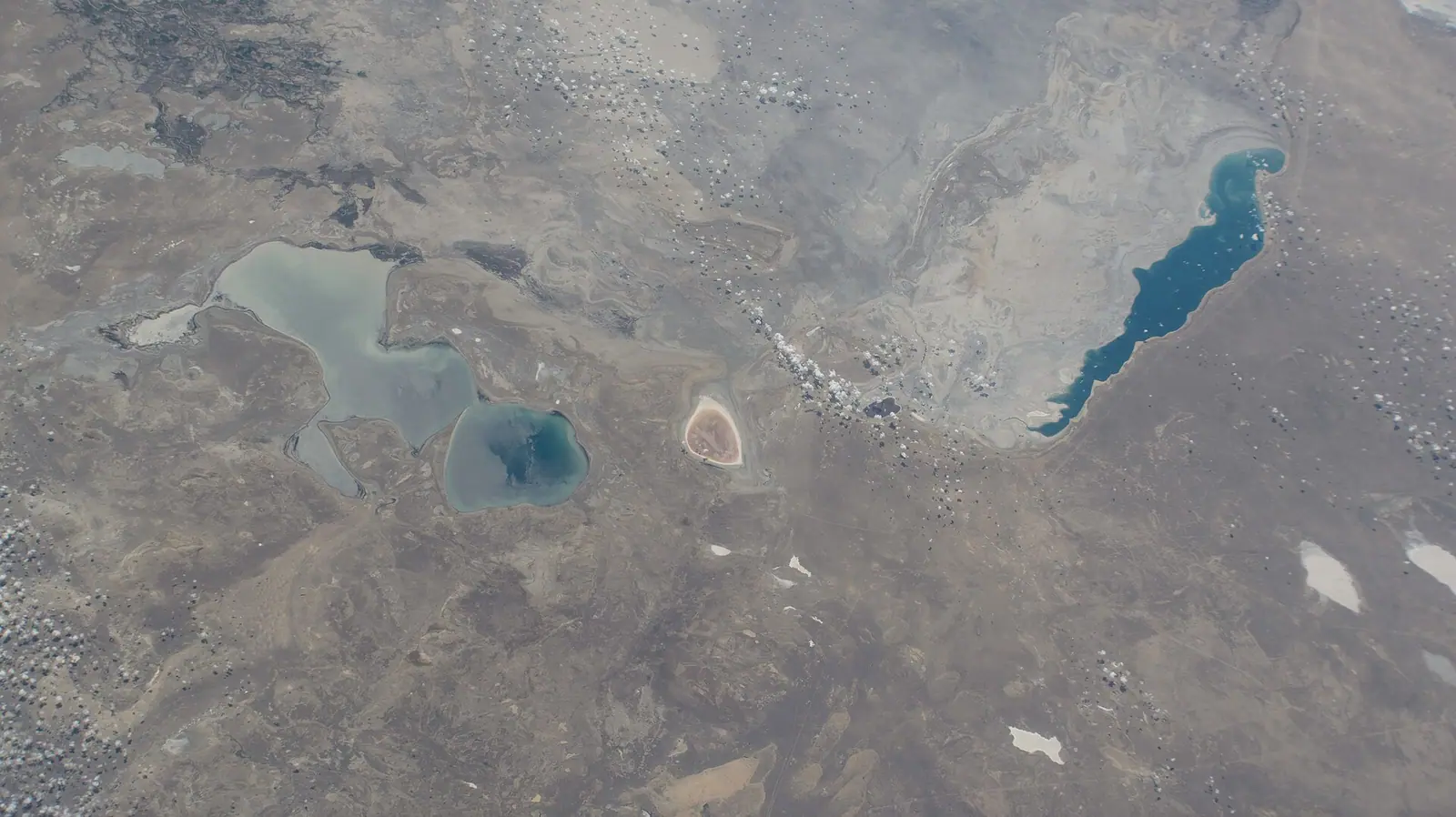
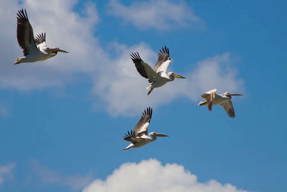
Real photos by travellers (Pexels, Unsplash, Wikimedia Commons); author and licence are given in each caption.
Ostrov Barsakelmes, Kazakh for roughly “if you go, you won’t come back”, was once the largest island in the Aral Sea and is now a stretch of land on the dried sea floor in the Aral District of Kyzylorda Region. It contains the Barsakelmes Nature Reserve. It suits travellers interested in the Aral Sea disaster, desert landscapes and Soviet-era folklore. We could not confirm how visitors reach it or what permission they need.
Where Barsakelmes is and what kind of trip it means
Barsakelmes lies in the Aral District of Kyzylorda Region, about 180 km southwest of the town of Aralsk according to Russian Wikipedia. The city of Kyzylorda is about 445 km away in a straight line, and Aktobe about 556 km. The remaining part of the Aral Sea is about 94 km away in a straight line.
This is a remote desert destination, not a stop on a standard route. We could not confirm any public transport, road condition, ranger post or visitor programme. Someone with no car and no Russian should treat it as an expedition-style trip that should be arranged in advance, ideally by contacting the reserve. Without confirmed access the trip may be wasted.
From island to peninsula to dry ground
The sea around it has changed, and with it the size of the land. In the 1960s the island measured about 23 by 7 km (Russian Wikipedia), while Kazakh Wikipedia gives 28 by 8 km and an area of 133 km² for 1987. As the Aral shrank, Barsakelmes grew. Russian Wikipedia says it became a peninsula in 1997 and measured about 40 by 16 km in the early 2000s.
Sources disagree on what came next. Russian Wikipedia says it stopped being a peninsula in summer 2009 when the eastern part of the Large Aral dried out, reappeared as one in 2010, disappeared again in 2014 and has been a peninsula since 2015, with the shoreline peaking in the wet years of 2017 and 2020. Kazakh Wikipedia says it lost peninsula status from 2009 and is now a hill on the former sea bed. Expect the shoreline to vary year to year.
| Feature | Figure |
|---|---|
| Size in the 1960s | 23 × 7 km (ru) or 28 × 8 km (kk) |
| Area, 1980s | 133 km² |
| Highest point | 108 m (ru) or 113 m (en, kk; Shagalaly hill) |
| Became a peninsula | 1997 |
| Early 2000s size | about 40 × 16 km |
| Historical name | Suzhok, “waterless” |
What the landscape and wildlife look like
The south is a raised plateau. The north is a gently rolling plain cut by dry stream valleys. Soils are grey-brown, with patches of sand, takyr clay flats and saltpans, and the old sea floor around it is salt marsh. Kazakh Wikipedia notes rocky cliffs on the west coast and a flat eastern shore, with saxaul, wormwood and other salt-tolerant shrubs.
On animals, Kazakh Wikipedia says that as the sea dried and the soil turned saline, saiga, kulan (Asian wild ass), goitered gazelle and hares were moved to the Kapshagai hunting reserve and to the Ustyurt Reserve. We could not confirm which large mammals live in the reserve today. A jumping spider, Sitticus barsakelmes, was named after the island in 1998.
The salt deposits matter in practice: English Wikipedia advises visitors to close their eyes during dust storms and strong winds.
The legend of the place of no return
The name comes with a story of people who went to the island and returned years later, believing only two or three days had passed. In the late Soviet era the tale grew into reports of a prehistoric flying lizard, UFO landings and broken time, peaking in the early 1990s with an article in the magazine Tekhnika Molodyozhi.
It was a hoax. Science fiction writer Sergey Lukyanenko, then in Almaty, and Grigory Neverov of a Moscow fantasy fans’ club later admitted fabricating letters from fishermen. Tracing it back, they found that the original newspaper story was itself a journalist’s joke; Lukyanenko said it dates to a 1950s piece in the paper Leninskaya Smena. Kazakh Wikipedia also records a gentler legend of a clan led by Latpay who crossed the ice to the island and prospered.
The real history is plainer. Geographer A. Maksheyev and topographer A. Akishev surveyed the island in August 1848, and Taras Shevchenko made the first sketches of its plants and animals. Boris Lavrenyov set his 1924 novella The Forty-First here.
When to go to Barsakelmes
The climate is sharply continental and very dry, and the short spring and autumn windows are the realistic choice. The figures below are ERA5 reanalysis normals for 2011–2020 at a grid point at 101 m, close to the reserve’s own height, not a weather station.
Day high, °C / Night low, °C · Rain/snow, mm
A computed reanalysis normal for these coordinates, not weather station records.
Monthly figures
| Month | Day high, °C | Night low, °C | Rain/snow, mm |
|---|---|---|---|
| Jan | -4.4 | -9.4 | 14 |
| Feb | -3.7 | -10.2 | 8.4 |
| Mar | 5.1 | -2.5 | 23.9 |
| Apr | 14.5 | 6.2 | 17.7 |
| May | 23.9 | 14.5 | 8.3 |
| Jun | 29.5 | 20.5 | 3 |
| Jul | 32.3 | 23.3 | 2.6 |
| Aug | 30.3 | 21.2 | 4 |
| Sep | 23.1 | 14.5 | 5.2 |
| Oct | 13.9 | 6 | 10.5 |
| Nov | 3.7 | -2.1 | 16.2 |
| Dec | -2.5 | -7.4 | 14.1 |
May and September are the most comfortable: daytime highs around 22–23 °C and nights near 15 °C. April and October are cooler at about 13 °C by day. July averages 31.5 °C by day and stays above 24 °C at night, and Russian Wikipedia records an absolute maximum of +44 °C. From December to February days stay below freezing, with a recorded minimum of −36 °C. June to August bring under 5 mm of rain a month, so there is almost no relief from heat or dust.
| Period | Conditions | Verdict |
|---|---|---|
| Dec–Feb | Below freezing day and night | Not sensible |
| Mar, Nov | Near freezing, wettest months | Marginal |
| Apr–May, Sep–Oct | Mild days, cool nights | Best window |
| Jun–Aug | Hot, almost no rain | Only with shade and water planned |
The annual total is small either way: about 130 mm in the reanalysis, 128 mm per Russian Wikipedia, 100–120 mm per Kazakh Wikipedia.
Combining it with other places
Barsakelmes is probably best seen as part of a wider Aral Sea trip. The Aral Sea page covers the shrinking sea itself. The Baikonur cosmodrome is about 266 km away in a straight line, in the same region. Other sites on this guide are 600 km or more away.
For a summer swim in Aral District, people usually go to Lake Kambash, though its level changes from year to year.
- Whether the Barsakelmes Nature Reserve admits independent visitors and what permit is required
- Road condition and travel time from Aralsk to the reserve
- Which large mammals, such as kulan or saiga, live in the reserve today
- Whether any accommodation, water or ranger facilities exist on site
Barsakelmes: tips before you go
- Close your eyes during dust storms: the dried sea floor around Barsakelmes is salt marsh and the wind carries salt dust.
- Plan for May or September: highs near 22 °C, while July averages 31.5 °C and has had records of +44 °C.
- Expect the shoreline to differ from maps: Barsakelmes has switched between island, peninsula and dry ground since 1997.
- Contact the reserve before travelling, since we could not confirm visitor access, permits or transport from Aralsk.
More to see nearby


Frequently asked questions
What animals were bred in Barsakelmes?
What does Barsakelmes mean?
Is Barsakelmes still an island?
Are the Barsakelmes time and UFO stories true?
How high is Barsakelmes?
Sources
Read also
 Almaty Zoo in Kazakhstan: opening hours and how to visit
 Ayusai Gorge, Almaty: visitor centre and waterfall trail
 Gorelnik Gorge above Medeu: waterfalls, trail and season
 Kamenskoe Plateau above Almaty: observatory and trails
 Pervomaiskie Ponds near Almaty: location, swimming, season
 Saty village: base for the Kolsai and Kaindy lakes