- Getting there
- Kyzylorda: ~12 h by train
- When
- May, Sepbest timeNow: possible
- Lake
- Sea now 12–25 km away
- History
- Railway station since 1905
- Good to know
- 36,004 people (2021)
- Good to know
- Seabed: go with a driver
Aralsk (Aral), Kazakhstan: when to go, month by month
November · now- January: off season
- February: off season
- March: possible
- April: good
- May: best time
- June: possible
- July: possible
- August: possible
- September: best time
- October: good
- November: possible
- December: off season
May and September bring dry 25–27 °C days; summer reaches 34 °C with no shade on the seabed, and winter nights fall to about −14 °C.
Aralsk (Aral), Kazakhstan: why go
Ships on the old seabed
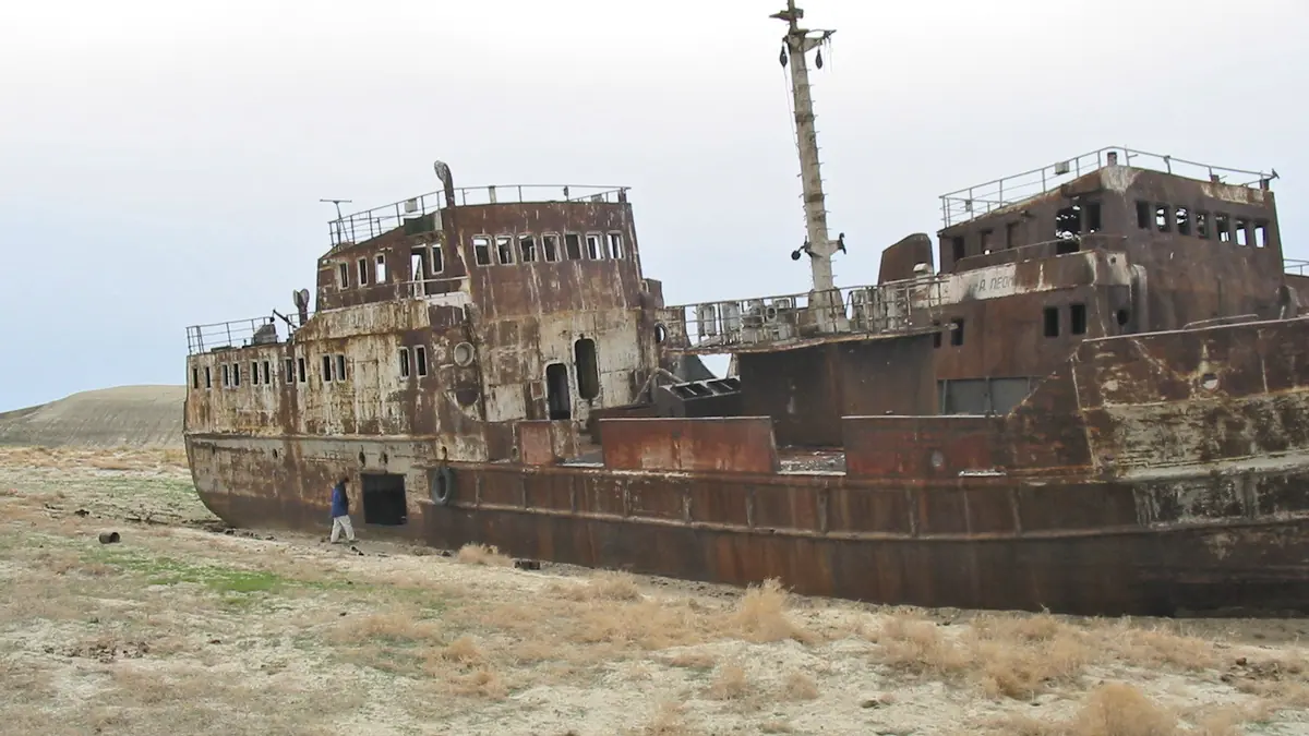
Abandoned boats lie on the dry seabed by the old harbour near the centre, and a jeep reaches a ship cemetery or the water in about half an hour (Wikivoyage).
Aral Fishermen's Museum
Opened in 2013 with over 2,000 items. The star piece is a 1921 lathe sent in thanks for 14 wagons of fish shipped to famine-hit Russia.
The sea is coming back
Since the 2005 Kokaral dam the North Aral Sea has risen, and the shore that once lay 100 km away has moved back towards town.
A dry climate
About 135 mm of precipitation a year. July highs average 34.2 °C, and September sees only about 4 mm.
Aralsk (Aral in Kazakh) is a small town in Kyzylorda Region that grew up as a fishing port on the northern shore of the Aral Sea. As the sea shrank from the 1960s, the water pulled back by about 100 km and left boats stranded on the seabed. It is now the main Kazakh base for seeing what happened to the Aral and how the northern part is recovering.
Where Aralsk is and how far the sea is now
The town sits in the north-east of the Aral basin at 57–60 m above sea level (46°48′N, 61°40′E). It is the administrative centre of Aral District and had 36,004 residents at the 2021 census.
The distance to the water is the question everyone asks, and the answer keeps changing. Before 2005 the shore lay roughly 100 km away. Then the Kokaral dam sealed off the North Aral Sea and its level rose. English Wikipedia now puts the shore about 12 km from town; Russian Wikipedia, in its article on the dam, says 25 km. We found no recent measurement, so treat both as rough.
For the sea itself, its history and the reasons it dried up, see our page on the Aral Sea and the before-and-after analysis.
A short history: railway town, then fishing port
Reliable records of the settlement start in 1900, the year of surveys for the Orenburg–Tashkent railway (built 1899–1905). When the station opened in 1905, merchants founded the Khiva fishing company that same year and began commercial fishing on the Aral. Renamed Aralsk after the revolution, it became a city in 1938. By Soviet times it was a port. According to Russian Wikipedia, the Aralrybprom association processed 45% of the whole Aral catch.
Kazakh newspapers still retell the story of the 14 wagons of fish that Aral fishermen sent to famine-hit Russia in the early 1920s. In return, says Kazakhstanskaya Pravda, the town received lathes and milling machines for its ship repair yard. One of those lathes is now in the museum.
What to see: the ship graveyard and the fishermen’s museum
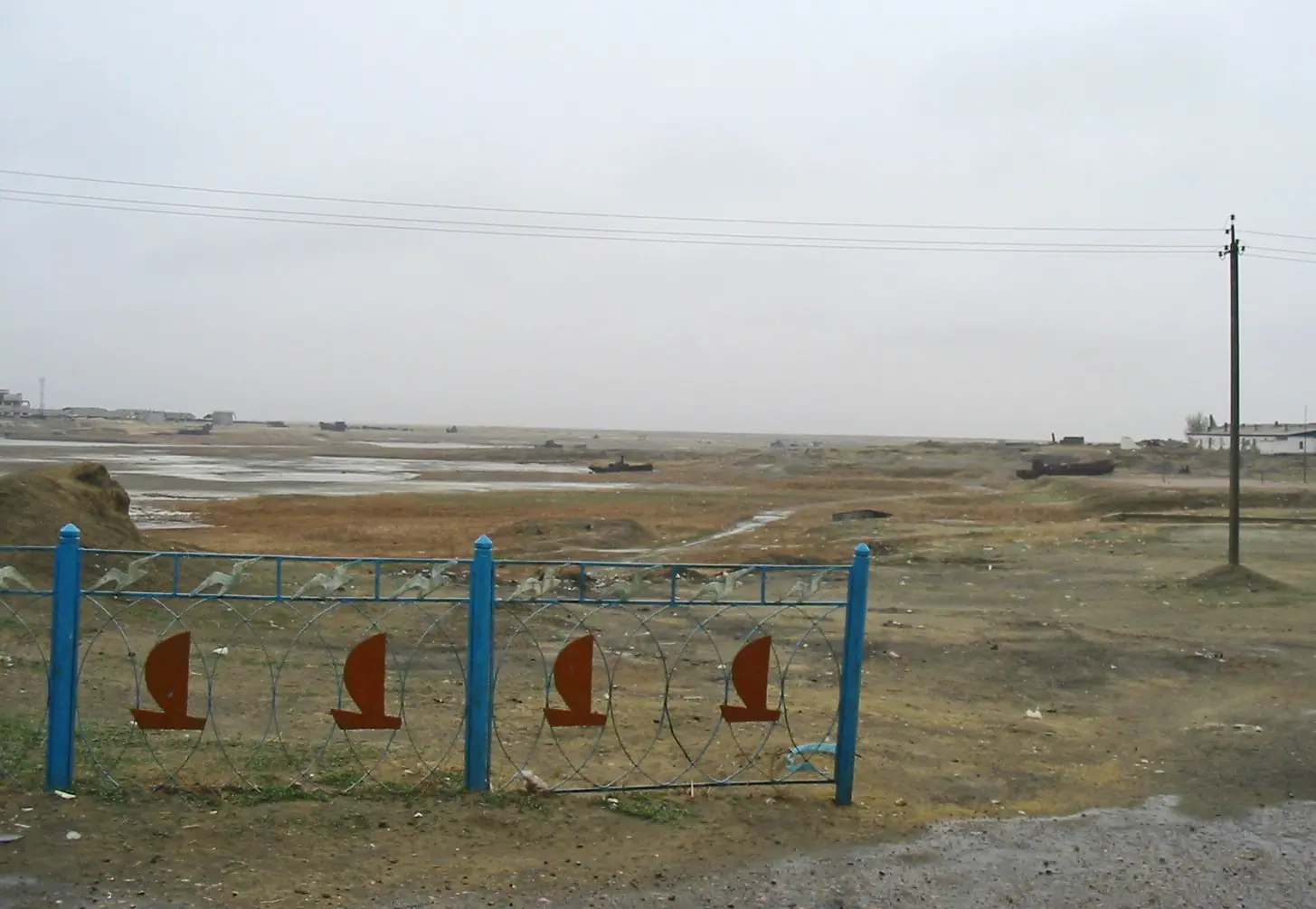
- The old harbour. Wikivoyage says it is a short walk from the centre and that you can walk out to abandoned ships on the dry seabed.
- The ship cemetery and the water. By jeep, a ship cemetery or the shore is about half an hour away (Wikivoyage). Go with a local driver: there are no marked roads on the old seabed.
- Aral Fishermen’s Museum. Opened in 2013 as a branch of the district museum, it holds over 2,000 items: nets, documents, photographs and machinery (Kazakhstanskaya Pravda). The star exhibit is the 1921 lathe, which worked in the ship repair shops for more than 30 years. Outside stand restored boats, including the launch Tolegen Toktarov, in service from 1953 to 1983, and a rescue boat, plus the sledges that carried winter catches behind camels and horses. Opening hours and ticket prices were not published that we could find.
Aralsk weather by month
Aralsk has a dry continental climate with about 135 mm of rain and snow a year. The chart shows long-term averages from the town’s weather station, not a forecast. For the next few days, check Kazhydromet or any weather service.
Day high, °C / Night low, °C · Rain/snow, mm
Averages over the full record of the Aral weather station (running since 1884), via the Pogoda i Klimat site. Station records run from −37.9 °C (January 1969) to +44.8 °C (July 1984).
Monthly figures
| Month | Day high, °C | Night low, °C | Rain/snow, mm |
|---|---|---|---|
| Jan | -6.8 | -14.4 | 11 |
| Feb | -4.9 | -13.6 | 11 |
| Mar | 5.3 | -4.4 | 16 |
| Apr | 18.2 | 5.8 | 14 |
| May | 26.5 | 12.7 | 13 |
| Jun | 32.4 | 18.4 | 12 |
| Jul | 34.2 | 20.5 | 8 |
| Aug | 32.6 | 18.4 | 6 |
| Sep | 25.2 | 11.2 | 4 |
| Oct | 15.8 | 3.3 | 11 |
| Nov | 4 | -4.4 | 14 |
| Dec | -4.2 | -11.4 | 13 |
Source: Погода и климат — климат Аральска, метеостанция 35746
| Season | Day | Night | For your trip |
|---|---|---|---|
| Winter (Dec–Feb) | −7 to −4 °C | −14 to −11 °C | frost, wind, short days |
| Spring (Apr–May) | 18–27 °C | 6–13 °C | best time for seabed trips |
| Summer (Jun–Aug) | 32–34 °C | 18–21 °C | hot, no shade on the seabed |
| Autumn (Sep–Oct) | 16–25 °C | 3–11 °C | dry, second good window |
July is the hottest month, with an average high of 34.2 °C and a station record of 44.8 °C. January averages −6.8 °C by day and −14.4 °C at night. September is the driest month, with about 4 mm.
Getting to Aralsk
The town is on the Orenburg–Tashkent line, and the station is called Aralskoe More. Wikivoyage gives about 12 hours by train from Kyzylorda and about two days from Astana. Book through KTZ, the national railway, and check our page on trains in Kazakhstan. The station is about 15 minutes’ walk from the centre, and the town is small enough to explore on foot.
Day trips from Aralsk
- North Aral Sea. The nearest living water, reached by 4x4 across the old seabed.
- Kokaral dam. About 196 km and roughly 3 hours away, says the welcome.kz portal. See our Kokaral dam guide.
- Barsakelmes. A nature reserve on a former island: Barsakelmes.
- Baikonur. The cosmodrome lies further east along the same railway, with its own entry rules: Baikonur.
Archaeologists also work at the medieval sites of Kerderi-1, Kerderi-2 and Zhankent, which appeared when the water retreated (district tourism office, quoted by Zakon.kz in 2025).
Aralsk (Aral), Kazakhstan: tips before you go
- Aim for May or September: warm days and almost no rain.
- Go to the water and the ship cemetery by 4x4 with a local driver: there are no marked roads on the seabed.
- Check trains to Aralskoe More station with KTZ before you book.
More to see nearby
- Kokaral Dam (Kok-Aral dike) The Kokaral dam, a 13 km earth dike finished in 2005, stopped the Syr Darya's water draining …


Frequently asked questions
How far is Aralsk from the Aral Sea today?
Is there a ship graveyard in Aralsk?
How do I get to Aralsk by train?
What is the weather like in Aralsk?
Do I need a guide to reach the water from Aralsk?
Sources
- Aral, Kazakhstan — Wikipedia
- Аральск — Wikipedia (Russian)
- Aral — Wikivoyage
- Kokaral dam — Wikipedia (Russian)
- O, more, more! (Aral fishermen's museum) — Kazakhstanskaya Pravda, 31.03.2022
- Mars next door: travelling around the Aral region — Zakon.kz, 21.10.2025
- Climate of Aralsk, station 35746 — Pogoda i Klimat
- Weather forecast — Kazhydromet
Read also
-
The Aral Sea in Kazakhstan: where it lies, what is left and how to reach it
- Kokaral Dam (Kok-Aral dike): how it saved the North Aral Sea and how to get there
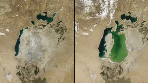 Aral Sea before and after: area and volume from 1960 to 2026
 Things to do in Kyzylorda, the desert city on the Syr Darya
- Astana Grand Mosque: visiting the largest mosque in Central Asia
- Baikonur launch: how tourists watch a rocket lift off