- Getting there
- Almaty about 630 km, 9–10 h
- When
- Jul–Augbest timeNow: off season
- Lake
- Area 2,696 km²
- Size
- Up to 54 m deep, 22 m average
- Water
- Brackish water, not drinkable
- Winter
- Frozen January to April
- Note
- Border area: carry your passport
Lake Alakol: when to go, month by month
November · now- January: off season
- February: off season
- March: off season
- April: off season
- May: possible
- June: good
- July: best time
- August: best time
- September: good
- October: possible
- November: off season
- December: off season
Swimming runs from June to mid-September; July days reach about 31 °C and the water warms to 24–26 °C. From January to April the lake is frozen.
Lake Alakol: why go
A lake at 343 m
An endorheic lake 104 km long and up to 52 km wide, on the border of the Abai and Zhetysu regions, with 348 km of shoreline.
July is the warmest month
ERA5 reanalysis for 2011–2020 gives July an average high of 31.2 °C and a low of 21.7 °C. August is slightly cooler at 29.8 and 19.6 °C.
Water with radon, fluorine and bromine
The water is classed as balneological, with raised radon, fluorine and bromine and a sodium-chloride make-up. It is not drinkable.
Two shores, two routes
Akshi and Koktuma sit on the south-west side in Alakol district. Kabanbay is on the north-east side in the Abai region, near the Barlyk-Arasan spa.
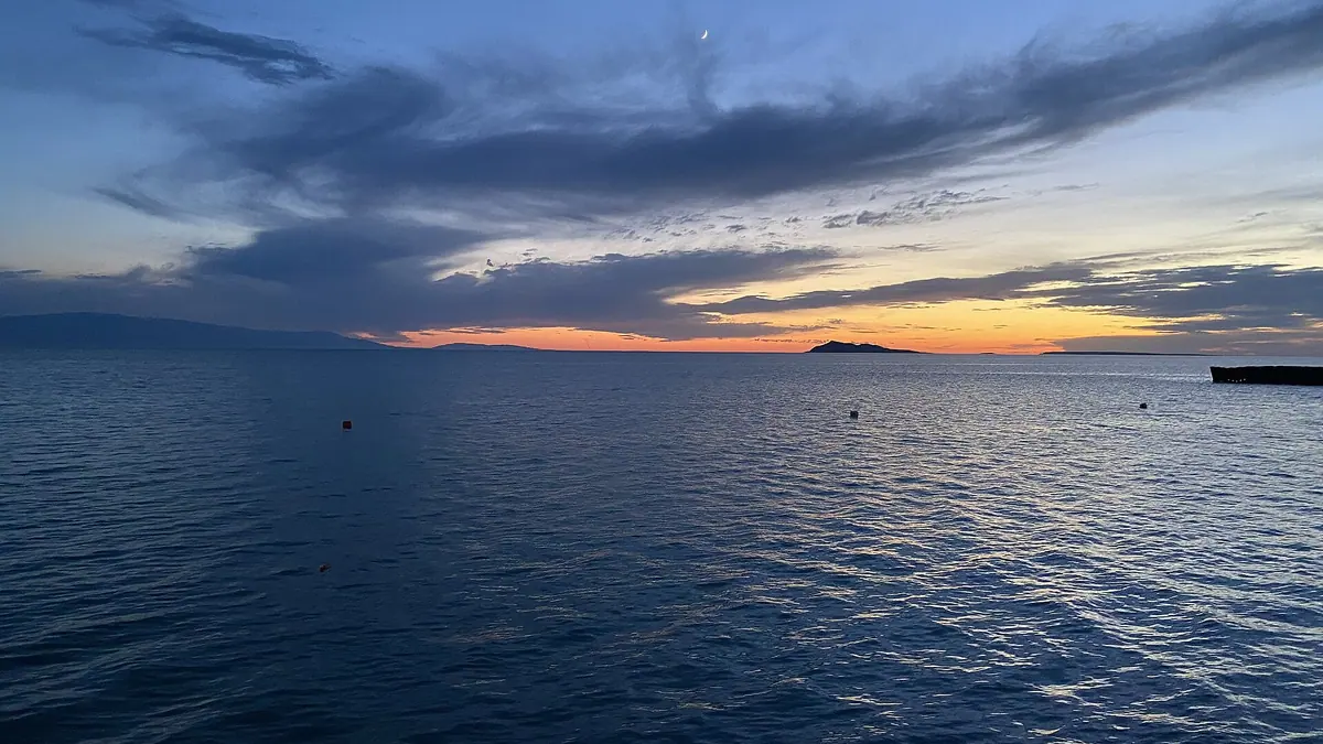
Lake Alakol is a brackish, endorheic lake in eastern Kazakhstan, on the border of the Abai and Zhetysu regions and about 60 km from China. It covers 2,696 km² and is up to 54 m deep. Swimming season runs from June to mid-September, when the water reaches 24–26 °C, and the lake is roughly 630 km by road from Almaty.
Where Lake Alakol is
Alakol lies in the Balkhash-Alakol basin between the Tarbagatai range to the north and the Dzungarian Alatau to the south. To the south-east begins the Dzungarian Gate, a narrow valley leading into China. A regional border runs across the water: the northern and eastern shores belong to Urzhar district of the Abai region, the southern and western shores to Alakol district of the Zhetysu region.
| Measure | Value |
|---|---|
| Area with islands | 2,696 km² |
| Length / width | 104 km / up to 52 km |
| Depth max / average | 54 m / 22 m |
| Elevation | 343 m |
| Shoreline | 348 km |
Figures from Russian Wikipedia; English Wikipedia lists 2,650 km². The level swings by about 1.2 m within a year. Five rivers flow in and none flows out. The name comes from Kazakh ala köl, “the many-coloured lake”.
The lake system and its fish
Alakol is the largest of a chain of lakes. Together with the shallow Sasykkol, Koshkarkol and Zhalanashkol it forms a system whose catchment reaches 55,000 km², and Sasykkol and Koshkarkol are linked to Alakol by channels. Zhalanashkol, to the south-east near the Dzungarian Gate, also gives its name to the railway station used by summer trains.
A legend from the time of Timur calls the lake “It-Ichmes”, “the one a dog will not drink”, because of its salty water. Commercial fishing goes on: Russian Wikipedia lists marinka, gubach, perch, zander, bream and carp. Rules for recreational anglers, licences and closed seasons are explained on our fishing in Kazakhstan page.
Weather at Alakol by month
The lake sits in a semi-desert: hot dry summers and freezing winters, with ice from January to April. The chart shows computed ERA5 normals for 2011–2020 at a point by the lake, not a forecast.
Day high, °C / Night low, °C · Rain/snow, mm
A computed reanalysis normal for these coordinates, not weather station records.
Monthly figures
| Month | Day high, °C | Night low, °C | Rain/snow, mm |
|---|---|---|---|
| Jan | -6.4 | -12.9 | 20.8 |
| Feb | -3.3 | -10.8 | 15.4 |
| Mar | 6.7 | -2.6 | 18.8 |
| Apr | 17.5 | 7.3 | 26.1 |
| May | 24 | 14.1 | 23.5 |
| Jun | 29.3 | 20.1 | 19.6 |
| Jul | 31.2 | 21.7 | 14.1 |
| Aug | 29.8 | 19.6 | 14.7 |
| Sep | 23.9 | 13.7 | 16.1 |
| Oct | 15.5 | 6.5 | 24.2 |
| Nov | 4.6 | -2.3 | 31.4 |
| Dec | -2.7 | -9 | 19 |
Source: Open-Meteo, ERA5 reanalysis, 2011–2020
| Month | Day | Night | Swimming |
|---|---|---|---|
| June | 29.3 °C | 20.1 °C | season opens |
| July | 31.2 °C | 21.7 °C | peak |
| August | 29.8 °C | 19.6 °C | peak |
| September | 23.9 °C | 13.7 °C | until mid-month |
July is the hottest month, with nights averaging 21.7 °C. May is still too early for the beach (the season starts in June), and by late September the water is cooling. Rain is scarce all summer, around 14–20 mm a month.
The water: salt, temperature, depth
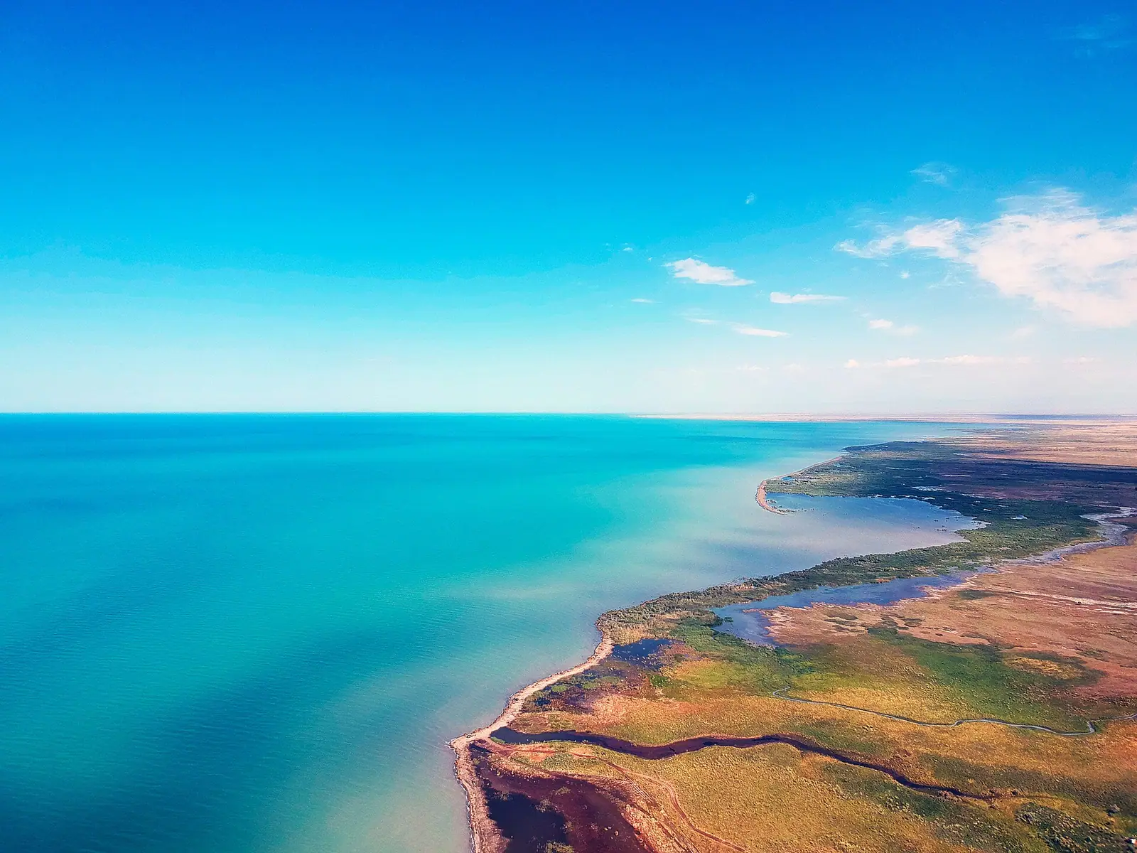
The water is brackish and very hard, and it is not drinkable. A 2006 study by Kazhydromet researcher A. S. Aktymbaeva notes that mineralisation rises from the river mouths towards the centre of the lake, with the freshest water by the Urzhar mouth in the north-west. There is no single salinity figure for the whole lake, so we do not give one.
Russian Wikipedia classes the water as balneological, with raised radon, fluorine and bromine and a sodium-chloride make-up. That is where the local reputation as a “healing lake” comes from; we have not checked any medical claims. Clarity grows from 0.6–0.8 m in the shallow north-west to 6 m or more in the centre (Aktymbaeva).
Choosing a shore: Akshi, Koktuma or Kabanbay
| Village | Shore | Region | Nearest airport |
|---|---|---|---|
| Akshi | south-west | Zhetysu | Ushral, ~70 km |
| Koktuma | south-west | Zhetysu | Ushral |
| Kabanbay | north-east | Abai | Urzhar |
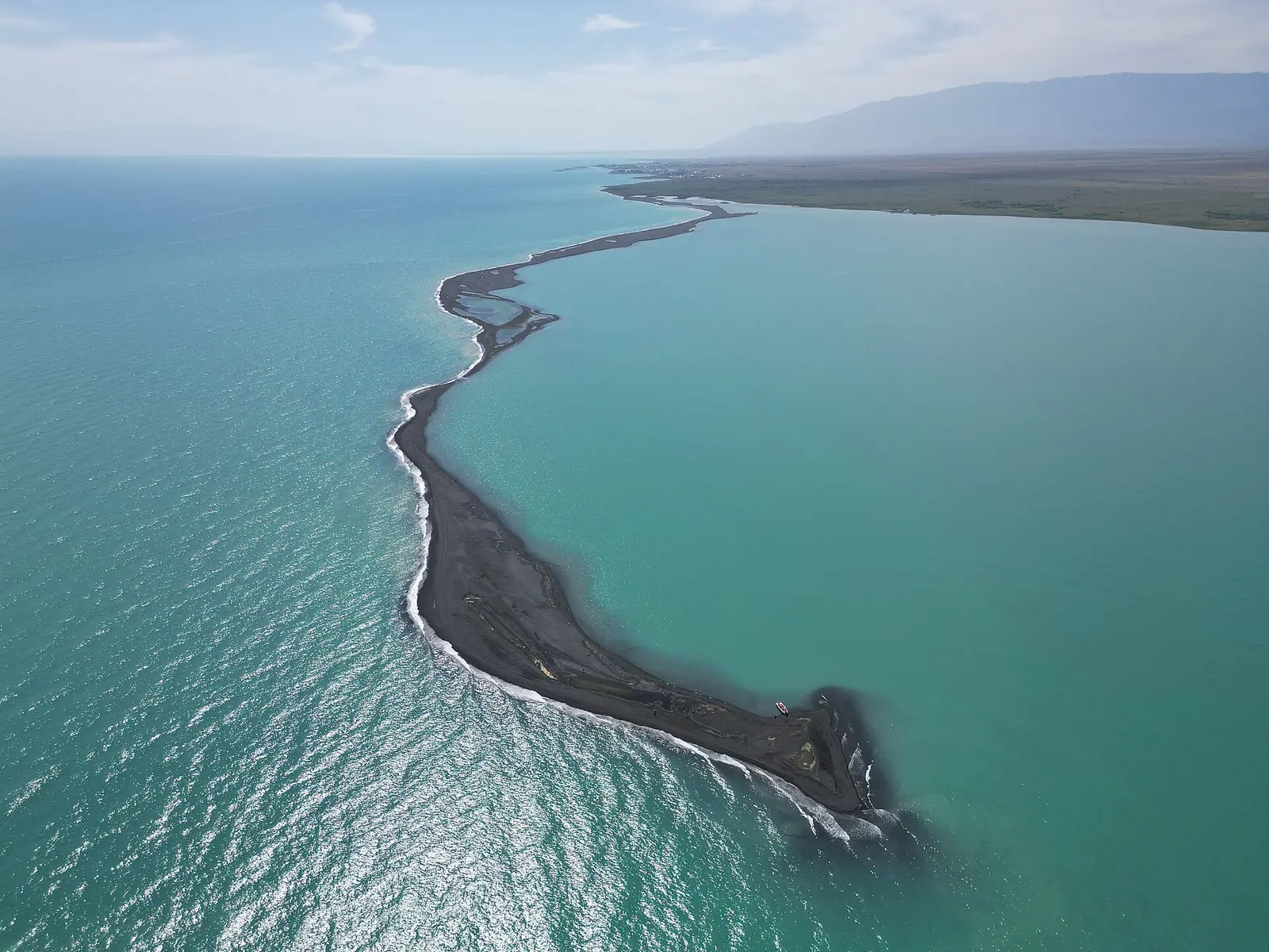
Akshi and Koktuma are the classic resort villages on the south-west side, reached by summer trains and by tourist buses from Almaty. Kabanbay, on the north-east shore, is the natural choice if you drive from Astana or Semey, and it puts you about 15 km from Barlyk-Arasan, a spa with hot springs.
We do not list or recommend specific places to stay. If you are weighing Alakol against other beach lakes, see Alakol, Balkhash or Kapshagay.
Getting to Alakol
By car from Almaty it is about 630 km via Taldykorgan, 9–10 hours (WE project, May 2026). From Astana the road runs through Semey and Makanchi, about 1,200 km in total. Our distance tool gives road distances from other cities.
By train, Kazakhstan Railways adds summer services to stations on the southern shore, and a seasonal train runs from Astana to Dostyk. Numbers and days change every season; see trains to resorts. The summer 2027 timetable has not been published yet.
By air, summer flights from Almaty reach Ushral in about an hour; Akshi is about 70 km from the airport. For Kabanbay, fly to Urzhar. WE project reports that local mobile coverage by the shore is patchy, so arrange your transfer before you land.
Border zone rules
Alakol is near the Chinese border, but you do not need a border permit for the beaches. Government Decree No. 356 exempts the whole Alakol district and an 8 km stretch of the Alakol shore in Urzhar district from the permit regime. Carry your passport anyway. Where permits are required, and how to get one, is covered in our guide to the border zone.
The islands and the nature reserve
The islands in the north-east of the lake and the Tentek delta belong to a strict nature reserve. Landing on the Araltobe islands is banned from May to September, with a 2 km buffer zone; boat trips “to the islands” in that period break the rules. The reserve, and how to visit it legally, has its own page: Alakol Nature Reserve. The resort beaches are outside the reserve.
Prices and money
There is no entry fee for the lake or its public beaches; the protected-area tariff applies only to the nature reserve. Prices for rooms, food and transfers vary by shore and month, and we do not quote them because they change every season. Bring some cash in tenge: we could not confirm that every guesthouse on the shore takes cards. For general advice on cards, cash and exchange, see money in Kazakhstan.
Alakol with children
- Go in late June or August if July heat (about 31 °C by day) is too much for small children.
- Bring shade: a tent or umbrella.
- Watch children in the water at all times; the lake is deep, 22 m on average, and we found no evidence of lifeguards on every beach.
- Carry drinking water, as the lake water is not drinkable.
For how summer demand for Kazakhstan’s resorts peaks week by week, see our summer peak study.
Lake Alakol: tips before you go
- Choose your shore before booking: Akshi and Koktuma are reached via Ushral, Kabanbay via Urzhar.
- Arrange transfers in advance: WE project reports patchy local mobile coverage by the shore.
- Do not boat out to the islands: landing is banned from May to September, with a 2 km buffer zone around them.
More to see nearby


Frequently asked questions
Where is Lake Alakol?
How warm is the water in summer?
Akshi or Kabanbay: which shore should I choose?
How long does it take to get to Alakol from Almaty?
Do foreigners need a border permit for Alakol?
Is Alakol worth it for a foreign traveller?
Sources
- Lake Alakol — Wikipedia
- Алаколь — Wikipedia (Russian)
- Aktymbaeva A. S. Hydroecology of the Alakol lakes — Hydrometeorology and Ecology (Kazhydromet), 2006, No. 2
- How to get to Alakol from Almaty and Astana — WE project, 30.05.2026
- What awaits tourists at Alakol — Zakon.kz
- Genghis Khan's favourite lake — Tengrinews
- Government Decree No. 356 of 16.04.2014 — border zone and exemptions
- Tourists banned from three Alakol islands — NUR.KZ, 2024
- Open-Meteo Historical Weather API: ERA5 reanalysis, 2011–2020
Read also
 Alakol
 Barlyk-Arasan hot springs near Lake Alakol: water, radon and what to ask
- Beach lakes in Kazakhstan: which lake suits a summer swim
 Aralsk (Aral), Kazakhstan: the former port, ship graveyard and how to get there
- Astana Grand Mosque: visiting the largest mosque in Central Asia
- Baikonur launch: how tourists watch a rocket lift off