Akzhaiyk Reserve: when to go, month by month
- January: off season
- February: off season
- March: possible
- April: good
- May: best time
- June: good
- July: possible
- August: possible
- September: best time
- October: good
- November: possible
- December: off season
May and September combine mild days of about 23-25 °C with low rain, while July is hot and dusty and December to February stay below freezing.
Akzhaiyk Reserve: why go
Migrating flocks at Akzhaiyk
Thousands of flamingos, Dalmatian pelicans and swans stop in the Ural Delta on the Siberia to East Africa flyway, with the threatened lesser white-fronted goose.
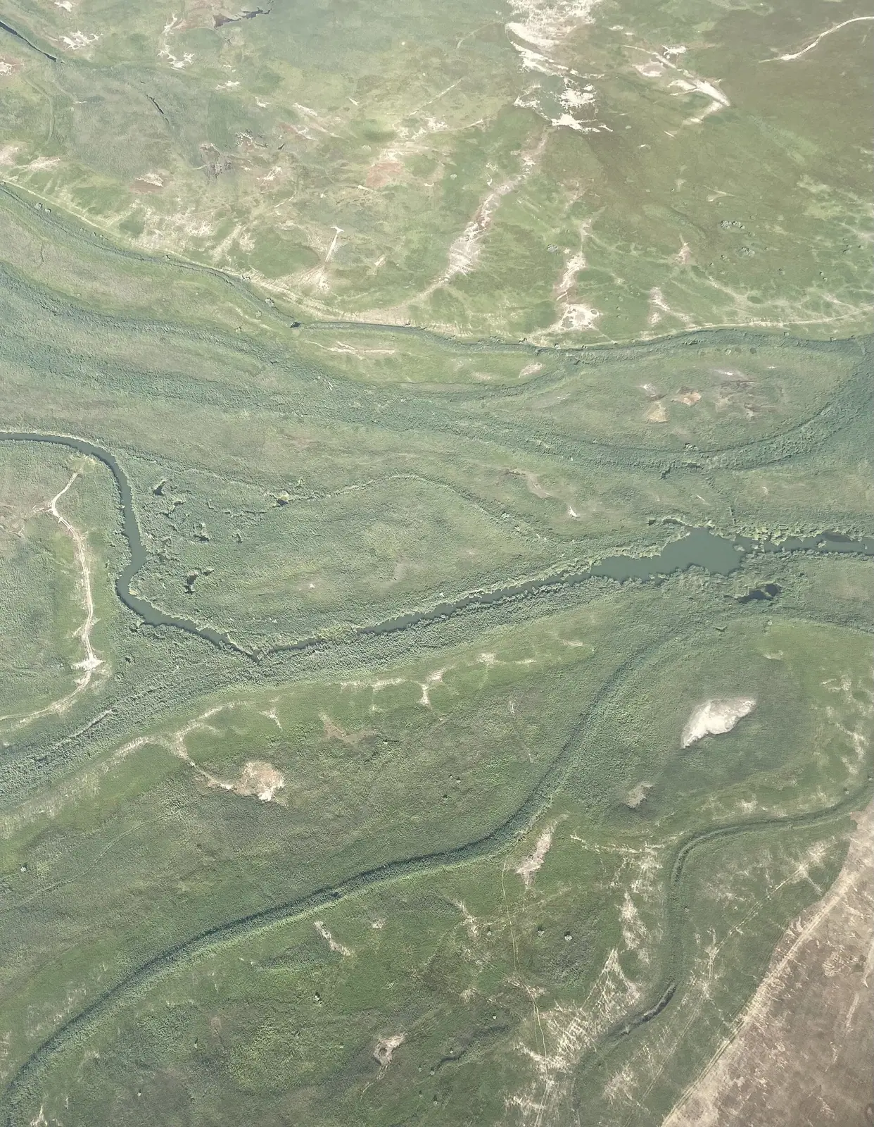
The Ural Delta wetland
Reed and bulrush stands, floating water lilies and water chestnut, and 130 plant species, about 54% of the flora of the Kazakh North Caspian.
A base in Atyrau
The reserve lies about 19 km in a straight line from Atyrau, in far western Kazakhstan, across the country from Almaty; access arrangements need confirming.
Spring flood on the Ural
The river rises from late April and peaks in late May or early June at 3-7 m above low water, then falls to its low in August and September.
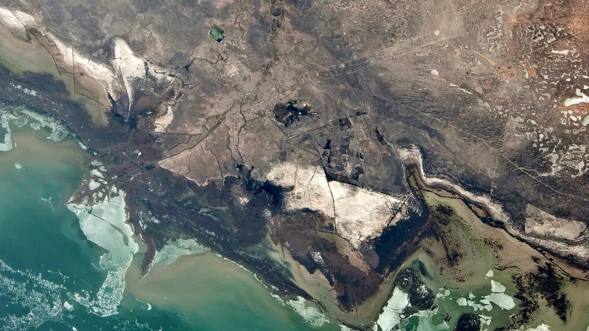
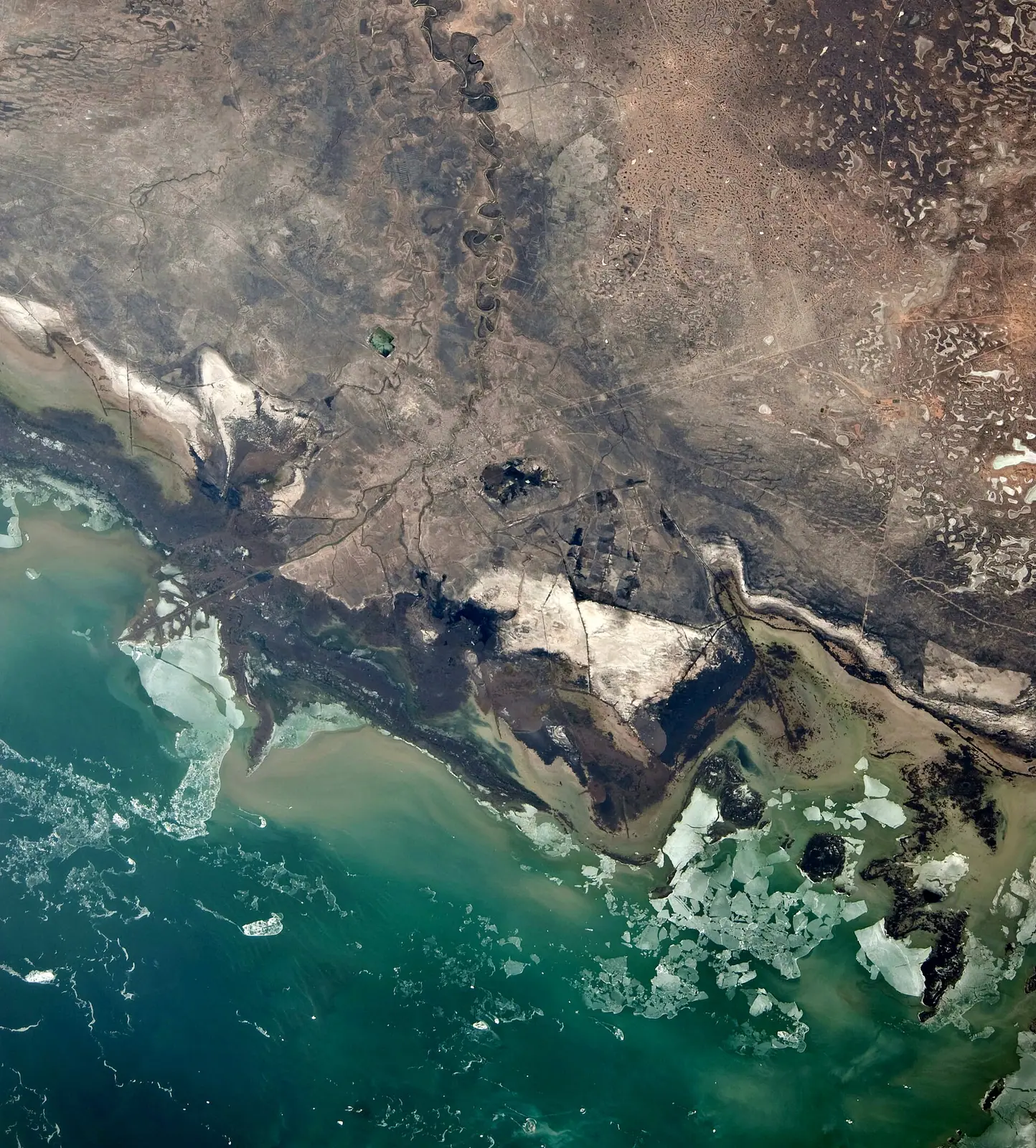
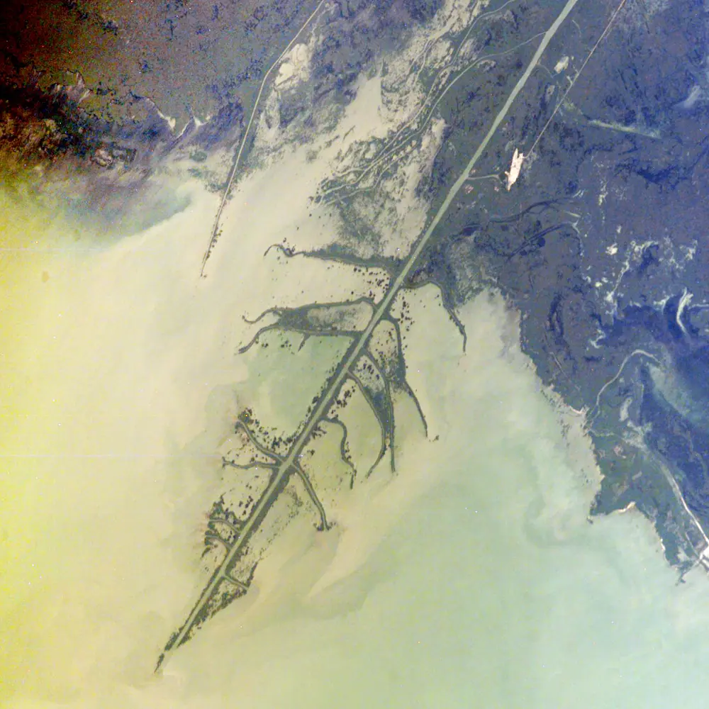
A Caspian shoreline that wanders
Wind surges shift the shoreline 3-5 km in normal conditions; in extremes the sea can flood 20-30 km inland for hours or days.
Akzhaiyk Reserve in photos
Real photos by travellers (Pexels, Unsplash, Wikimedia Commons); author and licence are given in each caption.
The Akzhaiyk Reserve is a protected wetland in the delta of the Ural River where it meets the Caspian Sea, about 19 km in a straight line from Atyrau in western Kazakhstan. It matters to birders above all: thousands of flamingos, Dalmatian pelicans and swans stop here on migration. This is a specialist trip far from Almaty and Astana, and the practical side of a visit is poorly documented.
Where the Akzhaiyk Reserve is and what it protects
The reserve lies in the Makhambet district of Atyrau region and on land belonging to the city of Atyrau, covering the Ural Delta and the neighbouring Caspian coast. The Kazakh name of the Ural is Zhaiyk, which is where the reserve takes its name. It is a long way from the usual Kazakhstan circuit: Atyrau is on the opposite side of the country from Almaty, and even Aktau on the Caspian is about 372 km away in a straight line.
| Key fact | Detail |
|---|---|
| Created | 6 February 2009, government decree No. 119 |
| Wetland of international importance | Listed 1 April 2009, second in Kazakhstan after the Tengiz-Korgalzhyn lakes |
| UNESCO biosphere reserve | Since 2014 |
| Plants | 130 species, about 54% of the flora of the Kazakh North Caspian |
| Mammals | 78 species |
| Elevation | Below sea level, around -26 m at the climate grid point |
For a traveller, the international listings tell you what kind of place this is: a working conservation area built around water and birds, not a scenic park with viewpoints and trails.
Birds are the main reason to come
The delta sits on the Siberia to East Africa flyway, and the bird list is what sets it apart. By Wikipedia, rare species include glossy ibis, Eurasian spoonbill, little egret, cattle egret and purple swamphen. During passage, thousands of flamingos, Dalmatian pelicans, Pallas’s gulls and swans stop over, along with the threatened lesser white-fronted goose.
The water itself carries a layer of life worth knowing about. Reed and bulrush stands grow above the surface, water lilies and water chestnut float on it, and hornwort and water-milfoil grow below. The regional list of endangered species counts 20 birds, 24 insects, 2 reptiles and 2 mammals, and sturgeon and the Caspian seal are described as on the verge of disappearing. We could not confirm which months the main flocks pass through, so check migration timing with a local birding contact before fixing dates.
A river and a sea that move under your feet
The shoreline here is not fixed, and that shapes any plan to reach the coast. The Caspian is shallow and flat at this end, so wind pushes water onto land or drains it away several times a month: on average 3-4 surges and 4-5 drawdowns. In ordinary winds the shoreline shifts 3-5 km; in extremes the sea can retreat 8-12 km or flood 20-30 km inland, for hours or for days.
| Period | River | Sea surges |
|---|---|---|
| Second half of April | Water starts to rise | April-May: 16.7% of the largest surges |
| Late May to first half of June | Flood peak, 3-7 m above low water | June-July: 21.3% |
| August-September | Low water | No figure given |
| October-November | Low water | 25.1%, the highest share |
The practical reading: autumn and early summer carry the most risk of sudden flooding on the coast, and late spring brings the highest river. The Caspian also rose sharply from 1978, by about 14 cm a year and up to 30 cm in some years, and has shown a falling trend since 2006, so older maps of the coastline may not match what you find.
When to go to the Ural Delta
Late spring and early autumn are the comfortable windows; midsummer is hot and winter is cold and windy. The figures below are computed ERA5 reanalysis normals for 2011-2020 at a grid point in the delta, not a weather station.
Day high, °C / Night low, °C · Rain/snow, mm
A computed reanalysis normal for these coordinates, not weather station records.
Monthly figures
| Month | Day high, °C | Night low, °C | Rain/snow, mm |
|---|---|---|---|
| Jan | -3 | -7.6 | 17.4 |
| Feb | -2.3 | -7.9 | 9.8 |
| Mar | 5.6 | -0.6 | 15 |
| Apr | 15.5 | 8 | 20.5 |
| May | 24.8 | 16.6 | 19.3 |
| Jun | 29.8 | 21 | 12.2 |
| Jul | 32.2 | 23.4 | 11.4 |
| Aug | 30.4 | 21.5 | 10.7 |
| Sep | 22.8 | 14.6 | 8.4 |
| Oct | 13.7 | 6.8 | 14.3 |
| Nov | 4.5 | -0.4 | 11.8 |
| Dec | -1.1 | -5.2 | 17.4 |
May averages highs around 25 °C and September around 23 °C, with nights of 15-17 °C. July peaks near 32 °C by day and stays above 23 °C at night, and the regional climate description adds dust storms on 20-30 days a year and summer humidity no higher than 37%. From December to February daytime highs stay below zero and nights fall to about -7 °C. Rain is scarce all year, roughly 150 mm annually, so the limit is heat, wind and cold rather than wet weather.
Getting there without a car or Russian
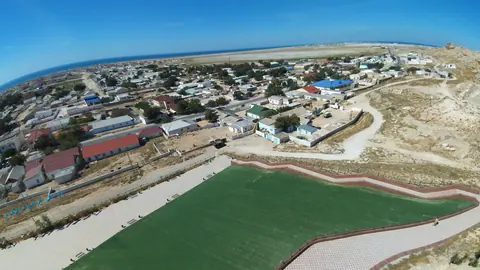
Atyrau is the only realistic base, about 19 km in a straight line from the reserve; road distance will be longer. Beyond that, we could not confirm how visitors reach the delta, whether independent entry is allowed, whether a permit or a ranger escort is needed, or whether boats are the only way into the channels. Access rules could not be confirmed, so check in advance.
For a visitor with no Russian or Kazakh, this is the hardest part. Plan to contact the reserve administration in Atyrau before travel, ideally with help from someone who speaks Russian, and do not build a fixed itinerary until access is confirmed.
Pairing Akzhaiyk with the Caspian and Mangystau
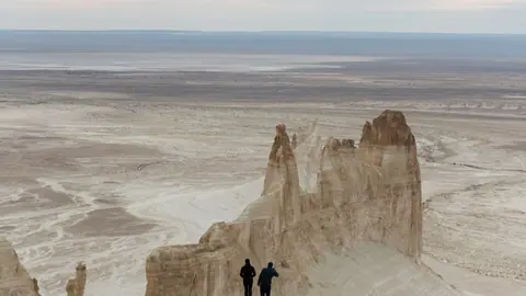
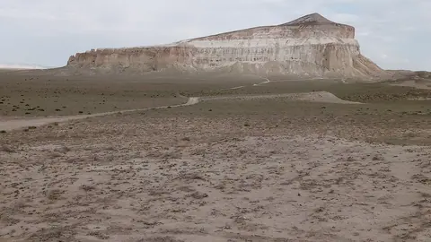
If you are already in western Kazakhstan, the desert landscapes of Mangystau are the natural pairing, though they are several hundred kilometres away. The landscapes of Bozzhyra and Mangystau lie about 345 km in a straight line, and the old Caspian port of Fort-Shevchenko about 296 km. The stone spheres of the Torysh valley lie about 290 km in a straight line. Together they make a western loop of water, birds and desert that is quite different from the mountains of the southeast.
For flyways and other sites, see birdwatching in Kazakhstan, and on the pink birds, flamingos.
- Whether independent visitors may enter the reserve, and whether a permit or escort is required
- How to get from Atyrau to the delta, and whether boats are needed
- The exact months of peak spring and autumn bird migration
- Whether any visitor facilities, hides or marked routes exist
- Whether Caspian seals can be seen from the reserve
Akzhaiyk Reserve: tips before you go
- Avoid July if you can: computed highs near 33 °C, nights above 23 °C, and dust storms on 20-30 days a year in the region.
- October-November has the largest share of big sea surges (25.1%), so treat coastal areas as unpredictable in autumn.
- Confirm entry rules with the reserve administration in Atyrau before booking travel; independent access could not be confirmed.
- Winter highs stay below zero from December to February with strong winds, so bring a windproof layer if you come off-season.
More to see nearby



Frequently asked questions
Is the Akzhaiyk Reserve a UNESCO site?
How far is Akzhaiyk from Atyrau?
Can you see flamingos in the Ural Delta?
Is the Ural Delta a Ramsar wetland?
Are there Caspian seals at Akzhaiyk?
Sources
Read also
 Almaty Zoo in Kazakhstan: opening hours and how to visit
 Ayusai Gorge, Almaty: visitor centre and waterfall trail
 Gorelnik Gorge above Medeu: waterfalls, trail and season
 Kamenskoe Plateau above Almaty: observatory and trails
 Pervomaiskie Ponds near Almaty: location, swimming, season
 Saty village: base for the Kolsai and Kaindy lakes