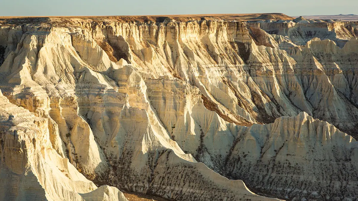
Aktolagai chalk cliffs: when to go, month by month
- January: off season
- February: off season
- March: possible
- April: good
- May: best time
- June: possible
- July: possible
- August: possible
- September: best time
- October: good
- November: possible
- December: off season
May and September bring daytime highs of about 23–25 °C, July–August average 31–33 °C, and winter days stay below freezing.
Aktolagai chalk cliffs: why go
Aktolagai's chalk sculptures
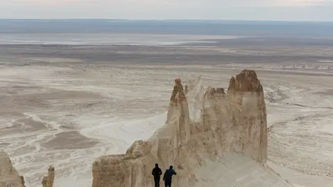
Locals call the ridge an open-air museum, with eroded forms named the lion, the Titanic, the sphinx, the camel, the turtle and a chess rook.
An ancient seabed at Aktolagai
The chalk formed on a warm sea floor. Wikipedia lists Cretaceous shark teeth, belemnites, ammonites, sea urchins and turtle shell fragments.
The long road to Aktolagai
The ridge is about 252 km in a straight line from Atyrau and 325 km from Aktobe. We could not confirm a road route or any public transport.
Aktolagai in spring and autumn
May and September average daytime highs of about 25 °C and 23 °C. July reaches about 33 °C, and January days stay below freezing.
Three colours in a day
According to Russian Wikipedia, the plateau looks yellowish at dawn, white at midday and bluish in the evening, so plan for both ends of the day.
Aktolagai chalk cliffs in photos
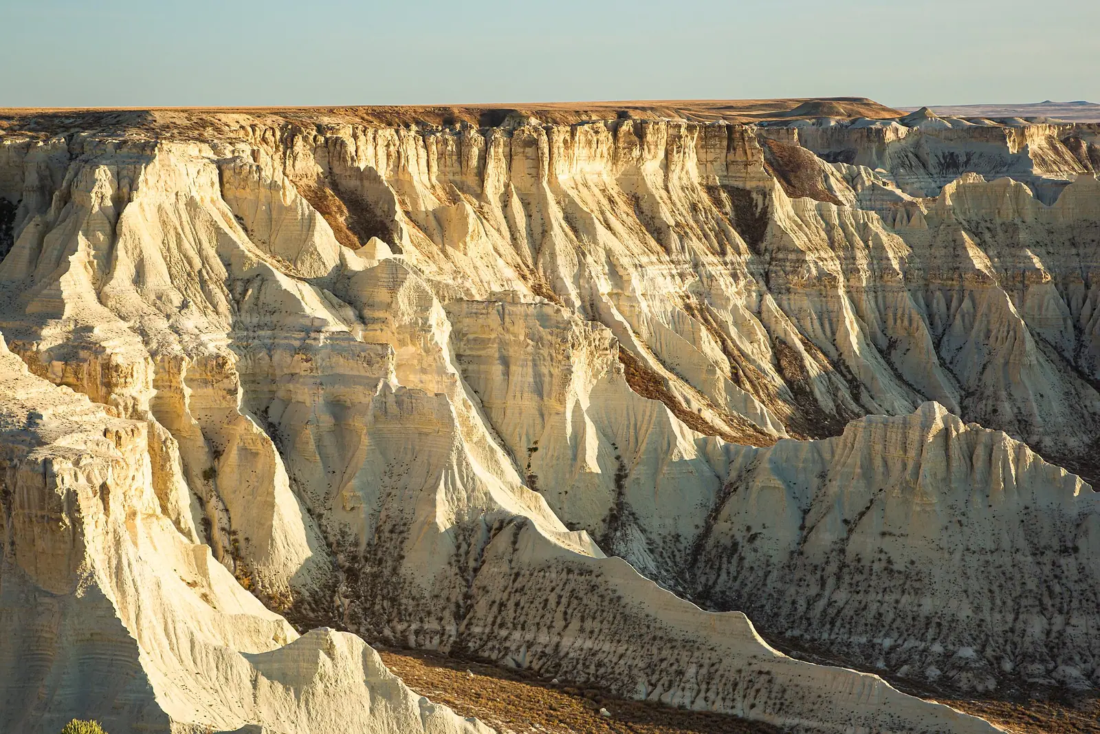
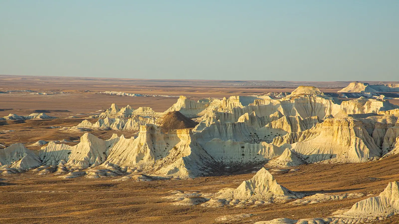
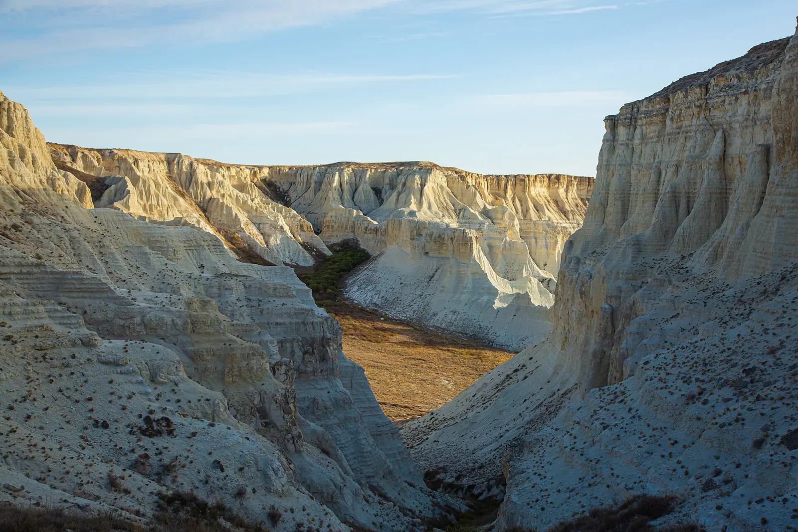
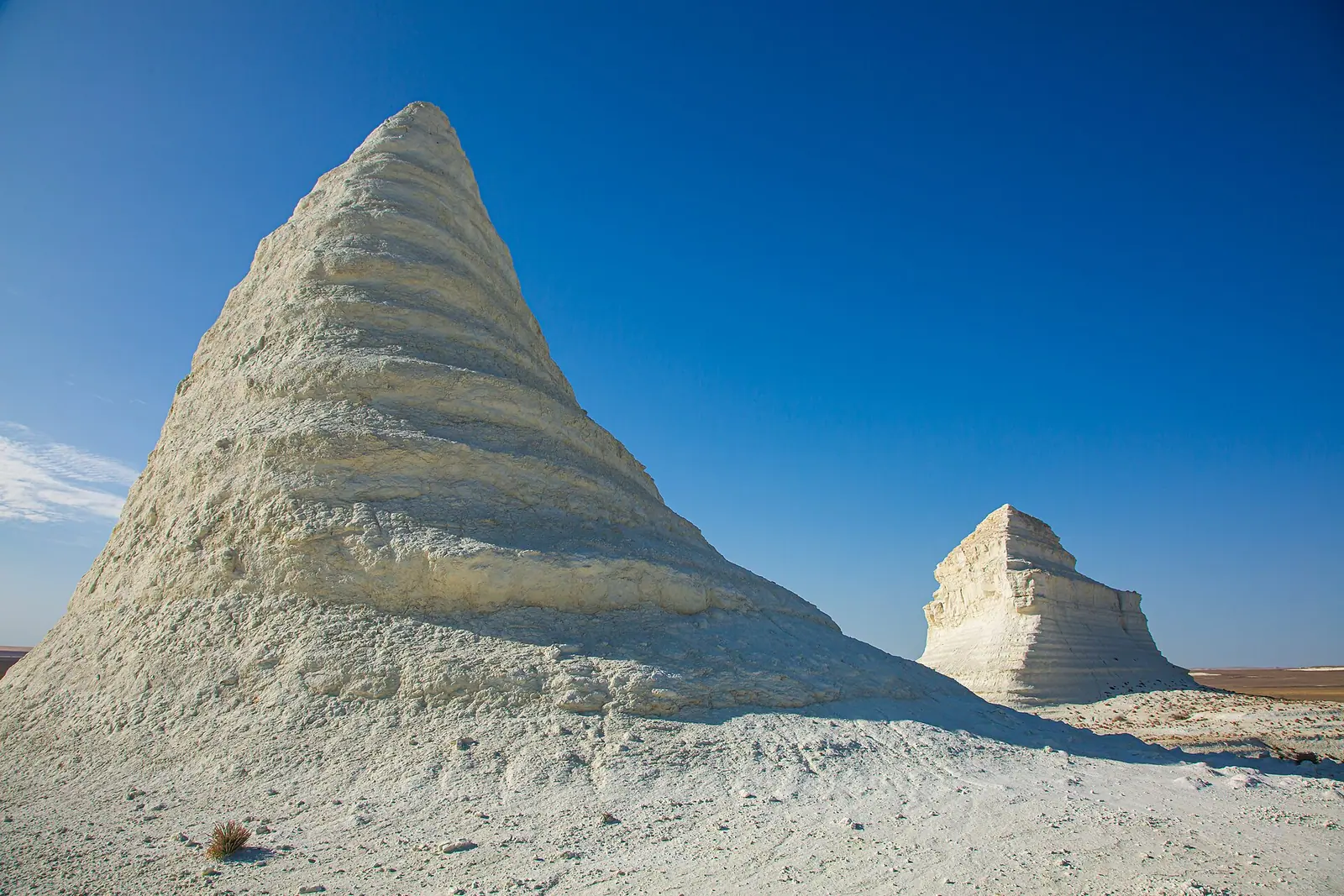
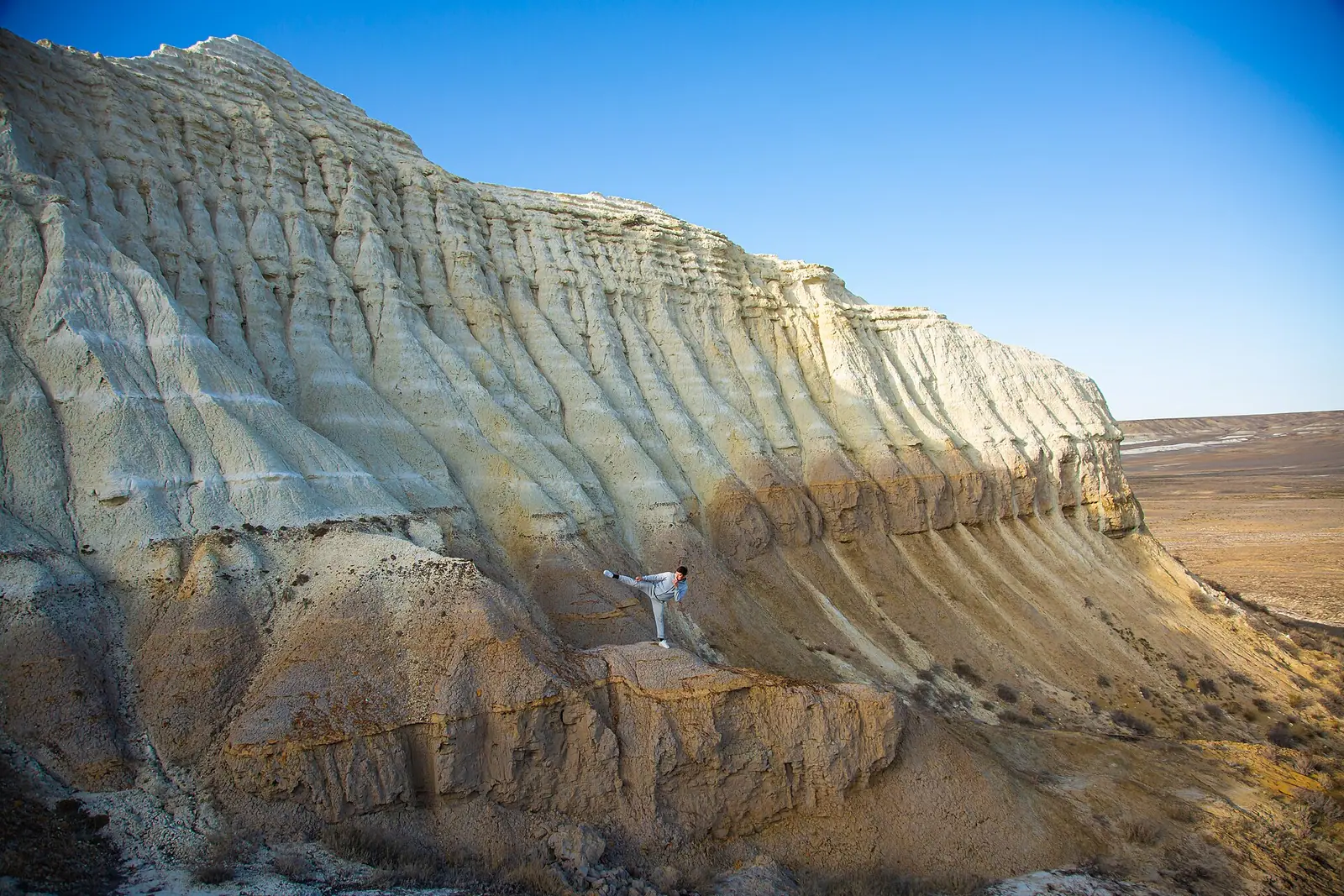
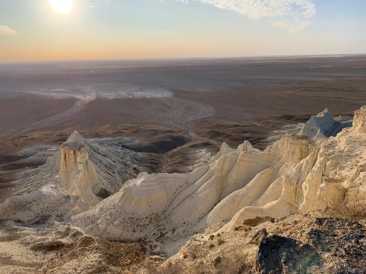
Real photos by travellers (Pexels, Unsplash, Wikimedia Commons); author and licence are given in each caption.
The Aktolagai chalk cliffs are a 90 km ridge of white chalk and marl in Baiganin District of Aktobe Region, in western Kazakhstan. It lies about 252 km in a straight line from Atyrau, which makes this a long self-planned desert trip rather than an easy excursion.
Where Aktolagai is and what you are looking at
Aktolagai is a low chalk plateau between the Sagyz and Zhem rivers. It runs north-east to south for about 90 km and is 5–10 km wide. It meets the Caspian Lowland along the right bank of the Zhem. The western side is the dramatic one: a steep scarp, in places up to 140 m deep according to Kazakh Wikipedia, cut by gullies and ravines. Lake Tolagaisor lies to the west, and the Terisakkan river rises on the ridge.
| Key fact | Figure |
|---|---|
| Length | 90 km |
| Width | 5–10 km |
| Highest point | Nartobe, 302 m (Russian Wikipedia) or Kiyakty, 217 m (Kazakh Wikipedia) |
| Western scarp | up to about 140 m drop |
| Kulshar peak | 251 m |
| Nearest city, straight line | Atyrau, about 252 km |
| Other cities, straight line | Aktobe about 325 km, Oral about 481 km, Aktau about 544 km |
The two Wikipedia editions disagree on the highest point and even on its name, so treat the summit height as unsettled. These are modest heights. What draws visitors is the white relief of the scarp, not altitude.
Chalk sculptures and a former sea floor
Locals call Aktolagai an open-air museum because erosion has left forms that look like figures. Named shapes include a lion, the Titanic, a chess princess, a camel, a turtle, a sphinx, a chess rook, a yurt and several pyramids. Some residents call the place Alatau.
The chalk is made of the fossil remains of billions of tiny ancient organisms laid down on the bed of a warm sea. Wikipedia lists larger fossils as well: Cretaceous shark teeth, belemnites, ammonites, corals, sea lilies and sea urchins. Russian Wikipedia also mentions whale vertebrae and turtle shell fragments. We could not confirm whether collecting fossils is permitted, so check before taking anything away.
Russian Wikipedia also says the plateau changes colour three times a day: yellowish in early morning, white at midday and bluish in the evening. If you want photographs, plan to be on site at both ends of the day.
Around the plateau, the land alternates between salt domes 60–80 m high and salt flats. The vegetation is sparse wormwood and saltwort scrub on grey and saline soils.
Kulshar peak and the Kurmangazy connection
The best-known summit is shaped like a skullcap and named after Kulshar, a hero of the Adai clan. According to Russian Wikipedia, he dug a cave above the peak and defended himself there against enemies. His grave stands on the 251 m summit, which is reached by a single path. This is a burial site, so treat it with the same quiet respect you would give any grave.
Elders say that the kui “Alatau” by the composer Kurmangazy was dedicated to this gorge. This is local tradition as Wikipedia reports it, not a documented fact.
When to go: May and September
Late spring and early autumn are the comfortable windows. Midsummer is hot and winter is well below freezing. The figures below are computed ERA5 reanalysis normals for 2011–2020 at a grid point 186 m above sea level. They are not weather station readings, and the grid point’s height may differ from the ridge itself.
Day high, °C / Night low, °C · Rain/snow, mm
A computed reanalysis normal for these coordinates, not weather station records.
Monthly figures
| Month | Day high, °C | Night low, °C | Rain/snow, mm |
|---|---|---|---|
| Jan | -6.3 | -12.6 | 16.6 |
| Feb | -5.1 | -12.8 | 17.1 |
| Mar | 4.7 | -4.5 | 23.4 |
| Apr | 16.6 | 4.7 | 25.2 |
| May | 25.8 | 12.7 | 30.5 |
| Jun | 30.7 | 17.1 | 10.5 |
| Jul | 33.2 | 19.8 | 13.9 |
| Aug | 31.3 | 17.9 | 8.4 |
| Sep | 23.3 | 10.4 | 11.3 |
| Oct | 13.7 | 2.1 | 14 |
| Nov | 2.4 | -5.5 | 18.4 |
| Dec | -4.2 | -10.3 | 25.1 |
May averages highs of about 26 °C and lows of 13 °C. September is similar, at about 23 °C and 10 °C. July reaches about 33 °C by day and stays near 20 °C at night. From December to February, daytime highs stay below zero and nights drop to around −13 °C. Rain is scarce all year: May is the wettest month at about 31 mm, and August sees only about 8 mm.
| Period | What to expect |
|---|---|
| April | Highs about 16 °C, cool nights near 5 °C; possible |
| May | Highs about 25 °C; best balance of warmth and mild nights |
| June–August | Highs 30–33 °C, very dry; hard going in the middle of the day |
| September | Highs about 23 °C; second best window |
| October | Highs about 13 °C, nights near freezing |
| November–March | Sub-zero or near-zero days; not sensible for a casual visit |
Getting there and what we could not confirm
Aktolagai suits travellers who already plan to be in western Kazakhstan. Atyrau is the closest city at about 252 km in a straight line, and Aktobe is about 325 km away. Road distances will be longer. We could not confirm a road route, road conditions, the nearest village, or any public transport to the ridge. For a visitor with no car and no Russian, that means arranging a driver in advance. Expect remote steppe with no confirmed services on site.
If you want more chalk-and-desert scenery in the west, the Mangystau sites are the logical pairing. They are still about 450–490 km away in a straight line: see Sherkala, Torysh and Bozzhyra and Mangystau.
- Road route, road condition and the nearest settlement to the cliffs
- Whether any public transport or local drivers serve the area
- Whether fossil collecting is permitted and whether the area has protected status
- Availability of water, fuel or any services on or near the ridge
Aktolagai chalk cliffs: tips before you go
- July averages highs near 33 °C with about 14 mm of rain all month, so carry ample water and avoid walking at midday.
- Plan to be on the cliffs at dawn and dusk: local accounts say the chalk shifts from yellowish to white to bluish during the day.
- Kulshar peak (251 m) has a batyr's grave on its summit. Keep to the single path and treat it as a burial site.
- Check the rules before picking up shark teeth or ammonites. We could not confirm whether fossil collecting is allowed.
More to see nearby


Frequently asked questions
Where are the Aktolagai chalk cliffs?
Can you find fossils at Aktolagai?
How high is Aktolagai?
Is it too hot to visit Aktolagai in summer?
What does the name Aktolagai mean?
Sources
Read also
 Almaty Zoo in Kazakhstan: opening hours and how to visit
 Ayusai Gorge, Almaty: visitor centre and waterfall trail
 Gorelnik Gorge above Medeu: waterfalls, trail and season
 Kamenskoe Plateau above Almaty: observatory and trails
 Pervomaiskie Ponds near Almaty: location, swimming, season
 Saty village: base for the Kolsai and Kaindy lakes