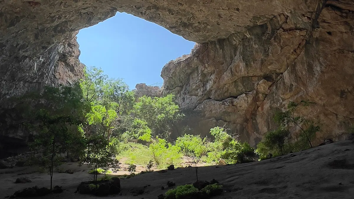
Akmeshit Cave, Kazakhstan: when to go, month by month
- January: possible
- February: possible
- March: possible
- April: best time
- May: best time
- June: good
- July: possible
- August: possible
- September: best time
- October: best time
- November: possible
- December: possible
April, May, September and October suit best; November to April brings 74–83 mm a month and slippery stairs.
Akmeshit Cave, Kazakhstan: why go
The way down into Akmeshit
A metal staircase of about 10–12 m and a narrow path. A guide said in 2025 that the steps were renewed, though the descent is still hard work.
Size figures disagree
Published lengths are 254 m, over 200 m or 162 m, and heights 25 m or 32–35 m. Only the width agrees, at about 65 m.
Trees under the broken roof
Trees and shrubs grow beneath the opening in the roof. Inbusiness mentions mulberry, and Zakon.kz describes jackdaws nesting in the cracks.
Akmeshit is a place of prayer
Kazakh Wikipedia says couples without children and people who are ill stay the night here. Do not photograph people praying without asking.
Akmeshit Cave, Kazakhstan in photos
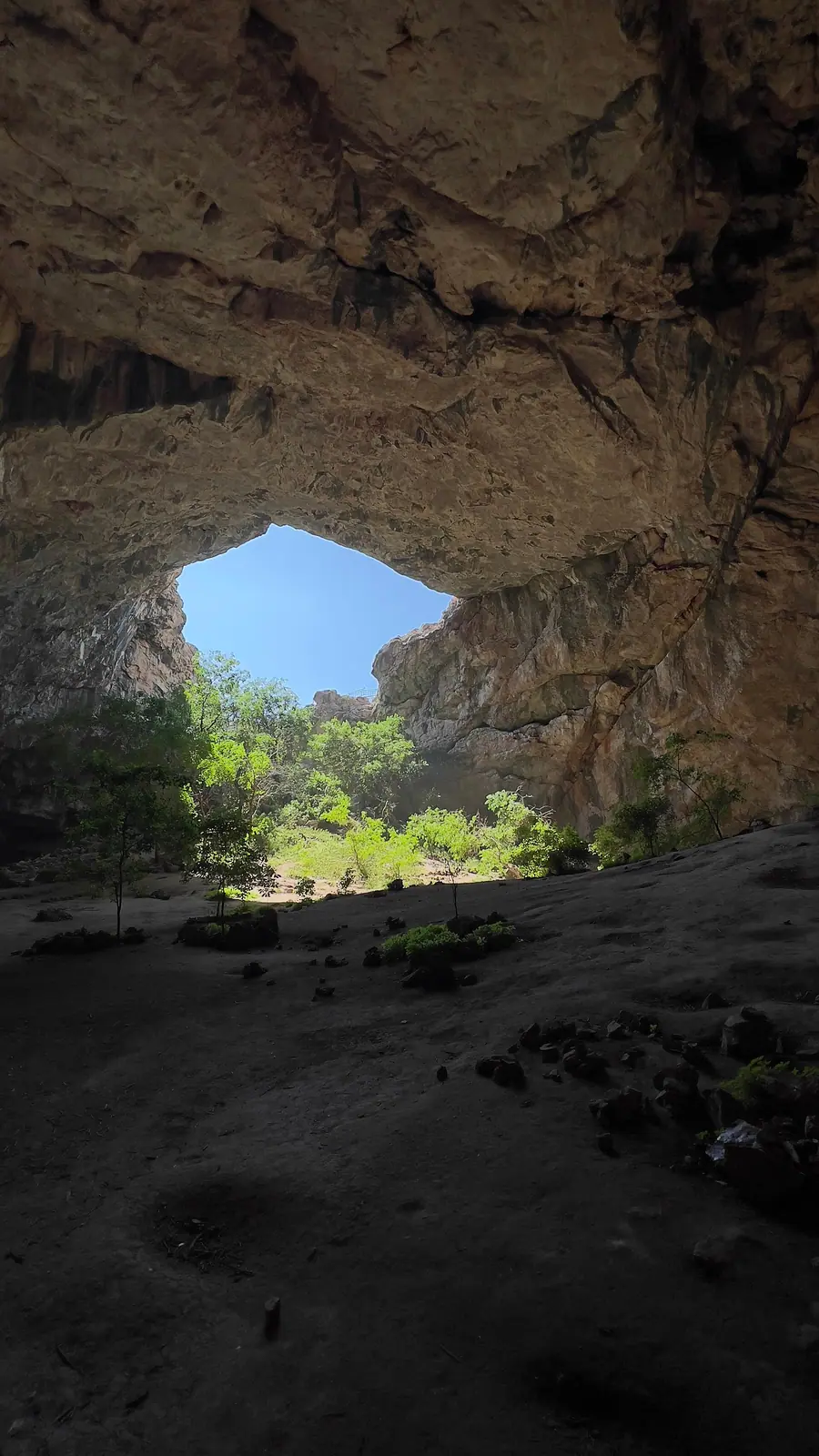
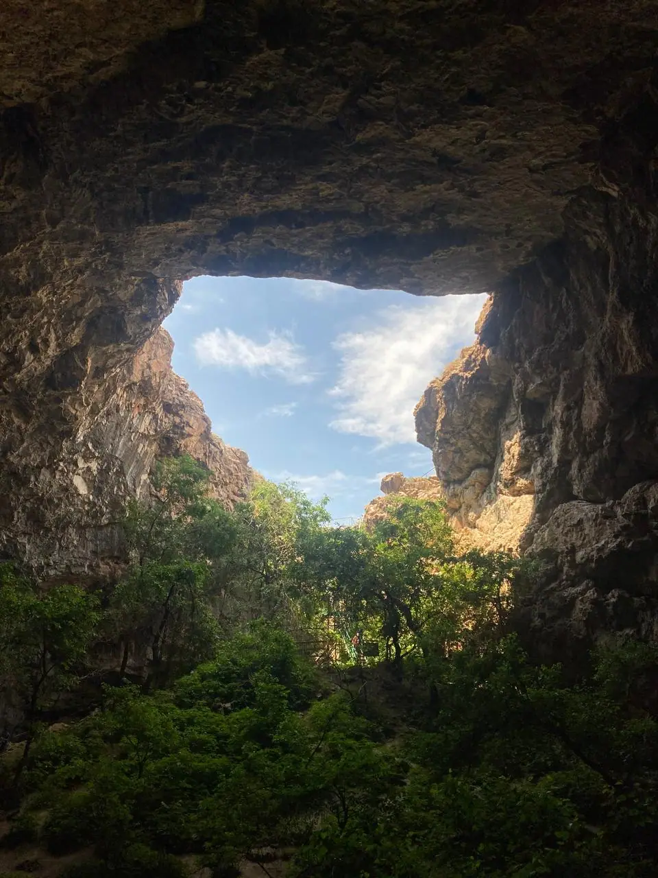
Real photos by travellers (Pexels, Unsplash, Wikimedia Commons); author and licence are given in each caption.
Akmeshit Cave is an enormous cavern with a collapsed roof in Baidibek District, Turkistan Region, in the foothills of the Karatau range and 5 km from Kenestobe village. A metal staircase of about 10–12 m takes you down to a hall with trees growing under the opening. Shymkent is the base: about 74 km in a straight line, a full day with a hired car.
Where it is, and how to find it on a map
Search for “Akmechet”: that is how OpenStreetMap labels the entrance, at 43.0062, 69.7040. The name also belongs to other places, including a mosque in Shymkent and the highest peak of Ulytau, so check that your map shows Baidibek District.
Published road distances from Shymkent are 80 km (Tengrinews, 2018) and 90 km (Zakon.kz, 2025). We found no timetable for public transport. A hired driver is the practical choice, and tour listings offer organised days from Shymkent.
The way down
The climb is the real price of this trip. A guide quoted by Zakon.kz in October 2025 said the staircase used to be close to unsafe and has since been renewed, but the descent is still hard work. You then climb back up, in full sun if you visit at midday.
- Wear shoes with firm soles: water drips from the roof and the floor is stony.
- Carry water and food. Sources mention no shop at the entrance.
- Bring a scarf and modest clothing, and read our notes on visiting sacred places.
How big it is
Nobody seems to have published a dated survey, so treat any single figure with care.
| Source | Length | Width | Height |
|---|---|---|---|
| Kazakh Wikipedia | 254 m | 65 m | 25 m |
| Tengrinews, 2018 | over 200 m | 65 m | 25 m |
| Inbusiness, 2020 | 162 m | 64 m | 32–35 m |
Origin is equally unsettled. Kazakh Wikipedia describes a hollow in limestone, Tengrinews says part of the roof fell in during the 20th century, and Moscow geologists in 1973 reportedly suggested a meteorite.
Why people come
Akmeshit is on Kazakhstan’s 2017 list of national sacred sites. Couples without children and people who are ill come to pray, and some stay the night, according to Kazakh Wikipedia. Please do not photograph people at prayer without asking.
The stories you will hear vary: a dragon subdued by the prophet Sulaiman, or a Kazakh army sheltering from a storm and praying at dawn, which gave the cave its name of White Mosque. A guide told Zakon.kz that tales of villagers hiding here from Dzungar raids have no documents behind them.
When to go
April, May, September and October suit the trip. These are computed normals for a point at 545 m, and the air in the hall behaves differently.
Day high, °C / Night low, °C · Rain/snow, mm
A computed reanalysis normal for these coordinates, not weather station records.
Monthly figures
| Month | Day high, °C | Night low, °C | Rain/snow, mm |
|---|---|---|---|
| Jan | 3.3 | -4.1 | 85.1 |
| Feb | 5.1 | -3.5 | 77.6 |
| Mar | 12.8 | 3.3 | 85.6 |
| Apr | 19.2 | 9.5 | 86.1 |
| May | 25.3 | 14.5 | 65 |
| Jun | 30.2 | 18.2 | 15.7 |
| Jul | 32.9 | 20.8 | 4.3 |
| Aug | 31.3 | 19.5 | 6.3 |
| Sep | 25.9 | 13.6 | 5.5 |
| Oct | 18.2 | 7 | 41.6 |
| Nov | 9 | 0.1 | 78.4 |
| Dec | 3.9 | -4.3 | 81.3 |
July averages 32.9 °C by day with almost no rain. November to April brings 74–83 mm a month, which makes stairs and path slippery.
Combining it with other sites
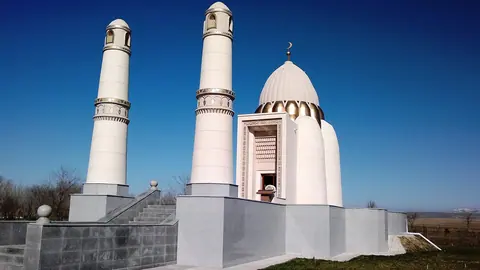
Tour listings pair the cave with the mausoleums of Domalak Ana and Baidibek Ata, both within about 20 km in a straight line. Our guide to sacred places shows how this cluster fits with Turkistan.
- The condition of the last stretch of road from Kenestobe
- Any fee, caretaker or opening hours
- Written rules on photography and staying overnight
- The cave’s exact dimensions and inside temperature
Akmeshit Cave, Kazakhstan: tips before you go
- Search maps for Akmechet and check for Baidibek District: that is how OpenStreetMap labels the entrance.
- Take water, food and firm-soled shoes: sources mention no shop at the entrance.
- Set off early in summer: July days average 33.4 °C.
More to see nearby


Frequently asked questions
Can I reach Akmeshit Cave by public transport?
How difficult is the descent?
Is it the same as Ak-Mechet or the Dragon Cave?
Do I need a permit or ticket?
Sources
- Ақмешіт әулие үңгірі — Wikipedia (Kazakh)
- Akmeshit: the most mysterious cave of Kazakhstan — Tengrinews, 26.08.2018 (in Russian)
- Ak-Mechet cave — Zakon.kz, 29.10.2025 (in Russian)
- A trip to the ghost town and Dragon Cave — Inbusiness.kz, 13.08.2020 (in Russian)
- 4,000 km across Kazakhstan — Tengrinews, 13.09.2019 (in Russian)
- Sacred cave Ak Meshit — Sxodim (in Russian)
- Cave entrance — OpenStreetMap
- Open-Meteo Historical Weather API: ERA5 reanalysis, 2011–2020
Read also
 Almaty Zoo in Kazakhstan: opening hours and how to visit
 Ayusai Gorge, Almaty: visitor centre and waterfall trail
 Gorelnik Gorge above Medeu: waterfalls, trail and season
 Kamenskoe Plateau above Almaty: observatory and trails
 Pervomaiskie Ponds near Almaty: location, swimming, season
 Saty village: base for the Kolsai and Kaindy lakes