Verified: 2026-09
Tarbagatai: why go
The Tarbagatai range
Around 300 km along the border with China and up to 55 km wide, topped by Mount Tastau at 2,992.7 m. English Wikipedia gives about 250 km.
Tarbagatai steppe and meadows
Most of the range is grass-covered, with only the highest summits bare. The northern alpine belt is wetter and more varied than the southern one.
Urzhar, Katynsu, Emel valleys
Besides the southern slope, the park takes in the Karabas and Arkaly hills and river valleys; willow, poplar and barberry grow on the Barlyk spur.
Tarbagatai endemics
Over 1,600 vascular plant species, including the endemic Tarbagatai mertensia, stelleropsis and acantholimon. Wild fruit trees are protected too.
Tarbagatai wildlife in numbers
Over 270 bird species, 60 mammals, 23 reptiles and 19 fish species, though English Wikipedia counts 80 mammal species.
Tarbagatai in photos
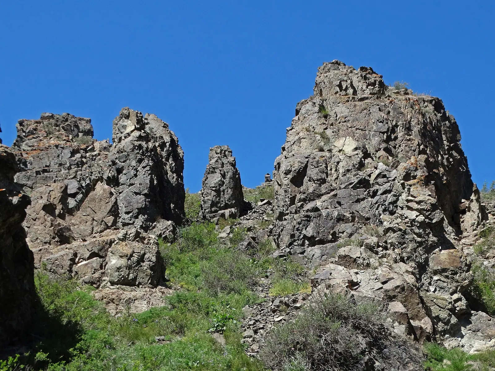
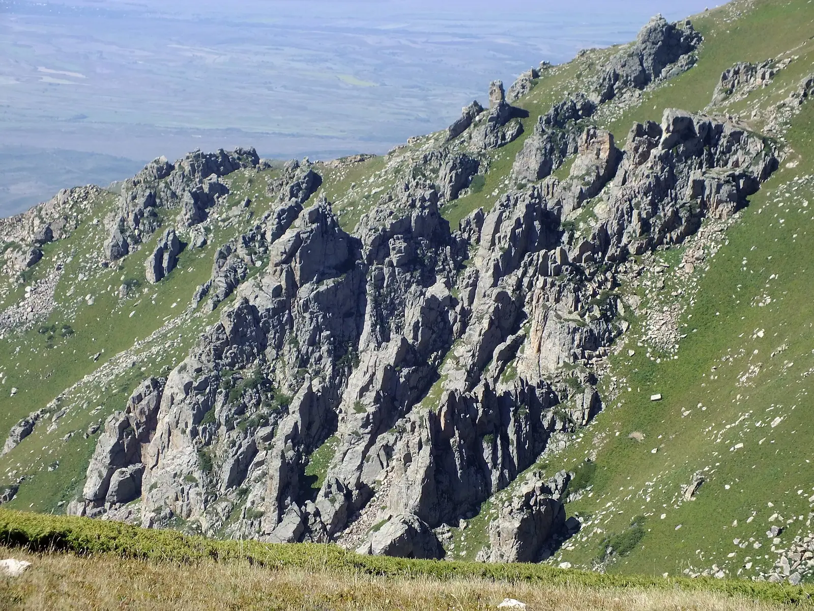
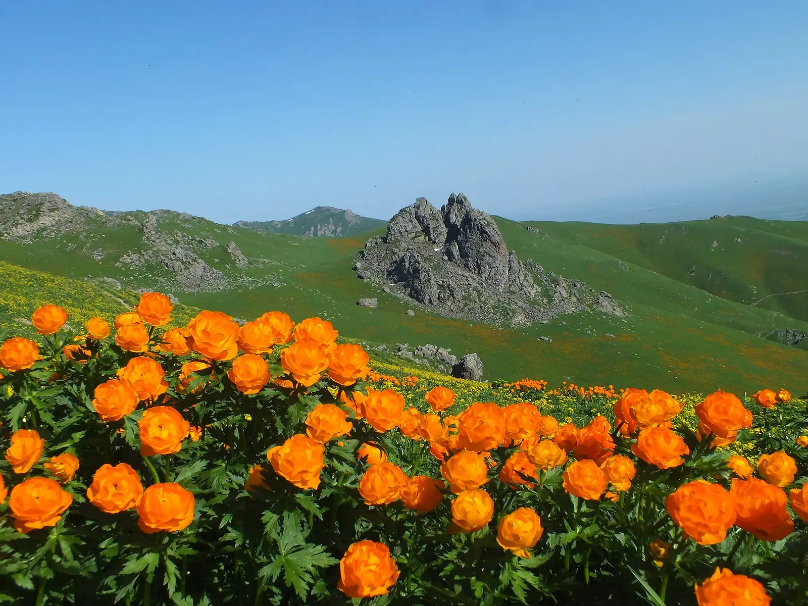
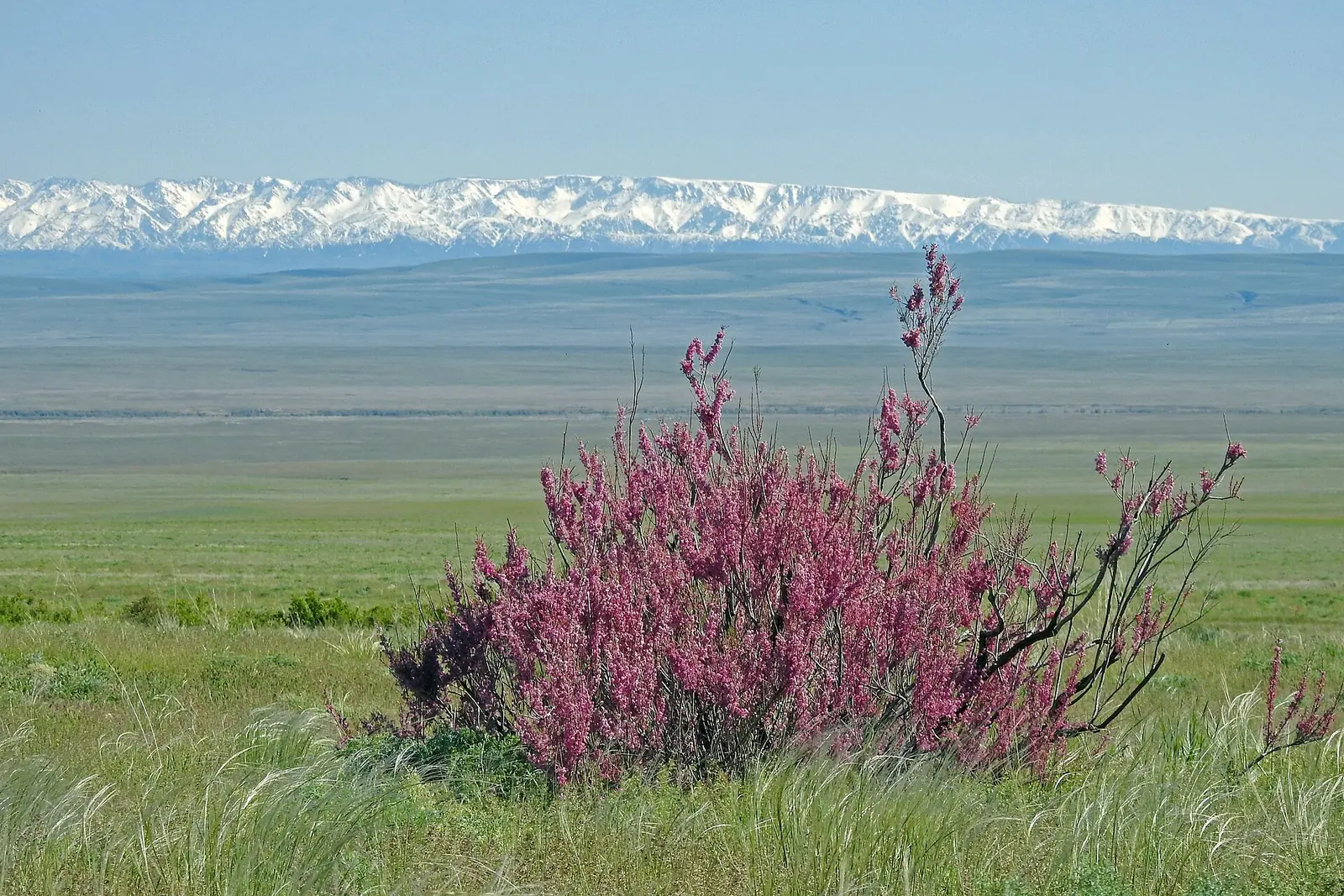
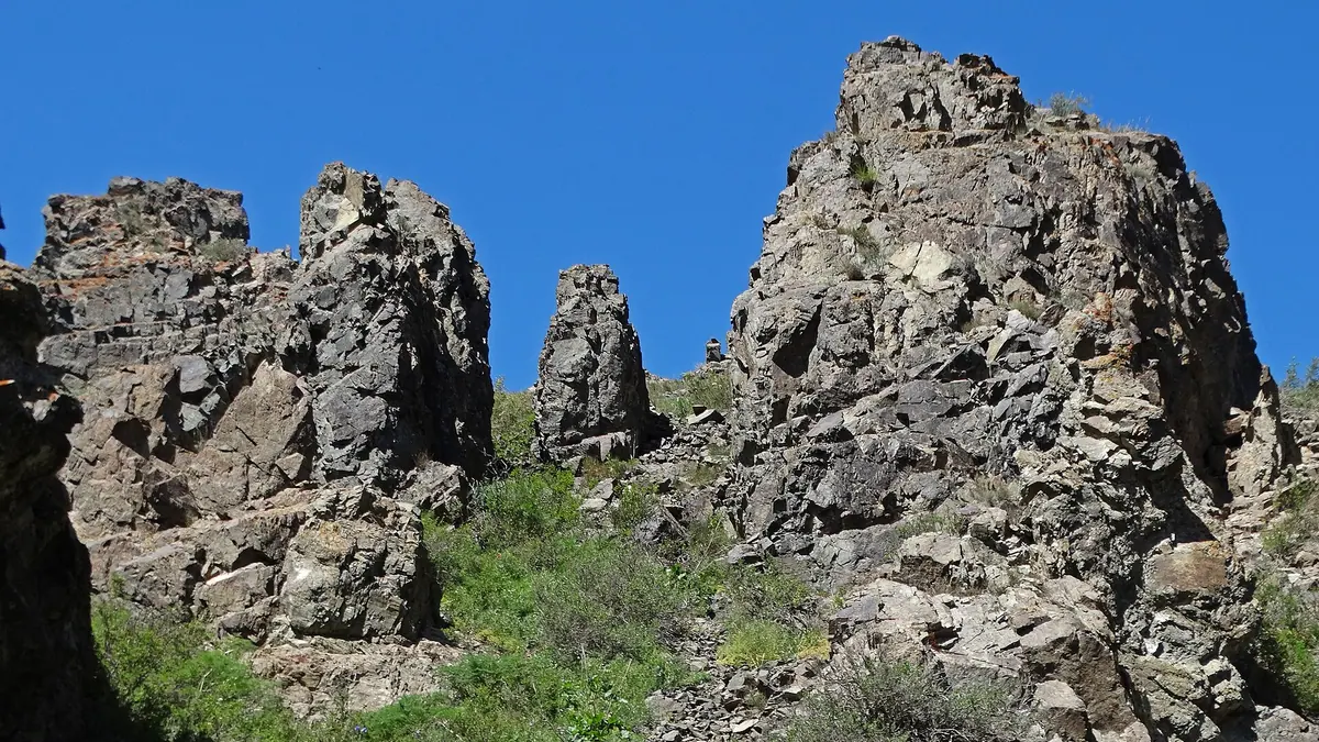
Real photos by travellers (Pexels, Unsplash, Wikimedia Commons); author and licence are given in each caption.
Tarbagatai — state national natural park, Abai Region.
Key figures
| Area | 143 550.5 ha |
| Region | Abai Region |
Category
State national natural park
A national park is open to visitors: you may stay in the recreation zone after paying the tariff.
Entrance tariff
0.2 MCI per pedestrian, 0.4 MCI per car. In 2026 that is 865 ₸ and 1,730 ₸.
The tariff is set by appendix 23 to Order No. 232 of 2 October 2024.
The tariff is set in MCI units rather than tenge, so the amount changes with each January budget.
What to see
- Tarbagatai Ridge
- steppe and alpine meadows
What Tarbagatai National Park is
Tarbagatai National Park protects mountain steppe and meadows on the south slope of the Tarbagatai range, in Urzhar district of Abai Region, on the border with China. The jumping-off point is the village of Urzhar, which you can reach by plane. Public information on the park’s visitor facilities is thin, so plan the trip through the park administration.
The park was created on 27 June 2018 by Government Resolution No. 382. Besides the south slope of the Tarbagatai, it includes parts of the Karabas and Arkaly mountains and the valleys of the Urzhar, Katynsu and Emel rivers. English Wikipedia notes that protecting stands of wild fruit trees was one of the reasons for setting it up.
The Tarbagatai range
| Parameter | Value |
|---|---|
| Highest point | Tastau, 2,992.7 m |
| Length | about 300 km |
| Greatest width | about 55 km |
| Border | the range follows the Kazakhstan-China border; the border crosses the Karakezen pass |
Figures from Russian Wikipedia; English Wikipedia gives the length as about 250 km and says the range starts some 70 km south-east of Ayagoz.
Most of the range is grass-covered, with only the highest summits bare. Forest appears in the southern river valleys and on the Barlyk spur, where willow, poplar and barberry grow. The northern alpine belt is wetter and more varied than the southern one.
Plants and wildlife
According to Wikipedia, the park has more than 1,600 vascular plant species, including Tarbagatai endemics such as Mertensia tarbagataica, Stelleropsis tarbagataica and Acantholimon tarbagataicum. Fauna: 19 fish, 23 reptile, more than 270 bird and 60 mammal species.
Getting there
The nearest sizeable settlement is Urzhar, the district centre. It has an airport with flights from Astana, Almaty, Ust-Kamenogorsk and Semey. From the village you drive on to the mountains.
Border zone: what we know
The Tarbagatai range runs along the Chinese border. For Urzhar district, Resolution No. 356 exempts only the Alakol lake shore from the pass regime; Tarbagatai National Park is not named among the exemptions. That does not automatically mean every route needs a pass; it depends on whether a given spot lies inside the border zone. Check with the park administration before you go. The logic of the regime is laid out in border zone permits: where you need one and where you do not, and other paperwork in what permits exist and when you actually need them.
Entry and rules
Tarbagatai is a national park: you can stay in the recreation zone once you have paid the fee (MCI fractions in the card above, current amount in the fee calculator). How a park differs from a zapovednik is explained in zapovednik, park, rezervat: where you will be let in. If Lake Alakol is on the same trip, see the Alakol card.
Tarbagatai: when to go, month by month
- January: possible
- February: possible
- March: possible
- April: possible
- May: possible
- June: possible
- July: possible
- August: possible
- September: possible
- October: possible
- November: possible
- December: possible
Road conditions, routes and places to stay are not documented publicly, so agree your dates with the park administration.
Tarbagatai: tips before you go
- You can fly to Urzhar, whose airport has flights from Astana, Almaty, Ust-Kamenogorsk and Semey, then drive on to the hills.
- The park is not on the border-zone exemption list, so ask the administration and Border Service if your route needs a pass.
- Distances from Urzhar to the entrances, routes and lodging are undocumented, so plan the trip through the park administration.
- Heading to Alakol as well? In Urzhar district only the Alakol shore is exempt from the border pass regime.


