
Verified: 2026-09
Aksu-Zhabagly: why go
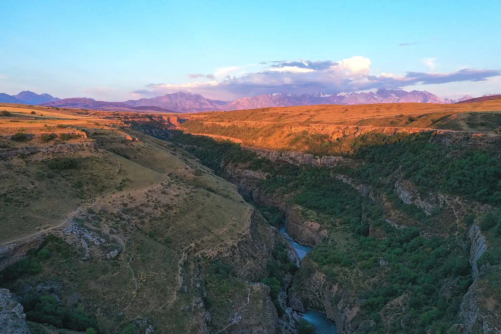
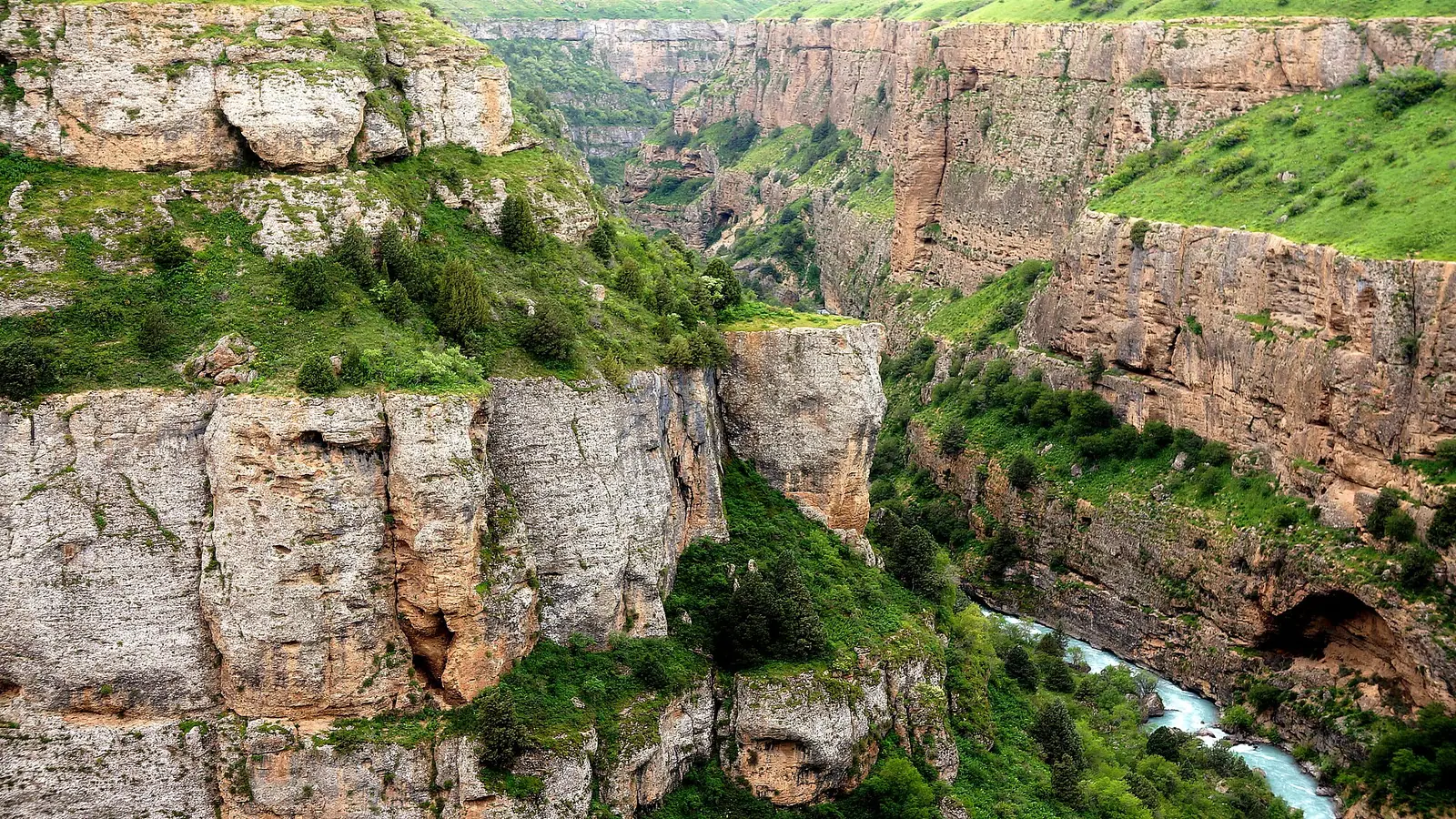
Aksu Canyon
About 37 km long and up to 500 m deep in places, with near-vertical walls; the only crossing is a narrow footbridge in the south of the reserve.
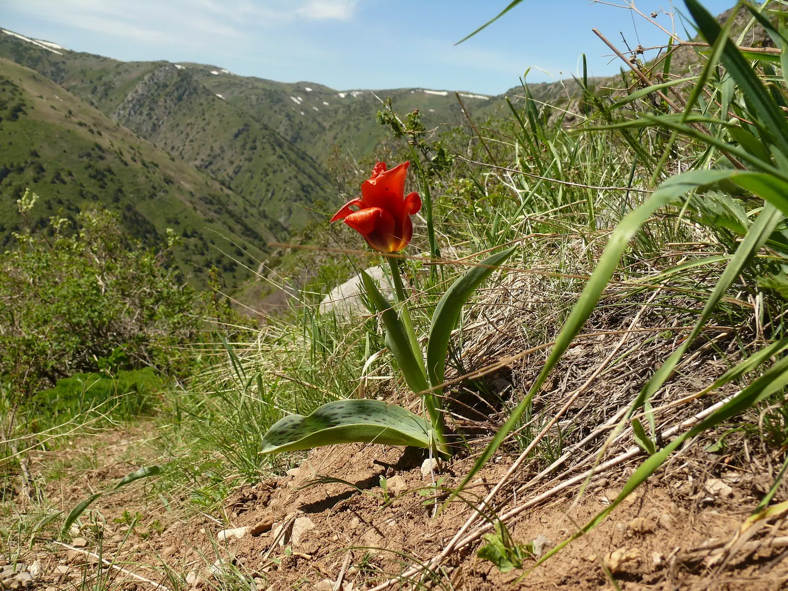
Greig's tulip
The reserve's emblem, with crimson-red petals 12–15 cm long, flowers in early and mid spring. Kaufmann's tulip grows here as well.
Central Asia's oldest reserve
Founded on 14 July 1926 with 30,545 ha; the Aksu Canyon was added in 1929. Nearly a century of records makes it a benchmark for the Western Tien Shan.
Snow leopard and argali
The reserve records 52 mammal and 247 bird species. Argali are among the hoofed animals; the snow leopard lives here too but is rarely seen.
Karabastau fossil site
A 126 ha palaeontological site on the Boroldai ridge, about 120 km to the north-west. The reserve's second such site, Aulie, covers 100 ha.
Kaskabulak petroglyphs
According to the Orexca guide, a three-day horseback route leads to these rock carvings, covering 24 km each way.
Aksu-Zhabagly in photos


Real photos by travellers (Pexels, Unsplash, Wikimedia Commons); author and licence are given in each caption.
Aksu-Zhabagly — state nature reserve (zapovednik), Turkestan and Zhambyl Regions.

Key figures
| Area | 131 934 ha |
| Region | Turkestan and Zhambyl Regions |
| Established | 14 July 1926 |
Category
State nature reserve (zapovednik)
A zapovednik is the strictest category. There is no free entry: permission and prior arrangement are required, usually along marked ecological trails and with an escort.
UNESCO: Западный Тянь-Шань (2016)
Entrance tariff
0.2 MCI per pedestrian, 0.7 MCI per car. In 2026 that is 865 ₸ and 3,027.5 ₸.
The tariff is set by appendix 2 to Order No. 232 of 2 October 2024.
The tariff is set in MCI units rather than tenge, so the amount changes with each January budget.
What to see
- Aksu Canyon
- Greig tulip
- Kaskabulak petroglyphs
Aksu-Zhabagly in one minute
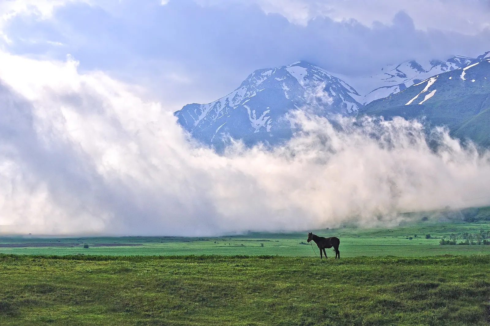
Aksu-Zhabagly is the oldest nature reserve in Central Asia, set in the Western Tien Shan across Turkestan and Zhambyl regions. It spans elevations from 1,100 to 4,236 m, includes the Aksu river canyon (up to 500 m deep) and is home to the Greig tulip. The single most important thing to know before you go: this is a strict reserve, not a national park. You cannot wander freely; visits are arranged in advance and follow set routes.
How a strict reserve works for visitors
Kazakh law defines a zapovednik as a conservation and research institution whose purpose is to preserve and study natural processes. Tourism is not part of that definition. In practice:
- there is no free entry: visits are agreed with the reserve administration in advance;
- you walk only on designated ecological routes, usually with an escort;
- the reserve’s core is closed to tourism entirely, and routes run through zones with a softer regime;
- the reserve regime bans any activity that disturbs the natural state of the area, including hunting and fishing.
Why “the reserve is closed” and “you can walk a trail in the reserve” are both true is explained in our guide to protected area categories. For other paperwork, see what permits exist.
The entry fee is shown on the card above; the park fee calculator converts it into tenge for the current year. Having a published fee does not mean entry is open.
How to plan a visit
A sequence that saves you from being turned back at the ranger post:
- Pick your goal: the canyon, tulips, the horseback route to the petroglyphs or the fossil sites. That decides the season and the section.
- Contact the reserve administration in advance and agree the route, date and escort. Without this step there is no visit to the reserve proper.
- Think in altitude. The reserve climbs from 1,100 to 4,236 m: spring in the foothills and spring near the glaciers fall in different months.
- Bring documents. A passport or ID card is needed both for the border regime and for registering your visit.
If you cannot arrange a visit, the neighbouring Sayram-Ugam National Park is an alternative: a national park’s recreation zone is open to visitors by law, and it is also part of the Western Tien-Shan UNESCO site.
Aksu Canyon
The Aksu canyon is the region’s most dramatic sight. The river rises near Western Tien Shan glaciers at around 3,500 m and enters the canyon after a descent of roughly 40 km.
| Feature | Figure | Source |
|---|---|---|
| Canyon length | about 37 km | Inbusiness.kz |
| Depth | up to 500 m in places | Inbusiness.kz, Wikipedia |
| Drive from Shymkent | about one hour | Inbusiness.kz |
| Reserve elevation range | 1,100–4,236 m | Wikipedia |
| Bugulutor ridge | 3,926 m | Wikipedia |
According to English Wikipedia, the canyon can only be crossed in the southern part of the reserve, on a narrow footbridge. The walls are near-vertical and the descent to the water is hard work. If the canyon is the point of your trip, ask when arranging the visit which section and which viewpoints your route includes: the canyon runs for tens of kilometres, and the experience differs a lot from one section to another.
When to go: spring, the second half of summer and early autumn. In May and June the river runs high and getting down to the water and the grottoes is impossible.
Greig tulips and other plants
The Greig tulip is the reserve’s emblem: a large flower with crimson-red petals 12–15 cm long. It blooms in early to mid-spring and usually stands 20–30 cm tall. Kaufmann’s tulip grows here too. In total, 44 of the reserve’s plant species are listed in Kazakhstan’s Red Data Book.
A well-known flowering spot is a hill called Krasnaya Gorka (“Red Hill”). Blooming shifts from year to year, so if tulips are the reason for your trip, check conditions with the reserve first.
Why “the oldest”
The reserve was established on 14 July 1926 by decree of the Council of People’s Commissars of the Kazakh ASSR, followed by an RSFSR resolution on 27 May 1927. Its original area was 30,545 ha; the Aksu canyon was added in 1929. The boundaries have changed many times since, and nearly a century of continuous scientific observation is what makes Aksu-Zhabagly a benchmark for the whole Western Tien Shan.
Wildlife and fossils
Russian Wikipedia records 52 mammal species, 247 bird species, 11 reptile species, 3 amphibian species and 7 fish species. Argali are among the ungulates and the snow leopard among the predators, though it is rarely seen.
The reserve also has two palaeontological sections away from the main territory:
- Karabastau, 126 ha, about 120 km north-west on the Boroldai ridge;
- Aulie, 100 ha.
The card above mentions the Kaskabulak petroglyphs; according to Orexca, they are reached on a three-day horseback route, 24 km each way.
Border zone and UNESCO
Part of the area lies near the Kyrgyz border. Government Decree No. 356 explicitly names the Aksu-Zhabagly reserve (Zhualy District, Zhambyl Region, a 3 km section) among areas where entry for foreigners on Interior Ministry passes is waived. Carry your passport regardless. More in our page on border zone permits.
Aksu-Zhabagly is part of the Western Tien-Shan UNESCO World Heritage site. Kazakhstan’s other listed sites are covered in our overview of UNESCO heritage in Kazakhstan.
Aksu-Zhabagly: when to go, month by month
- January: possible
- February: possible
- March: good
- April: best time
- May: good
- June: possible
- July: good
- August: best time
- September: best time
- October: possible
- November: possible
- December: possible
Tulips flower in early and mid spring. Visit the canyon in spring, late summer or early autumn: May–June high water blocks the way down to the river.
Aksu-Zhabagly: tips before you go
- Agree the route, date and escort with the reserve administration in advance; without that you won't get in.
- Tulip timing shifts from year to year, so check conditions with the reserve before you travel.
- The reserve climbs from 1,100 to 4,236 m, so spring at the bottom and spring near the glaciers fall in different months.
- Bring your passport or ID: you need it both for the border rules and to register your visit.
- If you can't arrange a visit, try neighbouring Sayram-Ugam: a national park's recreation zone is open by law.
More to see nearby


Frequently asked questions
Can I just turn up at Aksu-Zhabagly Nature Reserve?
Where is Aksu Canyon and how deep is it?
When do Greig tulips bloom?
When is the best time to go down into Aksu Canyon?
Do foreigners need a border zone permit for Aksu-Zhabagly?
What wildlife lives in Aksu-Zhabagly?
Sources
- Aksu-Zhabagly Nature Reserve — Wikipedia
- Aksu-Zhabagly Reserve — Wikipedia (Russian)
- Point on the map: Aksu river canyon — Inbusiness.kz, 2021
- Tulipa greigii — Wikipedia
- Government Decree No. 356 of 16.04.2014 — border zone and list of exemptions (Adilet)
- Law of Kazakhstan on Specially Protected Natural Areas (Adilet)
- Aksu-Zhabagly Reserve — Orexca