A Mangystau itinerary for 3 or 5 days, planned out from Aktau
A day-by-day planning skeleton for Mangystau region in Kazakhstan's far southwest, built around chalk cliffs, rock mosques and Karagiye, the country's lowest point. Distances come from our place pages. Drive times and overnight stays mostly do not.
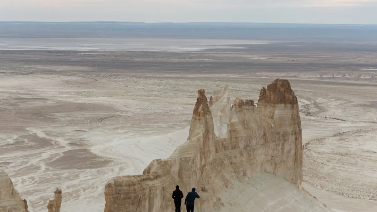
Mangystau is a desert region on the eastern shore of the Caspian Sea, and a trip there means long off-road days out of the port city of Aktau. This page is a planning skeleton for 3 or 5 days. It puts our Mangystau places in a sensible order, but nobody has checked it as a driven route, and road times, fuel stops and beds are mostly unknown.
What this skeleton is and what it is not
This is an order of places, not a tested route. Every distance below comes from our individual place pages. Some are marked as straight-line figures, others are simply given as distances from Aktau. A straight line in this desert can be far shorter than the track you will actually drive.
Only one drive time is stated anywhere: Beket-Ata is 4–5 hours’ drive from Aktau. Everything else about timing, overnight stops and road surface is a gap you need to fill with whoever drives you. Bozzhyra is described as off-road only and without mobile signal, so the region is not a self-drive trip for a hire car and a phone map.
Where Mangystau is and how it works as a trip
Mangystau region sits in Kazakhstan’s far southwest, on the Caspian coast, near the borders with Uzbekistan and Turkmenistan. Aktau is the base: a Soviet-built port city with an airport 24–25 km north of town. The sights spread out from there into the Mangystau desert and up onto the Ustyurt plateau.
The sights fall into three bands by distance. Karagiye is close, about 56 km in a straight line. Torysh and Sherkala are a mid-range day at 90–180 km. Shopan-Ata, Beket-Ata and the Bozzhyra cliffs lie roughly 180–300 km out, which is why the longer plans need nights away from Aktau.
| Stop | Distance from Aktau | What it is | Practical point |
|---|---|---|---|
| Karagiye | about 56 km in a straight line | Basin 132–134 m below sea level | The Aktau–Zhanaozen highway crosses the floor |
| Torysh | 90–150 km | Stone spheres up to 4 m across | 17.5 km from Taushyk; not a protected area |
| Sherkala | 175–180 km | Lone limestone mountain, 332 m | 18 km from Shetpe; 50–60 km to Torysh |
| Shopan-Ata | about 179 km in a straight line | Rock-cut mosque, graves 10th–19th century | On the way to Beket-Ata |
| Beket-Ata | 280–285 km | Underground mosque at Oglandy | 4–5 hours’ drive; no photos inside |
| Bozzhyra | 298–300 km | Chalk ‘fangs’ on the Ustyurt edge | Off-road only; no mobile signal |
The table shows why the order matters: the close stops fit around arrival or departure, the far ones need a full day each.
Mangystau in 3 days: the core loop
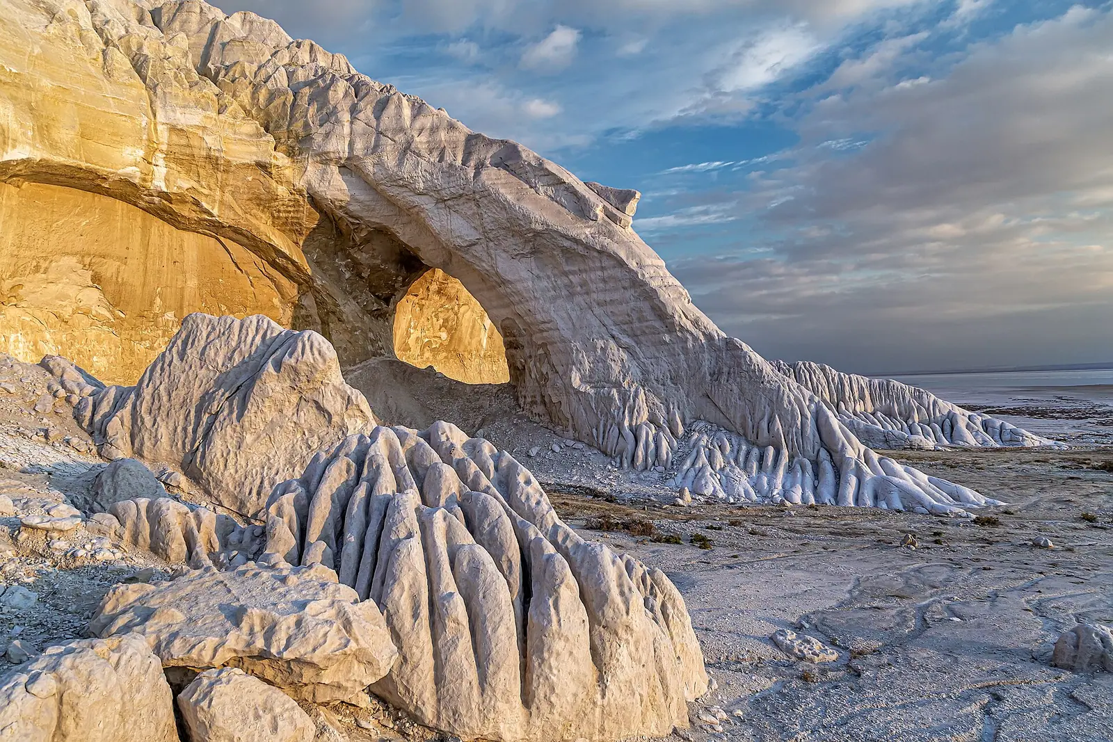
Three days covers the main sights if you accept long days and at least one night away from Aktau.
| Day | Stops | Known distances | Night |
|---|---|---|---|
| 1 | Karagiye, Torysh, Sherkala | Karagiye 56 km line; Torysh to Sherkala 50–60 km | Unknown: back to Aktau or near Shetpe |
| 2 | Shopan-Ata, Beket-Ata | Beket-Ata 280–285 km, 4–5 hours from Aktau | Pilgrims’ guesthouse at Beket-Ata exists; booking unconfirmed |
| 3 | Bozzhyra, return to Aktau | Bozzhyra 298–300 km from Aktau | Aktau |
Day 1 strings the near and mid-range stops together because Torysh and Sherkala are only 50–60 km apart. Day 2 follows the stated pairing of Shopan-Ata on the road to Beket-Ata. Day 3 is the weak link: we could not confirm the distance or track between Beket-Ata and Bozzhyra, so ask your driver whether the two can be joined or whether Bozzhyra needs its own run out of Aktau.
Mangystau in 5 days: slower, with the coast
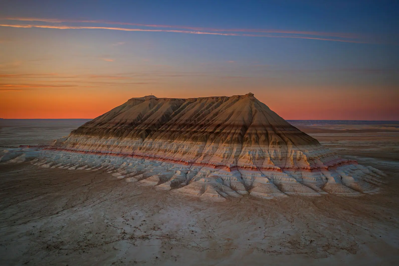
Five days lets you split the long desert days and add the Caspian shore.
| Day | Stops | Known distances |
|---|---|---|
| 1 | Fort-Shevchenko, Aktau seafront | Fort-Shevchenko about 121 km in a straight line; seafront walk about 5 km |
| 2 | Karagiye, Torysh, Sherkala | As in the 3-day plan |
| 3 | Shopan-Ata, Beket-Ata | 280–285 km, 4–5 hours |
| 4 | Bozzhyra and the Ustyurt edge | 298–300 km from Aktau |
| 5 | Return to Aktau, optional Karagiye stop on the highway | Karagiye 56 km line |
Fort-Shevchenko is a small fort town on the Tupkaragan cape, with a museum to Taras Shevchenko, who served his exile there in 1850–1857, and 19th-century lighthouses. It is not paired with any of the desert sights on our pages, so it works best as a separate day at either end.
If you have more time, the Ustyurt Reserve (about 284 km in a straight line, 2,230 km², cliffs over 200 m) and the Karynzharyk sands (about 275 km) are possible extensions. Ustyurt is a strict nature reserve, and Karynzharyk has no known facilities, so both need access and logistics settled in advance.
When the itinerary works: spring and autumn
April–May and September are the windows our place pages agree on; several also rate October as possible or better. Bozzhyra and Sherkala both see summer days above +40 °C, which turns long off-road days into a real risk, especially with no mobile signal at Bozzhyra. Month-by-month climate figures for the region are in Mangystau month by month: inland near Bozzhyra, July averages 22 days of 35 °C or more, while April and September–October bring 20–24 comfortable days a month. Still check a forecast for the week you travel.
Winter is marked as possible for Shopan-Ata, Beket-Ata, Karagiye, Fort-Shevchenko and Karynzharyk, but off for Bozzhyra, Sherkala and Torysh. Summer suits the Caspian rather than the desert: swimming at Aktau runs from late May to August, with the sea about 18 °C.
Visiting the rock mosques with respect
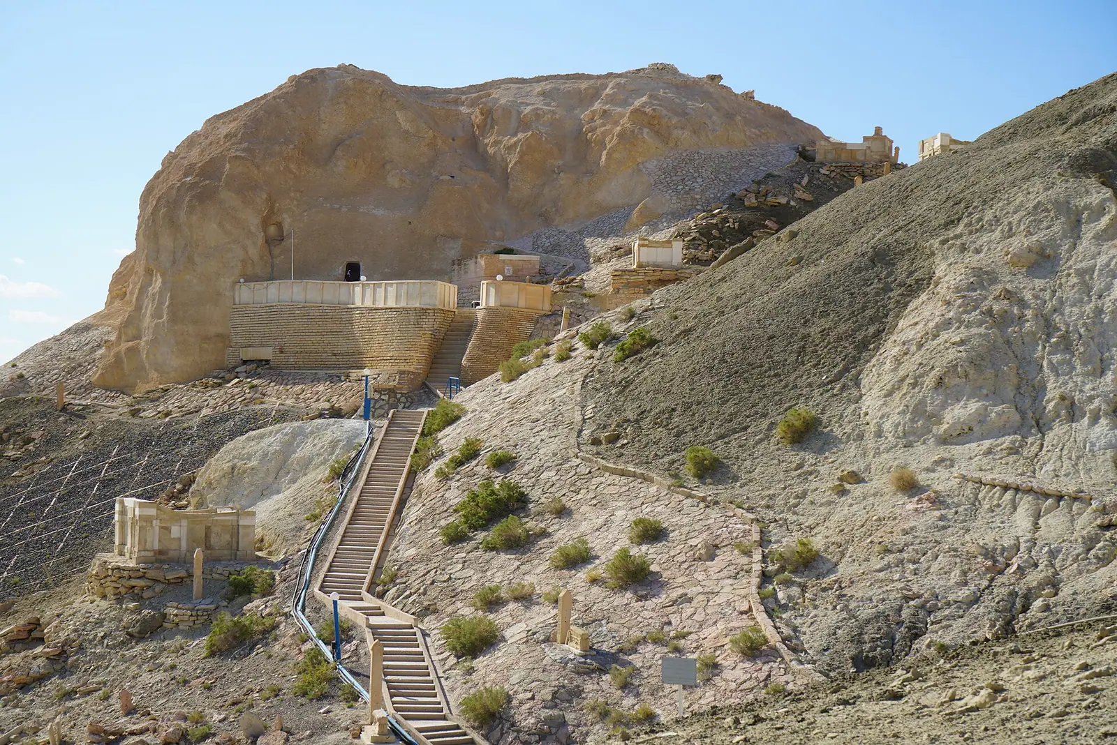
Shopan-Ata and Beket-Ata are active places of pilgrimage, not just sights. Both are UNESCO-listed as of 2026: Beket-Ata has been part of the World Heritage site of Mangystau’s rock mosques since July 2026, and our Shopan-Ata page lists it as UNESCO-listed in 2026. Photography is not allowed inside Beket-Ata. The Shopan-Ata mosque hall measures 7.1 × 5.1 m, so expect a small space shared with pilgrims. We could not confirm dress rules or visiting hours; ask on arrival or through your driver.
- Drive times and track conditions between stops, especially Beket-Ata to Bozzhyra; only the Aktau–Beket-Ata time (4–5 hours) is stated.
- Where to sleep on days 1 and 3, and whether the pilgrims’ guesthouse at Beket-Ata takes non-pilgrim travellers or bookings.
- Current entry fees and access rules at Bozzhyra and the Ustyurt Reserve.
- Whether any public transport or English-speaking drivers are available for the desert sights.
- Fuel, water and food stops along the routes.
Frequently asked questions
Where is Mangystau region?
What is the Mangystau plateau?
Is Mangystau a desert?
Can I see Mangystau without a car?
What is the lowest point in Kazakhstan?
Read also
 An Almaty itinerary for 3, 5 or 7 days in the city and the mountains
- Trips from Aktau, Kazakhstan: the coast, the desert and the Mangystau hills
 Kazakhstan itinerary: choose 5, 7, 10 or 14 days by what you can reach
- Mangystau region: choosing between chalk cliffs, rock mosques and the Caspian coast
 Where to go from Almaty for a day or a weekend
- Where to go on Kazakhstan's Caspian Sea coast, and when