Burial mounds and kurgans: the park's archaeological trail
One of the three routes designated by Charyn park. Underground and above-ground burial structures on open steppe.
Verified: 2026-10
“Burial grounds and kurgans” is the archaeological route of Charyn park, alongside the Valley of Castles and the ash grove. It can be walked or driven. According to English Wikipedia, it is an area of scattered archaeological sites about 12 km off the Chundzha–Almaty highway. Nearby, in the Sarytogay tract, lies a burial ground that the state list of monuments dates to between the 1st–2nd century BCE and the 2nd century CE.
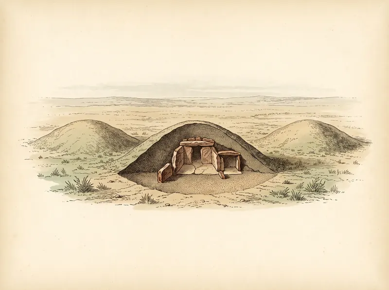
What they are
Kurgans are burial structures, underground or above ground, built in the form of a raised mound. The park treats them as historical and cultural heritage on equal footing with its natural features.
The park’s three routes total 49 kilometres, according to the park materials available to us. In June 2026 the Committee for Forestry and Wildlife listed four routes with a combined length of 30.5 kilometres: the Charyn ash grove, Charyn Canyon — Valley of Castles, Burial grounds and kurgans, and Temirlik — the Small Canyon. The figures probably differ because the routes were re-measured or redrawn; the Committee’s publication is the more recent source.
Which monuments are on the state list
The kurgans around Charyn are not an abstraction. The state list of local historical and cultural monuments of Almaty Region, approved by Akimat Resolution No. 258 of 16 August 2024, includes dozens of kurgan groups in Uygur District. Three entries lie closest to the park:
| Monument | Location (per the state list) | Dating | Number |
|---|---|---|---|
| Sarytogay burial ground | 18.2 km west of Chundzha village, Sarytogay tract | 1st–2nd c. BCE – 2nd c. CE | KZ-19-0796-00 |
| Kurgans | 13.2 km from Chundzha, right of the road to Almaty via the Sarytogay tract | Early Iron Age | KZ-19-0795-00 |
| Kurgans | Temirlik, 10 km from the village, right of the road to Shonzhy | Early Iron Age | KZ-19-0794-00 |
The data come from the consolidated Wikivoyage list, which cites the akimat resolution. All three are classed as archaeological monuments of local significance.
Note the addresses. The Sarytogay tract is the home of the relict Sarytogay ash grove, and Temirlik is one of the system’s canyons covered in the canyons without crowds. So the archaeology is best seen not as a separate outing but together with the grove.
How large the kurgan fields are
The neighbouring entries on the same list show the scale. Uygur District has burial grounds of 239 kurgans (near Dolayty village), 137 (near Kyrgyzsay), and 74 and 66 (the Aktam tract), almost all assigned to the Early Iron Age. They are not part of the park route, but they explain why kurgans are everywhere on the steppe around Charyn — and why they are easy to miss: a low, slumped mound in the grass does not look like a monument.
The dating of the kurgans on the route, which culture they belong to, how many lie along it, its length, and where it sits relative to the checkpoint and the Valley of Castles. Our sources name the route and nothing more.
Whether the monuments on the state list (the Sarytogay burial ground and the kurgans along the Sarytogay road and near Temirlik) coincide with the park route’s sites is unconfirmed.
We will not publish cultural attribution assembled from retellings: archaeology is a field where imprecision is both obvious to a specialist and useless to a reader. The dates above come from the state list, not from retellings.
How to visit
Follow the park route. The kurgans stand on open steppe, and driving off-road to a mound that catches your eye is a violation: the rules allow driving only on public roads and designated excursion roads.
Do not climb the mounds. A kurgan is a burial structure, and slumped earth crumbles easily. Look and photograph from the side.
Take nothing. No stones from the mound, no “finds” from the surface.
Plan for the light. A low mound vanishes in a midday photograph. Morning and evening shadows reveal its relief, just as they do for the canyon walls.
Combine it with the grove. Sarytogay is the stop day trips usually skip; if you are going to the grove anyway, the archaeology adds almost no extra distance. Day planning is covered in Charyn in a day, or staying overnight.
What matters
The visiting rules apply in full to archaeological sites. Damaging monuments of nature, history, culture and archaeology is explicitly prohibited, as is any digging or removal of objects.
Frequently asked questions
What are kurgans?
Where are the kurgans in Charyn National Park?
How old are the kurgans near Charyn?
How many visitor routes does Charyn park have?
Can I dig or look for finds at the kurgans?
Can I combine the kurgans with the ash grove?
Sources
- Materials of the Charyn National Park administration
- Committee for Forestry and Wildlife of Kazakhstan: Charyn park overview, 18 June 2026 — four routes, 30.5 km
- Charyn National Park — Wikipedia: Cemeteries and Burial Mounds route, 12 km off the Chundzha–Almaty highway
- Wikivoyage (Russian): cultural heritage of Uygur District, Almaty Region — based on Almaty Region Akimat Resolution No. 258 of 16 August 2024
- Rules for visiting the protected area of Charyn National Park, 2019 edition